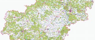
The Volgograd region is a territory with a length of more than 400 km. A satellite map of the Volgograd region clearly shows that this territory has a favorable location.
The map is a reliable assistant on any journey. It makes it easy to make a trip plan. This is an excellent opportunity to create convenient routes for various excursions.
Using a road map of the Volgograd region, you can see that the Volga-Don Canal flows along the region. This water artery connects the Volga and Don.
Industries such as mechanical engineering and agriculture have been developing in the region for a long time. Ships, tractors, as well as drilling equipment and metallurgy are produced. The region is located in the south of the country and is included in the territory of the Southern Federal District.
Central districts of the Volgograd region on the map
The area of the region is divided into many districts on the map of the Volgograd region. It is worth highlighting the main zones of this region:
- In the northwest is the Alekseevsky district . Deposits of lime, brown stone and chalk were found on its territory. The area also contains gas fields and irrigation canal lines.
- Significant mineral resources have also been found on the territory of the Danilovsky district These include oil and gas fields and stone materials for construction. With a map of the Volgograd region by district, you can easily find a given area. The Medveditsa River flows along the territory of the property, in the vicinity of which there are many lakes, meadows and forests.
- In the northwest is the Uryupinsky district . On its territory, rich peat resources, raw materials for creating ceramic bricks, as well as phosphorite deposits and valuable sources of groundwater were found. Also in the area there are unique natural monuments - the Shemyakinskaya dacha and the Chernichkin garden. Agriculture is considered the main activity. With the help of a detailed map of the Volgograd region, you can easily find dairy processing shops, a bakery organization, as well as collective farms.
Map of the Volgograd region with cities and villages
Traveling through the cities of the region, you can easily get lost. Therefore, it is recommended to plan your trip and routes of the Volgograd region on the map in advance. A detailed travel plan will allow you to calculate the exact distances and calculate the travel time.
Among the important cities of the region are:
- Volgograd was founded in the 16th century. In those days it was called Tsaritsyn. Today the city is the most important production center. It produces more than 40% of all products in the region. A large share in the production sector is occupied by heavy industries: metalworking, mechanical engineering, and chemical enterprises. A map of the Volgograd region with villages will help you find them. Among the well-known organizations are: the drilling equipment plant, Red October, the shipbuilding plant, as well as Khimprom and Kaustik. In the city you can find interesting cultural and historical monuments. There are many monuments and museums dedicated to the Great Patriotic War. These include the famous Mamayev Kurgan and the museum panorama of the Battle of Stalingrad.
- Volzhsky is considered one of the large cities . You can find it on a map of the Volgograd region with cities in good quality. On the territory of the city there are enterprises of the mechanical engineering and chemical industries, as well as enterprises related to ferrous metallurgy.
- Important cities in the region include Kamyshin . It is located on the Volga coast. It is predominantly home to food industry organizations.
- On the coast of the Medveditsa River is Mikhailovka . The map of the Volgograd region displays in detail all important organizations within the city limits. The territory is dominated by food and light industry enterprises.
- Uryupinsk is located on the Khoper River . Among the main enterprises, it is worth highlighting the plant for the production of packaging materials for food products, as well as the crane plant.
Tourist passports
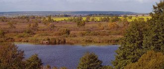
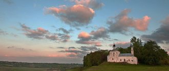
The Volgograd region is an amazing place at the junction of various historical, geographical, economic and ethnic spaces. Here you can take excursions into the distant past and the near present through the cities and villages of the region, and visit amazing sites of natural, cultural and historical heritage. The Volgograd region is not only the site of the most massive Battle of Stalingrad in the history of mankind, but also the capital of the Golden Horde, Sarai-Berke, and the village of Zimoveyskaya, the birthplace of Emelyan Pugachev and Stepan Razin. These include the amazing landscapes of the Volga-Akhtuba floodplain, the chalk mountains of the Don region, the largest salt lake in Europe Elton, and the Medveditskaya ridge - a favorite place for ufologists.
The Volgograd region is located in the south of Russia and borders the Saratov, Rostov, Astrakhan and Voronezh regions, the Republic of Kalmykia and Kazakhstan. From north to south and from west to east, the region stretches for more than 400 km. There are forests, swamps, steppes, semi-deserts and even real deserts. About 200 rivers flow through the territory of the Volgograd region. The most famous of them are the Volga and Don.
The Volgograd region consists of 32 districts and 6 urban districts, each of which is unique in its own way.
Passports of municipalities
| Urban districts | Municipal districts | ||
|
|
|
|
Volgograd
The urban district of the hero city of Volgograd is the center of the Volgograd region, the largest settlement in the region. Since ancient times, its geographical location has determined the city as an important transit hub for many transport links. It is here that the most powerful Volzhskaya hydroelectric power station in Europe, the Volga-Don Canal, and the famous “dancing” bridge across the Volga are located. Why is the city attractive to curious tourists? First of all, military glory and history.
Among the most significant sights of the city are the memorial complex “Heroes of the Battle of Stalingrad” on Mamayev Kurgan with its main monument “The Motherland Calls!”, and the state historical and memorial museum-reserve “Battle of Stalingrad” with the artistic panorama “Defeat of the Germans” located in it. -fascist troops at Stalingrad."
Tourist passport of Volgograd () ()
Volzhsky
The urban district of the city of Volzhsky is the second largest city in the region by size and population. Its history is inextricably linked with the construction of the Volzhskaya hydroelectric power station - the largest hydroelectric power station in Europe. Despite the fact that Volzhsky is one of the industrial giants of the region and the Lower Volga region, the city has been repeatedly awarded the title “The Most Comfortable City in Russia.” Since its founding, park areas have been laid out for residents, cultural centers and museums have been opened. Due to its close proximity to the regional center, Volzhsky is sometimes called the “satellite city” of Volgograd.
Tourist passport of Volzhsky () ()
Kamyshin
The urban district of Kamyshin is the third largest city in the Volgograd region with a three-hundred-year history. Located 200 km from Volgograd. Architectural monuments and picturesque landscapes create a unique appearance for the city, which can rightfully be called the pearl of the Volga region. The city annually hosts a major gastronomic watermelon festival “Zelo Oyagode District” and the history of Kamyshin.
Kamyshin tourist passport ( in word ) ()
Frolovo
The urban district of Frolovo is located in the geographical center of the Volgograd region. From time immemorial, the Don Cossack Army was located on the territory of the modern Frolovsky district. In Frolovo, the sights of the beginning have been preserved. XX century - the merchant house of the industrialist I. Deev, the old French Bridge, the Church of the Nativity of the Blessed Virgin Mary. The city's park complexes contain numerous symbolic and historical monuments.
Tourist passport Frolovo () ()
Uryupinsk
The urban district of Uryupinsk is one of the oldest Cossack settlements in the Lower Volga region. The city is honorably called “the capital of the Russian province”, and they also remember the catchphrase: “Whoever has not been to Uryupinsk does not know Russia.” In the Cossack city there are monuments to outstanding villagers, heroes of the story “The Fate of Man,” needlewomen and even a goat, since Uryupinsk is famous throughout the country for its knitted items made from goat fluff.
Tourist passport of Uryupinsk () ()
Mikhailovka
The urban district of Mikhailovka is located 190 km from Volgograd, on the banks of the Medveditsa River. The history of the city and many surrounding villages is directly related to Cossack culture and traditions. Mikhailovsky District is rich in unique natural sites and anomalies, as well as architecture with a centuries-old history. To date, the city of Mikhailovka is one of the largest settlements in the region, thanks to its developed agriculture and cement industry.
Mikhailovka tourist passport () ()
Alekseevsky municipal district
Alekseevsky district is located in the northwestern part of the Volgograd region. The Khoper and Buzuluk rivers flow on its territory, and the Nizhnekhopersky natural park is also located. In the regional center - the village of Alekseevskaya, guests can stroll through park areas and streets, where interesting memorial signs to residents of the village and historical figures can tell about the history and culture of the city.
Tourist passport of Alekseevsky district ( in word ) ()
Bykovsky municipal district
Bykovsky district is located in the eastern part of the Volgograd region, on the left coast of the Volgograd reservoir. The area is known for its melon crops, landscaped tulip reserve and habitats of Red Book species of animals. Archaeological excavations of Bronze Age sites are taking place on the banks of the Volgograd Reservoir. In the regional center, the village of Bykovo, there is a memorial complex to the heroes of the Great Patriotic War.
Tourist passport of Bykovsky district () ()
Gorodishchensky municipal district
Gorodishchensky district is located in the suburban area of Volgograd and has great tourism potential. On the territory of the district and in the district center, the village of Gorodishche, there are many memorials to the fallen soldiers of the Battle of Stalingrad, at the sites of heavy battles. The most famous memorial complexes in the area are the Rossoshinskoye cemetery and the Soldiers' Field. There is a juice production complex “Gardens of Pridonya” in the region, and a protective Guard Line, built in the 18th century from the Volga to the Don, stretches across the entire region from Volgograd.
Tourist passport of Gorodishchensky district () ()
Danilovsky municipal district
The Danilovsky district is located in the north of the Volgograd region, on the territory of the picturesque rivers Medveditsa and Buzuluk, in the valley of which there are forests, meadows, and lakes. These places are a center of attraction for lovers of fishing and active recreation at any time of the year, usually summer. Every year, a festival of military-historical reconstruction “Cossack Outpost” is held in the area on the banks of the Medveditsa. Believers will find many holy places in the region, from old temples to consecrated springs. District center - r.p. Danilovka is located 190 km. from Volgograd.
Tourist passport of Danilovsky district () ()
Dubovsky municipal district
The Dubovsky district is located on the right coast of the Volgograd reservoir and represents a unique and unique connection between history and nature. The past of the Dubovsky district is largely connected with trade routes between the Volga and Don, and therefore the current regional center, the city of Dubovka, has become a place of attraction for trade patrons and merchants. In Dubovka, in addition to the preserved merchant buildings and churches of the 19th-20th centuries, there grows a centuries-old oak tree, which has become a landmark and symbol of these places. Many unique natural objects are located in the Dubovsky district: pure springs, the Alexander Graben and excavation sites of ancient inhabitants of the region.
Tourist passport of Dubovsky district () ()
Elansky municipal district
The Elansky district is located in the north of the Volgograd region on the border with districts of the Saratov region. The territory of Elani is rich in unique landscapes, conducive to a pleasant holiday in the lap of nature. Here is a state water natural monument - the Kraishevsky spring with drinking water with a high silver content. In the regional center, r.p. Yelan, guests can visit not only local parks and museums, but also take several unique trips, one of which is a trip along the old railway with a historical excursion, and another - a trip to the chalk hills and find out what the area was like in prehistoric times times millions of years ago.
Tourist passport of the Elansky district () ()
Zhirnovsky municipal district
The Zhirnovsky district is located in the steppe zone on both sides of the Medveditsa River in the north of the Volgograd region. The regional center, the city of Zhirnovsk, is best known in the region as a center of oil and gas production. The city has created several park areas, cultural leisure facilities, and organizes a large number of holidays and festivals. The territory of the region is also famous for its anomalous zones and unique natural objects: the Medveditskaya Ridge, or “Slope of Crazy Lightning,” attracts attention with inexplicable phenomena and legends of this place, the Great Stone Ravine is a monumental source of information about prehistoric times, and the Olga spring on the site of the demolished St. Trinity Convent has healing properties.
Tourist passport of Zhirnovsky district () ()
Ilovlinsky municipal district
The Ilovlinsky region has an interesting cultural heritage associated with Cossack settlements in these areas, and the natural beauty of places along the banks of the Don and along the steppe plains. The district is located in the central part of the Volgograd region, the district center is the village. Ilovlya is located 70 km from Volgograd. The region miraculously combines the largest chalk deposits in Europe, cut by deep canyons with sprawling massifs of fescue-feather grass steppes, with the region's most extensive water meadows and floodplain forests. Historically, the modern Ilovlinsky district was part of the All-Great Don Army. In Ilovlya, the unique “Museum of Cossack Culture and Life” tells about the way of life of the Cossacks.
Tourist passport of Ilovlinsky district () ()
Kalachevsky municipal district
Kalachevsky district is located on both banks of the Don, about 80 kilometers from Volgograd. The village of Kalachevskaya, founded at the beginning of the 18th century, became one of the centers of trade routes with the opening of the Volga-Don railway in the 19th century. During the Battle of Stalingrad, the Kalachevsky district, despite the occupation, became famous for the resilience of its residents and the actions of partisan detachments, and at the end of November 1942, the counter-offensive of Soviet troops near Stalingrad was completed here. The regional center, the city of Kalach-on-Don, has held the honorary title “City of Military Glory” since 2010. After the war, a section of the Volga-Don shipping canal named after V.I. Lenin was dug through the territory of the region. In the village of Pyatimorsk there is the VDSK Museum, a unique park “History of the Russian State” and the monument “Union of Fronts” - a monument to Soviet soldiers who completed the encirclement of the Nazis in Stalingrad.
Tourist passport of Kalachevsky district ()
Kamyshinsky municipal district
Kamyshinsky district and the regional center - Kamyshin - are located on the steep right bank of the Volgograd reservoir. The area welcomes guests with cordiality and hospitality and invites them to plunge into cultural events that often take place in the summer. Unique natural landscapes are the strongest side of the Kamyshinsky district, and the Shcherbakovsky natural park is a real pearl of the Lower Volga region. Picturesque ravines and canyons, the legendary Usha Mountains, Stepan Razin’s Hill and the vertical coastal cliffs of Stolbichi attract lovers of active recreation and eco-tourism, and for the historical residence of the Volga Germans in these places and the landscape similarity with the Alpine meadows of Europe, the Shcherbakovsky Natural Park is called “Volga Switzerland” .
Tourist passport of Kamyshinsky district () ()
Kikvidzensky municipal district
The Kikvidzensky district is located in the north of the Volgograd region in the valleys of the Buzuluk and Machekha rivers. The regional center, the village of Preobrazhenskaya, is located 320 km from Volgograd. The region is famous for its natural diversity - the boundaries cover areas from forest tracts along rivers to steppe expanses with protected areas where Red Book plant species grow. In the village of Preobrazhenskaya, the main attraction is the Holy Transfiguration Church, built in 1871. The village preserves the memory of the commander of the Red Army during the Civil War, V.I. Kikvidze, participants in the Great Patriotic War, Cossack traditions, which is the great merit of the regional Kikvidzensky Museum of Local Lore.
Tourist passport of Kikvidzensky district () (
Kletsky municipal district
The Kletsky municipal district of the Volgograd region is located in the southwestern part of the region, on the right bank of the Don River. The area is rich in cultural monuments and Cossack architecture, combined with the nature of these places - the green floodplain of the Don and the chalk mountains. On its territory, monasteries and temples built in the 17th-18th centuries have been preserved; one of the famous is the Kremen Holy Ascension Monastery. In the regional center - the village of Kletskaya - merchant buildings of the 19th-20th centuries and monuments to participants in the Great Patriotic War who defended the Don land are preserved. The legendary film “They Fought for the Motherland” was filmed near the village in 1974; the great actor, writer and director Vasily Shukshin died here. Every year for more than 20 years in a row in October, Kletsk residents meet his relatives, friends and ordinary guests on the Shukshinsky cliff during the “Shukshin Memorial Days”.
Tourist passport of Kletsky district () ()
Kotelnikovsky municipal district
Kotelnikovsky district and its center - the city of Kotelnikovo - are the southernmost municipalities of the Volgograd region. The territory is located on the Don Plain and on the eastern bank of the Tsimlyansk Reservoir. Historically, the area became the birthplace of the famous Cossack atamans Stepan Razin and Emelyan Pugachev - both, according to the chronicle, were born in Art. Zimoveyskaya (now Pugachevskaya station). In memory of the battles near Stalingrad in 1942, many monuments and obelisks were erected to war heroes and natives of local villages. In recent years, popular types of tourism have been actively developing in the region - rural and event-based; an equestrian club has been organized in Kotelnikovo and a regional local history museum operates.
Tourist passport of Kotelnikovsky district () ()
Kotovsky municipal district
Kotovsky district is located in the northeastern part of the Volgograd region and is one of the leading industrial centers of the region, where the leading industry is gas and oil production. The extraordinary topography of the area is formed by the Volga Upland, the Donno-Medveditskaya ridge and 11 rivers, where you can combine active recreation with the opportunity to enjoy nature. The regional center - the city of Kotovo, located 215 km from Volgograd, is a place where guests are immersed in the world of history and culture thanks to the hospitality of the regional Museum of History and Local Lore, the unique Center of Ukrainian Culture and the exciting creation of traditional folk crafts in the regional House of Culture.
Tourist passport of Kotovsky district () ()
Kumylzhensky municipal district
The Kumylzhensky district is a picturesque and little-disturbed nature of the Nizhnekhopersky natural park. This is one of the cleanest rivers in Europe - the Khoper. Rich history and Cossack traditions. The youth of the famous writer Mikhail Sholokhov and the first pages of his novel “Quiet Don”.
Tourist passport of Kumylzhensky district () ()
Leninsky municipal district
The Leninsky district is located in four natural and climatic zones at once - the picturesque landscapes of the Volga-Akhtuba floodplain give way to endless flat steppes, gradually turning into semi-deserts, and then into deserts. And the history of the area is connected with the last capital of the Golden Horde - Tsarevskoye fortification.
Tourist passport of Leninsky district () ()
Nekhaevsky municipal district
The Nekhaevsky region is the homeland of nomadic tribes that have succeeded each other from century to century (Scythians, Alans, Huns, Ugrians, Khazars, Pechenegs). The unique beauty and richness of nature of the Nizhnekhopersky natural park have endowed the Nekhaevsky district with great tourism potential.
Tourist passport Nekhaevsky district () ()
Nikolaevsky municipal district
The Nikolaevsky district, located in the northeast of the region, is virgin steppes with Schrenk tulips, places of reproduction of wild boars in reed thickets, the largest estuary of the Trans-Volga region with valuable meadow vegetation and the left bank of the endless Volgograd “sea”.
Tourist passport of the Nikolaev region ( pdf )
Novoanninsky municipal district
The territory of the Novoanninsky municipal district is one of the most beautiful, environmentally friendly places in the Volgograd region. The forest park area along the Buzuluk River has the status of a landscape reserve. And the picturesque lakes Darga and Mironovo are natural monuments.
Tourist passport of Novoanninsky district () ()
Novonikolayevsky municipal district
Novonikolaevsky district is located on the territory of the Khopersko-Buzuluk plain. Here is one of the amazing natural monuments - the Kosarka tract - artificial forests in the steppe.
Tourist passport of Novonikolaevsky district () ()
Oktyabrsky municipal district
The Oktyabrsky district is located in the interfluve of the small rivers Aksai Esaulovsky and Myshkova. The territory of the village of Oktyabrsky and adjacent villages was the center of one of the Sarmatian tribes. Large-scale archaeological research is carried out here.
Tourist passport of Oktyabrsky district () ()
Olkhovsky municipal district
The Olkhovsky district is a land of amazing nature, unique history, and rich spiritual culture. The territory of the region is decorated with the unique beauty of the chalk hills stretching along the picturesque floodplain of the Ilovlya River, unique flora and fauna, juniper thickets and an alley of 400-year-old oak trees, caves containing inexplicable facts.
Tourist passport of Olkhovsky district () ()
Pallasovsky municipal district
Pallasovsky district is the largest in area in the Volgograd region, occupies its eastern part and borders on Kazakhstan. The area is famous for the largest salt lake in Europe, Elton, and the sanatorium of the same name, which welcomes people from different parts of the country and abroad. Around the lake there is the Eltonsky Natural Park with extraordinary landscapes, numerous Red Book animals and state natural monuments.
Tourist passport of Pallasovsky district () ()
Rudnyansky municipal district
The Rudnyansky district is located in the northern part of the region and has natural monuments - Kozlovskaya and Tersinskaya forest dachas, thin-leaved peony, Karchi and Shikhan springs. The preserved merchant buildings of the 19th century and modern buildings add a special flavor.
Tourist passport of Rudnyansky district ()
Svetloyarsk municipal district
Svetloyarsky district is an agricultural region of the Volgograd region, uniting more than 60 nationalities. A special feature of the Svetloyarsk region is that the Volga-Don shipping canal passes through its territory. Of the 13 canal locks, 6 are located in the region.
Tourist passport of the Svetloyarsk region () ()
Serafimovichsky municipal district
Serafimovichsky district is the “Archedinsko-Don sands”, the Don and Medveditsa rivers, the Literary and Local History Museum named after. Serafimovich, Cossack art gallery, Church of the Resurrection of the Lord with the chapel of St. Nicholas the Wonderworker and the Ust-Medveditsky Spaso-Preobrazhensky Monastery. The history of the region is inextricably linked with the history of the Don Cossacks.
Tourist passport of Serafimovichsky district () ()
Sredneakhtubinsky municipal district
Picturesque landscapes of the Volga-Akhtuba floodplain, a unique ecological complex, Lake Lotus, the Museum of Russian Fairy Tales named after A.S. Pushkin, kayaking and horseback riding, comfortable recreation centers - this is all the Sredneakhtuba district, which annually attracts both residents of the Volgograd region and and guests from other regions and countries.
Tourist passport of Sredneakhtubinsky district () ()
Surovikinsky municipal district
In the southwest of the Volgograd region, on the shore of the Tsimlyansk reservoir, there is one of the ecologically clean areas - Surovinsky, famous for such natural monuments as the Tulip Field, Bad Islands, Sviridov Lakes.
Tourist passport Surovikinsky district () ()
Staropoltavsky municipal district
The Staropoltava region is located in the Trans-Volga-Kazakhstan steppe province in the zone of fescue-feather grass steppes. The meadows with Shrenk's tulips and the Saltovsky forest, which are natural monuments, attract with their beauty and uniqueness.
Tourist passport of Staropoltava region () ()
Uryupinsky municipal district
Uryupinsky district is the birthplace of the famous artist I.I. Mashkov. The area is unique in terms of tourism development and mass recreation. The favorable climate of the southern Russian summer, the steppe region on the banks of the purest Khoper, unique in beauty and diversity of flora and fauna, has recently attracted many tourists, painters, and photographers.
Tourist passport of the Uryupinsk region () ()
Frolovsky municipal district
Frolovsky district is located in the central part of the Volgograd region. The rich history and nature have endowed the area with great tourism potential. In the ancient Cossack village of Malodelskaya, which recently celebrated its 300th anniversary, ancient buildings have been preserved. The Archedinsky forestry enterprise, with thousands of hectares of artificially grown pine forest on the Don sands, rich in mushroom and hunting grounds, annually attracts active tourists.
Tourist passport of Frolovsky district () ()
Chernyshkovsky municipal district
On the right bank of the Don River in the southwestern part of the Volgograd region is the Chernyshkovsky district. The Chirsko-Don Plateau and the Tsimlyansk Sands are the most typical landscapes here, defining the characteristic natural features of the area. Historical settlements and villages have preserved the spirit and traditions of the Don Cossacks.
Tourist passport of Chernyshkovsky district () ()
Economy and industry of the Volgograd region
Yandex maps of the Volgograd region display all industrial facilities in the given territory. The region produces tower cranes, commercial, drilling and transport and storage equipment, and various tractors.
There are many enterprises specializing in the production of building materials, food products, as well as woodworking and textile products. The organization will be helped to find a map of the Volgograd region with cities and villages.
Only in this region are some types of bearings, polyurethane pipes, and gas pipes produced.
There are also a large number of light industry enterprises in the region. You can easily find them with a map of the Volgograd region. This is a knitwear production enterprise in Uryupinsk, a cotton mill in Kamyshin, and a sewing manufactory in Tsaritsino.
Companies producing footwear and leather goods are mainly concentrated in Volgograd. The Svetloyarsk district is known for wool processing organizations, and textile production is concentrated in Kamyshin.
In which cities and districts of the Volgograd region coronavirus was detected as of December 9, 2021
New cases of COVID-19 recorded in 28 districts of the region
