Kemerovo is a city located 3482 km from Moscow, in the southeast of Western Siberia. It is the administrative, industrial, transport and cultural center of the Kemerovo region. According to 2021 data, the city is home to about 557 thousand people. In this article we will talk about the administrative division of Kemerovo, the districts and their distinctive features.
General information
Kemerovo is located on both banks of the Tom River, at the confluence of the Iskitimka tributary. Thus, it is geographically divided into two parts. Initially, the settlement of the city began from the right bank. The private sector dominates here, interspersed with high-rise buildings. In this part there are two districts - Kirovsky and Rudnichny.
On the left bank there are such districts of Kemerovo as Central, Zavodskoy and Leninsky. Here you will find many high-rise buildings and new buildings. People flock here to relax and have fun. The historical center of the city is very popular. Factories and industrial enterprises also operate here.
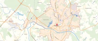
Map of the city of Kemerovo with roads. Transport infrastructure
Kemerovo is located on the route of the most important transport routes connecting Eastern and Western Siberia.
2 road and 1 railway bridges were built across the Tom River within the city, and 6 road and 1 railway bridges across Iskitimka.
The satellite map of Kemerovo shows that the city is crossed by the federal highway R-255 “Siberia” Novosibirsk – Kemerovo – Krasnoyarsk – Irkutsk and the regional highway R-384 Novosibirsk – Leninsk-Kuznetsky – Kemerovo – Yurga.
A section of the West Siberian Railway passes through Kemerovo. From the Kemerovo-Pasazhirsky railway station trains depart in the directions Kemerovo - Novosibirsk, Kemerovo - Tomsk, Anapa - Novokuznetsk, Moscow - Kemerovo. The movement of commuter trains to Taiga, Shishino and Plotnikovo has also been established. Station address: Kuznetsky Avenue, 79.
The local bus station , located on Kuznetsky Avenue, 81, provides bus service between the city and Belovo, Tomsk, Anzhero-Sudzhensky, Barnaul, Berezovsky, Krasnoyarsk and other cities.
Kemerovo International Airport. A. A. Leonova receives and sends aircraft to Moscow, Simferopol, Sochi, Antalya, Phuket, Pattaya and Cam Ranh. On the map of the city of Kemerovo, the airport is located 11 km southeast of the city center. Buses No. 101 and 126 go to the airport.
Public transport in Kemerovo is represented by 74 city and 72 suburban bus routes, as well as 5 tram and 9 trolleybus routes. Urban transport is in satisfactory condition, due to the lack of budget funds for the purchase of new transport units. The fare for all types of public transport is 16 rubles.
Kirovsky district
It is the same age as the city, although initially housing construction was not planned here at all. It was assumed that industrial enterprises would be built on the right bank. In particular, Progress Production Association, which produces paints and varnishes, is located here. In addition, it is here that the winds carry harmful emissions from chemical plants located in the Zavodskoy district. Therefore, the environmental situation leaves much to be desired. However, the buildings arose spontaneously, and after the war the area actively developed.
Now it is considered the most crime-prone in the city. There is a special regime prison on its territory. Transport provision leaves much to be desired. All this leads to traditionally low housing prices.
Economy and industry of Kemerovo
The basis of the city's economy is the coal and chemical industries, and mechanical engineering. The largest enterprises in these areas:
- OJSC "UK KuzbassRazrezUgol" and "Ugolnaya" - coal mining;
- OJSC Koks – coke production;
- OJSC "Azot" - production of nitrogen fertilizers and ammonium nitrate;
- FSUE "PO Progress" - production of paint and varnish products;
- JSC "Khimprom" - production of organic and inorganic chemical products;
- State Unitary Enterprise "Kemerovo Mechanical Plant" - production of equipment for agricultural machines.
Electric power and food industry enterprises also play an important role in the city’s economy:
- OJSC "Kemerovo Dairy Plant";
- LLC "AG Kemerovo Meat Processing Plant";
- IP "Volkov Peasant Farm";
- OJSC Kuzbassenergo.
In addition to industry, Kemerovo has developed services, retail trade and banking.
Rudnichny district
It is the oldest, because it was here that the city’s first coal mining enterprises, the mines, arose. Now they are not functioning. Most residents of the area live in private houses, although active construction is currently underway. The center, built up with high-rise buildings, was called “Rainbow”. It is located along the largest Miners Avenue.
The main attraction of this area of Kemerovo is the pine forest. It is a section of relic taiga preserved in its original form. In winter there are ski resorts here.
The Rudnichny district includes three remote residential areas: Promyshlennovsky, Kedrovka and Lesnaya Polyana. In the territory of the first two, open-pit coal mining is carried out. The Lesnaya Polyana microdistrict was founded in 2007. This is a satellite city with developed infrastructure, located remotely from all industrial enterprises. The ecological situation here is very favorable, the houses are mostly low-rise, special attention is paid to landscape design, walking areas, parks and squares.
Historical background and national composition
There is an assumption that the name of the city of Kemerovo comes from the Turkic word kemer, which means mountain slope, cliff, hill. There is probably some truth to this hypothesis, since the city is surrounded on all sides by steep mountains. In the 1960s, the only way to get here was by sea.
The first notes about Kemerovo date back to 1721 in connection with the finds of coal. In the autumn of 1734, in the notes of S. Krashennikov there is a mention of red stones at the base of the settlement, which stands at the mouth of the Tom River. Previously, there was the village of Iskitim, and before that the village of Shcheglovo.
By the way, the city at first also bore the name Shcheglov due to the formation of the Shcheglovsky district, but was renamed on March 27, 1932.
Most of the nationalities here are Russian citizens. As a percentage, they occupy almost 95% of the population. Almost 1.5% are Tatars. The remaining 3.5% is occupied by Ukrainians, Armenians, Germans and other peoples.
Zavodskoy district of Kemerovo
It is the largest in population and is located in the southwestern part of the city. There are two large industrial enterprises operating on its territory - Azot and Khimprom. However, the area received its name not for the abundance of factories, but for its location “across the water,” that is, on the other bank of the Tom.
All major transport facilities are located here. These include the airport, bus and train stations. Like Rudnichny, Zavodsky district includes remote residential areas: Pioner and Yagunovsky. Unofficial microdistricts include “FPK” and “Yuzhny”. "FPK" is a residential area. “Yuzhny” consists of the private sector and new neighborhoods, where active construction is underway and infrastructure is being developed.
central District
It is located in the central part of the city and is divided in half by the Iskitimka River. The left bank is densely built up with five-story buildings. This is the center of the city's cultural life. It is here that the main square of Kemerovo, administrative buildings, museums, theaters, libraries, cinemas, a circus, the Khimik stadium, and the Arena and Lazurny sports complexes are located. On the right bank of Iskitimka, a one-story private sector has been preserved. Now the gradual demolition of dilapidated housing is underway here, and the construction of modern high-rise buildings is beginning.
The central district is a favorite vacation spot for city residents. Many people walking can be seen in the evening on the main square of Kemerovo in front of the administration building. Sovetsky Prospekt, the main street of the city, leads to it. Kemerovo residents also love to walk along the beautiful Spring Street and admire the picturesque view of the Tom River from the embankment.
Map of Kemerovo with streets and houses
- St. Nakhimova is a long (7 km) street in the Rudnichny district, starting at the confluence of Militseiskaya Street with Logovoy Shosse and ending on the outskirts of the city with the highway to Anzhero-Sudzhensk and Mariinsk. The street passes through the private sector, near it there are the Severny Sports Complex and the City Clinical Hospital No. 11.
- Kuznetsky Prospekt on the map of Kemerovo is one of the longest (8 km) and busiest arteries of the city, running through the territory of the Central and Zavodsky districts. The avenue starts from the Tom River and ends in the village of Komissarovo. It contains: a monument to the First Kemerovo tram, the shopping center "Ya" and "City Park", a branch of REU named after. Plekhanov, railway station and bus station.
- Lenin Avenue is the widest highway in Kemerovo (10 lanes), crossing the Zavodsky, Central and Leninsky districts. Its name in the address is: Alexander Nevsky Church, Children's Clinical Hospital No. 1, Antoshka Park and Park named after. Vera Voloshina, Kemerovo Circus, Munira Mosque. The avenue runs entirely through multi-storey residential buildings.
- Gagarin Street is a street in the Zavodsky and Central districts, starting from the embankment of the Iskitimka River. On it are located: St. George's Church and the Znamensky Cathedral, park named after. D. G. Medvedeva, Children's Clinical Hospital No.
- St. Tukhachevsky is a short (2.5 km) street in the Zavodsky district of the city, passing through multi-apartment residential buildings, an industrial zone and ending at the dacha areas on the outskirts of the city.
- St. Krasnoarmeyskaya is a street in the Central and Zavodsky districts, 7 km long. On it there are: the Magnit supermarket, the Dynamo sports complex, the Radio House, Victory Park named after. G. K. Zhukova.
- Shakhterov Avenue - on the map of Kemerovo with streets, it crosses the Rudnichny district and is its main thoroughfare. Trams and trolleybuses also run along the avenue; its length is 5 km. On Shakhterov Avenue you can find: Art College, Mining Court, Peoples' Friendship Park.
Leninsky district of Kemerovo
Its construction began in 1979. The new microdistrict became a twin city of the Hungarian city of Salgotaryan and was named by this name. Gradually, the southeastern part of the city grew, large streets, avenues, and boulevards appeared. Now the Leninsky district includes an industrial zone and residential buildings with developed infrastructure, parks, lawns, and roads.
A favorite place for walking is Stroiteley Boulevard, the longest alley in the city. Other interesting sights are the Holy Trinity Church and the Munir Mosque.
As we see, each of the districts of Kemerovo has its own character, its own history and, we hope, its own future.
Sights of the city of Kemerovo
- The Church of the Holy Trinity is a beautiful temple, built in 2008 in a modern style. Located in Kuzbass Park, Khimikov Avenue, 32.
- Znamensky Cathedral is a unique church made in the style of Siberian Baroque and Classicism, recognized as a monument of regional significance. Address: Sobornaya street, 24.
- The Church of Xenia of St. Petersburg is a small wooden church with a chapel, reconstructed in 2008. On the map of Kemerovo with streets and houses, this church can be found in the village of Borovoy, on Svyatoy Istochnik Street, 26.
- Coal Museum , displaying examples of mined grades of coal from local coal mines. Here you can also get acquainted with the history of the development of the coal industry in Kuzbass and paleontology. Museum address: Leningradsky Prospekt, 10.
- The monument to the miners of Kuzbass is a sculpture of a working man in a helmet, 12 meters high. Its author is Ernst Neizvestny. The monument was installed on Krasnaya Gorka Street, 17.
- Kuznetsky Bridge , built across the Tom River and is the second widest (40.5 m) in Siberia after the Oktyabrsky Bridge in Krasnoyarsk. Its length is 638 meters, the traffic on the bridge is six-lane, and trams run in both directions.
- Victory Park , located on the left bank of Iskitimka, along Michurina Street. In the park there are monuments to G.K. Zhukov, home front workers and sculptures of military equipment from the Great Patriotic War.
- Kemerovo Regional Museum of Local Lore is the oldest museum in the region, opened in 1929. Here you can get acquainted with nature, modern and military history of the region, and the memorial complex. The museum is located on Sovetsky Prospekt, 55.
- open-air museum of railway equipment Entrance to the museum is free. Address: Pionersky Boulevard, 1.
