Omutninsk
(Kirov region)
OKATO code:
33228501
Founded:
1773
City since:
1921 City of district subordination (Omutninsky district, Kirov region)
Center:
Omutninsky district
The city was formerly called:
| Omutninsky Plant | 1921 |
| Telephone code (reference phone) | |
| 83352***** | 22-2-22 |
Deviation from Moscow time, hours:
0
Geographic latitude:
58°40′
Geographic longitude:
52°11′
Altitude above sea level, meters:
210 Sunrise and sunset times of the Sun and Moon in the city of Omutninsk
Factory Museum and Exhibition Center
It is located in the local Palace of Culture and opened in 1973. This event was timed to coincide with the bicentenary of the plant. The museum's collection includes both an ethnographic exhibition, that is, ancient household items, models and photographs that tell the history of both enterprises and cities. So are stands with samples of modern steel products produced by the plant. In addition, various exhibitions of paintings, photographs and crafts are constantly held here.
Location: 30th Anniversary of Victory Street - 16.
Map
| Omutninsk: maps |
Omutninsk: photo from space (Google Maps) Omutninsk: photo from space (Microsoft Virtual Earth)
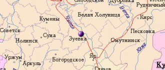
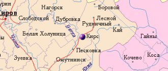
| Omutninsk. Nearest cities. Distances in km. on the map (in brackets along roads) + direction. Using the hyperlink in the distance , you can get the route (information courtesy of the AutoTransInfo website) | |||
| 1 | Oriental | 13 (14) | WITH |
| 2 | Peskovka | 43 (52) | WITH |
| 3 | Yar (Udmurt Republic) | 47 (125) | YU |
| 4 | Fallonki | 48 (176) | SW |
| 5 | Glazov | 65 (88) | SE |
| 6 | Afanasyevo | 66 (73) | IN |
| 7 | Zuevka | 67 (206) | SW |
| 8 | Kearse | 74 (86) | WITH |
| 9 | White Kholunitsa | 79 (99) | Z |
| 10 | Yukamenskoye (Udmurt Republic) | 86 (124) | YU |
| 11 | Balezino (Udmurt Republic) | 89 (121) | SE |
| 12 | Nagorsk | 107 (170) | NW |
| 13 | Krasnogorskoe (Udmurt Republic) | 108 (141) | YU |
| 14 | Uni | 109 (232) | YU |
| 15 | Slobodskaya | 115 (138) | Z |
a brief description of
Located in the Urals, on the slopes of the Verkhnekamsk Upland, on the river. Omutnaya, 190 km east of Kirov. Railway Stalnaya station.
Territory (sq. km): 50
Information about the city of Omutninsk on the Russian Wikipedia site
Historical sketch
Founded as a village in connection with construction on the river. Omutnaya (Omutnitsa) in 1773 iron smelter and named Osokino after the name of the founder, Lieutenant Colonel Osokin. But soon the name after the river became firmly established in use: Omutninsky Plant.
In the middle of the 19th century. under the owner Pastukhov, the second blast furnace was launched. At the end of the 19th century. One of the creators of arc welding, electrician N.G., worked at the plant. Slavyanov and metallurgist scientist, founder of the blast furnace process M.A. Pavlov.
The city of Omutninsk since 1921. Hydronym from omut “a deep hole at the bottom of the river; a whirlpool in a deep place.” In ATD 1931 the city of Omutnin.
Economy
Metallurgical plant. Wood processing enterprises (3 timber industry enterprises) and food industry, etc.
Main enterprises
FERROUS METALLURGY
OJSC "Omutninsky Metallurgical Plant"
612700, Kirov region, Omutninsky district, Omutninsk, st.
Kokovikhina, 2 Offers:
Hot-rolled steel, twisted drill steel, cold-drawn section steel, for reinforced concrete reinforcement, steel shaped profiles
OJSC "Peskovsky Foundry"
612760, Kirov region, Omutninsky district, Peskovka village, st.
Lenina, 73 Offers:
Steel, cast iron, furnace castings, components and parts made of ferrous metals
MEDICAL INDUSTRY
OJSC "Vostok"
612711, Kirov region, Omutninsky district, Vostochny village,
Offers:
Disposable syringes, medications (injection solutions)
Architecture, sights
Omutninsk is built up mainly with one-story wooden houses.
| Population by year (thousands of inhabitants) | |||||||
| 1926 | 6.4 | 1992 | 29.6 | 2007 | 25.0 | 2016 | 22.4 |
| 1931 | 7.3 | 1996 | 29.2 | 2008 | 24.8 | 2017 | 22.3 |
| 1939 | 17.4 | 1998 | 29.0 | 2010 | 24.4 | 2018 | 22.0 |
| 1959 | 24.8 | 2000 | 29.0 | 2011 | 23.6 | 2019 | 21.8 |
| 1967 | 27 | 2001 | 28.9 | 2012 | 23.2 | 2020 | 21.6 |
| 1970 | 28.8 | 2003 | 26.1 | 2013 | 22.9 | 2021 | 21.4 |
| 1979 | 28.5 | 2005 | 25.4 | 2014 | 22.7 | ||
| 1989 | 29.2 | 2006 | 25.1 | 2015 | 22.5 | ||
Embankment of Omutninsky Lake
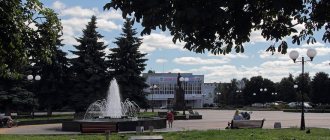
After getting acquainted with the history of Omutninsk, it would be good to go to the most beautiful place in the whole city - this is the embankment of Omutninsky Lake. It's actually a pond. But it is so beautiful that both locals and visitors call it a lake.
A walk along the embankment promises to be memorable thanks to the beautiful views all around. In addition, there are benches, a stage, a lighthouse and a monument to a worker with a hammer and sickle.
Location: 30th Anniversary of Victory Street - 16.
History of Omutninsky district
The area is inhabited by Russians whose religion is Orthodox. This is due to the fact that in 1582 Russian settlement occurred after the Verkhovyatsky Catherine Monastery was built. Before this time, around 1543, the city of Shestakov was built, a new district was formed, where Udmurts, Russians and Komi-Permyaks lived.
- Kirs Attractions
- Lebyazhsky district of Kirov region
The territory of the Omutninsky district was rich in forests and ore, which
contributed to the construction of an iron smelting plant in 1773. The first settlement where workers lived also appeared here. Subsequently, it was named Omutninsk, and popularly called the “Omutninsky Plant”. The district appeared in 1929 and was part of the Nizhny Novgorod region of the Vyatka district. In the 30s of the 20th century, a railway was built through the village. Today, the distance to Kirov is 232 km, if you travel by train. In addition to the metallurgical industry, the microbiological industry is also developed here. In 1958, a chemical plant appeared. As in the old days, the area is rich in forest, so work related to its harvesting is carried out here. From an archaeological point of view, the Verkhnevyatsky region is very interesting and little explored. Treasures of gold coins (Golden Horde) were found here, as well as ingots of silver coins.
The best attractions of the Omutninsky district
Among the most famous and interesting places in the city are:
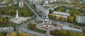
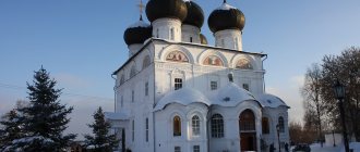
Church of the Life-Giving Trinity - in 1991. The temple began to be rebuilt and construction work continued until 2003. The shrine stands on the shore of a pond. The interesting thing is that there is an edicule underneath it;
The lake and its embankment are a favorite vacation spot for Omutninsk residents with benches equipped with volleyball and dancing grounds. Several monuments are located on the shore. Among them is a monument to a worker with a hammer and sickle, as well as a lighthouse;
The Church of the Intercession of the Blessed Virgin Mary was built of brick in the likeness of the previous one made of wood. Operates as an Old Believer church;
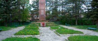
Civil War Alley - here is a mass grave (those who died in the civil war), founded on 11/07/1932 and a monument to these heroes;
Monument to Combat Veterans (Afghanistan) - built in 2011. Meetings of veterans and holidays for them are held here.
Ekaterina Tkacheva, for the site www.mykirov43.ru
Other monuments
If you wander around Omutninsk you can see other monuments. For example, to Veterans of combat in Afghanistan and local wars, installed in 2011 on Svoboda Street.
Or a monument to the liquidators of the accident at the Chernobyl nuclear power plant and other nuclear facilities. Its opening coincides with the 25th anniversary of the accident and also falls in 2011. And this memorial is located near the Central Library named after A.L. Aleyny on Vorovsky Street.
And that’s not all, there are other monuments. They are scattered throughout the city.
Links[edit]
Notes[edit]
- ^ abcdefgh Law No. 203-ZO
- ^ a b Federal State Statistics Service (2011). “All-Russian Population Census 2010. Volume 1" [All-Russian Population Census 2010, vol. 1]. All-Russian Population Census 2010 [All-Russian Population Census 2010]
. Federal State Statistics Service. - "26. The size of the permanent population of the Russian Federation by municipalities as of January 1, 2021". Federal State Statistics Service. Retrieved January 23, 2021.
- ^ abcde Law No. 284-ZO
- "On the Calculation of Time". Official Internet portal of legal information
. June 3, 2011. Retrieved January 19, 2021. - Post office. Information and computing center of OASU RPO. ( Post office
).
Search for postal service objects ( postal Search for objects
) (in Russian) - ↑
Federal State Statistics Service of Russia (May 21, 2004).
“The population of Russia, the constituent entities of the Russian Federation as part of federal districts, urban settlements, settlements, settlements of 3 thousand or more people” [Population of Russia, its federal districts, federal districts, districts, urban settlements, rural settlements - administrative centers and rural settlements with a population of more than 3000] (XLS). All-Russian Population Census of 2002 [All-Russian Population Census of 2002]
. - “All-Union Population Census of 1989. The current population of union and autonomous republics, autonomous regions and districts, territories, negative phenomena, urban settlements and rural district centers” [All-Union Population Census of 1989: current population of union and autonomous republics, Autonomous regions and districts , territories, regions, districts, urban settlements, villages performing the functions of district administrative centers. All-Union Population Census of 1989 [All-Union Population Census of 1989]
.
Institute of Demography of the National Research University: Higher School of Economics [Institute of Demography of the National Research University: Higher School of Economics]. 1989 - via Demoscope Weekly
.
Sources [edit]
- Legislative Assembly of the Kirov region. Law No. 203-ZO of December 4, 2007 “On the register of administrative-territorial units and settlements of the Kirov region,” as amended. Law No. 350-ZO of November 11, 2013 “On amendments to certain Laws of the Kirov Region.” Came into force after ten days from the date of official publication. Published: “Vyatka Territory”, No. 227 (4115), December 11, 2007 (Legislative Assembly of the Kirov Region. Law of December 4, 2007 No. 203-ZO “ On the register of administrative-territorial units and settlements of the Kirov Region”,
as amended , introduced by the Law of November 11, 2013 No. 350-ZO “
On Amendments”).
Various laws of the Kirov region ( come into force on the day following ten days after the day of official publication). - Legislative Assembly of the Kirov region. Law No. 284-ZO of December 7, 2004 “On establishing the boundaries of municipalities of the Kirov region and granting them the status of a municipal district, city district, urban settlement, rural settlement,” as amended. Law No. 350-ZO of November 11, 2013 “On amendments to certain Laws of the Kirov Region.” Came into force after 10 days from the date of official publication. Published: “Vyatka Territory”, No. 233–234 (3401–3402), December 21, 2004 (Legislative Assembly of the Kirov Region. Law No. 284-ZO of December 7, 2004 “ On establishing the boundaries of municipalities of the Kirov Region and assigning them municipal district, urban district, urban settlement, rural settlement
as amended by Law No. 350-ZO of November 11, 2013
On amendments to various laws of the Kirov region
... Valid after 10 days from the date of official publication.).
