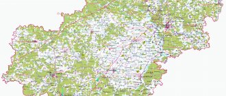
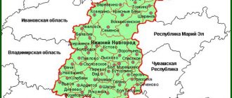
The Novgorod region is located in the European part of the country in its northwestern part. The region has a glorious history. Once upon a time, the lands of the region belonged to Kievan Rus, and from the 12th century. Veliky Novgorod became one of the largest city-states in Europe. Use satellite maps of the Novgorod region to get an idea of this region, consider its borders, cities and other settlements.
The borders of the region on 4 sides limit the territories of such areas as:
- Leningradskaya;
- Vologda;
- Pskovskaya;
- Tverskoy.
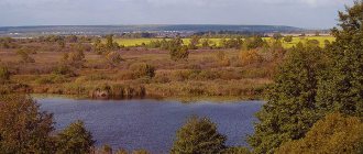
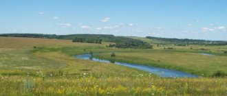
Hydrographic objects are displayed on the map of the Novgorod region with diagrams. In the center of the region is the large Lake Ilmen, surrounded by picturesque shores, a large number of recreation centers and beaches. Several large lakes are also located in the southeastern part of the region - Valdai, Seliger, etc.
There are more than 50 rivers in the region, most of them flow into the Ilmen. In different areas on the map of the Novgorod region you can see the following rivers:
- Volkhov;
- Lovat;
- Shelon;
- Kholynya;
- Redhya;
- Veryazha.
Tourists often come to the region. A large number of architectural monuments have been preserved here, as well as fishing and other outdoor activities. When going on a trip, use maps of the Novgorod region with districts. The online service will help you navigate your way by choosing the right road, finding cities, and considering the location of streets, train stations, shops and restaurants.
Districts on the map of the Novgorod region
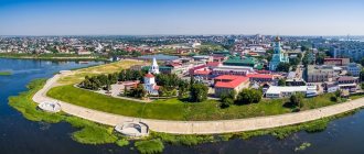
The region is divided into 20 districts. The main district is Novgorod, located in the western part. On its territory is Lake Ilmen and the capital of the region – Veliky Novgorod. Zoom into a detailed map of the Novgorod region and you can find the Novgorod Kremlin, which rises on the right bank of the Volkhov River. This main attraction of the area is a monument of defensive construction dating back to the time of economic prosperity of the city-state.
The region is connected with the neighboring northern and western regions by 3 railway lines. Also, several significant highways pass through the region’s districts, which are displayed on detailed road maps of the Novgorod region:
- M-10;
- R-21;
- M-11 (paid).
The easternmost district of the region is Pestovsky. It consists of 1 city and 7 villages. Light and food industry enterprises operate in the area. You can come here either by car or by rail.
The southernmost district is Kholmsky. On its territory there is the Rdeisky Monastery, which a map of the Novgorod region with villages will help you find. Part of the area's land belongs to the state nature reserve.
Population dynamics
| Population | ||||||||||
| 1897[3] | 1926[4] | 1959[5] | 1970[6] | 1979[7] | 1987[8] | 1989[9] | 1990[10] | 1991[10] | 1992[10] | 1993[10] |
| 1 367 022 | ↘1 050 604 | ↘736 529 | ↘721 471 | ↗721 790 | ↗752 000 | ↗753 054 | ↗753 369 | ↘751 908 | ↘748 820 | ↘746 950 |
| 1994[10] | 1995[10] | 1996[10] | 1997[10] | 1998[10] | 1999[10] | 2000[10] | 2001[10] | 2002[11] | 2003[10] | 2004[10] |
| ↘742 100 | ↘739 368 | ↘735 557 | ↘731 464 | ↘729 747 | ↘726 027 | ↘718 565 | ↘710 261 | ↘694 355 | ↘692 138 | ↘682 628 |
| 2005[10] | 2006[10] | 2007[10] | 2008[10] | 2009[10] | 2010[12] | 2011[10] | 2012[13] | 2013[14] | 2014[15] | 2015[16] |
| ↘674 071 | ↘665 365 | ↘657 595 | ↘652 437 | ↘645 986 | ↘634 111 | ↘632 799 | ↘629 748 | ↘625 855 | ↘622 430 | ↘618 703 |
| 2016[17] | 2017[18] | 2018[19] | 2019[20] | 2020[2] | 2021[1] | |||||
| ↘615 692 | ↘612 522 | ↘606 476 | ↘600 296 | ↘596 508 | ↘592 415 | |||||
Map of the Novgorod region with cities and villages
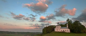
There are more than 20 cities and about 180 villages and settlements in the region. The population in cities is small. The largest number of people live in Novgorod the Great - more than 200 thousand people. The area attracts tourists interested in history, architecture, and active recreation. In addition, pilgrims and believers constantly flock here to visit numerous monasteries, temples, monasteries, and holy places. For whatever purpose you go to this beautiful region, use maps of the Novgorod region with cities and villages. The online service will help you plan and create your own route to such attractions as:
- Resurrection Cathedral – Derevyanitsy village;
- Perynsky monastery - in Yuryev;
- St. Nicholas Church - on Lipna;
- Ancient stone bridge over the Vitochka river;
- Church of Peter and Pavel - in Kozhevniki.
Using a map of the Novgorod region with settlements, you can go to the historical memorial dedicated to WWII soldiers, which is located in the village of Myasnoy Bor.
One of the most popular tourist destinations is the city of Staraya Russa. People come here not only to admire the beautiful architectural buildings, but also to relax in sanatoriums. For about 200 years, the unique methods of the sanatorium have been curing various diseases and helping to recover in the post-operative period, thanks to mineral waters and therapeutic mud. Yandex maps of the Novgorod region display all objects that may interest you.
Administrative-territorial structure of the region
In accordance with paragraph “l” of Part 2 of Article 5 of the Federal Law of October 6, 1999 No. 184-FZ “On the general principles of organization of legislative (representative) and executive bodies of state power of the constituent entities of the Russian Federation”, the establishment of the administrative-territorial structure of the constituent entity of the Russian Federation and order its changes are attributed to the powers of the legislative (representative) body of state power of the constituent entity of the Russian Federation.
The system of administrative-territorial structure of the Novgorod region is regulated by the regional law “On the administrative-territorial structure of the Novgorod region” dated November 11, 2005 No. 559-OZ (hereinafter referred to as regional law No. 559-OZ).
Regional Law No. 559-OZ determines the administrative-territorial structure of the region, the procedure for resolving issues of the administrative-territorial structure, the competence of state authorities of the region and local governments in resolving issues of the administrative-territorial structure of the region.
Article 3 of the said regional law defines the basic terms and concepts used in the regional law.
The administrative-territorial structure of the region is the territorial division of the region, established taking into account historical and cultural traditions, economic ties, the existing infrastructure for the implementation of the functions of public administration and the organization of local self-government, which is a system of administrative-territorial and territorial units included in the region.
Administrative-territorial unit is a part of the territory of a region within fixed boundaries, formed as a result of the administrative-territorial division of the region, having an administrative center, name and status established by law.
Administrative territorial units are administrative districts and settlements. A settlement is an administrative territorial unit that has within fixed boundaries one or more rural settlements united by a common territory.
The Novgorod region includes the following administrative districts and cities of regional significance:
administrative districts - Batetsky, Borovichsky, Valdaisky, Volotovsky, Demyansky, Krestetsky, Lyubytinsky, Malovishersky, Marevsky, Moshensky, Novgorodsky, Okulovsky, Parfinsky, Pestovsky, Poddorsky, Soletsky, Starorussky, Khvoyninsky, Kholmsky, Chudovsky, Shimsky;
cities of regional significance - Borovichi, Veliky Novgorod, Staraya Russa.
The administrative center of the region is the city of Veliky Novgorod. The administrative centers of administrative districts and settlements coincide with the administrative centers of the corresponding municipalities.
Regional Law No. 559-OZ operates in conjunction with the norms of regional laws establishing the boundaries of municipalities of the Novgorod region. According to Article 5 of the said regional law, the boundaries of an administrative district, as a rule, coincide with the boundaries of a municipal district. The boundaries of a settlement, as a rule, coincide with the boundaries of an urban or rural settlement.
At the same time, in accordance with regional law No. 559-OZ, cities of regional significance are not included in the administrative-territorial units: settlements and administrative districts. Cities of regional significance and urban-type settlements (worker settlements) are not included in the settlements.
A systematic list of administrative-territorial units, settlements of the region and information about them is contained in the register of the administrative-territorial structure of the region, approved by Resolution of the Regional Administration dated 04/08/2008 No. 121 “On the register of the administrative-territorial structure of the region” (hereinafter referred to as the Register).
Maintenance of the Register is carried out by the Administration of the Governor of the Novgorod Region for internal policy and consists of maintaining the Register in an updated form on the basis of current legislation in order to use it in the practical activities of state authorities and local governments, as well as informing legal entities and individuals about the administrative-territorial structure areas.
The basis for making changes to the Register are federal laws, regulatory legal acts of the Government of the Russian Federation, and the Regional Duma.
List of names of settlements in the Novgorod region*
| Administrative region | Settlement | Administrative center |
| Batetsky district | Batetsky settlement | p. Batetsky |
| Moikinskoe settlement | Moika village | |
| Peredolskoe settlement | village Novoe Ovsino | |
| Borovichi district | Volokskoe settlement | Volok village |
| Yogol settlement | Yogla village | |
| Zhelezkovskoe settlement | Zhelezkovo village | |
| Konchansko-Suvorovskoye settlement | With. Konchansko-Suvorovskoye | |
| Opechenskoe settlement | With. Opechensky Posad | |
| Peredskoe settlement | Peredki village | |
| Progressive settlement | n. Progress | |
| Sushanskoe settlement | Koegoshcha village | |
| Sushilovskoe settlement | Sushilovo village | |
| Travkovskoe settlement | Travkovo village | |
| Valdai district | Valdai settlement | Valdai |
| Edrovskoe settlement | With. Edrovo | |
| Ivanteevskoe settlement | village Ivanteevo | |
| Korotskoe settlement | p. Korotsko | |
| Kostkovskoe settlement | Kostkovo village | |
| Lyubnitskoe settlement | village Lyubnitsa | |
| Roshchinskoe settlement | Roshchino village | |
| Semenovshchinskoe settlement | Semyonovshchina village | |
| Yazhelbitskoe settlement | With. Yazhelbitsy | |
| Volotovsky district | Mountain settlement | Volot village |
| Volot settlement | Volot village | |
| Slavitin settlement | village Slavitino | |
| Demyansky district | Zhirkovskoe settlement | village Zhirkovo |
| Ilyinogorsk settlement | Shishkovo village | |
| Knevitskoe settlement | Knevitsy village | |
| Lychkovskoe settlement | With. Lychkovo | |
| Pesotskoe settlement | Peski village | |
| Polnovskoe settlement | With. Fully | |
| Yamnik settlement | village Yamnik | |
| Krestetsky district | Zaitsevskoe settlement | Zaitsevo village |
| Krestetskoye settlement | r.p. Sacrum | |
| Novorakhinskoe settlement | village Novoye Rakhino | |
| Ruchyevskoe settlement | Ruchi village | |
| Ustvolm settlement | Ust-Volma village | |
| Lyubytinsky district | Lyubytinskoe settlement | r.p. Lyubytino |
| Nebolch settlement | r.p. Be quiet | |
| Malovishersky district | Bolshevisher settlement | Bolshaya Vishera village |
| Burginskoe settlement | Burga village | |
| Verebyinskoe settlement | Verebye village | |
| Malovisherskoe settlement | Malaya Vishera | |
| Marevsky district | Velil settlement | With. Velily |
| Marevskoe settlement | With. Maryovo | |
| Moiseevskoe settlement | Moiseevo village | |
| Molvotitskoe settlement | With. Molvotitsy | |
| Moshensky district | Dolgovskoe settlement | d. Long |
| Kalinin settlement | village Novy Posyolok | |
| Kirov settlement | Sloptovo village | |
| Moshenskoe settlement | With. Moshenskoye | |
| Orekhovskoe settlement | Orekhovno village | |
| Novgorod district | Borkovskoe settlement | Borki village |
| Bronnitskoe settlement | With. Bronnitsa | |
| Ermolinskoe settlement | Ermolino village | |
| Lesnovskoe settlement | Lesnaya village | |
| Proletarian settlement | r.p. Proletarian | |
| Rakom settlement | village Staroe Rakomo | |
| Savinsky settlement | village Savino | |
| Tesovo - Netylskoe settlement | village Tesovo-Netylsky | |
| Trubichinskoe settlement | Trubichino village | |
| Okulovsky district | Berezovik settlement | With. Berezovik |
| Borovenkovskoe settlement | Borovenka village | |
| Kotovskoe settlement | p. Kotovo | |
| Kulotinskoe settlement | r.p. Kulotino | |
| Okulovskoye settlement | Okulovka | |
| Turbine settlement | Melnitsa village | |
| Uglovskoe settlement | r.p. Uglovka | |
| Parfinsky district | Parfinskoe settlement | r.p. Parfino |
| Polava settlement | p. Pola | |
| Fedorkovskoe settlement | Fedorkovo village | |
| Pestovsky district | Theological settlement | Bogoslovo village |
| Bykovskoe settlement | Bykovo village | |
| Vyatka settlement | Vyatka village | |
| Laptev settlement | Laptevo village | |
| Okhon settlement | Okhona village | |
| Pestovskoe settlement | village of Russkoe Pestovo | |
| Ustyutsk settlement | Ustyutskoe village | |
| Poddorsky district | Belebelkovskoe settlement | With. Belebelka |
| Poddor settlement | With. Poddorye | |
| Seleevskoe settlement | Seleevo village | |
| Soletsky district | Vybitskoe settlement | d. Knock out |
| Mountain settlement | Gorki village | |
| Dubrovskoe settlement | Dubrovo village | |
| Soletskoe settlement | Soltsy | |
| Starorussky district | Velikoselskoe settlement | Velikoye Selo village |
| Vzvad settlement | v. Vzvad | |
| Zaluchskoe settlement | With. Zaluchye | |
| Ivanovo settlement | village Ivanovskoe | |
| Mednikovskoe settlement | Mednikovo village | |
| Nagovskoe settlement | Nagovo village | |
| Novoselskoe settlement | p. Novoselsky | |
| Starorusskoe settlement | Staraya Russa | |
| Khvoyninsky district | Antsiferovskoe settlement | With. Antsiferovo |
| Borovskoe settlement | Borovskoe village | |
| Dvorishchenskoe settlement | Dvorishchi village | |
| Zvyagin settlement | Zvyagino village | |
| Kabozhsky settlement | railway station Kabozha | |
| Migoloshchi settlement | Migoloshchi village | |
| Minets settlement | With. Mintsy | |
| Ostakhnovskoe settlement | Ostakhnovo village | |
| Pessky settlement | With. Dog | |
| Yubileininskoe settlement | Yubileiny village | |
| Kholmsky district | Krasnoborskoe settlement | village Krasny Bor |
| Morkhovskoe settlement | Morkhovo village | |
| Togod settlement | d. Togod | |
| Chudovsky district | Georgian settlement | Krasnofarforny village |
| Tregubovskoe settlement | village Tregubovo | |
| Uspenskoe settlement | With. Uspenskoye | |
| Shimsky district | Medvedskoe settlement | With. Bear |
| Podgoszcz settlement | With. Prepare | |
| Utorgosh settlement | railway station Utorgosh | |
| Shim settlement | r.p. Shimsk |
*The list of settlements is an appendix to regional law No. 559-OZ.
In this list, the following abbreviations are accepted: city - city settlement - settlement r.p. - workers' village – village village – railway village Art. - railroad station
Economy and industry of the Novgorod region
The economic component of the region is represented by industry and agriculture. There are enterprises in the following industries in the region:
- metallurgy;
- mechanical engineering;
- food;
- woodworking;
- pulp and paper.
Agriculture is dominated by the cultivation of vegetables and root crops, as well as poultry farming. One of the largest farming enterprises in the region is Novgorod Bacon. This complex accounts for almost all the volumes of milk and pork production in the region.
Demography
| Fertility (number of births per 1000 population) | ||||||||
| 1970[21] | 1975[21] | 1980[21] | 1985[21] | 1990[21] | 1995[21] | 1996[21] | 1997[21] | 1998[21] |
| 12,0 | ↗13,2 | ↗14,4 | ↗14,7 | ↘12,2 | ↘7,9 | ↘7,5 | ↘7,4 | ↗7,9 |
| 1999[21] | 2000[21] | 2001[21] | 2002[21] | 2003[22] | 2004[22] | 2005[22] | 2006[22] | 2007[23] |
| ↘7,2 | ↗7,4 | ↗8,1 | ↗8,8 | ↗9,2 | ↗9,5 | ↘9,3 | ↗9,8 | ↗10,7 |
| 2008[23] | 2009[23] | 2010[23] | 2011[24] | 2012[25] | 2013[26] | 2014[27] | ||
| ↘10,6 | ↗11,2 | ↗11,3 | ↗11,5 | ↗11,9 | ↗12,0 | ↘11,8 | ||
| Mortality rate (number of deaths per 1000 population) | ||||||||
| 1970[28] | 1975[28] | 1980[28] | 1985[28] | 1990[28] | 1995[28] | 1996[28] | 1997[28] | 1998[28] |
| 11,4 | ↗12,9 | ↗14,2 | ↗14,9 | ↘14,1 | ↗19,7 | ↘18,2 | ↘17,1 | ↗17,5 |
| 1999[28] | 2000[28] | 2001[28] | 2002[28] | 2003[29] | 2004[29] | 2005[29] | 2006[29] | 2007[30] |
| ↗19,1 | ↗19,8 | ↗20,9 | ↗21,9 | ↗23,5 | ↘22,4 | ↗22,5 | ↘21,5 | ↘20,1 |
| 2008[30] | 2009[30] | 2010[30] | 2011[31] | 2012[32] | 2013[33] | 2014[34] | ||
| ↗20,9 | ↘20,4 | ↘20,1 | ↘18,4 | ↘17,9 | ↘17,8 | ↘17,3 | ||
| Natural population growth (per 1000 population, sign (-) means natural population decline) | ||||||||
| 1970[35] | 1975[36] | 1980[37] | 1985[38] | 1990[39] | 1995[40] | 1996[41] | 1997[42] | 1998[43] |
| 0,6 | ↘0,3 | ↘0,2 | ↘−0,2 | ↘−1,9 | ↘−11,8 | ↗−10,7 | ↗−9,7 | ↗−9,6 |
| 1999[44] | 2000[45] | 2001[46] | 2002[47] | 2003[48] | 2004[48] | 2005[48] | 2006[48] | 2007[49] |
| ↘−11,9 | ↘−12,4 | ↘−12,8 | ↘−13,1 | ↘−14,3 | ↗−12,9 | ↘−13,2 | ↗−11,7 | ↗−9,4 |
| 2008[49] | 2009[49] | 2010[49] | 2011[50] | 2012[51] | 2013[52] | 2014[53] | ||
| ↘−10,3 | ↗−9,2 | ↗−8,8 | ↗−6,9 | ↗−6,0 | ↗−5,8 | ↗−5,5 | ||
| Life expectancy at birth (number of years) | ||||||||
| 1990[54] | 1991[54] | 1992[54] | 1993[54] | 1994[54] | 1995[54] | 1996[54] | 1997[54] | 1998[54] |
| 67,6 | ↘67,2 | ↘65,5 | ↘62,6 | ↘61,2 | ↗62,0 | ↗63,8 | ↗65,1 | ↗65,2 |
| 1999[54] | 2000[54] | 2001[54] | 2002[54] | 2003[54] | 2004[54] | 2005[54] | 2006[54] | 2007[54] |
| ↘63,7 | ↘62,8 | ↘62,4 | ↘61,9 | ↘60,6 | ↗61,4 | ↗61,7 | ↗62,7 | ↗64,0 |
| 2008[54] | 2009[54] | 2010[54] | 2011[55] | 2012[55] | 2013[55] | |||
| ↘63,6 | ↗64,5 | ↗65,0 | ↗66,5 | ↗67,6 | ↗67,7 | |||
Ratio of men and women (data from Rosstat[56])
| Year | Number of women per 1000 men |
| 2005 | 1230 |
| 2010 | 1228 |
| 2011 | 1227 |
| 2012 | 1227 |
| 2013 | 1224 |
| 2014 | 1224 |
| 2015 | 1222 |
| 2016 | 1219 |
| 2017 | 1217 |
| 2018 | 1215 |
| 2019 | 1212 |
National composition
According to census data, the population of the region is represented mainly by the following nationalities:
| 1959 [57] people | % | 1979 [58] people | % | 1989 [59] people | % | 2002 [60] people | % from everything | % of those who indicated nationality | 2010 [61][62] people | % from everything | % of those who indicated nationality | |
| Total | 736529 | 100,00 % | 722125 | 100,00 % | 751555 | 100,00 % | 694355 | 100,00 % | 634111 | 100,00 % | ||
| Russians | 715879 | 97,20 % | 695152 | 96,26 % | 711760 | 94,70 % | 652165 | 93,92 % | 94,68 % | 560280 | 88,36 % | 95,06 % |
| Ukrainians | 6801 | 0,92 % | 9160 | 1,27 % | 14435 | 1,92 % | 10449 | 1,50 % | 1,52 % | 7025 | 1,11 % | 1,19 % |
| Gypsies | 1896 | 0,26 % | 2611 | 0,36 % | 3066 | 0,41 % | 3388 | 0,49 % | 0,49 % | 3598 | 0,57 % | 0,61 % |
| Belarusians | 2757 | 0,37 % | 5149 | 0,71 % | 6734 | 0,90 % | 5294 | 0,76 % | 0,77 % | 3438 | 0,54 % | 0,58 % |
| Armenians | 345 | 0,05 % | 253 | 0,04 % | 571 | 0,08 % | 1940 | 0,28 % | 0,28 % | 1836 | 0,29 % | 0,31 % |
| Tatars | 754 | 0,10 % | 1355 | 0,19 % | 1963 | 0,26 % | 2080 | 0,30 % | 0,30 % | 1658 | 0,26 % | 0,28 % |
| Azerbaijanis | 109 | 0,01 % | 241 | 0,03 % | 824 | 0,11 % | 1574 | 0,23 % | 0,23 % | 1497 | 0,24 % | 0,25 % |
| Uzbeks | 271 | 0,04 % | 367 | 0,05 % | 751 | 0,10 % | 613 | 0,09 % | 0,09 % | 1062 | 0,17 % | 0,18 % |
| Moldovans | 110 | 0,01 % | 266 | 0,04 % | 791 | 0,11 % | 601 | 0,09 % | 0,09 % | 804 | 0,13 % | 0,14 % |
| Chechens | 135 | 0,02 % | 688 | 0,09 % | 1074 | 0,15 % | 0,16 % | 727 | 0,11 % | 0,12 % | ||
| Germans | 537 | 0,07 % | 716 | 0,10 % | 927 | 0,12 % | 1010 | 0,15 % | 0,15 % | 664 | 0,10 % | 0,11 % |
| Tajiks | 34 | 0,00 % | 133 | 0,02 % | 242 | 0,03 % | 0,04 % | 539 | 0,09 % | 0,09 % | ||
| Chuvash | 164 | 0,02 % | 551 | 0,08 % | 822 | 0,11 % | 728 | 0,10 % | 0,11 % | 494 | 0,08 % | 0,08 % |
| Mordva | 161 | 0,02 % | 291 | 0,04 % | 585 | 0,08 % | 538 | 0,08 % | 0,08 % | 386 | 0,06 % | 0,07 % |
| Georgians | 229 | 0,03 % | 126 | 0,02 % | 333 | 0,04 % | 435 | 0,06 % | 0,06 % | 354 | 0,06 % | 0,06 % |
| Koreans | 26 | 0,00 % | 150 | 0,02 % | 186 | 0,02 % | 325 | 0,05 % | 0,05 % | 341 | 0,05 % | 0,06 % |
| Jews | 1473 | 0,20 % | 896 | 0,12 % | 794 | 0,11 % | 490 | 0,07 % | 0,07 % | 310 | 0,05 % | 0,05 % |
| Lezgins | 30 | 0,00 % | 261 | 0,03 % | 299 | 0,04 % | 0,04 % | 270 | 0,04 % | 0,05 % | ||
| Poles | 360 | 0,05 % | 395 | 0,05 % | 418 | 0,06 % | 373 | 0,05 % | 0,05 % | 232 | 0,04 % | 0,04 % |
| Avars | 18 | 0,00 % | 201 | 0,03 % | 176 | 0,03 % | 0,03 % | 231 | 0,04 % | 0,04 % | ||
| Finns | 1498 | 0,20 % | 848 | 0,12 % | 601 | 0,08 % | 354 | 0,05 % | 0,05 % | 194 | 0,03 % | 0,03 % |
| Karelians | 191 | 0,03 % | 347 | 0,05 % | 346 | 0,05 % | 282 | 0,04 % | 0,04 % | 183 | 0,03 % | 0,03 % |
| Kazakhs | 72 | 0,01 % | 99 | 0,01 % | 305 | 0,04 % | 192 | 0,03 % | 0,03 % | 182 | 0,03 % | 0,03 % |
| Bashkirs | 64 | 0,01 % | 167 | 0,02 % | 394 | 0,05 % | 253 | 0,04 % | 0,04 % | 177 | 0,03 % | 0,03 % |
| Latvians | 745 | 0,10 % | 592 | 0,08 % | 429 | 0,06 % | 272 | 0,04 % | 0,04 % | 175 | 0,03 % | 0,03 % |
| Dargins | 25 | 0,00 % | 150 | 0,02 % | 193 | 0,03 % | 0,03 % | 175 | 0,03 % | 0,03 % | ||
| Estonians | 1421 | 0,19 % | 835 | 0,12 % | 548 | 0,07 % | 307 | 0,04 % | 0,04 % | 171 | 0,03 % | 0,03 % |
| Udmurts | 35 | 0,00 % | 151 | 0,02 % | 273 | 0,04 % | 253 | 0,04 % | 0,04 % | 146 | 0,02 % | 0,02 % |
| Lithuanians | 168 | 0,02 % | 265 | 0,04 % | 268 | 0,04 % | 231 | 0,03 % | 0,03 % | 145 | 0,02 % | 0,02 % |
| Ossetians | 50 | 0,01 % | 83 | 0,01 % | 174 | 0,02 % | 132 | 0,02 % | 0,02 % | 131 | 0,02 % | 0,02 % |
| Turkmens | 12 | 0,00 % | 136 | 0,02 % | 100 | 0,01 % | 0,01 % | 127 | 0,02 % | 0,02 % | ||
| Komi | 46 | 0,01 % | 131 | 0,02 % | 190 | 0,03 % | 150 | 0,02 % | 0,02 % | 123 | 0,02 % | 0,02 % |
| Arabs | 12 | 0,00 % | 2 | 0,00 % | 66 | 0,01 % | 0,01 % | 114 | 0,02 % | 0,02 % | ||
| Mari | 62 | 0,01 % | 127 | 0,02 % | 188 | 0,03 % | 150 | 0,02 % | 0,02 % | 105 | 0,02 % | 0,02 % |
| Tabasarans | 10 | 0,00 % | 62 | 0,01 % | 95 | 0,01 % | 0,01 % | 101 | 0,02 % | 0,02 % | ||
| other | 272 | 0,04 % | 523 | 0,07 % | 1214 | 0,16 % | 1956 | 0,28 % | 0,28 % | 1400 | 0,22 % | 0,24 % |
| indicated nationality | 736496 | 100,00 % | 722123 | 100,00 % | 751523 | 100,00 % | 688780 | 99,20 % | 100,00 % | 589395 | 92,95 % | 100,00 % |
| did not indicate nationality | 33 | 0,00 % | 2 | 0,00 % | 32 | 0,00 % | 5575 | 0,80 % | 44716 | 7,05 % |
shows nations with a population of more than 100 people according to the 2010 census
