Bratsk is a city in the Irkutsk region of Russia with the status of an urban district; administrative center of the Bratsk district of the Irkutsk region (not included in the municipal district).
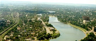
Located on the banks of the Bratsk and Ust-Ilimsk reservoirs, formed on the Angara River. It is an agglomeration of dispersed residential areas separated by significant forests and water areas. Residential areas, varying in size and degree of improvement, are former settlements that arose near industrial enterprises under construction.
Distance to Krasnoyarsk - 543 km (as the crow flies)
General information
Bratsk is located in the north-west of the Irkutsk region in the central part of the Angara Ridge. The city arose in 1955, in connection with the construction of the Bratsk hydroelectric power station, north of the ancient village of Bratsk (Bratsk), founded as a fort in 1631.
Today Bratsk is one of the largest industrial centers of the Angara region.
Despite the fact that the city is located in harsh climatic conditions, outside the zone of intensive development of Eastern Siberia, its economic and geographical position is relatively favorable and is characterized by developed infrastructure (transit railway (Baikal-Amur Mainline), federal and regional roads, power lines, airport , which has international status), high resource and economic potential (the largest industrial city in the region, electric power resources of the Bratsk Hydroelectric Power Station, huge water resources, shipping and timber rafting routes, etc.). Bratsk serves as an important support base for the development of the northern regions of Eastern Siberia and the Far East. The city is the second most populous in the Irkutsk region, but the population is constantly declining.
He is a member of the Association of Siberian and Far Eastern Cities, the Association of Municipalities of the Northern Territories of the Irkutsk Region, the Union of Cities of the Arctic and the Far North.
The city of Bratsk, attractions – photos with descriptions
Beautiful places in Bratsk are found in different areas. While walking around the city, you can visit the theatre, shopping malls, and cozy restaurants and cafes. Each part of the settlement has its own unique features. Must see:
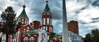
- Memorial of Glory. This majestic structure amazes with its scale. Residents of the city are proud of the monument as one of the main attractions. The concrete monument consists of three flames that harmoniously intertwine with each other. The height is twenty-eight meters. The monument was erected in honor of the thirtieth anniversary of the victory in the Second World War. The opening took place in 1975. The entire structure consists of concrete blocks, completely empty inside. A group of professionals worked on the memorial; nearby they installed a wall with the names of city residents who gave their lives for their native country in the war. In total, more than two and a half thousand names are listed here.
- Grazing elk. The paleontological monument is one of the main exhibits of the popular exhibition of paleontological monuments. This is the oldest stone structure, which is about eight thousand years old. Okladnikov, a famous archaeologist, discovered a moose on high rocks. The piece with the design was detached and given to the surrounding area.
- Bratsk hydroelectric power station. The river in Bratsk made it possible to build the largest hydroelectric power station in Russia. It became not just a symbol of the city, but also the basis of its formation. The hydroelectric power station divides the settlement into two regions; it is the largest structure, which is the main facility in the city. The length of the dam reaches five kilometers. In the sixties, the station was recognized as the largest in the world. The hydroelectric power station contributed to the formation of the largest Bratsk reservoir, which was chosen by local residents. This is a great place for fishing and beach holidays.
- Brotherly prison. The architectural monument is located on the coast of the Angara River, in the east. For the first time in history it was mentioned in 1638. The prison was often moved; later it ceased to perform a protective function. Now guests are invited to familiarize themselves with a wooden model that exactly copies the protective structure.
Story
Founding of the Bratsk fort
The first winter hut “under the Bratsky rapids” was set up in 1626 by a detachment of Cossacks under the leadership of the clerk of the Yenisei fort, Maxim Perfilyev.
The construction of the fort, planned for 1630, was carried out in 1631. The initial location for the construction of the fort was determined near the mouth of the Oka River, but since this place was located almost in the center of the Buryat camps, it was chosen closer to the Padun threshold.
... but only the Bratsk people will allow a fort to be built on the Tunguzka River on the left side, and that fort will be under the very Bratsk uluses, only half a day's walk in light plows to the Okinsky mouth.
On June 18, Perfilyev reported to the Yenisei governor about the completion of the construction of the Bratsk prison:
... in two reaches near the Bratsky threshold of Padun in the Kodogonov uluses, half a boat's walk from the mouth of the Oka.
In 1648, the fort was moved, but not to the mouth of the Oka River, but on the contrary, to the right bank of the Angara River, where several villages were located close to the foot of the Bratskaya and Monastyrskaya peaks.
In 1654, Dmitry Firsov moved the fort to the mouth of the Oka River, possibly first to its southern side, and then to the left bank 2 km above its confluence with the Angara River.
If the time of the establishment of the Bratsk fort is unclear, it would be more careful to attribute its construction to the period between 1631 and 1654, since later there is no mention of new construction or the transfer of the fort to another place.
The brotherly fort was the threshold to the conquest of Transbaikalia.
The first among those built on the Buryat lands, it was of enormous importance for the Russians: firstly, as a guard post covering the path from the Yenisei to the Lena; secondly, as a stronghold for collecting yasak from the Buryats; thirdly, as a convenient point for equipping expeditions beyond Baikal and as an advanced reconnaissance point about the lands lying beyond Baikal and the peoples inhabiting them.
Padun village
The emergence and slight development of the village, and then the village of Paduna, was due to the need to create a pilot service to guide ships through the Paduna threshold. The villagers' breadbasket were the islands near Padun (about fifteen). The islands bore both non-Russian names - Inkei, Sinikei, Kokidal, Turukan, Chuburun, Kotoroi, Kautoy, and Russian names - Russian, Podkamenny, Verkhniy, Medvezhiy, Krugly and others. The islands served as hunting, berry, and mushroom grounds; grain was sown on the island's arable land and meadows, hay was harvested, and hundreds of heads of cattle, sheep, and horses were transported to the island pastures annually.
Taiga province
Throughout the 17th century, the Bratsk fort was assigned to the Yenisei fort. With the loss of military significance, the fort turned into the village of Bratsko-Ostrozhnoe, in a number of sources - Bratskoe, later - Bratsk.
By 1950, 754 people lived in these settlements. In 1927 in the village. A hydrometeorological station was created in Paduna. In the early 30s, a topographical survey was carried out near Padun. Active engineering and geological research was carried out for fifteen years.
Birth and development of the city
The city arose in connection with the construction of the Bratsk hydroelectric power station, north of the village of Bratsk, flooded by the waters of the Bratsk Reservoir.
In 1946, the Council of People's Commissars of the USSR adopted a resolution “On the organization of management of Angarsk construction” (Angarstroy). On September 23, 1954, a resolution was adopted on the construction of the Bratsk hydroelectric power station. On July 15, 1955, the construction of the Bratsk hydroelectric power station and the city of Bratsk was declared an all-Union construction project. On March 30, 1957, the first closure of the Angara was completed (the river was blocked for more than 9 hours). On July 26, 1961, the filling of the Bratsk Reservoir began; September 1, 1961 is considered the date of birth of the Bratsk Sea.
In the Bratsk region alone, 119 settlements were intended for transfer, including the working-class village of Zayarsk (6.4 thousand inhabitants, 1959). On August 29, 1961, the evacuation of residents of old Bratsk was completed. In 1959, there was the city of Bratsk (51.5 thousand inhabitants, 1959) and the working village of Bratsk (15.8 thousand inhabitants, 1959).
In connection with the construction of the Bratsk Reservoir, the village of Bratsk was moved to a new location and in 1951 it was transformed into a working village. On December 12, 1955, it was merged with a number of other villages into the city of Bratsk.
Green town. It was named after the color of 159 tents, and a town (not a town, not a village) - with the hope that there would be a city here. The first tents were erected on the left bank of the river. Hangars at the Padunsky threshold in 1954 for short-term accommodation, but they stood for two years. Later, Green Town was overgrown with panel and timber two-story eight- and sixteen-apartment buildings and temporary shacks. They had their own eight-year school, clinic, bathhouse, and canteen. Up to six and a half thousand people lived in the town. The Green Town ceased to exist in March-April 1961, and in September of the same year it was flooded by a reservoir.
Modern residential areas were originally called villages.
The village of Padun. In the spring of 1956, wooden cottages began to be erected there, then timber two-story eight- and sixteen-apartment buildings began to be built. At first, Padun was called the village of the Left Bank, then Pursey, and later was called Permanent, because it was originally built on a permanent area not flooded by a future reservoir, next to the Green Town and the village of Padun, which were being demolished. Finally, it was decided to preserve for history the indigenous name of the village of Padun, assigning it to the village. From 1957 to 1967 the village of Padun is the center of the city of Bratsk: after moving from old Bratsk, the city executive committee and the city committee of the CPSU were located there. From the very beginning of development, Padun has been the center of Bratskgesstroy. In the village, numerous buildings housed the divisions of Bratskgesstroy, its administration, a computer center, and Hydroproject. The western part of Padun is occupied by an array of individual residential buildings that arose in the fifties (Individualny settlement).
Energetik village. This part of the city began to be built in 1959. Initially it was called the New Town, but it became Energetik when post office No. 9 was opened. The village of Energetik is the closest of all other villages to the Bratsk Hydroelectric Power Plant, it was built for workers of the hydroelectric power station and construction industry factories. In the planning structure of the entire Big Bratsk, Energetik took the place of a satellite city of its Central Residential District.
Brotherly Sea. During the preparation of the reservoir bed, a railway stop was created, which was attractive only because it stood on the Taishet-Lena railway. Later, during the construction of South Padun, it was actually absorbed by it.
Hydrobuilder. At first the village was called the Right Bank. Its construction began in 1955. It grew unusually quickly: the main but temporary production base for the construction of the Bratsk Hydroelectric Power Station dam was created here. In honor of the builders, the village was named Gidrostroitel. From the very beginning, it was built up with wooden barracks and apartment-type houses. As in Padun, a vast array of individual buildings arose here.
Osinovka arose from a peasant farmstead, adjacent aspen copses, islets of fields among the taiga and hayfields in the floodplain of the Angara River. These places were later occupied by the village of Gidrostroitel. In the late 50s, when preparing the reservoir, it became necessary to accommodate the residents of the village of Zayarsk and the Angarstroy administration, including the railway station and logging site, in a new location. In 1956, the Osinovka railway station arose, and in 1961, when the railway station was built, the station received the name Gidrostroitel. From the transported residential buildings in Osinovka, the Zayarsky residential area arose, separated by a railway line.
The village of Sukhoi arose in 1959 during the preparation of the Bratsk reservoir, when from the village of Pravoberezhny to a new place, on the shore of the bay of the river. Zyaby, they moved the Plekhanov timber transshipment base. For many years, a geological exploration expedition was based in Sukhoi. In December 1960, the villages of Osinovka and Sukhoi were united into the Osinovsky Village Council of Workers' Deputies.
Central District. Initially it was built for workers of the timber industry (the Central District was called the forestry complex district), aluminum plant workers and residents of flooded settlements. Later it became the administrative center of the city.
Construction of the city began on the so-called Pyanovskaya site in 1958. In 1960, intensive construction began. Builders of Bratskgesstroy came here in the mornings from Padun, future settlers from old Bratsk and Zayarsk, who decided to build their own houses. In 1963, the first streets were formalized and given names: Mira, Podbelskogo, Komsomolskaya, Yuzhnaya, Kirova.
Chekanovsky, Porozhsky, Stroitel arose to quickly overcome the backlog of housing construction in the Central region. These wooden villages were built as temporary ones in the zone of harmful influence of enterprises. This location deprived the villages of promising development and gave rise to the decades-long problem of their liquidation and resettlement of residents.
Porozhsky arose in connection with the resettlement of the population from the flood zone, as a temporary settlement for timber raftsmen. The name Porozhsky comes from the words “threshold, thresholds”. The official date of formation of the village of Porozhsky is December 27, 1960, but the history of the village began earlier. It then had other names: Nizhny Settlement (before the reservoir bed was filled in the Nizhny Settlement, the Bratsky LPH was based, which was a structural division of the Bratskles plant), Verkhny Settlement (on the territory of the modern village in the mid-fifties, here, in addition to tents, the first panel houses appeared) .
Sights of Bratsk - photos with names
A locality with an interesting history invites guests to explore a variety of attractions. An exciting trip around the city of Bratsk – what to see:
- Angarsk village. City Museum of Culture and Ethnography. Its area is about forty hectares. Visitors will be able to get acquainted with two indigenous peoples - Russian and Evenki. It was the Evenks who were the first indigenous inhabitants; the Russians settled on the territory when they were exploring Siberia. Every kilometer of the museum contains many unique exhibitions; the entire complex is divided into two zones in accordance with ethnographic characteristics. The advantage of the attraction is its unique location - the museum is located in a luxurious forest, where you can get acquainted with the pristine beauty of nature. Guests will be invited to take a walk between Evenk and Russian houses and outbuildings. Among the artifacts there are many interesting devices. A stone, more than five thousand years old, with a unique example of a primitive design, is also presented among the exhibits.
- Museum of Light. A unique complex that Russia is proud of as the only place where numerous lighting devices are presented. The organizer is Yuri Bordonsky, a local entrepreneur and businessman. He independently decided to create a unique exhibition. Here you can see unique lighting devices that were used back in the tenth century. Guests will be introduced to the main, most expensive artifact - a Byzantine oil lamp. It was made more than a thousand years ago. Nearby are a variety of modern appliances that are made in the original style.
- Historical Museum of Political Exile. The date of establishment of the attraction is 1989. When the village was flooded, the museum had to be moved to the city, where it continues to operate to this day. The museum is dedicated to the repressions of the thirties and fifties. He talks about people who were unjustly expelled from their cities and homes. The institution often initiates thematic exhibitions.
Geography
The geographical location of Bratsk determined its status as the northern gateway of the Far East. The city is located in the center of the East Siberian region of Russia in the central part of the Angara Ridge on the shore of the Bratsk Reservoir at the intersection of the most important communications (railway (BAM), water, road, aviation, information) connecting the European and Asian continents with the north of Eastern Siberia and Yakutia, which is the basis for its economic, social and cultural development. The city has an airport with international status. Bratsk is connected by railways (BAM) with the cities of central Russia, Siberia, Yakutia, Transbaikalia, and the Far East. Main roads: Tulun - Bratsk - Ust-Kut (as part of the federal highway A 331 "Vilyuy" with a planned extension to Yakutsk), Taishet - Chunsky - Bratsk (not completed on the section from Chunsky to Vikhorevka), Bratsk - Ust-Ilimsk. The length of the city along the coast of the reservoir is 65 km.
Popular message topics
- The work of Yuri Yakovlev
Yakovlev Yuri Yakovlevich is a Soviet writer and screenwriter, creator of his own books for children. His son is Ezra Howkin. Yuri Yakovlev was born on June 22, 1922 in the city of Leningrad. - Rowan
Rowan is an unforgettable plant, the bright berries of which often turn us to the past, to childhood, or remind us of warm summer. In the old days, it was mentioned in every home as a protector against illnesses. - Pluto and Neptune (their discovery)
The most distant planet in the solar system is Neptune, orbiting at a distance of 4.5 billion kilometers from the Sun. But previously there were 9 planets in the solar system, including Pluto.
Angarsk - located on the main river of the region
Angarsk is the third largest and second largest settlement in the Irkutsk region: 294 km² and 226,374 inhabitants. It owes its appearance to the active development of industry in Siberia, and specifically to the construction of a plant for the production of liquid fuel. Equipment for it was received as reparations after the victory in the Great Patriotic War. These two facts gave rise to the unofficial but telling names of the settlement: “city of petrochemists” or “born of Victory.”
From the beginning of the construction of the first temporary houses for workers who came to the construction site in 1945 and until 1959, the number of residents increased from zero to 134,000: in a short time, about 70,000 m² of housing was built for them. Today's Angarsk is one of the most modern and comfortable settlements in Transbaikalia. It has been repeatedly recognized as the most comfortable and clean at all-Russian competitions.
As at the beginning of development, industry is the basis of the economy: it accounts for about 13% of the total regional volume. Angarsk is one of the largest industrial zones in Asia, stretching along the Angarsk coast for a record 30 km. If previously the city-forming enterprise was the petrochemical plant, which ensured the emergence of the city, today the budget is formed thanks to hundreds of other enterprises. More than 6,000 companies in various fields of activity are registered here, including 4 large industrial complexes.
Number of residents of urban settlements
| Settlement | Number of registered residents |
| Markova | 23672 |
| Chunsky | 14135 |
| Zalari | 9 576 |
| New Igirma | 9 496 |
| Kuitun | 9 487 |
| Belorechensky | 7 643 |
| Mikhailovka | 7 478 |
| Kachuk | 6 950 |
| Railway | 6 463 |
| Trunk | 6 053 |
| Mishelevka | 5 260 |
| Yurts | 5 247 |
| Thelma | 5 136 |
| Zhigalovo | 4 983 |
| Lesogorsk | 4 982 |
| October | 4 952 |
| Average | 4 909 |
| Ulkan | 4 719 |
| Taiturka | 4 614 |
| Novobiryusinsky | 4 463 |
| Tyret First | 3 944 |
| Kultuk | 3 715 |
| Rudnogorsk | 3 198 |
| Big River | 2 936 |
| Mother | 2 851 |
| Ticket | 2 712 |
| Shumsky | 2 530 |
| Alekseevsk | 2 157 |
| Listvyanka | 1 972 |
| Shitkino | 1 786 |
| Mamakan | 1 640 |
| Uk | 1 593 |
| Atagay | 1 569 |
| Yantal | 1 543 |
| Khrebtovaya | 1 268 |
| Artemovsky | 1 253 |
| We see | 1 108 |
| Kropotkin | 1 102 |
| Balakhninsky | 1021 |
| Yangel | 984 |
| Radishchev | 956 |
| Star | 854 |
| Shestakovo | 606 |
| Lugovsky | 367 |
| Vitimsky | 260 |
| Kunerma | 0 |
Ethnic composition
According to the 2010 All-Russian Population Census, representatives of thirty-seven nationalities then lived in the region, the vast majority of which were Russians (2,144,075 people or 88.28%). Next come the Buryats (77,667 people or 3.20%) and Ukrainians (30,827 people or 1.27%). Ethnic composition of the Irkutsk region (according to the 2010 All-Russian Population Census).
| Nationality | Total, person | Percent of all |
| Number of inhabitants of all nationalities | 2 428 750 | 100 % |
| Russians | 2 144 075 | 88,279 % |
| Buryats | 77 667 | 3,198 % |
| Ukrainians | 30 827 | 1,269 % |
| Tatars | 22 882 | 0,942 % |
| Belarusians | 7 929 | 0,326 % |
| Armenians | 6 558 | 0,270 % |
| Azerbaijanis | 5 384 | 0,222 % |
| Chuvash | 4 589 | 0,189 % |
| Kyrgyz | 4 507 | 0,186 % |
| Uzbeks | 4 367 | 0,180 % |
| Tajiks | 4 169 | 0,172 % |
| Germans | 3 725 | 0,153 % |
| Mordva | 2 119 | 0,087 % |
| Tuvans | 1 674 | 0,069 % |
| Bashkirs | 1 637 | 0,067 % |
| Jews | 1 594 | 0,066 % |
| Moldovans | 1 465 | 0,056 % |
| Poles | 1 364 | 0,056 % |
| Koreans | 1 342 | 0,055 % |
| Gypsies | 1 305 | 0,054 % |
| Evenks | 1 272 | 0,052 % |
| Udmurts | 1 180 | 0,049 % |
| Chinese | 1 118 | 0,046 % |
| Georgians | 1 080 | 0,044 % |
| Lithuanians | 1 046 | 0,043 % |
| Kazakhs | 952 | 0,039 % |
| Mari | 931 | 0,038 % |
| Mongols | 867 | 0,036 % |
| Yakuts | 858 | 0,035 % |
| Tofalar (tofa) | 678 | 0,028 % |
| Chechens | 475 | 0,020 % |
| Lezgins | 447 | 0,018 % |
| Ossetians | 423 | 0,017 % |
| Yazidis | 403 | 0,017 % |
| Ingush | 359 | 0,015 % |
| Komi-Permyaks | 313 | 0,013 % |
| Khakassians | 298 | 0,012 % |
| Persons who indicated other nationalities | 3 756 | 0,155 % |
| Number of persons indicating nationality | 2 345 635 | 96,578 % |
| Number of persons who did not indicate nationality | 83 115 | 3,422 % |
