Gorodovikovsk: areas, recreation, excursions, museums and churches, cuisine and restaurants, shopping and shops, attractions of Gorodovikovsk.
- New Year tours
to Russia - Last minute tours
to Russia
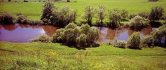
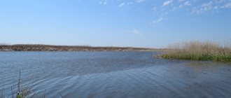
Gorodovikovsk is a small town in Kalmykia, which is famous for its fishing and hunting. Tourists from different parts of the region come to local lands to hunt hares and wild boars and catch fish in local lakes; perch bites especially well here.
Other attractions include an old oak grove, where the first trees were planted in the 19th century, and the tantric monastery of Lord Zonkawa, which is considered the first Buddhist monastery in Europe. Many shrines are kept within its walls.
2 things to do in Gorodovikovsk:
- Go fishing - the bite is great here. In Kalmykia, fishing is generally okay. Over the weekend you can catch tens of kilos of small pike, perch and carp. It’s worth finding out in advance which places you can fish in and where it’s better not to go. The fact is that local residents are jealous of visiting fishermen. So, to avoid conflict, it is better to collect information.
- Hunt - in Kalmykia, hunting is one of the main ways of obtaining meat, and for tourists it is one of the entertainments. Here they hunt hare, fox, wild boar, and various birds.
Commercial bases offer their services tastefully. However, you need to be careful: entrepreneurs are ready to use various tricks just to lure a client. For example, they post unverified information on the site or post old photographs without talking about what is happening now in the “fat” places. So when choosing a database, you should trust trusted sources and authoritative sites.
Rural and urban settlements
Below are lists of rural settlements (rural municipalities) and urban settlements (urban municipalities) by district (district municipalities) of Kalmykia
Urban settlements (urban municipalities) are highlighted in bold
font.
Gorodovikovsky district
- Gorodovikovskoe urban municipality
- Vinogradnenskoe rural municipality
- Druzhnenskoe rural municipality
- Lazarevskoe rural municipality
- Pushkin rural municipality
- Rosenthal rural municipality
- Yuzhnenskoe rural municipality
- Bagaburul rural municipality
- Zundatolginskoe rural municipality
- Iki-Burul rural municipality
- Kevyudovo rural municipality
- Mantsinketsovskoe rural municipality
- Manych rural municipality
- Orgakinskoe rural municipality
- Primanych rural municipality
- Svetlovskoe rural municipality
- Utsala rural municipality
- Khomutnikovskoe rural municipality
- Chogray rural municipality
- Cholunkhamur rural municipality
- Altsynkhuta rural municipality
- Ergeninsky rural municipality
- Gashun-Burgustinskoe rural municipality
- Kegultinsky rural municipality
- Ketchenerovo rural municipality
- Sarpinskoe rural municipality
- Tugtuna rural municipality
- Chkalovskoe rural municipality
- Shatta rural municipality
- Lagansk city municipality
- Dzhalykovskoe rural municipality
- Krasi rural municipality
- Northern rural municipality
- Ulankhol rural municipality
- Iki-Bukhusovskoe rural municipality
- Maloderbetovskoe rural municipality
- Plodovitenskoe rural municipality
- Tundutovskoe rural municipality
- Khanatinsky rural municipality
- Khonchnur rural municipality
- Bolshetsarynsky rural municipality
- Voshodovskoe rural municipality
- Dzhangar rural municipality
- Idzhil rural municipality
- Mirny rural municipality
- Khosheutovskoe rural municipality
- Tsagan-Nur rural municipality
- Bulukta rural municipality
- Vorobyovskoe rural municipality
- Nartinskoe rural municipality
- Oktyabrskoe rural municipality
- Pervomaiskoe rural municipality
- Sandy Rural Municipality
- Priyutnenskoe rural municipality
- Uldyuchinsky rural municipality
- Arshanzelmen rural municipality
- Kanukovskoe rural municipality
- Kirov rural municipality
- Korobkinsky rural municipality
- Obilnenskoe rural municipality
- Sadovskoe rural municipality
- Salyntugtun rural municipality
- Umantsevskoe rural municipality
- Sharnutovskoe rural municipality
- Baga-Chonosovskoe rural municipality
- Verkhneyashkul rural municipality
- Voznesenovskoe rural municipality
- Iki-Chonosovskoe rural municipality
- Naintakha rural municipality
- Ovatinskoe rural municipality
- Trinity rural municipality
- Khar-Buluk rural municipality
- Tselinnoe rural municipality
- Chagorty rural municipality
- Yalmta rural municipality
- Adykovskoe rural municipality
- Artesian rural municipality
- Achinerovo rural municipality
- Komsomolsk rural municipality
- Kum rural municipality
- Narynkhuduk rural municipality
- Prikumskoe rural municipality
- Sarul rural municipality
- Barun rural municipality
- Berginsky rural municipality
- Tatal rural municipality
- Harbin Rural Municipality
- Tsaganaman rural municipality
- Erdnievo rural municipality
- Yustinskoe rural municipality
- Bagatugtun rural municipality
- Berezovsky rural municipality
- Veselovskoe rural municipality
- Krasnomikhailovskoe rural municipality
- Krasnopartizanskoe rural municipality
- Manych rural municipality
- Oktyabrskoe rural municipality
- Solenovskoe rural municipality
- Ulyanovsk rural municipality
- Esto-Altai rural municipality
- Yashalta rural municipality
- Gashun rural municipality
- Youth rural municipality
- Privolnenskoe rural municipality
- Tavngashun rural municipality
- Ulanerginskoe rural municipality
- Utta rural municipality
- Hartolga rural municipality
- Khulkhuta rural municipality
- Tsagan-Usna rural municipality
- Chilgiri rural municipality
- Elvga rural municipality
- Yashkul rural municipality
Iki-Burulsky district
Ketchenerovsky district
Lagansky district
Maloderbetovsky district
Oktyabrsky district
Priyutnensky district
Sarpinsky district
Tselinny district
Chernozemelsky district
Yustinsky district
Yashalta district
Yashkul district
Entertainment and attractions of Gorodovikovsk
Several sights of the city that will help reveal its essence.
Oak Grove
In the last century, more than 20 natural monuments of regional significance were created in Kalmykia. One of them is an oak grove located in Gorodovikovsk. The first trees were planted here in 1887.
Today the grove is diligently protected by local authorities. And local residents appreciate it for its beauty and clean air produced by hundreds of trees.
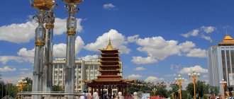
Tantric Monastery of Lord Zonkava
This Buddhist monastery is the first tantric monastery in Europe. It is dedicated in honor of the lama and preacher Zaonkawa.
The monastery took 3 years to build and was opened during the holy month of Ur Sar. Buddhist relics are kept here - a piece of the skull of Lama Tsongkhapa and the relics of famous lamas in the form of white balls.
The monastery consists of three levels. On the first there is a prayer hall for 150 people, on the second there are rooms for the Shajin Lama of Kalmykia and the Dalai Lama, on the third there is a retreat room. A retreat is a time dedicated to spiritual practice.
Church of St. Michael the Archangel
And this is an Orthodox church, which stands in the center of the park. It was consecrated in the name of the holy Tsarevich Alexei back in 1914.
After the revolution, the temple was closed and given over to a club, and then completely dismantled for building materials. It was restored in the 90s of the last century and consecrated in honor of St. Archangel Michael. The church expanded and a bell tower appeared. In 2008, construction of a new temple in the name of Tsarevich Alexei began here.
Museum of Local Lore
Tourists usually have a disdainful attitude towards local history museums. Especially for instances of small cities. Like, what interesting things can you see there? Boredom.
The example of Gorodovikovsk is an exception. The local museum contains interesting materials that tell about the history of the city (formerly the settlement of Bashanti), Bolshederbetovsky ulus and Kalmykia. In addition, here you can get acquainted with fascinating information about the founder of the settlement, Mikhail Gakhaev, and how the local residents survived the Great Patriotic War.
True, the museum works with a variable schedule. To get here, you need to agree with the administration in advance. Web site.
History of the administrative-territorial division of Kalmykia
Kalmyk Autonomous Region
On November 2, 1920, the Council of People's Commissars of the RSFSR adopted a resolution granting autonomy to the Kalmyk people. On November 4, 1920, a joint resolution was adopted by the All-Russian Central Executive Committee and the Council of People's Commissars of the RSFSR, published under the signatures of M. I. Kalinin and V. I. Lenin, on the formation of the Autonomous Region of the Kalmyk People.
The Autonomous Region, according to this resolution, included: from the Astrakhan province - the Bagatsokhurovsky, Ikitsohurovsky, Khosheutovsky, Kharakhusovsky, Erketenevsky, Maloderbetovsky uluses (with the exception of the Chervlensky and Severny aimaks, which were included in the Chernoyarsk district), Yandyko-Mochazhny, Manychsky and the Kalmytsky ulus Bazaar, all the volosts and villages of the Chernoyarsk district of the Tsaritsyn province, lying south of the Abganerovo and Aksai volosts: Sadovaya, Obilnaya, Kiseleva, Zavetnaya, Torgovaya, Valuevka, Remontnaya, Kresty, Kormovaya, Priyutnoye, Elista, Bulgan, Keryulta and Ulanskoye; from the Stavropol province - Bolshederbetovsky ulus, with the exception of the Yashaltinsky volost and the village of Knyaz-Mikhailovsky; from the Don region - part of the territory of the Salsky district, connecting the Bolshederbetovsky ulus with the main territory of the Kalmyk region and located between the provincial borders of the Stavropol and Astrakhan provinces and parallel to 46 ° 30 of the Pulkovo meridian, the so-called Don triangle; from the Terek region - Kum aimak.
At the request of the Kalmyk CIK on February 14, 1923, the resolution of the All-Russian Central Executive Committee by the administrative-territorial structure of the Kalmyk autonomy was approved as part of 8 uluses (Bolshesterebetovsky, Ikitsokhurovsky, Kalmyk-Bazarinsky, Maloderbetovsky, Manychsky, Bagatsukhurovsky, Khocheutovsky, Erkentevsky), Rustensky district, 41 aima-aima. and 5 volosts : Kiselevskaya, Zavetnenskaya, Remontnenskaya, Elistinskaya and Kormovskaya. The formation of the Remontnensky district as part of the Kalmyk region was supposed to streamline the structure of land use. The district with a population of 49,524 people covered an area of 650,692 dessiatines. Basically, these were the lands with which the population of the villages of the Remontnensky district was allocated at the time of its formation. Therefore, it continued to use quitrent, lease and other plots of land located outside the boundaries of the district, for example, in the neighboring Don region. This complicated national-land relations.
At the end of 1922, the Kalmyk Central Executive Committee decided to transfer the Elista volost from the Manych ulus to the Remontnensky district. However, this did not simplify national relations. Initially, it was planned to transfer part of the territory of the Salsky district of the Don region to the Remontnensky district, but in the end it was decided to transfer the district to the Salsky district. However, the district was transferred partially: on May 25, 1925, the Presidium of the All-Russian Central Executive Committee decided to include the Remontnensky district of the Kalmyk region into the Salsky district of the North Caucasus region, with the exception of the villages of Troitskoye (Bulgun), Elista, Voznesenovka (Kerulta), Bislyurta, Priyutnoye, Sadovoe, Umantsevo, Tolochkova farm.
A little earlier in the same 1925, the borders of the region had already changed: the German-Khaginskaya and Esto-Khaginskaya volosts of the Stavropol province were included in the Bolshederbetovsky ulus of Kalmykia in January 1925, and the Yashaltinskaya volost - in March 1925.
In 1930, an important administrative and territorial reform was carried out. “In order to overcome ulusism and rodovism,” the existing uluses were abolished and 5 new uluses (districts) were formed - Central, Sarpinsky, Volga, Primorsky and Western.
The subordination of the region itself also changed - in 1928, the Kalmyk Autonomous Region became part of the Lower Volga Region (soon renamed the Lower Volga Region), and in 1934 - into the Stalingrad Territory. In 1931, the Tundutovsky, Plodovitinsky and Tingutinsky village councils were transferred to the Kalmyk Autonomous Region from the disbanded Krasnoarmeysky district of the Nizhnevolzhsky region, as having an affinity for the Sarpinsky district, with transfer to the latter.
In 1934, by the Resolution of the Presidium of the All-Russian Central Executive Committee, the Chernozemelsky ulus was formed with its center in the village of Yashkul by separating it from the Central ulus.
On October 20, 1935, the Kalmyk Autonomous Region was transformed into the Kalmyk Autonomous Soviet Socialist Republic.
Abolition of Kalmyk autonomy
On December 27, 1943, as a result of the deportation of Kalmyks, the Decree of the Presidium of the Supreme Soviet of the USSR “On the liquidation of the Kalmyk Autonomous Soviet Socialist Republic and the formation of the Astrakhan region as part of the RSFSR” was issued. At the same time, the city of Elista, Dolbansky, Ketchenerovsky, Lagansky, Privolzhsky, Troitsky, Ulan-Kholsky, Chernozemelsky, Yustinsky districts of the former Kalmyk Autonomous Soviet Socialist Republic were included in the newly formed Astrakhan region; Malo-Derbetovsky and Sarpinsky districts are included in the Stalingrad region; Western (center - Bashanta) and Yashaltinsky - part of the Rostov region; Priyutinsky district is part of the Stavropol Territory.
Restoration of the Kalmyk Autonomous Okrug
On November 24, 1956, the Presidium of the CPSU Central Committee adopted a resolution “On the restoration of the national autonomies of the Kalmyk, Karachay, Chechen and Ingush peoples.” On January 9, 1957, the Decree of the Presidium of the Supreme Soviet of the RSFSR “On the formation of the Kalmyk Autonomous Region as part of the Stavropol Territory” was adopted. On January 12, 1957, by the Decree of the Presidium of the Supreme Council of the RSFSR “On the administrative composition of the Kalmyk Autonomous Region”, the Kalmyk Autonomous Region was restored as part of 10 districts - Western, Yashaltinsky, Priyutnensky, Sarpinsky, Priozerny, Tselinny, Caspian, Yashkulsky, Yustinsky, Chernozemelsky with the center in the city of Elista .
On January 25, 1957, the USSR Ministry of Internal Affairs issued an order “On allowing residence and registration of Kalmyks, Balkars, Karachais, Chechens, Ingush and members of their families in the places from which they were expelled.”
On February 11, 1957, the Supreme Soviet of the USSR approved the formation of the Kalmyk Autonomous Region, making a corresponding amendment to Article 22 of the USSR Constitution. At the same time, the region included: the city of Elista, the following districts: Western (center - the working village of Bashanta), Kaspiysky (Kaspiysky settlement), Priozerny (Priozerny village), Priyutnensky (Priyutnoye village), Sarpinsky (Sadovoye village), Tselinny (Tselinny village), Chernozemelsky (Komsomolsky village), Yustinsky (Yusta village), Yashaltinsky (Yashalta village), Yashkulsky (Yashkul village).