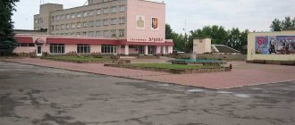
Shakhty is a border town, which is located 26 km from Ukraine in the southwest of the Rostov region. Until 1921, it was called the Grushinsky settlement and was one of the largest places where coal was mined.
If you look at the map of Mine from a satellite, you can find about 20 reservoirs in the city. The largest is the Artemovskoye Reservoir. Its length is 2 km. This is an artificially created reservoir, which was necessary for the settlement to cool the turbines of the state district power plant.
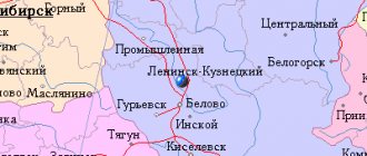
The city was formed from many nearby and distant mining villages, so on the map of Shakhta with diagrams you can see that today it consists of small settlements. The division of the city into 8 districts is officially recognized.
The settlement is surrounded by steppes with rare artificial forest plantings. And urban landscapes are characterized by the location of many terricots - mountains of soil removed from coal mines. Therefore, if a strong wind rises, the city is covered with coal dust, which is blown off the surface of the terricotta.
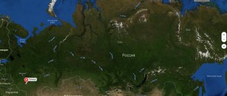
Where is the city of Shakhty?
Shakhty is a city in the southwestern part of the Rostov region, which is located on three rivers: Ayuta, Grushevka and Kadamovka.
It is located 26 km from the border with Ukraine on the south-eastern slopes of the Donetsk Ridge. It has the status of a supporting center of the East Donbass agglomeration. The approximate population of the city is 235 thousand people, the area of the city is 158 square kilometers. There are more than 20 reservoirs on the territory of the city of Shakhty. The largest body of water is the Artemovskoye Reservoir, which is more than 2 km long. The climate in the city is temperate continental, with characteristic features of the subtropical Mediterranean. The annual precipitation rate is about 400 mm.
The mines are located in the same time zone as Moscow, the offset relative to Coordinated Universal Time (UTC) is +3.
Map
| Mines: maps |
Mines: photo from space (Google Maps) Mines: photo from space (Microsoft Virtual Earth)
| Mines. Nearest cities. Distances in km. on the map (in brackets along roads) + direction. Using the hyperlink in the distance , you can get the route (information courtesy of the AutoTransInfo website) | |||
| 1 | Quarries | 4 (4) | YU |
| 2 | Cossack Camps | 18 () | SW |
| 3 | Persianovsky | 21 (24) | YU |
| 4 | Red Sulin | 22 (41) | NW |
| 5 | Novoshakhtinsk | 23 (25) | Z |
| 6 | Novocherkassk | 33 (34) | YU |
| 7 | Krivyanskaya | 35 () | YU |
| 8 | Zverevo | 35 (72) | WITH |
| 9 | Rodionovo-Nesvetaiskaya | 39 (52) | Z |
| 10 | Gukovo | 43 (55) | NW |
| 11 | Dawn | 45 () | SW |
| 12 | Bagaevskaya | 45 (74) | YU |
| 13 | Semikarakorsk | 48 (103) | SE |
| 14 | Ust-Donetsk | 49 (102) | IN |
| 15 | Aksai | 55 (67) | SW |
| 16 | Sinegorsky | 58 (58) | NE |
| 17 | Olginskaya | 61 () | YU |
| 18 | Coke | 63 (96) | NE |
| 19 | Rostov-on-Don | 64 (80) | SW |
| 20 | Belaya Kalitva | 66 (86) | NE |
| 21 | Konstantinovsk | 67 (72) | IN |
| 22 | Kamensk-Shakhtinsky | 67 (73) | WITH |
| 23 | Staraya Stanitsa | 70 () | WITH |
| 24 | Donetsk | 72 (100) | WITH |
| 25 | Bataysk | 72 (92) | SW |
| 26 | Chaltyr | 72 (96) | SW |
| 27 | Funny | 78 () | SE |
| 28 | Kirovskaya | 82 (114) | YU |
| 29 | Zhirnov | 84 () | NE |
| 30 | Gornyatsky | 84 (111) | NE |
a brief description of
The city is located on the southeastern spurs of the Donetsk Ridge, 75 km northeast of Rostov-on-Don. Railway Shakhtnaya. Road junction.
Territory (sq. km): 159
Information about the city of Shakhty on the Russian Wikipedia site
Historical sketch
The settlement on the steppe river Grushevka, on the site of modern Shakhty, was founded in the late 17th - early 18th centuries. Don Cossacks. Near the settlement, the development of the outcropping seams of coal began, which was used for local needs. In 1790, the Cossack Dvuzhzhenov contracted to deliver up to 3 thousand pounds of coal to the Taganrog port annually.
By the middle of the 19th century. There were 57 mines around the village of Grushevskaya. In 1867 it received city rights with the name Mountain Grushevskoe Settlement. In 1881 it was renamed Aleksandrovsk-Grushevsky. By the end of the 19th century. one of the major centers of the coal industry in the South of Russia. Name by river Grushevka, the motive for choosing the first part of the name has not been established; there is a possible connection with the name of Emperor Alexander I (1777-1825), who reigned during the founding of the village.
At the end of the 19th century. Aleksandrovsk-Grushevsky is a city without a district in the Cherkassy District of the Doskogo Army Region.
In 1920, the city was renamed Shakhty, the name is motivated by the fact that since the end of the 18th century. underground coal mining was carried out here. The Mine included the surrounding mining villages.
During the Great Patriotic War of 1941-45, the city was occupied by Nazi troops on June 21, 1942. It was liberated on February 12, 1943 by troops of the Southern Front during the Rostov operation. During the retreat, the Germans blew up and flooded coal mines and destroyed many public buildings.
The village of Artemovsky entered the city boundaries (PGT since January 21, 1929, 25.8 thousand inhabitants, 1931; 29.2 thousand inhabitants, 1939).
In 1954-57. there was a Kamensk region, the center of which since August 1955 was the city of Shakhty.
Municipal indicators
| Index | 1999 | 2001 | 2003 | 2005 |
| Demography | ||||
| Number of births, per 1000 population | 6.7 | 7.7 | 8.4 | 8.1 |
| Number of deaths, per 1000 population | 17 | 18.2 | 18.1 | 17.5 |
| Natural increase (decrease), per 1000 population | -10.3 | -10.5 | -9.7 | -9.4 |
| Standard of living of the population and social sphere | ||||
| Average monthly nominal accrued wages, rub. | 898.9 | 1697.3 | 3132.2 | 5319.3 |
| Average housing area per inhabitant (at the end of the year), sq.m. | 17.3 | 17.6 | 17 | 17.4 |
| Number of preschool institutions, pcs. | 60 | 51 | 52 | 51 |
| Number of children in preschool institutions, thousand people | 4.9 | 5.1 | 4.8 | 5 |
| Enrollment of children in preschool educational institutions (at the end of the year), as a percentage of the number of children of the corresponding age, % | 52.6 | 44.1 | ||
| Number of daytime educational institutions (at the beginning of the school year), pcs. | 47 | 47 | 46 | 46 |
| Number of students in daytime educational institutions, thousand people | 31.2 | 28.1 | 24.4 | 21 |
| Number of doctors, people. | 912 | 904 | 906 | 903 |
| Number of nursing staff, people. | 3009 | 2809 | 3081 | 2989 |
| Number of hospital institutions, pcs. | 16 | 16 | 16 | 16 |
| Number of hospital beds, thousand units | 3 | 2.6 | 2.5 | 2.8 |
| Number of medical outpatient clinics, pcs. | 31 | 31 | 28 | 28 |
| Capacity of medical outpatient clinics, visits per shift, thousand units. | 6.2 | 6.2 | 5.7 | 5.7 |
| Number of registered crimes, pcs. | 4302 | 4016 | 3747 | 3409 |
| Persons who committed crimes were identified, persons. | 2307 | 1984 | 1634 | 1324 |
| Economy, industry | ||||
| Number of enterprises and organizations (at the end of the year), pcs. | 3033 | 3971 | 20193 | 4013 |
| Number of operating enterprises by type of activity: mining (at the end of the year), pcs. | 1 | |||
| Number of operating enterprises by type of activity: manufacturing (at the end of the year), pcs. | 61 | |||
| Number of operating enterprises by type of activity production and distribution of electricity, gas and water (at the end of the year), pcs. | 20 | |||
| Volume of shipped goods of own production by type of mining (in actual prices), million rubles. | 167 | |||
| Volume of shipped goods of own production by type of manufacturing (in actual prices), million rubles. | 2310.5 | |||
| Volume of shipped goods of own production by type of production and distribution of electricity, gas and water (in actual current prices), million rubles. | 1287 | |||
| Construction | ||||
| Volume of work performed by type of activity “Construction” (until 2004 - volume of work performed under construction contracts), million rubles. | 151.6 | 276.7 | 607.5 | 1071 |
| Commissioning of residential buildings, thousand sq.m. of total area | 33.6 | 43.1 | 34.1 | 35 |
| Commissioning of residential buildings, apartments | 421 | 687 | 427 | 421 |
| Commissioning of preschool institutions, places | 0 | 0 | 0 | 0 |
| Commissioning of educational institutions, places | 0 | 0 | 0 | 0 |
| Commissioning of hospital facilities, beds | 0 | 0 | 0 | 0 |
| Commissioning of outpatient clinics, visits per shift | 0 | 0 | 0 | 0 |
| Transport | ||||
| Number of bus routes (in intracity traffic), pcs. | 9 | 8 | 16 | 17 |
| Number of tram routes, pcs. | 0 | |||
| Length of operational tram tracks (at the end of the year), km | 14.8 | 0 | ||
| Number of trolleybus routes, pcs. | 2 | 0 | ||
| Length of operational trolleybus lines (at the end of the year), km | 15 | 15 | ||
| Number of passengers transported by buses per year (in intracity traffic), million people. | 14 | 10.1 | 10.2 | 5.8 |
| Number of passengers transported by trams per year, million people. | 1.2 | 0 | 0 | |
| Number of passengers transported by trolleybuses per year, million people. | 2.6 | 2.1 | 1.9 | |
| Connection | ||||
| Number of residential telephone sets of the city public telephone network, thousand units. | 19 | 21 | 22.7 | 27.2 |
| Number of payphones of the city telephone network (including universal ones), pcs. | 129 | 116 | ||
| Trade and services to the population | ||||
| Retail trade turnover (in actual prices), million rubles. | 1898.2 | 3224.6 | 5064.6 | 6788.4 |
| Retail trade turnover (in actual prices), per capita, rub. | 7514.8 | 13039.2 | 20042 | 27328.5 |
| Index of physical volume of retail trade turnover, % compared to the previous year | 107.3 | 104.2 | ||
| Public catering turnover (in actual prices), million rubles. | 24.4 | 48.2 | 83.5 | 129.5 |
| Index of physical volume of public catering turnover, % compared to the previous year | 105.8 | 100.6 | ||
| Number of stores, pavilions (at the end of the year), pcs. | 34 | 31 | ||
| Sales area of shops, pavilions (at the end of the year), sq.m. | 3495 | 3252 | ||
| Volume of paid services to the population (in actual prices), million rubles. | 375 | 676.9 | 1210.6 | 1693 |
| Volume of paid services to the population (in actual prices), per capita, rub. | 1484.5 | 2737.2 | 4790.6 | 6815.6 |
| Volume of household services to the population (in actual prices), million rubles. | 113.6 | 172 | 235.1 | 294.1 |
| Volume of household services to the population (in actual prices), per capita, rub. | 449.7 | 695.4 | 930.4 | 1183.9 |
| Investments | ||||
| Investments in fixed assets (in actual prices), million rubles. | 288.9 | 594.6 | 575.8 | 1986.8 |
| Share of investments in fixed assets financed from budgetary funds in the total volume of investments, % | 23.5 | 26.4 | 7.2 | 6.2 |
Data sources:
- Regions of Russia. Main characteristics of the constituent entities of the Russian Federation: statistical collection. Goskomstat of Russia. - M:, 2003.
- Regions of Russia. Volume 1. Statistical collection. Goskomstat of Russia. - M:, 2001. p. 291
- Regions of Russia. Basic socio-economic indicators of cities. Statistical collection. Rosstat. - M:, 2005. p. 197
- Transport in Russia: Statistical collection. Goskomstat. - M:, 2003. pp. 110, 112, 120, 122
- Transport in Russia: Statistical collection. Rosstat. - M:, 2005. pp. 117, 119, 127, 129
- Regions of Russia. Basic socio-economic indicators of cities. 2006. Statistical collection. Rosstat. - M:, 2006. p. 197
Economy
The mines are the main industrial, organizational and economic center of Eastern Donbass. Coal mining.
Mechanical engineering and metalworking - factories: electric transport engineering, mechanical engineering, etc. Production of building materials, incl. reinforced concrete structures, ceramic products.
Light industry enterprises: cotton mill, 2 shoe factories, linen, clothing factories, etc. Food industry: meat, dairy.
Main enterprises
COAL INDUSTRY
OJSC "Rostovugol"
346500, Rostov region, Shakhty, st.
Sovetskaya, 187-189 Offers:
coal
INDUSTRY OF PRECAST CONCRETE AND CONCRETE (EXCEPT WALL MATERIALS) STRUCTURES AND PRODUCTS
OJSC "Stroyfarfor"
346516, Rostov region, Shakhty, st.
Doronina, 2b Offers:
Ceramic tiles for interior wall cladding
TEXTILE INDUSTRY
CJSC "Don-Tex"
346527, Rostov region, Shakhty, st.
Voroshilova, 2 Offers:
yarn and fabrics, sewing products
Culture, science, education
Branch of the Rostov Design Institute Giprougleavtomatizatsiya. Technological Institute of Consumer Services.
Branch of the Novocherkassk Polytechnic Institute.
Drama Theater.
Museum of Local Lore.
Universities of the city
Institute of Open Education
346500, Rostov region, Shakhty, st. Sovetskaya, 279 bldg. 2 WWW: https://www.ioo.ru/
Shakhty Institute (branch) of the South Russian State Technical University
346500, Rostov region, Shakhty, pl. Lenina, 1 WWW: https://www.siurgtu.ru/
Shakhty branch of the Humanitarian Institute (Moscow)
346500, Rostov region, Shakhty, st. Sovetskaya, 279
Shakhty branch of the South Russian Humanitarian Institute
346500, Rostov region, Shakhty, Sadovaya st., 21
South Russian State University of Economics and Service
346500, Rostov region, Shakhty, st. Shevchenko, 147 WWW: https://www.sssu.ru/
Southern Federal University (Shakhtinsky branch)
346500, Rostov region, Shakhty, st. Shevchenko, 151
Museums, galleries, exhibition halls
Shakhtinsky Museum of Local Lore 346500, Rostov region, Shakhty, st. Shevchenko, 149
Architecture, sights
Arrays of multi-storey buildings are located in the city center, in the north and south of the city. In most other areas, irregular single-story buildings predominate. Large areas are occupied by mine sites and waste rock dumps, and on the outskirts of the city - quarries for the extraction of building materials.
| Population by year (thousands of inhabitants) | |||||||
| 1897 | 16.5 | 1976 | 210 | 2003 | 222.6 | 2015 | 237.2 |
| 1926 | 40.9 | 1979 | 209.5 | 2005 | 249.1 | 2016 | 236.7 |
| 1931 | 75.7 | 1982 | 215 | 2006 | 247.7 | 2017 | 235.5 |
| 1939 | 114.1 | 1986 | 223 | 2007 | 245.9 | 2018 | 233.8 |
| 1956 | 180 | 1989 | 225.8 | 2008 | 244.4 | 2019 | 231.6 |
| 1959 | 196.2 | 1992 | 227.5 | 2010 | 245.2 | 2020 | 230.3 |
| 1962 | 201 | 1996 | 229.2 | 2011 | 240.0 | 2021 | 228.8 |
| 1967 | 209 | 1998 | 226.7 | 2012 | 238.5 | ||
| 1970 | 205.3 | 2000 | 221.8 | 2013 | 237.6 | ||
| 1973 | 214 | 2001 | 219.8 | 2014 | 237.4 | ||
What is Shakhty known for?
- One of the main monuments of the city is the monument dedicated to Alexander II. The monument is located in the central part of the city and is made of bronze. The height of the sculpture is 5.7 m.
- Also on the territory of the city there is a cross stone or “Khachkar - cross-stone”, which was installed in 2014. The monument is a symbol of Russian-Armenian relations. The purpose of the monument is to call people to unity and friendship of nations. A carved cross is depicted on the stone stele.
- In Alexander Park there is the Chapel of the Resurrection of the Lord, which was installed in 2014. Previously, the chapel was the family crypt of the Baranov merchant family. Today, the building is a reminder to city residents of the rich history of the Mines.
- At 74 Sovetskaya Street there is the Intercession Cathedral, which was founded in 1902 after wooden churches were destroyed in the city. One of the main relics of the temple is an icon with the relics of the Great Panteleimon the Healer.
- Among the city’s monuments, it is also necessary to highlight the monument on Sadovaya Street, 12, dedicated to the Russian athlete Vasily Alekseev. The monument captures the moment of the athlete’s victory. Near the monument there is a sports palace.
- Among the Orthodox churches of the city, it is worth noting the Holy Intercession Church, which stands out for its painting. Previously, this was the only place in the city of Shakhty where people could pray to God. Now the temple is one of the most visited places among tourists.

