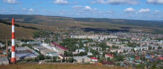
(in 1924–1991 Sverdlovsk) is the most important city in the Urals, an administrative, industrial, transport, trade, scientific and cultural center. Located on the eastern slope of the Ural ridge, on the river. Iset (in the Ob River basin). The regional center of the Sverdlovsk region of the Russian Federation, bordering in the north and northeast with the Khanty-Mansiysk Autonomous Okrug, in the southeast - with the Tyumen region, in the south - with the Kurgan and Chelyabinsk regions and with Bashkortostan, in the west - with the Perm region, in the north -west - with the Komi Republic. The territory of the city is 1143 sq. km.
Geography and natural conditions.
Also on topic:
RUSSIA (RUSSIAN FEDERATION, RF)
Yekaterinburg is located in the Middle Urals, on the border of Europe and Asia, stretching in the meridional direction at a distance of more than 2000 km. from the Kara Sea to the steppes of Kazakhstan. The Middle Urals have altitudes of up to 900 m above sea level. The Ural Mountains are composed of crystalline schists, accompanied in the east by outcrops of igneous rocks. The Sverdlovsk region is rich in natural resources: iron and copper ores, bauxite, asbestos, coal, peat. The forests around the city are coniferous and mixed.
The distance from the Atlantic and proximity to Siberia makes the climate of Yekaterinburg continental, with colder and longer winters, a greater difference between daytime and nighttime temperatures and lower humidity. Westerly winds predominate, but sometimes in winter northern cold air intrudes deeply to the south along the Ural ridge. The average January temperature is minus 16–17°C, the average July temperature is plus 18°C.
List of largest cities in the Sverdlovsk region
There are 47 cities and almost 1,850 small rural settlements in the Sverdlovsk region. However, there is only one metropolis - the capital of the region and the Urals Federal District, Yekaterinburg. Another 11 cities boast a size of more than 100 km², but in terms of population they lag significantly behind the million-plus city of Yekaterinburg, where 1,468,833 people live. The basis for the development of human settlements and their transformation in the course of history from small villages into large formations is industrial development based on the extraction and processing of minerals.
The largest cities in the Sverdlovsk region by area include:
- Ekaterinburg - 468 km².
- Serov - 418 km².
- Lesnoy - 360 km².
- Kachkanar - 317 km².
- Krasnoturinsk - 309 km².
- Zarechny - 299 km².
- Nizhny Tagil – 297 km²
- Verkhnyaya Tura - 236 km².
- Tavda - 148 km².
- Kamensk-Uralsky - 144 km².
Control.
Regulation of the life of the city is carried out by the administration, which is the executive and administrative body of local government. It operates under the leadership of the city head (since 1992 - Arkady Mikhailovich Chernetsky) and is accountable to the City Duma. Within the administration, on the basis of decisions of the Head of the city, committees, departments, departments and other structural units are created, directly subordinate to the head of the city. The city is divided into 7 districts.
Lesnoy is a large city located in a closed area
Surprisingly, the third largest city of Lesnoy with an area of 360 km² is only on the 13th place in the list of the largest cities by the number of inhabitants. This is explained simply: the formation is a closed territory, since the Elektrokhimpribor plant, which works with uranium, is located here. The factory and then the settlement were built by Gulag prisoners. In the first years of its existence, it was called Sverdlovsk-45: only in 1994 the name was renamed.
In this regard, there are no significant attractions in Lesnoy, but the infrastructure for local residents is well developed. There are about 500 companies in various segments of the economy, as well as 3 universities, among which there is one that corresponds to the profile of the city - a branch of the Scientific Research Nuclear University MEPhI.
Story.
Man has lived in the Middle Urals since ancient times. Sites from the Early Paleolithic (about 200 thousand years ago), Middle Paleolithic (Mousterian, about 50 thousand years ago), Late Paleolithic and Mesolithic periods have been discovered. In the Yekaterinburg area, remains of ancient skis dating back to 2–1 thousand BC were discovered. The ancient Greek historian Herodotus (5th century BC) placed the “Country of the Issedons” in this area. Back in the 2nd millennium BC. Here they began to mine copper (Gumeshevsky mine near Yekaterinburg) and produce bronze, and from the 7th century. BC. The Iron Age began, which was characterized by the creation of fortifications and pagan sanctuaries. It is assumed that during this period the Ugric and Ugro-Samoyedic population lived here. Settlers from the Northern Urals and Western Siberia laid the foundation for the Gumayun culture (10th–4th centuries BC), and in the Cis-Urals and Kama region in the 1st millennium BC. The Finno-Permian Ananino culture was established, which received raw materials for non-ferrous metalworking from the Trans-Urals. In the 1st millennium AD. The Urals became the object of various macro- and micro-migrations associated with the Great Migration of Peoples. Some semi-nomadic and even sedentary tribes turned into the forest-steppe and steppe zones and settled there. On the territory of the forest and mountain-forest belt of the eastern slope of the Ural ridge, a proto-Mansi ethnic group took shape. In the flow of the Great Migration of Peoples, Ugric horse breeders came to this area. The Mansi gradually developed small principalities, which by the 16th century. became dependent on the Siberian Khanate. At the same time, at the end of the 14th–15th centuries. Migrants from Russia penetrate from the Kama region to the Trans-Urals. After the collapse of the Siberian Khanate in the 16th century. The Trans-Urals region was finally included in the Russian state.
In 1721, by decree of Emperor Peter I and on the initiative of V.N. Tatishchev, the largest ironworks and fortress in Russia was founded on the banks of the Iset River. They were officially opened in November 1723, when a trial run of war hammers was carried out in the workshops. The fortress, which was built as the capital of the mining region, which spread over a vast territory on both sides of the Ural ridge, was built according to a master plan developed by a graduate of the artillery academy M.S. Kutuzov, in accordance with the best examples of European fortification art. It was named after Empress Catherine I.
In the 18th century Yekaterinburg served as the most important center of the mining industry. There was a Mining Chancellery (since 1723), which managed all the Ural and Siberian factories, a Mint was built (1725), which minted copper coins for 150 years, the Annensky Ironworks (later Verkhne-Isetsky) Plant was built (1726), and a Lapidary Factory was opened (1726). ), which became the main supplier of products from the Ural gems to St. Petersburg and Europe. In 1763, the Siberian Highway passed through Yekaterinburg. Paper, earthenware, brick, carriage, leather, soap and other factories arose. In 1781 Ekaterinburg received city status.
From the beginning of the 19th century. There was a rapid growth of the city caused by the “gold rush”. Widespread mining of gold, emeralds, and other precious stones began. In 1807, Yekaterinburg received the status of the only “mountain city” in Russia and until 1863 remained subordinate to the head of the mining factories of the Ural ridge, the minister of finance and the emperor personally, having been freed from the power of the Perm governor. Diamonds, emeralds, and sapphires were processed in the city, a new industry was formed - metalworking, and mechanical engineering (production of mining and metallurgical equipment, water turbines and steam engines) developed from the 1830s. By the middle of the 19th century. More than 15 thousand people lived in the city. In the last quarter of the century it became an important railway junction. Railways connected Yekaterinburg with Perm (1878), Tyumen (1885) and Chelyabinsk (1895–1896).
By the beginning of the 20th century. Yekaterinburg was a large industrial, commercial and financial center. There were 45 plants and factories in the city, incl. Imperial lapidary factory, mechanical plant of F. Yates, boiler plant of the Berenov brothers, machine-building plant of Voitekhova, refinery, mill of the Makarov brothers, rope factories of Khodov and Yashin, mechanical workshops of the Perm railway, match, pasta-vermicelli, cardboard-paper, cotton, woolen and other factories. The city was also the cultural center of the region. Its stone-cutters, painters, shoemakers, and potters were known far beyond the borders of the province. A mountain printing house opened in 1803. Subsequently, a mining scientific society (1825), the first city library (1832), and a mining museum (1834) were founded. In 1845 a brick theater building was built in Yekaterinburg, in 1847 an office of the State Commercial Bank was opened, and in 1853 a Mining School was opened. In 1870, the Ural Society of Natural History Lovers was established in the city. In 1916, the Mining Institute, about 40 educational institutions were functioning, in which 2.5 thousand people studied, 3 theaters, 3 cinemas and 3 public libraries operated, 2 daily newspapers and 5 magazines were published. The number of residents reached 72 thousand people.
During the revolution and civil war in Russia, Yekaterinburg repeatedly changed hands. Since August 1917, the city became the center of the Ural region, uniting the provinces of the region. In October, the City Council announced it was taking power into its own hands. In November, the Bolsheviks pushed aside other socialist parties. In January 1918, Yekaterinburg became the seat of the regional Soviet government - the Council of Commissars of the Urals. On the night of July 16-17, 1918, the former Russian Emperor Nicholas II and members of his family were shot in the Ipatiev House in Yekaterinburg. On July 25, 1918, the city was occupied by troops of the Czechoslovak corps, and the Bolshevik power fell. In August, the Ural Provisional Government was formed in Yekaterinburg, uniting various anti-Bolshevik parties. In July 1919, the city was again taken by the Red Army.
In the fall of 1923, Yekaterinburg became the administrative center of the Ural region of the RSFSR. In 1924 it was renamed Sverdlovsk - in honor of Ya.M. Sverdlov. Rapid industrialization transformed the appearance of the city. The largest metallurgical and engineering plants began to operate - the industrial giants Ural Heavy Engineering Plant (Uralmash, since 1928), Vtorchermet (since 1929), Elmash (1932), Khimmash (1934). At the same time, reconstruction of old plants and factories was carried out. By 1940, there were 140 plants and factories in Sverdlovsk. The population reached 423.3 thousand. During the division of the Ural region in 1934, the city became the center of the Sverdlovsk region.
During the Second World War, many evacuated enterprises were located in Sverdlovsk. The city has become Russia's largest center for the production of military equipment and weapons. Over 200 enterprises operated there, and the volume of industrial production increased 7 times. Works of art from the Leningrad Hermitage were delivered to Sverdlovsk for storage. Thousands of wounded officers and soldiers were treated in the city's hospitals.
In the post-war period, Sverdlovsk continued to occupy a leading position in key sectors of the economy. In the 1960s, new residential areas were built around large industrial enterprises. The number of residents grew rapidly and in 1967 exceeded 1 million. During the years of Perestroika (1985–1991), the city became an important center of social movements. In 1991, its historical name was returned - Yekaterinburg.
Ethnic composition
Currently, representatives of more than a hundred nationalities live in the city, the vast majority of which are Russian. There are also quite a few Tatars, Ukrainians and Bashkirs.
| Nationality | Total | % of those who indicated nationality | % from all of us |
| Russians | 1106688 | 89,03850 | 80,01047 |
| Tatars | 46232 | 3,71959 | 3,34245 |
| Ukrainians | 12815 | 1,03103 | 0,92649 |
| Bashkirs | 11922 | 0,95918 | 0,86193 |
| Mari | 6481 | 0,52143 | 0,46856 |
| Azerbaijanis | 6381 | 0,51338 | 0,46133 |
| Tajiks | 5868 | 0,47211 | 0,42424 |
| Armenians | 5271 | 0,42408 | 0,38108 |
| Kyrgyz | 4860 | 0,39101 | 0,35136 |
| Jews | 4339 | 0,34909 | 0,31370 |
| Uzbeks | 4072 | 0,32761 | 0,29439 |
| Belarusians | 3672 | 0,29543 | 0,26548 |
| Udmurts | 2666 | 0,21449 | 0,19274 |
| Mordva | 2664 | 0,21433 | 0,19260 |
| Chuvash | 2508 | 0,20178 | 0,18132 |
| Germans | 2383 | 0,19172 | 0,17228 |
| Chinese | 1678 | 0,13500 | 0,12131 |
| Kazakhs | 1304 | 0,10491 | 0,09428 |
| Yazidis | 925 | 0,07442 | 0,06687 |
| Gypsies | 863 | 0,06943 | 0,06239 |
| Georgians | 784 | 0,06308 | 0,05668 |
| Koreans | 709 | 0,05704 | 0,05126 |
| Lezgins | 682 | 0,05487 | 0,04931 |
| Moldovans | 639 | 0,05141 | 0,04620 |
| Greeks | 597 | 0,04803 | 0,04316 |
| Poles | 476 | 0,03830 | 0,03441 |
| Chechens | 300 | 0,02414 | 0,02169 |
| Komi-Permyaks | 273 | 0,02196 | 0,01974 |
| Avars | 267 | 0,02148 | 0,01930 |
| Bulgarians | 259 | 0,02084 | 0,01872 |
| Ossetians | 239 | 0,01923 | 0,01728 |
| Yakuts (Sakha) | 228 | 0,01834 | 0,01648 |
| Vietnamese | 208 | 0,01673 | 0,01504 |
| Buryats | 181 | 0,01456 | 0,01309 |
| Komi | 167 | 0,01344 | 0,01207 |
| Turkmens | 154 | 0,01239 | 0,01113 |
| Lithuanians | 153 | 0,01231 | 0,01106 |
| Tabasarans | 134 | 0,01078 | 0,00969 |
| Kumyks | 126 | 0,01014 | 0,00911 |
| Tuvans | 121 | 0,00974 | 0,00875 |
| Latvians | 116 | 0,00933 | 0,00839 |
| Dargins | 113 | 0,00909 | 0,00817 |
| Laktsy | 108 | 0,00869 | 0,00781 |
| Talysh | 100 | 0,00805 | 0,00723 |
| Estonians | 97 | 0,00780 | 0,00701 |
| Uyghurs | 91 | 0,00732 | 0,00658 |
| Udini | 89 | 0,00716 | 0,00643 |
| Assyrians | 87 | 0,00700 | 0,00629 |
| Kabardians | 87 | 0,00700 | 0,00629 |
| Turks | 87 | 0,00700 | 0,00629 |
| Ingush | 85 | 0,00684 | 0,00615 |
| Mongols | 78 | 0,00628 | 0,00564 |
| Gagauz | 64 | 0,00515 | 0,00463 |
| Tsakhur | 54 | 0,00434 | 0,00390 |
| Kurds | 53 | 0,00426 | 0,00383 |
| Finns | 53 | 0,00426 | 0,00383 |
| Serbs | 51 | 0,00410 | 0,00369 |
| Muncie | 44 | 0,00354 | 0,00318 |
| Abkhazians | 42 | 0,00338 | 0,00304 |
| Khakassians | 42 | 0,00338 | 0,00304 |
| Arabs | 39 | 0,00314 | 0,00282 |
| Khanty | 37 | 0,00298 | 0,00267 |
| Kalmyks | 34 | 0,00274 | 0,00246 |
| Karachais | 33 | 0,00266 | 0,00239 |
| Romanians | 33 | 0,00266 | 0,00239 |
| Rutulians | 32 | 0,00257 | 0,00231 |
| Karelians | 26 | 0,00209 | 0,00188 |
| Pamiris | 24 | 0,00193 | 0,00174 |
| Hungarians | 23 | 0,00185 | 0,00166 |
| Crimean Tatars | 23 | 0,00185 | 0,00166 |
| Altaians | 21 | 0,00169 | 0,00152 |
| Americans | 18 | 0,00145 | 0,00130 |
| Japanese | 18 | 0,00145 | 0,00130 |
| Georgian Jews | 17 | 0,00137 | 0,00123 |
| Nogais | 16 | 0,00129 | 0,00116 |
| Slovenians | 16 | 0,00129 | 0,00116 |
| Dungans | 15 | 0,00121 | 0,00108 |
| Spaniards | 14 | 0,00113 | 0,00101 |
| Nenets | 14 | 0,00113 | 0,00101 |
| Bosnians | 13 | 0,00105 | 0,00094 |
| Indians | 13 | 0,00105 | 0,00094 |
| Italians | 13 | 0,00105 | 0,00094 |
| Persians | 13 | 0,00105 | 0,00094 |
| Aguly | 12 | 0,00097 | 0,00087 |
| Adyghe people | 11 | 0,00089 | 0,00080 |
| Besermyane | 11 | 0,00089 | 0,00080 |
| Afghans | 8 | 0,00064 | 0,00058 |
| Mountain Jews | 8 | 0,00064 | 0,00058 |
| Nagaibaki | 8 | 0,00064 | 0,00058 |
| Circassians | 8 | 0,00064 | 0,00058 |
| Nivkhi | 7 | 0,00056 | 0,00051 |
| French people | 7 | 0,00056 | 0,00051 |
| Balkars | 6 | 0,00048 | 0,00043 |
| Cubans | 6 | 0,00048 | 0,00043 |
| Macedonians | 5 | 0,00040 | 0,00036 |
| Czechs | 5 | 0,00040 | 0,00036 |
| Shors | 5 | 0,00040 | 0,00036 |
| Evenks | 5 | 0,00040 | 0,00036 |
| Karakalpaks | 4 | 0,00032 | 0,00029 |
| Slovaks | 4 | 0,00032 | 0,00029 |
| Abazins | 3 | 0,00024 | 0,00022 |
| British | 3 | 0,00024 | 0,00022 |
| Vepsians | 3 | 0,00024 | 0,00022 |
| Chum salmon | 3 | 0,00024 | 0,00022 |
| Croats | 3 | 0,00024 | 0,00022 |
| Koryaks | 2 | 0,00016 | 0,00014 |
| Selkups | 2 | 0,00016 | 0,00014 |
| Chukchi | 2 | 0,00016 | 0,00014 |
| Yukaghirs | 2 | 0,00016 | 0,00014 |
| Dolgans | 1 | 0,00008 | 0,000072 |
| Izhorians | 1 | 0,00008 | 0,000072 |
| Karaites | 1 | 0,00008 | 0,000072 |
| Nganasans | 1 | 0,00008 | 0,000072 |
| Pakistanis | 1 | 0,00008 | 0,000072 |
| Rusyns | 1 | 0,00008 | 0,000072 |
| Sami | 1 | 0,00008 | 0,000072 |
| Tats | 1 | 0,00008 | 0,000072 |
| Central Asian gypsies | 1 | 0,00008 | 0,000072 |
| Montenegrins | 1 | 0,00008 | 0,000072 |
| Evens (Lamuts) | 1 | 0,00008 | 0,000072 |
| Indicating other answers about nationality (not listed above) | 443 | 0,03564 | 0,032028 |
| Persons whose census forms do not indicate their nationality | 140247 | 0 | 10,13947 |
| Total | 1383179 | ||
| Of these, nationality was indicated | 1242932 | 100 | 89,86053 |
General characteristics.
Yekaterinburg is the most important economic center of the Urals. The volume of products produced (work, services) excluding VAT and excise tax for large and medium-sized enterprises in 2002 was estimated at 43,267 million rubles. The average annual number of employees in 2002 reached 567.3 thousand people. 65% of employees are employed in the sphere of material production (including 26% in industry; 1% in agriculture; 8% in transport; 2% in communications; 8% in construction; 16.5% - in trade and public catering; 1% - in the field of MTS and sales; 2% - in the field of general commercial activities, etc.). 35% are employed in the social sector; 5% – in housing and communal services; 11% - in the field of public education; 3.5% – in science and scientific services; 2% – in the field of culture and art; 2% – in the field of credit, finance and insurance; 3% – in management bodies; 7% – in the field of healthcare and physical education. Looking for a job St. 11 thousand people, of which 6.8 thousand were officially recognized as unemployed.
Permian
- Population: 1,053,938 people (2019)
- Founded in 1723, 1940-1957 - Molotov.
Millionaire city. Perm is only 1.5° south of St. Petersburg, which is considered the northernmost city with a population of more than 1 million people.
Perm is located in the foothills of the Urals in the Eastern European part of the Russian Federation. It is the administrative center of the region, an urban district, a port on the Kama River, and a transport hub of the Trans-Siberian Railway. It is a diversified large industrial, logistics, cultural and scientific center of the Urals.
In 1916, a university was opened in Perm - the first in the Urals.
The Kama plays the role of a city-forming axis: Perm stretches along it for 70 km. Thanks to this river, Perm is connected by waterways with 5 European seas: the Baltic, Caspian, Black, White and Azov.
The right bank of the Kama is lower than the left, which is dissected by ravines and ravines. A characteristic feature of Perm is the many small rivers within the city; they flow through the city’s numerous ravines.
Industry.
Yekaterinburg is a center of mechanical engineering, metalworking, and the military-industrial complex. These industries employ more than 2/3 of the city's workers, producing more than half of the total output. In general, mechanical engineering and metalworking account for 42% of industrial production, ferrous metallurgy – 8%, non-ferrous metallurgy – 1%, etc. Russian mechanical engineering giants such as Uralmash, Uralelectrotyazhmash, and the Ural Optical-Mechanical Plant operate in the city. The Verkhne-Isetsky Metallurgical Plant continues to play a major role in the industrial structure. The building materials industry accounts for 3.5% of production. After the war, the chemical and petrochemical industry was formed in Yekaterinburg (8% of industrial production), represented by factories of rubber technical products, plastics, a tire factory, a plant of hard rubber products, etc. Light industry is developing in the city (over 1% of industrial production); The products of the Uralobuv factory, worsted factory, fur factory and clothing enterprises are famous. A network of food industry enterprises has been created (30% of industrial production): a meat processing plant, a fat processing plant, a wine and champagne plant, two confectionery factories, a tobacco factory, the Isetsky brewery, and the Ural Gems perfume and cosmetics factory. Traditionally, lapidary and stone-cutting are developing in the city: the jewelry factory “Jewelers of the Urals” and the production association “Russian Gems”.
Why was Yekaterinburg called Yekaterinburg
The city owes its sonorous name to the Russian engineer with Dutch roots, William de Gennin. He proposed to name this settlement in honor of the wife of Peter I, Catherine. There is an opinion that the toponym is also connected with the name of the patroness of mining, the Holy Great Martyr Catherine of Alexandria. The history of the name of the city of Yekaterinburg is inextricably linked with the construction of factory workshops and residential areas for artisans.
The city was rapidly developing and rebuilt. It became the center of the mining and ore mining cluster of the Ural region. Yekaterinburg occupied major positions in the production of cast iron and copper, the casting of cannons and cannonballs, and the manufacture of edged weapons.
Services and tourism.
Retail trade turnover in 2002 amounted to 65,070 million rubles. The volume of paid services provided to the population of Yekaterinburg was estimated at 15,486 million rubles. There are more than 1 thousand stores in the city, St. 1.1 thousand food establishments. Since the 1990s, market structures have been formed: there are 5 exchanges, 32 commercial banks, etc.
Yekaterinburg is one of the major tourist centers. In addition to the architectural and historical monuments of the city, popular tourist sites are places associated with the last days of the royal family, as well as the outskirts of Yekaterinburg - the border between Europe and Asia, the Kungur Ice Cave, the ancient metallurgical center in Nevyansk, etc. The city has 33 hotels with 3461 beds .
During the Great Patriotic War
Sverdlovsk had a deep rear. But the inhabitants of this harsh region also made a worthy contribution to the victory. More than 100 thousand Sverdlovsk residents were called to the front. 62 soldiers became Heroes of the Soviet Union, 13 thousand became holders of orders and medals. More than 500 formations were sent to the front line, including the famous 22nd Army and the Ural Volunteer Tank Corps.
More than 50 large enterprises were evacuated here from territories captured by the Nazis. On their basis, the production of military equipment, weapons and ammunition was launched. Sverdlovsk residents forged victory at the machines.
Residents of Sverdlovsk temporarily forgot ancient Yekaterinburg and why their city was called that.
Transport.
Yekaterinburg is one of the most important transport hubs in Russia, with seven railway lines, bus stations and airports Koltsovo and Uktus. The city has had a metro since 1992. In 2002, there were 7 metro stations, the operational length of the tracks was (in double-track terms) 8.5 km; During the year, 32.4 million passengers were transported. The route network of urban transport included: 52 bus routes with a length of 689 km. (251 million passengers), 17 trolleybus routes with a length of 77 km. (134 million passengers), 28 tram routes with a length of 79 km. (230 million passengers).
Planning and architecture.
Historically, Ekaterinburg stood out among other provincial cities of Russia in appearance. The urban planning was based on the regular scheme of the plant-fortress and the master plans of 1804, 1826 and 1845, developed with the participation of the architect M.P. Malakhov. The city was built up mainly with one-story wooden houses, which were located quarterly and faced the street. Among them stood out large white stone one-story and two-story houses that belonged to factory owners, gold miners, representatives of the clergy, as well as administrative and factory buildings. The true decoration of Yekaterinburg were the buildings in the classicist style, planned by Malakhov and his students: the Mining Chancellery, the Alexander Nevsky Cathedral, erected in memory of the victory in the War of 1812, the ensemble of the Rastorguev-Kharitonov estate, the Novo-Tikhvin Monastery, the houses of General Kachka, the Chief Director of the Mining Plants , the Ryazanovs, the architect Malakhov, the Chief Mountain Forester, as well as the house of the merchant Zheleznov (architect A. Turchevich), the mansion of the mining official Sevastyanov (architect A.I. Paduchev), the building of the Opera and Ballet Theater. The silhouette of the city was framed by the domes of the churches of B. and M. Chrysostom, the Catherine Cathedral, and the Epiphany Cathedral. Monastic churches with high bell towers, a Roman Catholic cathedral and a Lutheran church.
The architectural appearance of the modern city began to take shape in the second half of the 1920s around the main thoroughfare - Lenin Street. At that time, constructivism prevailed in the style of public and residential buildings; Among them, the most notable are the House of Offices (1930, architect V.I. Smirnov), the residential complex “Chekist Town” (1931, architects I.P. Antonov and V.D. Sokolov), the VTUZgorodok complex (1929–1930), etc. Near the new factories that arose during the period of industrialization, social towns were built - Uralmash (1929–1940, architects P.V. Oransky and M.V. Reischer), Uralkhimmash. Since 1959, mass construction of residential large-block and large-panel houses began. Since the 1990s, administrative and business buildings of new commercial and business institutions and firms began to be built in Yekaterinburg. The appearance of the city is dominated by high-rise buildings.
Kachkanar is large in area, but not in numbers
Kachkanar ranks fourth in area - 317 km², and fifteenth in number of inhabitants - 38,996 people. Like many others in the region, it arose in the 19th century thanks to the wealth of the Ural mineral resources: platinum and gold were discovered nearby.
This led to the emergence of many mining settlements. On the basis of one of them, in the fifties of the last century, a village appeared, created for workers of the Kachkanar group of iron ore deposits. The formation of the Kachkanarsky mining and processing plant occurred during the same period: the enterprise, declared an all-Union construction site, today acts as a city-forming enterprise. Kachkanar gives the impression of a well-groomed, clean and green town. Most of the attractions are monuments and memorials, including those to the Liquidators of Nuclear Disasters, as well as the heroes of the Second World War and the Afghan War. Some of the most beautiful buildings are the Old and New Temples of the “Seeking the Lost” icon.
Education.
The extensive education system in Yekaterinburg includes more than 300 preschool institutions (35 thousand children study), 233 state daytime comprehensive schools (152 thousand students), 11 non-state daytime educational institutions (1.2 thousand students), 7 evening state educational institutions ( 3 thousand students), 28 institutions of primary vocational education (12 thousand students), 38 state secondary specialized educational institutions (54 thousand students), 2 non-state secondary specialized educational institutions (1.5 thousand students), 16 state higher educational institutions institutions (149 thousand students) and 13 non-state higher educational institutions (23 thousand students). Higher educational institutions of the city: Ural State University named after. M. Gorky, Ural State Technical University (UPI), Ural State Economic University, Russian State Vocational Pedagogical University, Ural State College named after. I.I.Polzunov, Ural State Conservatory named after. M.P. Mussorgsky, Ural State Mining and Geological Academy, Academy of Arts and Crafts, Academy of Management and Entrepreneurship, Humanitarian University, Institute of International Relations, International Institute of Management and Market, Ural Academy of Public Service, Ural State Academy of Architecture and Art, Ural State Medical Academy, Ural State Medical Academy, Ural State Agricultural Academy, Ural State Law Academy, Ural State Forestry Institute, Ural State University of Transport, Ural Humanitarian Institute, Ural Institute of Business, Ural Institute of Commerce and Law. Ural Institute of Stock Market. Ural Financial and Legal Institute, Ural Legal Institute of the Ministry of Internal Affairs, Yekaterinburg Artillery Institute, Yekaterinburg State Theater Institute, Yekaterinburg Dance Institute.
60% of preschool institutions implement educational programs aimed not only at the early development of gifted children, but also at creating conditions for their full development. In recent years, the number of gymnasiums and lyceums has increased by 67%; 15 educational institutions in the city have the status of schools with in-depth study of subjects. In order to improve the quality of education, the “Young Intellectuals of Yekaterinburg” festival (80 thousand participants) and the “Gifted Children” program (since 2002) are organized. The city has maintained and developed a network of special (correctional) institutions that provide the opportunity for rehabilitation of children with developmental disabilities. This network is represented by 11 boarding schools and 9 special (correctional) schools. In addition, preschool educational institutions employ approx. 400 groups of compensating and combined types. To provide assistance to children, three centers for psychological-pedagogical and medical-social assistance to children with disabilities, a medical commission and a city psychological-medical-pedagogical commission have also been opened. There are 39 additional education institutions operating within the framework of the additional education system. incl. 15 children's and youth sports schools, 7 of which have the status of Olympic reserve schools.
Sterlitamak
- Population: 278,127 people. (January 1, 2021)
- Founded 1766
A city with republican subordination in Bashkortostan of the Russian Federation, a large regional center, a former administrative regional center. The former capital of the Bashkir Autonomous Soviet Socialist Republic, administrative district center, while Sterlitamak is part of an independent municipal formation of Bashkortostan - the urban district of the city of Sterlitamak. Population 274.38 thousand people, 2012. The second largest population in Bashkortostan after the capital of the republic - Ufa.
The city lies on the left bank of the river. Belaya (Kama tributary).
It is a major center of mechanical engineering and chemical industry.
Sterlitamak is the center of the polycentric agglomeration of Southern Bashkortostan, which has powerful production potential.
Sterlitamak is located in the European part of the Russian Federation, just south of Ufa, 121 km. To the east of the city (about 50 km) are the Ural Mountains, and to the west is the East European Plain. Within Sterlitamak (the valley of the Belaya River) lie the shikhans (Kushtau, Yurak-tau, Shakhtau, Tratau) - these are unique geological natural monuments. Near Mount Kushtau there are children's health camps, holiday homes and ski resorts. Ufa International Airport is located about 100 km from Sterlitamak.
Initially, the city was built between the Sterlya and Ashkadar rivers (historical center, Old Town). Then Sterlitamak was built up mainly to the north and west.
The largest nearby cities are Salavat (26 km to the south) and Ishimbay (21 km to the southeast).
The river flows in the center of the city. Sterlya, it flows into Ashkadar, on the eastern part. Five road bridges and one railway bridge were built across the river within Sterlitamak. In the southeast, Ashkadar is separated by the Zaashkadarye district from the main part of the city. The river is adjacent to the east. Belaya, this is the border between the Ishimbay and Sterlitamak regions of the republic. In the Mashzavod area, in the south, Sterlitamak borders the river. Olkhovka (tributary of the Ashkadar).
Culture.
Writer F.M. Reshetnikov, artist A.K. Denisov-Uralsky, heat mechanic I.I. Polzunov were born in Yekaterinburg, writers D.N. Mamin-Sibiryak and P.P. Bazhov lived and worked.
Yekaterinburg is one of the largest cultural centers of the Russian Federation. There are 5 professional and 8 other theaters operating here (State Academic Opera and Ballet Theater of Russia, Academic Drama Theater, Maly Drama Theater "Teatron", Ural State Variety Theater, Yekaterinburg Theater for Young Spectators, Musical Theater for Children "Vitamin", Municipal Ballet Theater " The Nutcracker", State Academic Theater of Musical Comedy, Yekaterinburg Puppet Theater, Chamber Theater of the United Museum of Writers of the Urals, "Old House", theater, studio theater "Perekrestok"), 2 state philharmonic societies (including children's), circus, Ural Folk Choir, several dozens of cinemas and recreation centers. There are 60 public libraries, which were visited by 308 thousand readers during 2002; the total volume of the book fund exceeds 4 million copies.
There are dozens of museums in Yekaterinburg, incl. Ural Geological, Ural Mineralogical, Yekaterinburg Museum of Fine Arts, history of architecture and industrial technology of the Urals, history of stone-cutting and jewelry art, museums of the history of Yekaterinburg, the middle Urals and the Uralmash plant, regional history and local history, military history and airborne troops , radio, Ural Folk Museum, Ural Youth Museum, “Nevyansk Icon”, “Literary Life of the Urals 20th Century”, literary and memorial museums of F.M. Reshetnikov, D.N. Mamin-Sibiryak, P.P. Bazhov, doll museums and children's books, memory of internationalist soldiers, nature of the Middle Urals, fruit gardening, municipal united museum of writers, museum of photography. The most important art galleries: State Center for Contemporary Art, “Art Game”, Ural Center for Folk Arts and Crafts, exhibition complex “Chum”, “Russia”, auction house “Mobi-Art-Tatiana’s Day”, “Anton-Invest”, “ Ural-poster", Yekaterinburg Creative Union of Cultural Workers, museum and exhibition complex UralGAKhA, art salon-gallery "Capital", branches of the Union of Artists of Russia, art salon, House of Actors, "Odoevsky Gallery", "White Gallery", "Noah's Ark" ", "Painting Salon", regional House of Peace and Friendship, etc.
The city publishes the newspapers “Uralsky Rabochiy”, “On Change!”, “Evening Ekaterinburg”, “Science of the Urals”, “Regional Newspaper”, etc., and the magazines “Ural”, “Ural Pathfinder”.
Sport.
Yekaterinburg has long-standing sports traditions. Here, in 1800, Efim Artamonov invented the first bicycle in Russia. The first sports society (cyclists) in the city arose in 1886. Currently, Yekaterinburg has established itself as a major sports center of international importance. It has 1,373 sports facilities, incl. 14 stadiums, 30 swimming pools, 135 hockey courts, 370 gyms, 15 ski resorts, 4 ice sports palaces, 665 flat structures (yard playgrounds). The city hosts prestigious international competitions, including the Climbing World Cup, the Christmas Starts athletics competition, the JAVA Trophy international sailing regatta, the European Parachuting Championships, the Speedway World Championships, the Europe-Asia International Ski Marathon, the International volleyball tournament for the Boris Yeltsin Cup, the traditional international bicycle ride "Tour Piper", the traditional international gathering of friendship among tourists on the border of Europe - Asia. Many Yekaterinburg athletes became champions and record holders of the world and the Olympic Games.
Vadim Damier
Automobile highways
Six federal highways pass through Yekaterinburg simultaneously, which is due to the city’s favorable geographical location between the European and Asian parts of Russia:
- P242 (Novomoskovsky tract) is a highway to Perm, adjacent to the city from the west.
- P351 is a highway to Tyumen in the eastern part of the city, turning into a backup of the Siberian Highway.
- P352 (Serovsky tract) - the road to Nizhny Tagil, then to Serov, adjoins the city from the north-west.
- P354 is a highway to Shadrinsk, then to Kurgan, it adjoins from the east and also turns into a backup of the Siberian Highway.
- P355 (Polevskoy tract) - road on Polevskaya, adjacent from the southwest.
Also, roads to Rezh (Rzhevsky Tract, adjacent to the EKAD - Yekaterinburg Ring Road) and Chusovskoye Lake (Chusovsky Tract) pass through Yekaterinburg, but they are not included in the list of federal highways.
The highway to Chelyabinsk is part of the AH7 route of the Asian international network. The route begins in Yekaterinburg and ends on the Indian Ocean coast in Karachi, passing through six (not counting Russia) states - Kazakhstan, Kyrgyzstan, Uzbekistan, Tajikistan, Afghanistan and Pakistan.
