Examples of distance calculations:
- Distance from Moscow to Kyiv
- Distance from Moscow to St. Petersburg
- Distance from Moscow to Nizhny Novgorod
- Distance from Moscow to Yaroslavl
- Distance from Moscow to Vladivostok
- Distance from Moscow to Minsk
- Distance from Moscow to Tver
- Distance from Moscow to Tula
- Distance from Moscow to Kazan
- Route Voronezh - Moscow
- Route Ekaterinburg - Moscow
- Route Rostov-on-Don - Moscow
- Route Ryazan - Moscow
- Route Kostroma - Moscow
- Route Vladimir - Moscow
- Route Smolensk - Moscow
- Route Samara - Moscow
- Route Kaluga - Moscow
Sights of the Nizhny Novgorod region
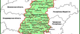
In the Nizhny Novgorod region there are natural monuments, architectural monuments, famous estates, and embodiments of the highest engineering thought - everything that can be found in the world treasury.
Naturally, the leader in the number of cultural heritage sites and simply interesting cultural monuments from different times is Nizhny Novgorod. Its main attractions are the Kremlin, the Volga slope, the Rukavishnikov estate and many others, however, the region does not lag behind its center.
The Gorodetsky and Lyskovsky districts of the Nizhny Novgorod region are famous for their preserved original culture, wooden architecture and museums of customs and traditions of the peoples of the Volga region. Bolsheboldinsky district is the patrimony of the Pushkin family, glorified by the famous Russian writer Alexander Seregeevich Pushkin in his works.
There are natural monuments in almost all districts of the Nizhny Novgorod region. The most famous are the Kerzhensky Nature Reserve, the Ichalkovsky Nature Reserve, lakes Svetloyar and Vadskoye, the Sundovik River and others. The virgin nature, the abundance of animals, birds and fish amazes the imagination.
The special pride of the Nizhny Novgorod region are monasteries, temples and holy places. There is no such person in the Orthodox world who has not heard about the village of Diveevo - the estate of St. Seraphim of Sarov - or the Makaryevsky, Blagoveshchensky or Pechersky monasteries. In terms of the number of pilgrims, these places are in no way inferior even to Israeli Christian shrines.
There are also quite rare industrial and engineering structures in the Nizhny Novgorod region that have become architectural monuments. Thus, in the Dzerzhinsk area there is a hyperboloid openwork tower - a steel work of art by engineer Shukhov. The buildings he built stand in Vyksa and also represent a certain architectural value for the world community. This is a workshop with sail-shaped steel floors and the world's first hyperbolic tower.
There are dozens of excursion routes throughout the Nizhny Novgorod region, and here are the most popular of them:
When is distance calculation useful?
Free calculation of distances between cities shows the exact distance between cities and calculates the shortest route with fuel consumption. It may be required in the following cases:
- The distance calculation service helps plan a route for a road traveler, for example, for a summer holiday with his family or when planning a business trip by car. Knowing the gasoline consumption and the average price per liter of fuel, it is not difficult to calculate the obligatory financial costs of the trip.
- For a truck driver, calculating the distance between cities allows you to plot a route on the map when preparing for a long trip.
- The distance calculator is useful for the shipper to determine the mileage and, in accordance with the tariffs of the transport company, estimate the cost of cargo transportation.
Gorky Sea
The Gorky Reservoir, popularly proudly called the Gorky Sea, is a favorite vacation spot for residents of Nizhny Novgorod and neighboring regions. People come here with children or cheerful, noisy groups to relax for the weekend or spend a whole vacation here. A lot of rest houses, sanatoriums, camps, and campsites on the shores of the Gorky Sea make a vacation in a picturesque place in the Nizhny Novgorod region as comfortable as possible.
The history of the appearance of the Gorky Reservoir is as follows. Back in the 50s of the 20th century, the Volga was blocked by the dam of the Gorky hydroelectric power station. Thus, a kind of “backwater” appeared with an area of about 160 hectares.
If the upper part of the Gorky Sea, located on the territory of the Ivanovo region, with its endless expanses of water and deserted islands, is most suitable for sailing regattas and boat trips, then the lower part of the reservoir in the Nizhny Novgorod region is a paradise for fishermen. Almost no one is left without a catch. The most common “sea” inhabitants are perch, pike perch, scavenger, and sorozhka.
The main beaches and recreation centers are located on the left bank of the Gorky Sea, while the right bank is not very suitable for recreation, as it is very steep and steep. There are a lot of options for recreation - from elite “vip” boarding houses to affordable student camps and recreation centers. Some beaches are loved by regulars of the “grief-sea” as places for wild relaxation.
Among the traditional marine entertainments, you can find rides on catamarans and boats along the coast. Immediately behind the sandy strip of beaches there are dense forests with berries and mushrooms. So, when coming to the Gorky Sea in July-August, you can stock up not only with positive emotions, but also with a portion of vitamins.
How to use distance calculation?
In order to calculate a route between cities, start entering the name of the starting point of the route in the “From” field. Select the desired city from the contextual tool drop-down. By analogy, fill out the “Where” field and click the “calculate” button.
On the page that opens, the route will be laid out on the map, the starting and ending settlements will be marked with red markers, and the route along the road will be shown with a red line. Above the map the total length of the route, travel time and fuel consumption will be indicated. Below this information there will be a summary table with detailed information about the route and sections of the route: type of road, estimated length and duration of each section of the route.
The resulting route can be printed or, by changing some parameters, the calculation can be repeated. In additional settings, you can specify transit settlements, as well as adjust the estimated speed on roads of each type. Below the additional settings there are data entry fields for the fuel calculator. Enter in them the current fuel consumption of your car and the average price of 1 liter of fuel. When re-calculating, this data will be used to calculate the required amount of fuel and its cost.
Map
| Zavolzhye: maps |
Trans-Volga region: photo from space (Google Maps) Trans-Volga region: photo from space (Microsoft Virtual Earth)
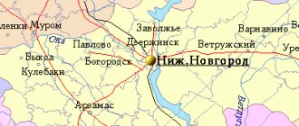
| Trans-Volga region. Nearest cities. Distances in km. on the map (in brackets along roads) + direction. Using the hyperlink in the distance , you can get the route (information courtesy of the AutoTransInfo website) | |||
| 1 | Gorodets | 5 (16) | IN |
| 2 | Chkalovsk | 17 (39) | NW |
| 3 | Hydropeat | 19 () | SE |
| 4 | Balakhna | 19 (23) | SE |
| 5 | Bolshoye Kozino | 32 (39) | SE |
| 6 | Puchezh | 41 (83) | WITH |
| 7 | Linda | 42 (55) | IN |
| 8 | Novosmolinsky | 44 () | SW |
| 9 | Mulino | 44 () | SW |
| 10 | Dzerzhinsk | 44 (63) | YU |
| 11 | Pestyaki (Ivanovo region) | 45 (74) | Z |
| 12 | Reshetikha | 46 (73) | YU |
| 13 | Volodarsk | 46 (79) | YU |
| 14 | Nizhny Novgorod | 50 (60) | SE |
| 15 | Bor | 50 (77) | SE |
| 16 | Ilyinogorsk | 52 (95) | SW |
| 17 | Upper Landeh (Ivanovo region) | 53 (94) | NW |
| 18 | Sokolskoye | 58 (92) | WITH |
| 19 | Gorbatov | 59 (140) | YU |
| 20 | Bogorodsk | 59 (96) | YU |
| 21 | Kovernino | 60 (81) | NE |
| 22 | Zhdanovsky | 64 () | SE |
| 23 | Gorokhovets | 64 (112) | SW |
| 24 | Talitsy (Ivanovo region) | 66 (194) | Z |
| 25 | Semyonov | 69 (94) | IN |
| 26 | Vorsma | 72 (116) | YU |
| 27 | Kstovo | 72 (87) | SE |
| 28 | Tumbotino | 74 (136) | YU |
| 29 | Pavlovo | 78 (129) | YU |
| 30 | Yuryevets | 78 (133) | WITH |
a brief description of
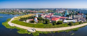
The city is located on the right bank of the Volga (Gorky Reservoir, pier), opposite the city of Gorodets, 56 km northwest of Nizhny Novgorod. Railway station.
Territory (sq. km): 20
Information about the city of Zavolzhye on the Russian Wikipedia website
Historical sketch
It arose as a settlement for the builders of the Gorky hydroelectric power station (protected by an artificial dam 15 km long).
On December 16, 1947, a government decree was issued on the construction of the Gorky hydroelectric power station, and at the end of that year the first builders arrived. On April 22, 1951, concrete laying began at the base of the spillway dam. On November 2, 1955, the first hydraulic unit of the Gorkovskaya HPP received an industrial load.
On March 21, 1950, the village of Pestovo was transformed into the working village of Zavolzhye. City since December 16, 1964
During the construction of the Gorky hydroelectric power station, some of the builders lived in the village of Pestovo on the right bank of the Volga, and some in Gorodets on the left. For the latter, Pestovo was beyond the Volga, and therefore the working settlement formed on the basis of this village was named Zavolzhsk, although in the generally accepted understanding, Zavolzhye is the left bank of the Volga, and not the right.
Economy
In the Volga region there is a specialized engine-building plant (one of the largest in the country), producing gasoline internal combustion engines for GAZ and PAZ cars, aluminum castings and foundry machines, plain bearings, etc.
Factories: caterpillar tractors, machine tools, industrial reinforced concrete.
Main enterprises
AUTOMOTIVE INDUSTRY
JSC "Zavolzhsky Motor Plant"
606431, Nizhny Novgorod region, Gorodetsky district, Zavolzhye, st.
Sovetskaya, 1 Offers:
gasoline carburetor engines, spare parts for cars
Culture, science, education
Branch of Nizhny Novgorod Technical University.
Universities of the city
Zavolzhsky branch of Nizhny Novgorod State Technical University named after.
R.E. Alekseeva 606520, Nizhny Novgorod region, Gorodetsky district, Zavolzhye, st. Pavlovsky, 1-a
| Population by year (thousands of inhabitants) | |||||||
| 1959 | 20.0 | 1998 | 46.8 | 2008 | 42.0 | 2016 | 38.9 |
| 1967 | 26 | 2000 | 46.3 | 2010 | 41.5 | 2017 | 38.5 |
| 1970 | 34.9 | 2001 | 46.0 | 2011 | 40.5 | 2018 | 38.2 |
| 1979 | 41.5 | 2003 | 44.0 | 2012 | 40.0 | 2019 | 37.8 |
| 1989 | 44.6 | 2005 | 42.9 | 2013 | 39.5 | 2020 | 37.6 |
| 1992 | 45.3 | 2006 | 42.6 | 2014 | 39.3 | 2021 | 37.2 |
| 1996 | 46.7 | 2007 | 42.2 | 2015 | 39.2 | ||
Other routing methods
Perhaps the simplest alternative is to open a road atlas and plot a route on the map by eye. Then, by rolling a curvimeter along the route, you can get the approximate mileage. Estimating travel time will be more difficult: to do this, you will have to divide the route into fragments with the same class of roads and measure the sum of the lengths of the fragments of each class. Further, knowing the average speed for each class of roads, it is easy to calculate the time by dividing the distance by the speed.
If you don’t have a curvimeter at hand, you can use a ruler. Place the zero mark of the ruler at the starting point of the route and move the ruler, tightly adjoining it to the curves of the road.
You can also calculate the distance between cities using tables that are published in atlases and reference books. This is quite convenient for routes starting and ending in large cities. Small settlements, as a rule, are not included in the tables.
Trans-Volga region
(Nizhny Novgorod Region)
OKATO code:
22228503
Founded:
1947
Urban settlement since:
1950
City since:
1964 City of district subordination (Gorodetsky district, Nizhny Novgorod region)
Telephone code (reference phone)
| 83169***** | 09-1-11 |
Deviation from Moscow time, hours:
0
Geographic latitude:
56°38′
Geographic longitude:
43°24′
Altitude above sea level, meters:
75 Sunrise and sunset times of the Sun and Moon in the city of Zavolzhye
Algorithm for calculating the distance between cities
Route calculation is based on an algorithm for finding the shortest path in a weighted road graph (Dijkstra's algorithm). Distances are determined using exact satellite coordinates of roads and settlements. The calculation is the result of computer modeling, and models are not ideal, so when planning your trip route, do not forget to include a reserve.
See also:
- table of distances between Russian cities
- Calculate distances for your site
- Calculation of distances in other languages in other countries:
