The holiday begins with the opening of events by officials. On this day, folk art fairs are held. Art exhibitions welcome art lovers within the walls of museums. Public organizations, with the support of the authorities, organize races. Everyone is welcome. Theaters show performances in the open air. An entertainment program is being prepared for children.
Musical and creative groups perform performances. Competitions bring together those who want to compete for championship in sports. On this day it is customary to open constructed objects. In the evening, popular performers are invited to the stage. The date ends with colorful fireworks.
In 2021, Volzhsky City Day is celebrated on July 22. If a holiday falls on a weekday, the program of events usually extends until the end of the week.
City information
Volzhsky is a city in the Volgograd region. It is located in the southeast of the European part of the Russian Federation. Located on the left bank of the Akhtuba River. The economy is represented by enterprises of the chemical and food industries, metallurgy, and mechanical engineering. Energy generating companies are operating.
There is a cargo-passenger railway junction. There is a river port. There are universities and their branches, secondary specialized and vocational educational institutions. There are attractions related to history and culture. The population is more than 320 thousand people.
Train Station
Volzhsky station is a railway station of the Volgograd branch of the Volga Railway. The station is located at st. Kirova, 19a. The opening date of the railway station is August 1964, the number of platforms is 2, the operating mode is 24 hours a day.
Popular long-distance train routes: Astrakhan, Grozny, Moscow, Baku, Dushanbe, Tashkent, Kyiv, Khujand, Grozny, Kulyab. In the summer, trains pass through the railway station in the following directions: Orsk, Novokuznetsk.
History of Volzhsky
The history of Volzhsky begins in the 14th century. On the site of the modern city there were settlements of the Golden Horde. The territory was used by nomads, between whom conflicts regularly broke out. During the time of Catherine II, a silk factory was built here, which fell into disrepair a few decades later. Only small peasant farms remained. During the Second World War, this territory was quite destroyed.
The emergence of a settlement on the site of the village of Verkhnyaya Akhtuba was facilitated by the construction of the Stalingrad hydroelectric power station. In 1951, the construction of housing began with the help of prisoners. On July 22, 1954, the village of Volzhsky was transformed into a city by Decree of the Presidium of the Supreme Soviet of the RSFSR. After this, its rapid development began. Two administrative districts arose, which were abolished at the end of the USSR. As part of the Russian Federation, it experiences difficulties in the economy and infrastructure renewal.
Nizhny Novgorod
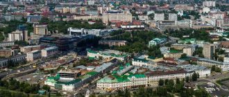
Nizhny Novgorod is the largest city in the Volga Federal District and one of the most famous in Russia. It was founded in 1221 by Prince Yuri Vsevolodovich. Its name, according to the first version, is associated with its lower location relative to Veliky Novgorod; according to the second, it is relative to another city with a similar name that was located higher along the Volga. During the period of the Mongol-Tatar yoke in Rus', Nizhny Novgorod was not very well known. But after the invaders were expelled from Russian soil, it began to actively develop, often noted in chronicles. Some historians believe that during the existence of the Nizhny Novgorod principality (in 1341-1392), the city could claim the status of the capital of Russia, since it was able to compete on equal terms with Moscow and Tver. In 1612, an army led by Minin and Pozharsky began to move from the walls of the Nizhny Novgorod Kremlin, which liberated our country from the Polish-Lithuanian invaders. In 1722, Emperor Peter the Great celebrated his fiftieth anniversary in Nizhny Novgorod. Russian geniuses Kulibin, Lobachevsky, Damascene, teacher Kuzhelev, historian Ilyinsky, traveler Baranshchikov lived here. The city was visited by A.S. Pushkin. He described his impressions of walks through the iconic places of Nizhny Novgorod in the chapters of “Eugene Onegin”. From the 30s until the collapse of the USSR, the city was named after the writer A. M. Gorky. Now Nizhny Novgorod is one of the industrial centers of Russia. The legendary historical and cultural heritage makes it popular among tourists and is a source of pride for Nizhny Novgorod residents themselves.
Coat of arms
The coat of arms of Volzhsky is presented in the form of a French shield. It is divided into two parts. At the top there is an azure field with a golden eight-pointed star. In the middle there are horizontal wavy belts of variable colors. Below there is a green tree on a yellow background.
The coat of arms was adopted by Resolution of the Volga City Duma No. 85/23 dated March 26, 2003 (as amended by Regulation No. 74-VGD dated November 1, 2006). The artistic composition is included in the State Heraldic Register of the Russian Federation under No. 110.
Volga Federal District
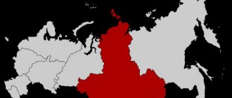
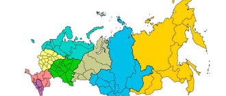
Volga Federal District (VFD) is a federal district in the European part of Russia; one of the nine federal districts of the Russian Federation. The administrative center is Nizhny Novgorod.
The district is located in the eastern part of the East European Plain, which is represented in this part by a combination of lowlands and large hills. In the east, the district is limited by the Middle and Southern Urals. The western slope of the Ural Mountains gradually decreases to the Russian Plain through low ridges and ridges with gentle slopes, and passes into the ridged and hilly elevated plains of the Cis-Urals. In the north of the district - Northern Uvaly, the watershed of the Volga and Northern Dvina basins. Along the right bank of the middle reaches of the Volga is the Volga Upland, in the south stretches the plateau-like General Syrt, the watershed of the rivers of the Volga and Ural basins.
The territory of the district is 1,036,975 km2, the population (as of January 1, 2021) is 29,673,644 people.
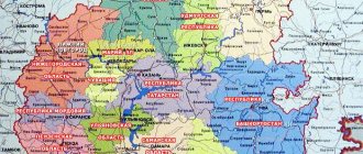
The Volga Federal District includes 6 Republics (Bashkortostan, Mari El, Mordovia, Tatarstan, Chuvash and Udmurt), 1 region (Perm) and 7 regions (Kirov, Nizhny Novgorod, Orenburg, Penza, Samara, Saratov and Ulyanovsk).
Surface water resources
The district's water resources are represented by a river network with a length of about 399.83 thousand km (the density of the river network is 0.39 km/km2), lakes and artificial reservoirs with an area of about 19.23 thousand km2 (lake density 1.85% - from 0.13% in the Kirov region to 7.11% in the Ulyanovsk region), swamps and wetlands with a total area of 13,559 km2 (swampiness 1.31% - from 0.12% in the Vologda region to 3.55% in Bashkiria). The Volga Federal District ranks third in terms of river network density after the Northwestern and Far Eastern Federal Districts.
The average long-term river flow is 271.3 km3/year. Surface water resources are distributed unevenly throughout the district; the Saratov region is most provided with river resources (241.5 km3/year), the least is the Republic of Mordovia (4.9 km3/year). In 2015, river flow in the Volga Federal District amounted to 253.2 km3/year, which is 6.67% lower than the long-term average. Below is the dynamics of river flow in the Volga Federal District from 2010 to 2015.
The Republics of Tatarstan and Mordovia became the most and least endowed with surface water resources in 2015 (214.2 km3/year and 3.8 km3/year, respectively). The change in water content in the regions of the district relative to the long-term average is different - from a decrease of 50.39% in the Orenburg region to an increase of 30.33% in Udmurtia. Below is the deviation of river flow in 2015 from the long-term average in all regions of the Volga Federal District.
On the territory of the Volga Federal District there is located most of the basin of one of the five largest rivers in Russia and the largest river in Europe - the Volga, in the east of the district there is part of the Ural basin, in the west, north and east there are small parts of the Don, Northern Dvina, Pechora and Ob basins, respectively. In addition to the Volga and the Urals, the large rivers of the federal district include: in the Volga basin - the Kama with its tributaries the Vyatka and the Belaya with its tributary the Ufa, the Oka with its tributary the Moksha and the Sura; in the Don basin - Khoper, in the Ob - Tobol basin.
The territory of the federal district contains most of the reservoirs of the Volga-Kama cascade - Gorkovskoye, Kuibyshevskoye, Saratovskoye and Cheboksary on the Volga and Kamskoye, Nizhnekamskoye and Votkinskoye on the Kama; large ones are also the Iriklinskoye reservoir in the Urals, Surskoye on Sura, Yumaguzinskoye on Belaya and Pavlovskoye on Ufa .
There are no large lakes on the territory of the district; the largest lakes are the lakes of the drainless regions of the Orenburg region - Shalkar-Ega-Kara and Aike, which strongly depend on the period of water availability.
In the Volga Federal District there are several irrigation and water supply systems, the largest main canals are the Saratov Canal named after. HER. Alekseevsky in the Saratov region and the unfinished Kuibyshevsky canal in the Samara region.
On the territory of the federal district there is a large swamp system included in the list of wetlands of international importance of the Ramsar Convention - the Kama-Bakalda group of swamps.
Groundwater resources
The forecast groundwater resources of the Volga Federal District are 84,738 thousand m3/day (9.74% of the total forecast groundwater resources in Russia). The largest volume of forecast resources is in Bashkiria (17,808 thousand m3/day - 21.02%), the smallest is in Chuvashia (630 thousand m3/day - less than 1%).
Groundwater reserves of the Volga Federal District as of January 1, 2015 amount to 16912.8 thousand m3/day, the degree of knowledge is about 20%. The underground resources of the Samara region are the most studied (53.19%), the least studied are the Penza region (4.93%).
According to data as of January 1, 2015, 4,615.7 thousand m3/day were produced and extracted from groundwater bodies of the Volga Federal District during the year, including 2,329 thousand m3/day from the fields. The highest figure is in Bashkiria (1107.5 thousand m3/day), the lowest is in Chuvashia (39.4 thousand m3/day). The degree of development of groundwater reserves in the Volga Federal District is 13.77%. The most developed underground water resources are in the Perm Territory (24.61%), the least - in the Saratov Region (1.39%).
Provision of population with water resources (according to 2015 data)
The provision of the district's population with river flow resources is 8.553 thousand m3/year per person, which is more than 3 times lower than the Russian average (31.717 thousand m3/year per person). The population of the Orenburg region is least provided with water resources (3.158 thousand m3/year per person), the most is the Ulyanovsk region (158.315 thousand m3/year per person).
The provision of predicted groundwater resources is 2.856 m3/day per person, which is almost 3 times less than the Russian average (5.94 m3/day per person). The lowest supply is in Chuvashia (0.509 m3/day per person), the highest in the Kirov region (6.483 m3/day per person). Below are the dynamics of the provision of the district's population with river flow resources in 2010–2015 and a comparison of the provision of river flow resources in 2015 in all regions of the Volga Federal District.
Water use (as of 2015)
The withdrawal of water resources from all types of natural sources in the Volga Federal District amounted to 8919.22 million m3. The largest intake is in the Perm Territory (1992.47 million m3), the smallest is in the Republic of Mordovia (56.87 million m3). Most of the water was taken from surface water sources - 7365.65 million m3 (82.58%), which is about 2.9% of the river flow resources of the federal district. Below is the dynamics of fresh water intake in the Volga Federal District in 2010–2015 and a comparison of fresh water intake in 2015 in all regions of the Volga Federal District.
The total water losses during transportation in the regions of the Volga Federal District amounted to 483.1 million m3 or 5.42% of the withdrawn water; the largest water losses are recorded in the Penza region (12.16%), the smallest in the Kirov region (1.46%). Below is the dynamics of water losses during transportation in the Volga Federal District in 2010–2015 and a comparison of water losses during transportation in 2015 in all regions of the Volga Federal District.
Direct-flow water consumption is 7781.85 million m3, from 52.58 million m3 in Mordovia to 1935.79 million m3 in the Perm region. Most of the water was used for industrial, as well as drinking and domestic needs (68.58% and 20.53%, respectively), irrigation and agricultural water supply account for 1.94% and 0.54%, respectively. The largest share of industrial water supply is in the Perm region (91.94%), drinking and household water supply is in Mordovia (66.49%), agricultural water supply is also in Mordovia (4.66%), water use for irrigation is in Saratov region (17.41%). Below is the dynamics of water consumption in the Volga Federal District in 2010–2015 and a comparison of water consumption in 2015 in all regions of the Volga Federal District.
Domestic water consumption per capita in the federal district is 53.841 m3/year per person (the Russian average is 56.205 m3/year per person) - from 37.521 m3/year per person in Chuvashia and up to 84.555 m3/year per person in the Samara region. Below is the dynamics of household water consumption per capita in the Volga Federal District in 2010–2015 and a comparison of household water consumption per capita in 2015 in all regions of the Volga Federal District.
The volume of circulating and re-sequential water consumption in the district is 27,858.81 million m3 or 78.17% of the total water consumption of the district. The most active use of "turnover" is in the Saratov region (93.71%), the least active - in the Penza region (30.37%). Below is the dynamics of direct-flow and recycling and re-sequential water consumption in the Volga Federal District in 2010–2015 and a comparison of direct-flow and circulating and re-sequential water consumption in 2015 in all regions of the Volga Federal District.
Discharge of wastewater into water bodies of the Volga Federal District is 6650.82 million m3, of which 62.17% is conditionally pure and normatively treated wastewater and 37.83% is polluted and insufficiently treated. The main polluters of the district are the Nizhny Novgorod region, the Perm region and the Republic of Tatarstan, discharging 15.48%, 15.22% and 15.2% of all polluted and insufficiently treated wastewater of the federal district, respectively. The water bodies of the federal district receive 17.45% of polluted and insufficiently treated wastewater in Russia - the third figure after the Central and Northwestern federal districts. Below is the dynamics of water disposal in the Volga Federal District in 2010–2015 and a comparison of water disposal in 2015 in all regions of the Volga Federal District.
Water quality (based on 2014 data)
In 2014, in the centralized water supply systems of the Volga Federal District, non-compliance with standards for sanitary and chemical indicators was recorded in 12.3% of samples taken, and for microbiological indicators - in 3.6% of samples. In non-centralized water supply systems, the quality of 27.3% of samples for sanitary-chemical indicators and 15.7% of samples for microbiological indicators did not meet the standard. Below is the dynamics of the corresponding indicators in the Volga Federal District in 2010–2014.
When preparing the material, we used data from the State reports “On the state and protection of the environment of the Russian Federation in 2015”, “On the state and use of water resources of the Russian Federation in 2015”, “On the state and use of land in the Russian Federation in 2015”, collection “Regions of Russia. Socio-economic indicators. 2016". The rankings of regions for surface and underground water resources do not take into account the indicators of federal cities - Moscow, St. Petersburg and Sevastopol.
Flag
The Volzhsky flag was approved on October 20, 2006. It is made in the form of a blue rectangular panel. The aspect ratio is 2:3. Below is a wavy stripe of yellow color measuring 1/16 of the width of the canvas. Above it, in the same proportion and color, is a horizontal wavy stripe. In the center is an eight-pointed gold star. The distance between the ends is 1/2 of the width of the flag. At 1/4 of the same size, the top beam does not reach the top edge.
Hymn
Our sun rises high, Playing in the Orthodox domes. The city floats like a white swan, over the expanse of wormwood land. A page of miracles opened, And palaces and factories stood up. A mighty hydroelectric power station was rising on hands stronger than stone and steel.
Chorus: The flag flies proudly: two rivers wave, We live under a happy star. My homeland, I am proud of you, the Volga garden city has become my destiny!
We keep the names of veterans. Continuing the great work, So that the heart sings Glory to the city of Volga at all times. The eight-winged star is shining, leading to a new life. Volzhsky is in my heart forever - the Glorious city of the great Fatherland.
Words and music by E. Kryukov.
Approved on May 28, 2010.