The main attractions of Mari El
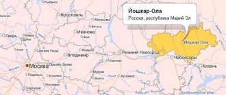
The Republic of Mari El is one of the constituent entities of the Russian Federation and is part of the Volga Federal District.
It neighbors the Kirov and Nizhny Novgorod regions, the Chuvash Republic and the Republic of Tatarstan. The total area of the republic is 23,375 km/sq.
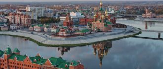
The capital of the republic is the city of Yoshkar-Ola. The population of the republic is about 680 thousand people. The first mentions of this nation are found in historical sources dating back to the 10th century.
Administrative-territorial structure[ | ]
Administrative-territorial division of Mari El
They are marked on the map with numbers. Districts:
1 - Volzhsky, 2 - Gornomariysky, 3 - Zvenigovsky, 4 - Kilemarsky, 5 - Kuzhenersky, 6 - Mari-Tureksky, 7 - Medvedevsky, 8 - Morkinsky, 9 - Novotoryalsky, 10 - Orsha, 11 - Paranginsky, 12 - Sernursky, 13 - Sovetsky, 14 - Yurinsky
Cities of republican significance (urban districts): I - Yoshkar-Ola, II - Volzhsk, III - Kozmodemyansk.
The territory of a subject of the Russian Federation, according to the Constitution of the Republic of Mari El, includes the territories of the following administrative-territorial units[1]:
- 3 cities of republican significance (Yoshkar-Ola, Volzhsk, Kozmodemyansk);
- 14 districts (Volzhsky, Gornomariysky, Zvenigovsky, Kilemarsky, Kuzhenersky, Mari-Tureksky, Medvedevsky, Morkinsky, Novotoryalsky, Orsha, Paranginsky, Sernursky, Sovetsky, Yurinsky).
According to the register of the administrative-territorial structure of the Republic of Mari El[2], the districts are divided into:
- 1 city of regional significance (Zvenigovo),
- 15 urban-type settlements,
- 105 rural districts.
There are 1,616 settlements on the territory of the republic, of which 1,597 are rural, and 19 are urban (cities and urban-type settlements)[3][4].
Section 1. Geographical location and administrative-territorial division
Geographical position. The Republic of Mari El is located in the east of the East European Plain, in the middle reaches of the Volga. The length of the territory from north to south is 150 km, from west to east 275.5 km, area – 23.38 thousand km2.
The capital of the republic is Yoshkar-Ola.
Republic of Mari El on the map of Russia
The republic is part of the Volga Federal District, borders the Kirov region from the north, the Nizhny Novgorod region from the west, the Chuvash Republic from the south, and the Republic of Tatarstan from the east.
The Volga River flows through the south of the region for 110 km and divides it into 2 unequal parts and is at the same time the border of two natural zones: Left Bank (96% of the territory) - the subzone of the southern taiga and subtaiga; The Right Bank or Pre-Volga region (4% of the territory) is a zone of deciduous forests. The republic is located in a temperate continental climate.
Despite the small area, the natural conditions of the republic are quite diverse: 56.8% is forested area, 43% is karst area, 3.7% is water resources: 208.3 thousand hectares are wetlands (1.4%), abundance large and small rivers (180 over 10 km long), about 700 lakes (Mari El is considered one of the most lacustrine in the Volga region), 33.1% is agricultural land (of which 60.5% is arable land). Natural diversity is confirmed by the position of the territory of the republic at the junction of three physical-geographical provinces: the Vetluzhsko-Unzhinskaya is represented by the Mari Lowland (49.9% of the territory), the Vyatsko-Kama - by the Mari-Vyatsky Uval (as we will henceforth call the Vyatsky Uval on the territory of Mari El, – 46.0% of the territory) and the Volga erosion upland (northern part, 4% of the territory).
Physical card
In the transport and economic situation, the republic is located between the highly developed economic regions of the country - Central and Ural, and borders on the most economically developed constituent entities of the Russian Federation - the Nizhny Novgorod region and the Republic of Tatarstan. The republic is greatly influenced by its proximity to large territorial production complexes - Kazan and Cheboksary. The distance from Yoshkar-Ola to Moscow is 862 km.
In the immediate vicinity of the republic there are important transport routes of federal and international importance: the Moscow-Kazan-Ekaterinburg railway, the Moscow-Cheboksary-Kazan-Ekaterinburg highway. Yoshkar-Ola is connected with them by rail and road. The republic is connected with another federal highway (Moscow - Kirov - Yekaterinburg) only by road. Trunk pipelines pass through the territory of the republic: the Surgut - Polotsk oil pipeline and the Urengoy - Pomary - Uzhgorod, Yamburg - Tula, Perm - Nizhny Novgorod gas pipelines. At the same time, they are mainly of transit importance for the Republic, although a gas pipeline branch to the city of Yoshkar-Ola has been built. The river has important transport and economic significance. Volga, which allows for relatively cheap transportation of goods between the republic and other regions of the Volga region.
The disadvantage of the transport-geographical position of the republic is the passage of main highways (railways, roads, the Volga River, pipelines) along the periphery of its territory, as well as the low capacity of transport infrastructure facilities within the republic, which complicates connections with these highways. Thus, the main railway in the republic (Green Dol - Yaransk) is a dead-end, single-track and non-electrified. The only airport, located in Yoshkar-Ola, does not have regular flights.
Administrative-territorial division. As of January 1, 2021, there were 138 municipalities in the Republic of Mari El, including 3 urban districts, 14 municipal districts, 16 urban and 105 rural settlements. The total population was 684.7 thousand people, of which 277.7 thousand lived in the urban district of Yoshkar-Ola.
Administrative division: districts and urban districts
In accordance with the intended purpose, the land fund of the republic is divided into seven categories: agricultural lands (32.9%), lands of settlements (3.6%), lands of industry, transport, communications, defense broadcasting and other purposes (3.3% ), lands of specially protected areas (2.5% - of which 99.2% are in specially protected natural areas of federal significance), forest lands (54.6%), water fund lands (2.9%), reserve lands (0.2%).
Land categories
Land plots consist of various land areas, which are divided into agricultural (arable land, fallow land, perennial plantings, hayfields, pastures) and non-agricultural (forests, trees and shrubs, water swamps, roads, disturbed lands, etc.). Therefore, in addition to the distribution of the land fund by land category, records are kept by type of land. Agricultural land in Mari El occupies 33.1%, forests - 56.8%, swamps - 1.4%, roads - 1.7%, waste landfills - 0.01%, 3.6% of the territory is under water.
Municipal structure[ | ]
As part of the municipal structure of the republic, within the boundaries of the administrative-territorial units of Mari El, by January 1, 2015, 138 municipalities were formed, including:
- 3 urban districts (corresponding to cities of republican significance),
- 14 municipal districts (corresponding to districts), which include: 16 urban settlements (corresponding to a city of regional significance and urban-type settlements),
- 105 rural settlements (corresponding to rural districts).
Districts and cities of republican significance (urban districts)[ | ]
| № | Russian name | Mari name | Flag | Coat of arms | Administrative center | Area, km²[6] | Population, people[5] (2021) | Population density, people/km² | OKATO | OKTMO |
| 1e-06 | Districts (municipal areas) | |||||||||
| 1 | Volzhsky | meadow moth. Yulser kundem | Volzhsk city | 913,86 | ↘21 188[5] | 23,19 | 88 204 | 88 604 | ||
| 2 | Gornomarisky | mining Kyryk mary kymdem | Kozmodemyansk city | 1971,47 | ↘20 476[5] | 10,39 | 88 208 | 88 608 | ||
| 3 | Zvenigovsky | meadow moth. Provoy kundem | Zvenigovo city | 2748,78 | ↘39 920[5] | 14,52 | 88 212 | 88 612 | ||
| 4 | Kilemarsky | meadow moth. Kilemar kundem gornomar. Kӹlemar kymdem | urban-type settlement Kilemary | 3098,89 | ↘11 626[5] | 3,75 | 88 216 | 88 616 | ||
| 5 | Kuzhenersky | meadow moth. Kuzheger kundem | urban-type settlement Kuzhener | 852,83 | ↘12 214[5] | 14,32 | 88 220 | 88 620 | ||
| 6 | Mari-Tureksky | meadow moth. Mari Turek kundem | town of Mari-Turek | 1513,86 | ↘18 242[5] | 12,05 | 88 224 | 88 624 | ||
| 7 | Medvedevsky | meadow moth. Medvedevo kundem | village Medvedevo | 2791,18 | ↘67 519[5] | 24,19 | 88 228 | 88 628 | ||
| 8 | Morkinsky | meadow moth. Morko kundem | village Morki | 2270,08 | ↘26 930[5] | 11,86 | 88 232 | 88 632 | ||
| 9 | Novotoryalsky | meadow moth. U Toryal kundem | urban-type settlement New Toryal | 920,09 | ↘13 980[5] | 15,19 | 88 236 | 88 636 | ||
| 10 | Orshansky | meadow moth. Orshanke kundem | Orshanka village | 896,49 | ↘12 909[5] | 14,4 | 88 240 | 88 640 | ||
| 11 | Paranginsky | meadow moth. Paranga kundem | Paranga village | 791,66 | ↘13 646[5] | 17,24 | 88 244 | 88 644 | ||
| 12 | Sernursky | meadow moth. Shernur kundem | town Sernur | 1032,08 | ↘22 697[5] | 21,99 | 88 248 | 88 648 | ||
| 13 | Soviet | meadow moth. Soviet kundem | Sovetsky village | 1392,45 | ↘27 846[5] | 20 | 88 252 | 88 652 | ||
| 14 | Yurinsky | meadow moth. Yurino kundem, gornomar. Yurnӹ kymdem | urban village Yurino | 2040,15 | ↘6590[5] | 3,23 | 88 256 | 88 656 | ||
| 14.000002 | Cities of republican significance (urban districts) | |||||||||
| 15 | Yoshkar-Ola | meadow moth. Yoshkar-Ola | Yoshkar-Ola city | 100,39 | ↗286 876[5] | 2858 | 88 401 | 88 701 | ||
| 16 | Volzhsk | meadow moth. Yulser-Ola | Volzhsk city | 39,47 | ↘52 703[5] | 1335,27 | 88 405 | 88 705 | ||
| 17 | Kozmodemyansk | mining Tsikmo | Kozmodemyansk city | 13,41 | ↘19 970[5] | 1489,19 | 88 405 | 88 705 |
History[ | ]
Mari Autonomous Okrug[ | ]
On November 4, 1920, the Decree on the formation of an autonomous region of the Mari people within Soviet Russia was adopted, which defined the territory and borders of the region. It included Kozmodemyansky and Krasnokokshaysky districts, parts of Cheboksary and Kazan districts of the Kazan province, parts of Urzhumsky and Yaransky districts of the Vyatka province and part of the Vasilsursky district of the Nizhny Novgorod province. The Mari Autonomous Okrug was divided into 3 cantons: Krasnokokshaysky, Kozmodemyansky and Sernursky.
In the 1920s, the territory was gradually formalized. In 1924, the left bank part of the Cheboksary district and lower Povetluzhye were transferred to the MAO, where new Zvenigovsky and Yurinsky cantons were formed, respectively. Morkinsky, Orsha, Toryalsky and Mari-Turek cantons were separated from the Krasnokokshaysky and Sernursky cantons. Thus the number of cantons increased to nine. Volosts were abolished and village councils were enlarged. There were changes in the borders with the Vyatka province and the Tatar Autonomous Soviet Socialist Republic. At this time, the borders were stabilized, and since then they have changed slightly.
In 1929, the Mari Autonomous Region became part of the Nizhny Novgorod Territory (renamed the Gorky Territory in 1932). In the same year, the Krasnokokshaysky canton was renamed Yoshkar-Olinsky.
On April 30, 1931, the Tatar region was formed. On December 10, 1931, the Kozmodemyansky and Yurinsky cantons were united into the Gornomariysky district.
In 1932, all cantons were renamed districts. On July 8, the Tatar district began to be called Paranginsky.
In 1934, the Kosolapovsky district was formed.
On January 25, 1935, Kuzhenersky and Ronginsky districts were formed. In the same year, Toryalsky district was renamed Novotoryalsky.
In 1936, Pektubaevsky and Sotnursky districts were formed. The Gornomariysky district was disaggregated into Elasovsky, Yurinsky and Kozmodemyansky districts. On December 5, 1936, the Gorky Territory was abolished, and the Mari Autonomous Soviet Socialist Republic was formed.
Mari ASSR[ | ]
On August 26, 1939, Lopatinsky (since 1940 - Volzhsky) and Kilemarsky districts were formed.
On December 6, 1943, the Kazan, Medvedevsky and Khlebnikovsky districts were formed.
On February 14, 1946, the Yoshkar-Olinsky district was transformed into the Semyonovsky district.
On January 6, 1956, the Sotnur district was abolished.
On March 11, 1959, Elasovsky, Kazansky, Kosolapovsky, Kuzhenersky, Pektubaevsky, Semyonovsky and Khlebnikovsky districts were abolished.
On February 23, 1960, the Ronginsky district was renamed Sovetsky.
On February 1, 1963, instead of the existing districts, Gornomariysky, Zvenigovsky, Mari-Tureksky, Medvedevsky, Morkinsky, Sernursky and Sovetsky rural districts, as well as the Zvenigovsky industrial district, were formed.
On March 4, 1964, the Novotoryalsky rural district was re-formed.
On January 12, 1965, the rural and industrial zoning system was abolished and the old system returned. At the same time, the Volzhsky, Kuzhenersky and Paranginsky districts were formed.
On December 30, 1966, the Kilemarsky district was formed
On March 31, 1972, the Yurinsky district was formed.
On October 22, 1990, the Mari ASSR was transformed into the Mari SSR.
Mari El[ | ]
On July 8, 1992, the Mari SSR was transformed into the Republic of Mari El[7].
Currently, the ATD of the Republic of Mari El has the following form:
| Urban districts and districts | Center | Rural and urban settlements |
| Urban district "City of Yoshkar-Ola" | Yoshkar-Ola city | |
| Urban district city of Volzhsk | Volzhsk city | |
| Urban district city of Kozmodemyansk | Kozmodemyansk city | |
| Volzhsky district | Volzhsk city | Privolzhsky, Bolsheparatsky, Karamaskoye, Obshiyarskoye, Petyalskoye, Pomarskoye, Sotnurskoye, Emekovskoye |
| Gornomariysky district | Kozmodemyansk city | Vilovatovskoe, Elasovskoe, Emeshevskoe, Krasnovolzhskoe, Kuznetsovskoe, Mikryakovskoe, Ozerkinskoe, Paigusovskoe, Troitskoposadskoe, Usolinskoe |
| Zvenigovsky district | Zvenigovo city | Zvenigovo, Krasnogorsky, Suslonger, Ismenetskoye, Kokshamarskoye, Kokshaiskoye, Krasnoyarskoye, Kuzhmarskoye, Chernoozerskoye, Shelangerskoye |
| Kilemarsky district | village Kilemary | Kilemary, Ardinskoye, Bolshekibeevskoye, Vizimyarskoye, Krasnomostovskoye, Kumyinskoye, Nezhnurskoye, Shirokundyskoye, Yuksarskoye |
| Kuzhenersky district | village Kuzhener | Kuzhener, Ishtymbalskoye, Russko-Shoyskoye, Saltakyalskoye, Toktaybelyakskoye, Tumyumuchashskoye, Shorsolinskoye, Shudumarskoye, Yuledurskoye |
| Medvedevsky district | village Medvedevo | Krasnooktyabrskoe, Medvedevo, Azanovskoe, Azyakovskoe, Ezhovskoe, Znamenskoe, Kuznetsovskoe, Kundysskoe, Kuyarskoe, Lyulpanskoe, Nurminskoe, Pekshiksolinskoe, Russko-Kukmorskoe, Ruemskoe, Senkinskoe, Sidorovskoe, Shoibulakskoe |
| Morkinsky district | village Morkie | Morki, Zelenogorskoe, Korkatovskoe, Krasnosteklovarskskoe, Oktyabrskoe, Sebeusadskoe, Semisolinskoe, Shalinskoe, Shinshinskoe, Shorunzhinskoe |
| Novotoryalsky district | village New Toryal | New Toryal, Maskanurskoye, Pektubaevskoye, Starotoryalskoye, Chuksolinskoye |
| Orsha district | village Orshanka | Orshanka, Wielkopolskoe, Markovskoe, Shulkinskoe |
| Paranginsky district | village Paranga | Paranga, Alashaiskoye, Yeleevskoye, Iletskoye, Ilpanurskoye, Kurakinskoye, Portyanurskoye, Russko-Lyazhmarinskoye, Usolinskoye |
| Sernursky district | village Sernur | Sernur, Verkhnekugenerskoe, Dubnikovskoe, Zashizhemskoe, Kazanskoe, Kuknurskoe, Marisolinskoe, Serdezhskoe, Chendemerovskoe |
| Sovetsky district | village Soviet | Sovetsky, Alekseevskoye, Verkh-Ushnurskoye, Vyatskoye, Kuzhmarinskoye, Mikhailovskoye, Ronginskoye, Solnechnoye |
| Yurinsky district | village Yurino | Yurino, Bykovskoye, Vasilyevskoye, Kozikovskoye, Maryinskoye, Yurkinskoye |
General information about the Republic of Mari El
Distinctive features .
Previously, the Republic of Mari El had a different name. In Soviet times, there was first the Mari Autonomous Region, and then the Mari Autonomous Soviet Socialist Republic. The Mari, also known as the Cheremis, belong to the Finno-Ugric tribes and have been known since the 10th century. By the will of history, the Mari found themselves sandwiched between two fires - Christian Russia in the west and Muslim Tatars in the east. All this was reflected in the culture of the Mari people, who were divided into mountain and meadow Mari. In total there are about 600 thousand Mari, and half of them live in the Republic of Mari El, which means “country of husbands.”
The economy of the Mari El Republic is primarily a manufacturing industry. Yoshkar-Ola is the capital of the republic and the largest industrial center. There are metallurgy, chemical and woodworking industries here. Unfortunately, the economy is not so developed that local residents can boast of high salaries. But the nature in Mari El is worthy of attention, as is the green city of Mari El, located in the middle of vast forests.
Geographical location . The Republic of Mari El is one of the regions of the Volga region. There is no need to guess which federal district it belongs to. Of course, to Privolzhsky. Its neighbors are the Nizhny Novgorod region in the west, the Republic of Tatarstan in the southeast, the Kirov region in the north and the Republic of Chuvashia in the northeast.
The Republic of Mari El is a real river region: 190 rivers flow through it with a watercourse length of more than 100 km. And the largest and most famous of them is Mother Volga. True, most of the territory of Mari El is located on the left bank of the Volga. And on the right bank there is only one district - Gornomariysky. It is so named because it occupies the northern part of the Volga Upland.
Most of the territory of the republic is covered with forests. The largest protected natural areas are the Mari Chodra National Park, famous for its karst lakes, and the Bolshaya Kokshaga Nature Reserve.
Bolshaya Kokshaga River
Population. Now the population of the Mari El Republic is 690,349 people. What is noteworthy is that in this national autonomy the number of residents of indigenous nationality is approximately equal to the number of Russians (45% and 41.76%, respectively), while in many other similar autonomies Russians make up either the overwhelming majority of the population, or, conversely, remain in a proud minority. In third place in terms of population are Tatars - 5.51%.
Mari Ethnographic Museum in Kozmodemyansk
It should be noted that although there was a slight decrease in numbers compared to what it was 20 years ago, in recent years the situation has been quite stable. There is even a small natural increase in population, although it is less than 1 person per 1000 inhabitants.
As for religion, almost half of the republic’s population are convinced Christians, but Islam is practiced by about 6% of the population.
Crime . The Republic of Mari El is in 61st place in the criminal ranking of regions. Yes, it is mostly quiet and calm here, but this does not mean that there are no crimes at all. There are also thefts and murders of businessmen. In general, everything is the same as in other regions, but still somehow calmer.
Unemployment rate. The economic situation in Mari El is quite difficult. There are practically no large industries here. Residents are forced to engage in trade in order to somehow survive. In terms of unemployment, the republic is in the bottom third of the ranking of regions. In 2012, this figure was 6.49%. The average monthly salary in Mari El is only 15.9 thousand rubles. At the same time, the highest incomes are among employees in the banking sector and in government bodies.
Property value. In Yoshkar-Ola, the average cost per square meter is 40-45 thousand rubles. One-room apartments here are offered at prices ranging from 1 million rubles and above, but the most common figure is 1.6 - 1.8 million rubles for a one-room apartment. Prices for two-room apartments start at approximately the same figures, and for three-room apartments - from 2.4 million rubles. Most of the housing stock was built at the end of the 20th century, and many houses already require, if not major repairs, then at least cosmetic updates.
Many new buildings in Yoshkar-Ola are made in the “signature” red color. Photo by Valentina (https://fotki.yandex.ru/users/zvenizaton/)
Climate. Although the republic is not located in the far north, the climate here is quite harsh. Long frosty winters and moderately warm summers are the main features of this region, located in the realm of a temperate continental climate. In winter, the average temperature is around −19°C, and the average summer temperature is +18°C.
The weather in Mari El is very unstable. In the middle of winter, thaws may begin out of the blue, giving way to new frosts, and frosts may appear in spring or autumn. In short, this is far from the best climate for agriculture.
Notes[ | ]
- Constitution of the Republic of Mari El (undefined)
. docs.cntd.ru. - Decree of the Government of the Republic of Mari El dated January 18, 2008 No. 9 “On the Register of the administrative-territorial structure of the Republic of Mari El” (unspecified)
. docs.cntd.ru. - Results of the 2010 All-Russian Population Census. Newsletter: No. 1. Number of city districts, municipal districts, urban and rural settlements. (unspecified)
(inaccessible link). Maristat (02/17/2012). Access date: December 1, 2014. Archived April 14, 2015. - Results of the 2010 All-Russian Population Census. Newsletter: No. 1. Grouping of rural settlements by population. (unspecified)
(inaccessible link). Maristat (02/17/2012). Access date: December 1, 2014. Archived April 14, 2015. - ↑ 123456789101112131415161718
The permanent population of the Russian Federation by municipalities as of January 1, 2021 (Russian). Date accessed: April 27, 2021. Archived May 2, 2021. - Mari El Republic. Total land area of the municipality
- Guide to the collections of the State Institution “State Archive of the Republic of Mari El”. - Yoshkar-Ola, 2012. - pp. 801-808. — 1136 p. — 500 copies. (unavailable link)
Details
Interesting facts about the Republic of Mari El
* In ancient times, the Mari were called “Cheremis”.
The exact origin of this name is unknown. * Ethnographically, the Mari are divided into three groups - mountain, meadow and eastern
* The Mari are called the last pagans of Europe
* Mari writing originated only in the 18th century
* In the Republic of Mari El, two language norms are widespread on equal terms - the Mountain Mari language and the Meadow-Eastern Mari language.
* There is a group of northwestern Mari living in the Nizhny Novgorod and Kirov regions. Their language is very different from other Mari languages. Their folk writing appeared only in 2005!
* Mari people began to be drafted into the army under Peter the Great
* The largest group of Mari lives in Bashkiria - approximately 103 thousand people
* The city of Yoshkar-Ola, as the capital of Mari El, was founded by decree of Tsar Fyodor Ioannovich in 1584. Initially it was called Tsarevokokshaysk, then Krasnokokshaysk, and at the beginning of the 20th century - Yoshkar-Ola.
* In 1936, large-scale industry began to develop on the territory of the republic
* In 1972, the first university opened on the territory of the republic - MarSU (Mari State University).
Main attractions of the Republic of Mari El
Like any region of the Russian Federation, the Mari Republic has its own unique characteristics and advantages.
These include unique nature, rich national culture (customs, traditions and folk crafts), as well as many historical and cultural monuments. We present to your attention the most interesting sights of the republic.
Sheremetev Castle
This magnificent architectural ensemble is located two hundred kilometers from Yoshkar-Ola, in the village of Yurino, on the banks of the Volga.
In 1812, the village of Yurino was acquired by the landowner Vasily Sergeevich Sheremetev, the great-nephew of the famous Count Sheremetev. Over the years, many famous architects were involved in the construction of the castle - R. Muller, A. Parlant, A. Korsch, A. Stern, S. Radionov, P. Malinovsky.
Construction of the castle lasted from 1874 to 1915. It would not be an exaggeration to say that the builders of the castle managed to create a true masterpiece of architecture of that time.
The entire estate was created in the style of a palace and park residence. The palace looks very harmonious, despite the combination of Gothic and traditional Russian styles. During construction, many expensive materials were used - granite, marble and valuable wood.
The interior decoration matches the appearance of the castle. In total, the palace has more than 100 rooms and each has its own style. Many rooms have luxurious mosaic decoration. The halls, designed in Arabic style, are especially beautiful. The winter garden is very beautiful, accessed by a large spiral staircase. It is very wide, with columns, decorated with ancient Greek amphorae and live plants in pots. The weapons hall is of great interest to tourists. It displays a large and rich collection of weapons - from medieval to weapons of the 19th century. There are such halls as “Picture Gallery”, “Oak Room”, “Eastern Cabinet”, “Skobelevsky Hall”.
The palace grounds are superbly landscaped. The total area of the estate complex is 45 hectares. In addition to the palace, the stone fence, some service buildings, as well as the ground floor and landscape ponds are well preserved.
There is a large park around the castle, consisting of two parts - northern and southern. You can admire fountains, decorative flowers, birch, spruce and pine trees, and various landscape panoramas. In the walking area there are pedestrian paths with green lawns along them.
In the nineties of the last century, the estate was very neglected. Fortunately, restoration of this historical site began, which continues to this day. Part of the castle is used as a hotel complex.
The estate is one of the architectural monuments of federal significance
The best museums of the Republic of Mari El
* Tsarevokokshay Kremlin in Yoshkar-Ola
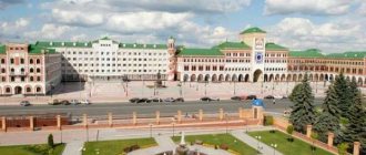
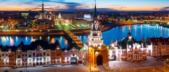
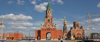
Located on Voznesenskaya street. It was built in 2009. In former times, there was an ancient wooden fortress in its place. Nothing has survived from it to this day. In the 19th century there was a city market square, in Soviet times Revolution Square. The construction of the Kremlin perpetuated the memory of this historical place.
The architectural ensemble of the Tsarevokokshay Kremlin includes the Cathedral of the Resurrection of Christ, an archaeological museum and a monument to Fyodor Ioanovich.
You can also view the exhibitions that are located in the open air. The Kremlin Archaeological Museum has an interesting exhibition of archaeological finds, weapons, ancient coins and jewelry. Information stands with historical documents and photographs about Yoshkar-Ola are installed in special niches of the Kremlin.
* Yezhov Myrrh-Bearing Monastery
This monastery is located 20 km from Yoshkar-Ola, in the village of Ezhovo. It was founded by decree of Tsar Alexei Mikhailovich in 1647. Initially it was male.
During construction, the Church of the Holy Myrrh-Bearing Women, cells and households were erected. the buildings. In 1719, construction of a new monastery stone church was completed. This temple is a monument of federal significance.
In 1924, the authorities closed the monastery. In Soviet times there was an orphanage there, and then state farm workshops.
The monastery was revived only in 1993. Restoration and repair work was carried out, and the monastery became operational, only as a women's monastery.
The monastery has miraculous shrines.
* Theotokos St. Sergius Hermitage
Located in the Kilemar district of Mari El, in the village of Kumya. Construction of this monastery began in 1997.
This monastery became a historical continuation of the nunnery, which was opened in 1888. All buildings of this iconic complex are made of wood.

