In the history of the USSR, it happened that the country’s authorities (for whatever reason) tried not to make them widely public. This mainly concerned those incidents that involved significant casualties. Even the consequences of some similar disasters, both man-made and natural, remain in secret archives years later.
Some events, such as the tragedy of the seaside town of Severo-Kurilsk on Sakhalin, were a little luckier: part of the truth about the natural disaster that occurred here in the mid-20th century and its consequences is now available to the general public.
Life surrounded by volcanoes
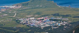
If we talk about the location of Severo-Kurilsk, then the colloquial expression “living like on a volcano” is exactly about this seaside town. After all, on the island of Paramushir (on which Severo-Kurilsk is located) there are 23 volcanoes. Of which 5 are considered to be currently in force. The closest (7 km) to the city is Ebeko, which regularly reminds itself of itself by throwing clouds of volcanic gases into the air.
Severo-Kurilsk / Photo: volcanodiscovery.com
Such “sighs” of the hill twice in history (in 1859 and 1934) caused mass gas poisoning of people living on the island and the death of animals. Knowing about these features of the local nature, the Sakhalin Hydrometeorological Service, along with a storm warning, always notifies residents of Severo-Kurilsk about the degree of air pollution by volcanic gases. In such cases, people in the city try not to go out without masks or respirators. Residents must pass water for drinking through filters. Volcanoes are volcanoes, but at the beginning of November 1952 in Severo-Kurilsk, what happened as one famous Russian proverb says: “Trouble came from an unexpected place.” Not from the crater of a volcano, but from the ocean expanses.
An unexpected blow from the ocean
At approximately 5 a.m. (local time) on November 5, 1952, a powerful earthquake measuring 8.3 on the Richter scale occurred in the Pacific Ocean. Its epicenter was located under the ocean floor at a depth of about 30 km, and at a distance of about 200 kilometers from Petropavlovsk-Kamchatsky. As a result of tremors in the ocean, a tsunami was formed, which moved towards the island of Paramushir. The height of the waves that reached land ranged from 10 to 18 meters.
Waves 10 meters high hit the island of Paramushir / Photo: ednews.net
The entire then Severo-Kurilsk with its 6,000 population was located in a natural bay in the northern part of Paramushir Island. A tsunami with waves 10 meters high hit the unprotected city, which had just begun to awaken. In just a few minutes, the disaster almost completely wiped out Severo-Kurilsk from the face of the earth. And along with it there are 4 more fishing villages - Okeansky, Rifovoye, Shelekhovo and Shkilevo. All buildings on the island: houses, outbuildings, military headquarters, were completely destroyed.
According to official statistics, 2 thousand 236 people are considered dead as a result of the 1952 tsunami. However, these are only those whose bodies the ocean washed ashore, and who were subsequently identified. The real number of victims of the tragedy in Severo-Kurilsk is still classified. The horror of that November morning is captured in the memories of surviving fishermen and border guards.
Northern Kuriles. Part 4. the city of Severo-Kurilsk and why we can’t see Onekotan Island.
01. Upon returning from Shumshu Island to Severo-Kurilsk, it again becomes clear that something is wrong, and our incomprehensible wait at the port continues. Then Leonid gathers us all together and says that we will not go to Onekotan...
To make it easier to understand why, you need to look at this map:
The 12 mile zone (22.2 km) around the coast is the territorial waters zone. By crossing this line and entering neutral waters (as well as in the opposite direction), the ship formally crosses the country’s border. There is nothing criminal in this, since all ships sailing into neutral waters have all the necessary documents and TSC (Technical Control Equipment). This is something like a navigator that transmits your coordinates to border guards. You applied for the route, went to the raid, the border guards see you, everything is according to the law, there are no problems. But here's the thing; The TSK on our Larga is outdated and you cannot go with it more than 12 miles from the coast. And when Leonid applied for access to Onekotan, he was turned away. And this despite the fact that every dog here knows Leonid, and such issues, it would seem, are resolved here in two minutes.
02.
03. At first there was a conversation that a new TSK costs, it seems, 300,000 rubles. Then, it seems, it turns out that the price of the device is much less, but it must be ordered in advance and registered... Then disputes begin, clarification of the circumstances and small details, a collective study of the Russian border. legislation and rules for ships going to sea. But the verdict is in: Larga will not go to Onekotan. This 11-kilometer isthmus between the territorial waters of Paramushir and Onekotan puts an end to our goal. All existing agreements and prepayments no longer matter.
04. We have passes to the border zone, we have a ship. We can be on Onekotan, a ship (off the coast of the island) can too, but it cannot go beyond the 12 mile zone from the shore.
Why not find another vessel that has the necessary TSC and is capable of sailing to Onekotan? But because he simply isn’t here. Severo-Kurilsk is a small port, and Larga is the only passenger ship in it. All other vessels are fishing vessels. But the fishermen refuse to take travel companions on board, not even getting to the point of discussing the amount of remuneration. This is because a few years ago one adventurer was able to negotiate with local fishermen to take him to Onekotan. His trip turned out to be more successful than ours, and he finally made it to the island. Upon returning home, he wrote a large and interesting report about this trip on his blog, describing in detail where, how, and with whom he negotiated. And everything would have been fine, but this report caught the eye of some high-ranking FSB boss in Moscow. After reading the report, impressed by the beauty of the distant, inaccessible island, he was so delighted that, despite the time difference, he decided to immediately call his subordinates in Severo-Kurilsk to share his impressions. The North Kuril border guards were flattered that high-ranking officials in Moscow itself started talking about the beauty of their native land and immediately ran to the port to share their joy with the port administration and fishermen who took the initiative to develop tourism in their native land... Since then, fishermen in the North Kuril In Kurilsk they don’t take anyone with them.
05.
06. Leonid complained a lot about the ambiguous borders. laws put a spoke in his wheels and prevent him from developing tourism in the Northern Kuril Islands. But another version of what happened was that Leonid (speaking diplomatically) did not approach the issue very responsibly, and did not learn in advance all the intricacies of the campaign against Onekotan on Larga. At the same time, taking an advance payment and promising to organize everything. However, be that as it may, we were all already in Severo-Kurilsk, having invested a significant portion of time and money into this trip, and we had to decide what to do next.
07. This turn of events, of course, left an unpleasant aftertaste. But, in general, I will say that Leonid is a good man and an excellent guide who knows his native land better than many others and can show a lot of things in those places.
08. Initially, one big transfer to Onekotan was planned, and everything else - if there was time. But, since insurmountable formalities arose between us and Onekotan, plans changed. Throughout the trip, we made small transfers on Larga to different places, each time, inevitably, returning back to the port of Severo-Kurilsk. For various reasons, we had to spend a significant part of the entire trip in the city and the port, mainly between three main locations - the store, Leonid’s house and Larga, located in the port, where we practically lived all this time.
09.
10. despite all the aloofness and remoteness of these places, prices keep up with the times. For the right to be assigned to the North Kuril port and park Larga here, Leonid gives the city treasury 68,000 rubles a month. One vessel call to the port costs 1,500 rubles. This is not a complete list of expenses of the ship owner.
11.
12.
13.
14.
15. Among the positive aspects of port life; About once a week, the port distributes free fish to everyone. Both red and white.
16. Fuss Peak even managed to crash into our Lagra once. No harm done.
17. Seals swim around the bay and chase seagulls.
18. Port area
19.
20. View of the port from the nearest hill.
Photo from here in November 1952 after a terrible flood.
21. Second Kuril Strait. in the background is Shumshu Island.
22.
23.
24. In the center of the photo is our ship Larga.
25. Coat of arms of Severo-Kurilsk at the entrance to the city.
26. Severo-Kurilsk is a small town that lives mainly on fishing. Fisherman's Day is one of the main holidays of the city. Population is about 2500 people. There are also quite a lot of migrant workers in the city. Tourists, as already mentioned, are no more than 200 people per year.
27. main street. There are quite a lot of vehicles in the city, considering that you can only travel here from the city to the port and back. Almost all cars are Japanese right-hand drive. “They won’t call a good left-hand drive” a local joke. In the evening and at night, many people drive around the city openly drunk. Nobody cares - everyone is their own.
28. Until 1945, Severo-Kurilsk was the Japanese village of Kashiwabara. Kashiwabara is translated from Japanese as “Oak Grove” and, naturally, has nothing to do with this nature. This is a copy of the name of some place in Japan.
29. view of the port from the hill.
Photo taken around the same place in 1959.
30. North Kuril Church.
31. Monument to fishermen.
In Severo-Kurilsk, Petropavlovsk-Kamchatsky is called “Peter”. Therefore, sometimes you can hear phrases like “We need to go to St. Petersburg for shopping.”
32. Interesting signs in the city.
33.
34. Suddenly, a new area for skateboards appears.
35. New building. In general, Severo-Kurilsk itself is not a big city, but something is actively being built there. new residential buildings, some kind of sports complex, the main road is being repaired. Considering the modest size of the city, you constantly come across some construction site where migrants from Central Asia are sitting and smoking hard. However, everything is the same as in Moscow.
36. view of the city from the nearest hill.
To be continued…
Expedition to the Northern Kuril Islands 2018
Part 1. Moscow - Severo-Kurilsk Part 2. Shumshu Island Part 3. Atlasov Island, Alaid Volcano. Part 4. the city of Severo-Kurilsk and why we can’t see Onekotan Island Part 5. Climbing the active volcano Ebeko Part 6. In the Paramushir mountains Part 7. The northern coast of Paramushir Part 8. Paramushir Island, Shelikhov Bay, Fuss and Chikurachki Volcanoes Part 9. Return to Shumshu and conclusion
Share this article:
Wave or war
In 1952, there were no specialized weather services in the USSR that could monitor earthquakes in the ocean and could promptly warn of an approaching tsunami. Therefore, in the early morning of November 5, when most of the residents of the settlements on the islands of Paramushir and Shumshu (where, in addition to the military, about 10 and a half thousand people lived) were still sleeping, only the military and fishermen who were awake at that time felt the earth shake a couple of times.
Ocean wave / Photo: wsspc.org
The approaching giant tsunami wave was first noticed by those closest to the ocean in Severo-Kurilsk Bay. Individual cries of “wave!” echoed throughout the city. The fishermen saw a wall of water rushing from the ocean to land. However, some people, who had already woken up from the tremors, heard something completely different - “war!” Many survivors of the tragedy admitted that in the first moments, when the elements first hit the island, they believed that the island was under attack.
And then in Severo-Kurilsk a real nightmare began. The tsunami's impact demolished all the buildings that were in its path. The wave carried away, and then brought down fishing boats and military boats onto the city. In a matter of minutes, the water flooded all the buildings that resisted its impact. Most people either died from the impacts or drowned. Many bodies were carried away by the tidal wave into the ocean. And after several days it washed ashore.
Blue whale washed up by a tsunami / Photo: englishrussia.com
One of the buildings that withstood the elements was the entrance gate to the city stadium. When the water receded, they presented a very depressing sight. Many eyewitnesses compared them to the arc of the apocalypse. Along with hundreds of people, many domestic animals and wildlife died. Archive documents contain a photo of a dead ocean giant, a blue whale, washed ashore.
Tragedy of Severo-Kurilsk
After the catastrophic disaster, having assessed the real losses, the authorities came to the conclusion not to restore the fishing villages and individual military units that were located on the island of Paramushir and neighboring Shumshu. Moreover, in the first days after the tsunami, all surviving military personnel were hastily evacuated from these islands. Thus, strategic areas of land were left completely unprotected.
Consequences of the tsunami in Severo-Kurilsk. 1952 / Photo: eugene.kaspersky.com
It is the evacuation of border guards and army units that many researchers associate with the fact that the Severo-Kurilsk tragedy was immediately classified as “top secret.” Officially, the Soviet authorities recognized only 2,236 people as killed as a result of the tsunami. However, these were only civilians. And even then only those whose bodies were discovered and identified.
Monument to the victims of the 1952 tsunami in Severo-Kurilsk / Photo: thesaxon.org
The number of dead sailors and soldiers from military units stationed at Paramushir at that time was immediately classified. And while the archives of the Navy Department became available for study in the early 2000s, the documents of the Ministry of Defense are still in the archives “under seven seals.” According to historians and researchers of this tragedy, the total number of deaths as a result of the tsunami on November 5, 1952 is no less than 8 thousand people. Almost 2 thousand of them are children and teenagers.
Climate[edit]
The climate of Severo-Kurilsk is subarctic (Köppen Dfc
). The average monthly temperature is above 10 degrees Celsius only in August and September. Due to the influence of the cold Oyashio Current, it is cold and humid all year round. The annual rainfall is more than five times that of Siberia.
| Climate data for Severo-Kurilsk (Climate ID: 32215) | |||||||||||||
| Month | Jan | Feb | Mar | Apr | May | Jun | Jul | Aug | Sep | October | But I | December | Year |
| Record high °C (°F) | 6,0 (42,8) | 6,0 (42,8) | 9,2 (48,6) | 14,6 (58,3) | 19,7 (67,5) | 24,3 (75,7) | 26,4 (79,5) | 25,1 (77,2) | 23,1 (73,6) | 16,9 (62,4) | 12,2 (54,0) | 7,0 (44,6) | 26,4 (79,5) |
| Average high °C (°F) | -2,2 (28,0) | -2,8 (27,0) | -1,1 (30,0) | 1,9 (35,4) | 5,4 (41,7) | 10,6 (51,1) | 13,4 (56,1) | 15,0 (59,0) | 13,3 (55,9) | 8,7 (47,7) | 3,1 (37,6) | -0,5 (31,1) | 5,4 (41,7) |
| Daily average °C (°F) | -4,1 (24,6) | -4,7 (23,5) | −3,3 (26,1) | -0,3 (31,5) | 2,7 (36,9) | 6,8 (44,2) | 9,8 (49,6) | 11,5 (52,7) | 10,2 (50,4) | 6,1 (43,0) | 1,0 (33,8) | -2,4 (27,7) | 2,8 (37,0) |
| Average low °C (°F) | −6 (21) | -6,8 (19,8) | -5,3 (22,5) | -2,2 (28,0) | 0,7 (33,3) | 4,0 (39,2) | 7,2 (45,0) | 8,9 (48,0) | 7,5 (45,5) | 3,6 (38,5) | −1 (30) | −4,3 (24,3) | 0,5 (32,9) |
| Record low °C (°F) | -22 (-8) | -18,9 (-2,0) | -17,6 (0,3) | -10,7 (12,7) | −6 (21) | -1,9 (28,6) | 1,6 (34,9) | 2,0 (35,6) | −1 (30) | −4 (25) | -12,2 (10,0) | -16,1 (3,0) | -22 (-8) |
| Average precipitation, mm (inches) | 134 (5,3) | 117 (4,6) | 128 (5,0) | 112 (4,4) | 111 (4,4) | 107 (4,2) | 144 (5,7) | 162 (6,4) | 166 (6,5) | 247 (9,7) | 230 (9,1) | 184 (7,2) | 1842 (72,5) |
| Average snowfall, cm (inches) | 64 (25) | 86 (34) | 103 (41) | 98 (39) | 27 (11) | 0,5 (0,2) | 0,2 (0,1) | 0 (0) | 0,1 (0,0) | 6 (2,4) | 10 (3,9) | 35 (14) | 429,8 (170,6) |
| Average rainy days | 1 | 0,3 | 1 | 6 | 15 | 16 | 17 | 19 | 21 years old | 24 | 12 | 4 | 136,3 |
| Average snow days | 30 | 29 | 29 | 23 | 11 | 0,5 | 0,2 | 0 | 0,1 | 6 | 24 | 30 | 182,8 |
| Average relative humidity (%) | 75 | 77 | 77 | 79 | 82 | 85 | 89 | 87 | 80 | 76 | 74 | 74 | 79 |
| Source: Pogoda.ru.net [11] | |||||||||||||
How Severo-Kurilsk lives today
Currently, Severo-Kurilsk is the only settlement on the island of Paramushir. After the tragedy of 1952, most fish processing plants and bases were closed. The military contingent was also significantly reduced. Since 1961, the migration of herring in coastal waters has stopped, which has hit the main industry of Severo-Kurilsk even harder. Shops for the production of canned fish continued to be closed. Naturally, people began to leave the city en masse: to Sakhalin, Petropavlovsk-Kamchatsky or to the mainland.
Severo-Kurilsk today / Photo: rbth.com
As of January 2021, the population of Severo-Kurilsk is 2 thousand 691 people. All adult North Kuril residents are mainly employed in the fishing industry, which still exists in the city. Also in Severo-Kurilsk, on the Matrosskaya River, there are 2 small hydroelectric power plants that provide the settlement and enterprises with electrical energy.
It’s difficult to say what the future is for this seaside town, located between two elements: volcanic and oceanic. However, no matter how sad it may sound, the tragedy of Severo-Kurilsk became the reason for the creation of a very necessary department. In 1956, a seismic and meteorological service began operating in the USSR, whose responsibilities included detecting earthquakes in the ocean and warning about tsunamis. It still operates today, although it slightly changed its name after 1991. Now it is the “Russian Tsunami Warning Service”.
===============
Links[edit]
Notes[edit]
- ^ abcde Law No. 25-ZO
- ^ a b Federal State Statistics Service (2011). “All-Russian Population Census 2010. Volume 1" [All-Russian Population Census 2010, vol. 1]. All-Russian Population Census 2010 [All-Russian Population Census 2010]
. Federal State Statistics Service. - https://www.gks.ru/free_doc/doc_2018/bul_dr/mun_obr2018.rar ; archived date: July 26, 2021; received: July 25, 2021; Archive URL: https://web.archive.org/web/20180726010024/https://www.gks.ru/free_doc/doc_2018/bul_dr/mun_obr2018.rar.
- ^ abc Law No. 524
- "On the Calculation of Time". Official Internet portal of legal information
. June 3, 2011. Retrieved January 19, 2021. - Post office. Information and computing center of OASU RPO. ( Post office
).
Search for postal service objects ( postal Search for objects
) (in Russian) - Telephone codes of Sakhalin - Telephone codes of Sakhalin (in Russian)
- ↑
Federal State Statistics Service of Russia (May 21, 2004).
“The population of Russia, the constituent entities of the Russian Federation as part of federal districts, urban settlements, settlements, settlements of 3 thousand or more people” [Population of Russia, its federal districts, federal districts, districts, urban settlements, rural settlements - administrative centers and rural settlements with a population of more than 3,000 people] (XLS). All-Russian Population Census 2002
. - “All-Union Population Census of 1989. The current population of union and autonomous republics, autonomous regions and districts, territories, negative phenomena, urban settlements and rural district centers” [All-Union Population Census of 1989: current population of union and autonomous republics, Autonomous regions and districts , territories, regions, districts, towns and villages performing the functions of district administrative centers. All-Union Population Census of 1989 [All-Union Population Census of 1989]
.
Institute of Demography of the National Research University: Higher School of Economics [Institute of Demography of the National Research University: Higher School of Economics]. 1989 - via Demoscope Weekly
. - "Earthquake of magnitude 7.5 near Severo-Kurilsk, Russia". SFGate
. March 25, 2021. Retrieved March 25, 2021. - "Pogoda.ru.net" (in Russian). Retrieved September 8, 2007.
- ↑
Sisterhood with Hokkaido
Sources [edit]
- Sakhalin Regional Duma. Law No. 25-ZO of March 23, 2011 “On the administrative-territorial structure of the Sakhalin region,” as amended. Law No. 62-ZO of June 27, 2013 “On amendments to Article 10 of the Law of the Sakhalin Region “On the administrative-territorial structure of the Sakhalin Region””. Entered into force on April 9, 2011. Published: “Provincial Gazette”, No. 55 (3742), March 29, 2011 (Sakhalin Regional Duma. Law No. 25-ZO of March 23, 2011 “ On the administrative-territorial structure of the Sakhalin region"
as amended by the Law of June 27, 2013 No. 62-ZO "
On Amendments to Article 10 of the Law of the Sakhalin Region") On the Administrative-Territorial Structure of the Sakhalin Region"
. Valid from April 9, 2011). - Sakhalin Regional Duma. Law No. 524 of July 21, 2004 “On the borders and status of municipalities in the Sakhalin region,” as amended. Law No. 45-ZO of May 27, 2013 “On Amendments to the Law of the Sakhalin Region” On the Borders and Status of Municipal Entities in the Sakhalin Region “”. Entered into force on January 1, 2005. Published: “Provincial Gazette”, No. 175–176 (2111–2112), July 31, 2004 (Sakhalin Regional Duma. Law No. 524 of July 21, 2004 “ On the boundaries and status of municipal entities in the Sakhalin region”
, as amended by Law No. 45-ZO of May 27, 2013 “
On Amendments to the Law of the Sakhalin Region “On State Rights”).
Borders and status of municipalities in the Sakhalin region " . Effective January 1, 2005).
