Photo: Ancient plan of Kexholm
The city of Priozersk is located near the coast of Lake Ladoga. Perhaps the proximity to Ladoga has created a special atmosphere here - clean, healthy, invigorating. The main attraction of the ancient city is the Korela fortress, which has survived to this day in excellent condition. On its territory you feel as if you are in a well-kept old Swedish castle.
From Korela to Priozersk
Priozersk is located in the northeast of the Leningrad region and is the administrative center of the district of the same name. It is separated from St. Petersburg only 140 km. The city is located on the banks of lakes Vuoksa and Ladoga, as well as the Vuoksa River. This area belongs to the Karelian Isthmus. Here are the most beautiful places in the region.
Photo: Priozersk is surrounded on all sides by water
Priozersk is one of the oldest cities in Russia. The fortress at the confluence of the Vuoksa River into Lake Ladoga was founded by the ancient Novgorodians. The settlement was first mentioned in Russian chronicles of the 13th century under the name Korela. It is believed that Prince Rurik himself, the founder of the Rurik dynasty, was buried here in 879.
At the end of the 15th century, the city became the capital of the Vodskaya Pyatina of the Novgorod Republic, and then of the Korelsky district, which included about 300 settlements. In 1568, the city had 406 households, four monasteries and one church. At the beginning of the 17th century, the city was captured by the Swedes, who renamed it Kexholm (“Cuckoo Island”). The fate of the fortress was then determined by the wooden walls and the presence of powerful artillery among the Swedes.
From 1917 to 1940 and from 1941 to 1944 the city was part of the Republic of Finland and was called Käkisalmi. During World War II, it was occupied by Finnish units and almost completely destroyed during the fighting. In March 1940, the city became Soviet, and in 1948 it was renamed Priozersk.
Economics and transport
The economy of the Priozersk region can be called diverse, although wood processing dominates in manufacturing with a share of about 70%. It is worth noting that not only timber is harvested here, but also lumber and other products are produced. In total, manufacturing accounts for almost 50%, and agriculture – 28%. The remaining 22 percent of the region's economy comes from small businesses, services, food, tourism, etc.
In general, the economic situation in the Priozersky region can be considered prosperous. The registered unemployment rate is at 0.3%. Average salaries are quite consistent with the regional average.
The main transport artery of the region is the A121 Sortavala highway. There is a railway line that goes from St. Petersburg and at Losev it is divided into two: to Sortavala and to Kamennogorsk (Vyborg district).
Karelian outpost
The Korela fortress was founded in 1310. At the end of the 16th century, the Swedes added a Round Tower and an Arsenal for storing gunpowder. Peter I returned the fortress to Russia during the Northern War. Then, in honor of the victory, the city gates were lined with armor from Swedish knights. The fortress remained a border outpost until 1809. Then, as a result of the last Russian-Swedish war, the border moved considerably to the west.
Photo: Korela Fortress
For some time the citadel was used as a political prison. Its first famous prisoner, John VI Antonovich, was kept in the fortress in the summer of 1762. Three children and the wife of Emelyan Pugachev were imprisoned here. They all died in the casemates of the fortress. Some Decembrists served their sentences here, including Wilhelm Kuchelbecker and Alexander Baryatinsky.
Photo: Round Tower
Currently, the building of the New (Suvorov) Arsenal houses a local history museum. Its exhibition includes more than 14 thousand items and documents. Here you can see the finds of archaeologists from their local excavations, ancient coins and ancient weapons. Tourists will certainly make their first stop at the square in front of the fortress. Military equipment is exhibited there - an ISU-152 self-propelled gun and an IS-3 tank. On the bank of the river there is a monument to Rurik.
Photo: Tank IS-3
Near the Old Fortress there was also a New Fortress. It stood on the former Spassky Island. Now this is the northern bank of the Vuoksa River. It was erected in the 16th century and then rebuilt several times. Alas, only the earthen ramparts with bastions, as well as the Korelsky and Southern Gates, and two old powder magazines of the 18th century have survived from the citadel. Since Soviet times, a sanatorium has been operating on this territory.
Content
- 1 Etymology
- 2 History 2.1 From antiquity to the 15th century
- 2.2 Novgorod land
- 2.3 Under Swedish rule (1580–1595)
- 2.4 Under Swedish rule (1617–1721)
- 2.5 As part of the Russian Empire 2.5.1 Grand Duchy of Finland (1811-1917)
- 6.1 Industry
- 8.1 Television
Milestones of time
No ancient buildings have survived directly in Priozersk itself. This is due to the numerous wars that swept through this territory in different eras. The oldest buildings date back to the beginning of the 20th century. Most of them can be seen on Lenin Street. This is, for example, the former bank of the Nordic countries, the residential building of timber harvester Kalle Reunanen. There are also typical examples of Finnish constructivism. Also of interest are the fire station, built in the late 1930s, and the power plant building, erected in the 1920s.
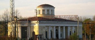
Photo: Old Priozersk
The Cathedral of the Nativity of the Blessed Virgin Mary, built in 1847 in the Russian-Byzantine style, is considered a landmark. There is an interesting story connected with the temple. In the fall of 1710, the Swedish garrison of the fortress surrendered to Russian troops, commanded by Major General Robert Bruce. At that time there were no Orthodox churches in the city, and the old Lutheran church was converted into a church. Services were held until 1836, until the temple fell into complete disrepair.
Photo: Former Nordic Bank
It was necessary to choose an elevated place on Trade Square and build a new cathedral. The money was allocated from the state treasury. The project was developed by the famous French architect Louis Tullius Joachim Visconti. He became famous for his fountains in Paris and the tomb of Napoleon, which was installed in the church of the Invalides. The construction of the temple was led by the merchant Andrei Lisitsyn. In 1910, in honor of the 200th anniversary of the liberation of the city from the Swedes, a bronze bust of Peter I was placed near the cathedral. The monument was made at the expense of soldiers and officers of the Kexholm regiment.
Photo: Cathedral of the Nativity of the Blessed Virgin Mary
Also of interest is the Lutheran Church, built in 1930 in the style of national romanticism. According to the idea of the architect Armas Lindgren, who is considered a classic of northern modernism, it was supposed to symbolize the old fortress with its powerful walls made of Ladoga boulders. In 1940, a special detachment of the NKVD was located in the building. The altar dais was then used as a stage on which visiting artists from Leningrad performed.
Photo: Monument to Peter I
In the 2000s, a youth entertainment center with a disco was built in the church. Now in the summer there is an exhibition of decorative and applied arts at the bell tower, as well as a panorama of the city “Priozersk from a bird’s eye view.” In 1996, a monument to 105 Kyakisalm soldiers was erected next to the temple.
Photo: Lutheran Church
Recently, the chapel of Arseny Konevsky appeared in the city center. It was erected in honor of the founder of the monastery on Konevets Island in Lake Ladoga. He is revered as the patron saint of sailors and is known for bringing the Konevskaya Icon of the Mother of God from Athos to Russia. There is also the Church of “All Saints”, which belongs to the courtyard of the Spaso-Preobrazhensky Valaam Monastery. It was built at the end of the 19th century according to the will of the merchant daughter Evdokia Andreeva. The church is decorated with wood carvings.
Demographics[ | ]
| Population | ||||||
| 1840 | 1850 | 1860 | 1865 | 1870 | 1875 | 1880 |
| 1473 | ↘1435 | ↘1181 | ↗1266 | ↘1101 | ↗1150 | ↗1184 |
| 1890 | 1897[16] | 1900 | 1910 | 1920 | 1930 | 1938 |
| ↘1109 | ↗1300 | ↗1626 | ↗1977 | ↗2432 | ↗2827 | ↗5115 |
| 1941 | 1945 | 1949 | 1959[17] | 1970[18] | 1979[19] | 1989[20] |
| ↗10 300 | ↘500 | ↗6787 | ↗13 936 | ↗16 652 | ↗19 053 | ↗20 557 |
| 1992[16] | 1996[16] | 1998[16] | 2000[16] | 2001[16] | 2002[21] | 2003[16] |
| ↘20 500 | ↘20 400 | ↘20 300 | ↘19 600 | →19 600 | ↗20 506 | ↘20 500 |
| 2005[16] | 2006[22] | 2007[16] | 2008[23] | 2009[24] | 2010[25] | 2011[16] |
| ↘19 500 | ↘18 300 | →18 300 | ↘17 900 | ↘17 588 | ↗18 933 | ↘18 900 |
| 2012[26] | 2013[27] | 2014[28] | 2015[29] | 2016[30] | 2017[31] | 2018[32] |
| ↘18 793 | ↗18 947 | ↘18 890 | ↘18 844 | ↘18 755 | ↘18 616 | ↘18 552 |
| 2019[33] | 2020[34] | 2021[1] | ||||
| ↘18 229 | ↘17 813 | ↘17 685 | ||||
As of January 1, 2021, in terms of population, the city was in 713th place out of 1116[35]cities of the Russian Federation[36].
Authorities[ | ]
Main article: Priozerskoe urban settlement
Priozersk is the center of the Priozersk urban settlement. The settlements of Brigadnoye, Burnevo, and Storozhevoye are also subordinate to the settlement administration[37].
The structure of local government bodies of the settlement, according to the charter adopted in the spring of 2009, is:
- Council of Deputies - elected for 5 years and consists of 18 deputies. The chairman of the council of deputies is the head of the settlement.
- head of the settlement - elected by deputies of the Council of Deputies from among its members for 5 years. Since September 2014, the position of head has been occupied by Vladimir Yuryevich Mylnikov
- settlement administration, which is led by the head of administration (city manager). The head of the administration is appointed under a contract concluded based on the results of a competition for a period of 5 years.
Since 2009, residents of the urban settlement have not directly elected either the head of the settlement or the head of the administration.
Literature[ | ]
- Gromov V.I., Potemkin L.P., Shaskolsky I.P.
Priozersk: (Korela—Kexholm—Priozersk): East. feature article. - L.: Lenizdat, 1960. - 128 p. — (Cities of the Leningrad region). - Gromov V.I., Potemkin L.P., Shaskolsky I.P.
Priozersk: (Korela—Kexholm—Priozersk): East. feature article. — 2nd ed., rev. and additional - L.: Lenizdat, 1963. - 147 p. — (Cities of the Leningrad region). — 50,000 copies. - Gromov V.I., Shaskolsky I.P.
Priozersk. — 3rd ed., rev. and additional - Lenizdat, 1976. - 160 p. — (Cities of the Leningrad region). — 50,000 copies.
Economics[ | ]
Industry[ | ]
Highways and railways pass through the city, connecting it with the cities of the region. The city has developed industry. The largest enterprises were the Priozersky woodworking plant.
Trade and services[ | ]
| The section lacks links to sources. Information must be verifiable or it may be deleted. You can edit the article to add links to authoritative sources. This mark was set on April 5, 2021 . |
- Pyaterochka supermarket chain
- Chain of supermarkets "Magnit"
- Communication salon "Euroset"
- Megafon customer service office
- MTS subscriber service office
- Beeline subscriber service office
- Tele2 subscriber service office
- Chain of pharmacies "Nevis"
- Furniture
- Chain of stores "Magnit Cosmetic Market"
- Branches of Sberbank of the Russian Federation
- Rosselkhozbank branch
- StroyMag
- "Vimos" (household and construction goods)
Notes[ | ]
- ↑ 12
The permanent population of the Russian Federation by municipalities as of January 1, 2021 (Russian). Date accessed: April 27, 2021. Archived May 2, 2021. - Gramota.ru - Word check
- ↑ 1 2 Dashing M.P.
Kexholm 1295 through the eyes of Swedish and Russian chroniclers. - Kexholm // Military Encyclopedia: [in 18 volumes] / ed. V. F. Novitsky ... [and others]. - St. Petersburg. ; [M.]: Type. t-va I. D. Sytin, 1911-1915.
- How Priozersk became Priozersk
- Photocopy of protocol No. 12 of the meeting of the Presidium of the Supreme Soviet of the RSFSR. (unspecified)
(inaccessible link). Access date: January 18, 2011. Archived May 1, 2013. - Korela is the center of the district as part of the Moscow centralized state (1478-1611) // Priozersk.ru (unspecified)
(inaccessible link). Access date: February 26, 2009. Archived May 21, 2012. - Manifesto on naming old and new Finland collectively Finland
- Borodkin M. M.
A brief history of Finland.
Part 6. The time of Alexander I. Rejection of the Vyborg province (undefined)
. Archived April 22, 2013. - Materials for statistics of Finland. - St. Petersburg, 1859. - P. 222.
- Käkisalmi Lutheran Church
- Waldhofin tehtaat Käkisalmessa (1931)
- OJSC "Lesplitinvest", History (unspecified)
(inaccessible link). Retrieved November 18, 2011. Archived December 6, 2011. - Selin A. A.
The image of Rurik in the modern space of North-West Russia // Historical examination. 2021. No. 4. P. 89—110 - Administrative-territorial division of the Leningrad region. - St. Petersburg, 2007. P. 24 (undefined)
. Archived October 17, 2013. - ↑ 1 2 3 4 5 6 7 8 9 10 People
's encyclopedia “My City”.
Priozersk (undefined)
. Retrieved July 5, 2014. Archived July 5, 2014. - All-Union Population Census of 1959. The size of the urban population of the RSFSR, its territorial units, urban settlements and urban areas by gender (Russian). Demoscope Weekly. Access date: September 25, 2013. Archived April 28, 2013.
- All-Union Population Census of 1970 The size of the urban population of the RSFSR, its territorial units, urban settlements and urban areas by gender. (Russian). Demoscope Weekly. Access date: September 25, 2013. Archived April 28, 2013.
- All-Union Population Census of 1979 The size of the urban population of the RSFSR, its territorial units, urban settlements and urban areas by gender. (Russian). Demoscope Weekly. Access date: September 25, 2013. Archived April 28, 2013.
- All-Union population census of 1989. Urban population (undefined)
. Archived from the original on August 22, 2011. - All-Russian population census 2002. Volume. 1, table 4. Population of Russia, federal districts, constituent entities of the Russian Federation, districts, urban settlements, rural settlements - regional centers and rural settlements with a population of 3 thousand or more (unspecified)
. Archived from the original on February 3, 2012. - Administrative-territorial division of the Leningrad region: [reference] / under general. ed. V. A. Skorobogatova, V. V. Pavlova; comp. V. G. Kozhevnikov. - St. Petersburg, 2007. - 281 p. (undefined)
. Retrieved April 26, 2015. Archived April 26, 2015. - Cities of the Leningrad Region (number of inhabitants - estimate as of January 1, 2008, thousand people) (unspecified)
. Date accessed: July 6, 2021. Archived July 6, 2016. - The size of the permanent population of the Russian Federation by cities, urban-type settlements and regions as of January 1, 2009 (unspecified)
. Retrieved January 2, 2014. Archived January 2, 2014. - All-Russian population census 2010. Leningrad region (undefined)
. Access date: August 10, 2014. Archived August 10, 2014. - Population of the Russian Federation by municipalities. Table 35. Estimated resident population as of January 1, 2012 (unspecified)
. Retrieved May 31, 2014. Archived May 31, 2014. - Population of the Russian Federation by municipalities as of January 1, 2013. - M.: Federal State Statistics Service Rosstat, 2013. - 528 p. (Table 33. Population of urban districts, municipal districts, urban and rural settlements, urban settlements, rural settlements) (undefined)
. Retrieved November 16, 2013. Archived November 16, 2013. - Table 33. Population of the Russian Federation by municipalities as of January 1, 2014 (unspecified)
. Access date: August 2, 2014. Archived August 2, 2014. - Population of the Russian Federation by municipalities as of January 1, 2015 (unspecified)
. Access date: August 6, 2015. Archived August 6, 2015. - Population of the Russian Federation by municipalities as of January 1, 2021 (Russian) (October 5, 2018). Date accessed: May 15, 2021. Archived May 8, 2021.
- Population of the Russian Federation by municipalities as of January 1, 2021 (Russian) (July 31, 2017). Retrieved July 31, 2021. Archived July 31, 2021.
- Population of the Russian Federation by municipalities as of January 1, 2021 (Russian). Retrieved July 25, 2018. Archived July 26, 2021.
- Population of the Russian Federation by municipalities as of January 1, 2021 (Russian). Date accessed: July 31, 2019. Archived May 2, 2021.
- Population of the Russian Federation by municipalities as of January 1, 2021 (Russian). Date accessed: October 17, 2021. Archived October 17, 2021.
- taking into account the cities of Crimea
- https://rosstat.gov.ru/storage/mediabank/bul_Chislen_nasel_MO-01-01-2021.rar Population of the Russian Federation by municipalities as of January 1, 2021 (1.85 Mb, 07/30/2021)
- Charter of the municipal formation "Priozersky urban settlement". (unspecified)
(inaccessible link). Retrieved November 18, 2011. Archived May 8, 2013. - Priozersk TV (unspecified)
(inaccessible link). Date accessed: January 6, 2021. Archived January 7, 2021. - Branch “Sanatorium “Priozersky” of the Ministry of Defense of the Russian Federation
- Sobory.ru (unspecified)
(inaccessible link -
history
). - Article from the official website of Priozersk
- Iltanen, Jussi. Radan varrella: Suomen rautatielikennepaikat.— Karttakeskus. — 432 p. — P. 408. ISBN 978-951-593-214-3

