General information and history of Gorno-Altaisk
Snow-white mountain peaks, mountain rivers, the tart smell of sun-burnt grass - this is how people know Altai. But there is no need to confuse the city of Gorno-Altaisk and tourist centers - the Mecca of budget holidays throughout Siberia. Many people go to Altai, but almost never look into the city. Either they are not on the way, or they simply don’t get there, in a hurry to drink vodka and “relax” before losing their passports and cell phones.
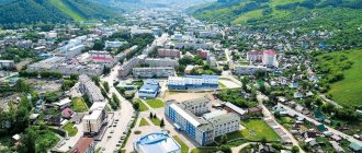
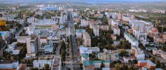
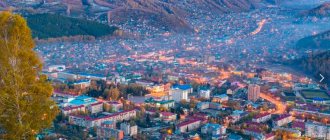
Gorno-Altaisk from a bird's eye view
Gorno-Altaisk lies in the north-west of the Altai Republic, 20 km from its border with the Altai Territory. The city is located in the foothill zone, that is, there already seem to be mountains, but they cannot be called serious. The maximum height is only 640 meters. For comparison: the highest mountain in the Republic, Belukha, is 4506 meters high. And they say that in recent years another couple of meters from above have “frozen.”
The city is very young, less than 100 years old. It was born in the small village of Ulala in 1824, and already in 1928 it became the city of Oirot-Tura, which is translated from Altai as “Altai (or Oirot) city.” Subsequently, in 1948, the city was renamed Gorno-Altaisk. In 1992, the Gorno-Altaisk Autonomous Region received the status of the independent Altai Republic and Gorno-Altaisk was promoted to the capital. This event is still widely celebrated in the city.
Day of the city
In post-Soviet times, there was a very strong decline in industry. If in Soviet times there were some enterprises operating in the city, for example, a bakery, a weaving factory or a reinforced concrete plant, now all that remains of them are the names of public transport stops. The city was saved by two things: recognition of the republic as independent, and the Altaians as a dying nation. As a result, money flowed into the republic to save the people. This is how they live. It may be worth noting the archaeological finds that also contributed to maintaining the historical status of the city. But the joy was short-lived and in 2010 this status was removed from the city.
Map
| Gorno-Altaisk: maps |
Gorno-Altaisk: photo from space (Google Maps) Gorno-Altaisk: photo from space (Microsoft Virtual Earth)
| Gorno-Altaisk. Nearest cities. Distances in km. on the map (in brackets along roads) + direction. Using the hyperlink in the distance , you can get the route (information courtesy of the AutoTransInfo website) | |||
| 1 | Maima | 7 (5) | NW |
| 2 | Choi | 39 (62) | IN |
| 3 | Krasnogorskoye (Altai Territory) | 40 (62) | WITH |
| 4 | Altai (Altai Territory) | 44 (145) | Z |
| 5 | Sovetskoe (Altai Territory) | 52 (127) | NW |
| 6 | Chemal | 59 (105) | YU |
| 7 | Belokurikha | 67 (161) | Z |
| 8 | Smolenskoe (Altai Territory) | 71 (121) | NW |
| 9 | Shebalino | 75 (122) | YU |
| 10 | Biysk | 83 (86) | NW |
| 11 | Turochak | 84 (152) | NE |
| 12 | Nagorny (Altai region) | 85 () | NW |
| 13 | Pervomayskoe (Altai Territory) | 87 () | NW |
| 14 | Solton (Altai region) | 103 (192) | WITH |
| 15 | Zonal (Altai Territory) | 106 (122) | NW |
| 16 | Bystry Istok (Altai Territory) | 117 (186) | NW |
| 17 | Soloneshnoye (Altai Territory) | 118 (221) | Z |
a brief description of
Located in the foothills of Altai, on the river. Maima, near its confluence with the river. Katun (pier), 96 km southeast of the railway. Biysk station and 7.5 km from the Chuysky tract, with which it is connected by road, 3641 km east of Moscow.
The climate is sharply continental. Average January temperatures are about -12, July +18. Precipitation is about 100 mm per year.
Territory (sq. km): 92
Information about the city of Gorno-Altaisk on the Russian Wikipedia site
Historical sketch
Around 1830 at the mouth of the river. Ulala there was a small Altai settlement. Later, due to the influx of Russian settlers, the village of Ulala arose here. Altai Ulula, where ulu is “big”, -la is the suffix of possession.
Since 1922, Ulala has been the center of the Oirot Autonomous Region. The city has been since 1928. Since 1932 it has been called Oirot-Tura (“city of the Oirots”; Oirots is an ethnonym, Tura is the Turkic “city”).
In 1948, in connection with the clarification of the ethnic name of the main population of the region (Altaians instead of Oirots), the autonomous region was renamed Gorno-Altaisk, the center - Gorno-Altaisk.
Municipal indicators
| Index | 1990 | 1999 | 2001 | 2003 | 2005 |
| Demography | |||||
| Number of births, per 1000 population | 14.5 | 12 | 13.4 | 16.6 | |
| Number of deaths, per 1000 population | 12.1 | 12.7 | 13.3 | 14.8 | |
| Natural increase (decrease), per 1000 population | 2.4 | -0.7 | 0.1 | 1.8 | |
| Standard of living of the population and social sphere | |||||
| Average monthly nominal accrued wages, rub. | 0.272 | 1509 | 2849 | 5288 | |
| Average housing area per inhabitant (at the end of the year), sq.m. | 12.7 | 15.2 | 14.7 | 15.1 | |
| Number of preschool institutions, pcs. | 20 | 14 | 13 | 13 | |
| Number of children in preschool institutions, thousand people | 2.6 | 1.6 | 1.5 | 1.5 | |
| Enrollment of children in preschool educational institutions (at the end of the year), as a percentage of the number of children of the corresponding age, % | 46.3 | ||||
| Number of daytime educational institutions (at the beginning of the school year), pcs. | 12 | 15 | 16 | 15 | |
| Number of students in daytime educational institutions, thousand people | 7.4 | 8.8 | 8.8 | 8.4 | |
| Number of doctors, people. | 330 | 431 | 438 | 492 | 485 |
| Number of nursing staff, people. | 995 | 1043 | 1073 | 1219 | |
| Number of hospital institutions, pcs. | 8 | 7 | 6 | 6 | |
| Number of hospital beds, thousand units | 1.4 | 1.3 | 1.3 | 1.3 | |
| Number of medical outpatient clinics, pcs. | 14 | 13 | 15 | 14 | |
| Capacity of medical outpatient clinics, visits per shift, thousand units. | 2 | 2.3 | 2.5 | 2.5 | |
| Number of registered crimes, pcs. | 1802 | 1654 | 1362 | ||
| Persons who committed crimes were identified, persons. | 758 | 873 | 645 | ||
| Economy, industry | |||||
| Number of enterprises and organizations (at the end of the year), pcs. | 6573 | 8787 | 10172 | ||
| Construction | |||||
| Volume of work performed by type of activity “Construction” (until 2004 - volume of work performed under construction contracts), million rubles. | 0.01 | 17.4 | 15.7 | 259.6 | |
| Commissioning of residential buildings, thousand sq.m. of total area | 14.1 | 6 | 8.1 | 8.5 | |
| Commissioning of residential buildings, apartments | 300 | 94 | 120 | 119 | |
| Commissioning of preschool institutions, places | 0 | ||||
| Commissioning of educational institutions, places | 0 | 0 | 0 | ||
| Commissioning of hospital facilities, beds | 0 | ||||
| Commissioning of outpatient clinics, visits per shift | 0 | ||||
| Transport | |||||
| Number of bus routes (in intracity traffic), pcs. | 2 | 2 | 2 | 2 | 2 |
| Number of passengers transported by buses per year (in intracity traffic), million people. | 10.1 | 7.2 | 6.1 | 6 | |
| Connection | |||||
| Number of telephone sets of the city public telephone network, thousand units. | 6.1 | 9.3 | 10.5 | 12 | |
| Number of residential telephone sets of the city public telephone network, thousand units. | 3.4 | 6.2 | 6.9 | 8.1 | |
| Number of payphones of the city telephone network (including universal ones), pcs. | 65 | ||||
| Trade and services to the population | |||||
| Retail trade turnover (in actual prices), million rubles. | 0.083 | 527.8 | 889 | 1524.3 | |
| Retail trade turnover (in actual prices), per capita, rub. | 1.7 | 10229 | 16617 | 28545 | 45385 |
| Index of physical volume of retail trade turnover, % compared to the previous year | 118.9 | ||||
| Index of physical volume of public catering turnover, % compared to the previous year | 108.7 | ||||
| Number of stores, pavilions (at the end of the year), pcs. | 31 | 72 | |||
| Sales area of shops, pavilions (at the end of the year), sq.m. | 12495.8 | 2546.5 | |||
| Volume of paid services to the population (in actual prices), million rubles. | 0.003 | 86.7 | 193.7 | 388.5 | |
| Volume of paid services to the population (in actual prices), per capita, rub. | 0.1 | 1661 | 3594 | 7276 | |
| Volume of household services to the population (in actual prices), million rubles. | 0.003 | 10.3 | 11.4 | 19.9 | |
| Volume of household services to the population (in actual prices), per capita, rub. | 0.059 | 197 | 211 | 372 | |
| Investments | |||||
| Investments in fixed assets (in actual prices), million rubles. | 0.014 | 72.2 | 139.2 | 371.5 | |
| Share of investments in fixed assets financed from budgetary funds in the total volume of investments, % | 72.6 | 55 | 34.7 | 63.6 | |
Data sources:
- Regions of Russia. Main characteristics of the constituent entities of the Russian Federation: statistical collection. Goskomstat of Russia. - M:, 2003.
- Regions of Russia. Basic socio-economic indicators of cities. Statistical collection. Rosstat. - M:, 2005. p. 291
- Regions of Russia. Basic socio-economic indicators of cities. 2006. Statistical collection. Rosstat. - M:, 2006.
Culture, science, education
Research Institute of History, Altai Language and Literature.
Pedagogical Institute.
Drama Theater.
Museum of Local Lore.
Universities of the city
Gorno-Altaisk State University
649000, Altai Republic, Gorno-Altaisk, st. Lenkina, 1 WWW: https://www.gasu.ru/
Gorno-Altai branch of the Modern Humanitarian Academy
649000, Altai Republic, Gorno-Altaisk, Krasnoarmeyskaya st., 58
Museums, galleries, exhibition halls
National Museum named after A.V. Anokhina 649000, Altai Republic, Gorno-Altaisk, st. Choros-Gurkina, 46 Phone(s): (38822) 4-77-73 Website: https://www.musey-anohina.ru/
Architecture, sights
The city is surrounded by mountains covered with forests: conifers, birches, and shrubs.
The central part of Gorno-Altaisk is built up mainly with five-story brick and block buildings.
Within the city limits, the oldest site of primitive people in Siberia, the Ulalinskaya site, has been preserved.
The Dendrological Park is located near Gorno-Altaisk
| Population by year (thousands of inhabitants) | |||||||
| 1931 | 8.5 | 1989 | 46.4 | 2007 | 53.7 | 2016 | 62.9 |
| 1939 | 24.0 | 1992 | 47.8 | 2008 | 54.3 | 2017 | 63.3 |
| 1959 | 27.5 | 1996 | 48.3 | 2010 | 56.0 | 2018 | 63.2 |
| 1962 | 29 | 2000 | 52.2 | 2011 | 56.9 | 2019 | 63.8 |
| 1967 | 32 | 2001 | 53.1 | 2012 | 59.7 | 2020 | 64.5 |
| 1970 | 34.4 | 2003 | 53.5 | 2013 | 60.8 | 2021 | 64.5 |
| 1973 | 37 | 2005 | 52.8 | 2014 | 61.4 | ||
| 1979 | 40.3 | 2006 | 53.1 | 2015 | 62.3 | ||
Climate and ecology of Gorno-Altaisk
The city itself lies between two low mountains - Tugai and Komsomolskaya. They protect the city from the wind and make even the most terrible winters much easier to bear. Siberians know it firsthand, and others can remember the film about Shurik, which showed the way to the library. Remember the howling and whistling of the wind that night? There is no such thing in Gorno-Altaisk. Happiness!
Well, another undeniable advantage of this location is the gorgeous view from the window. From any window in the city. You can't hide from the view of the mountains. Nowhere!
