Gumerovskoe Gorge
This famous protected place is located in the small village of Gumerovo. The transparent and incredibly beautiful Zigan River flows nearby. It goes beyond the mountain and forms a gorge, the width of which is 700-800 meters. The Gumerovsky Gorge consists of rocks of various shapes, reminiscent of the silhouettes of people and animals.
The territory of the attraction is rich in the presence of unique vegetation. Several species are included in the Red Book: Ural flax, shiverekia, feather feather grass. Among the animal representatives found in this place are the lynx and the brown bear.
Tourists come here every year to see the caves; catch fish; swim in the Zigan River and walk in the mountains, from where you can see the stunning landscape.
Mount Tratau
Not far from the city of Sterlitamak in the Republic of Bashkortostan there are several cone-shaped hills, their residents call them Sterlitamak shihans. Mount Tratau is the highest. Translated from Bashkir, the name means “horse-mountain”.
On the slopes of Tratau you can see rare species of herbaceous plants. Many of them are endangered. At the foot of the mountain flows the deep lake Tugar-Salgan, and at the top on the southern slope you can see several small caves and grottoes. If you believe the myth, a girl was forcibly held in one of these caves, trying to escape from her native land to a Russian soldier. A well-fed snake guarded the cave, not allowing the unfortunate girl to leave. In 1965, Mount Tratau was recognized as the main attraction of the Ishimbay region.
Ishimbay is a small, calm, well-maintained city with developed infrastructure and many memorable places. A land of graceful waterfalls and rocks that you can admire endlessly.
Kuk-Karauk waterfall
The village of Makarovo, Ishimbay district, is famous for this fascinating place. Kuk-Karauk is a multi-level waterfall that follows one after another at a height of 12 meters. Local and non-resident residents try to come here in the spring, since the melting snow causes the waterfall to become full-flowing, noisy and more spectacular than in summer.
The most successful months for visiting are April and May. The landscape is represented by mountain open forests, rocks and flowering herbs. In the last century, the waterfall was given the title of a natural monument of Bashkortostan.
Ishimbay on the map of Russia: geography, nature and climate
Ishimbay is located in the south of the Republic of Bashkortostan. It borders the city of Salavat, is located a few kilometers from the Ufa-Orenburg highway and 21 km from the city of Sterlitamak.
The climatic location of Ishimbay is in the temperate zone of the north-forest subzone. Summers are warm, winters are mildly cold, snowfall is sufficient and stable. The average minimum temperature in winter is -16.6 degrees, the average maximum temperature in summer is +26.2 degrees. The maximum temperature increase was noted in the summer of 1952 – -40.5. The coldest winter temperature was in 1943 – +47.6.
Average monthly precipitation is 1.87 mm.
The city is located on several hills: Mayak , Alabaster and hills 161.8 m and 255 m high. Ishimbayskaya cave . It is hidden under multi-colored rocks and is a natural monument.
Also on the territory of Ishimbay there are many reservoirs, both natural and artificially created. The city is located on the banks of the Belaya and Tairuk .
- flow through the territory: the streams Sarazh, Buzaigyr, Tukmak, Sikul, and the Termenyelga River .
- On the left bank of the river. Belaya has several oxbow lakes: Kurbalykul, Konnoye, Karakul and others;
- artificially created reservoirs: Tyurinsky, Tairuksky, Kuzminovsky, Termenyelginsky ponds .
There are many green areas and plantings in Ishimbay. The Zatairuk Forest Park is considered the largest . In the republic, the city is considered the green capital due to the large number of green spaces.
Ski resort Kush-Tau
This well-known landmark is located 18 km from the village of Sterlitamak on the mountain Kush-Tau. Lovers of active recreation come here from all cities of the region. Here you can use five ski slopes. Experienced tourists and extreme sports enthusiasts find forest slopes on which the snow is not at all rolled. Those interested are provided with rental equipment for skiing: sleighs, cheesecakes. Guests arriving by personal transport can park their car in the parking lot located next to the complex. On the territory of Kush-Tau there are cafes, restaurants, and a medical center.
Museum of History and Local Lore
The opening of the museum took place in 1997 under the leadership of an honorary resident of the city of Ishimbay and honored local historian of Bashkortostan - Vladimir Leontyevich Ignatiev. For citizens and visitors, the museum organizes a range of events dedicated to the culture of the past and present. Those who wish can also get acquainted with the history of the city by visiting 6 halls:
- Land of Yurmata.
- At the origins of oil in Bashkiria.
- Stages of development of Ishimbay.
- Ishimbay in wartime.
- Ishimbay and labor.
- Exhibition of local artists.
Location: Lenin Avenue - 16.
Historical facts of the city
- 1770 – I.I. Lepekhin’s expedition discovered a source of oil at the mouth of the Tairuk River.
- 1812 - the first mention of the village of Ishimbayevo, in whose honor the city of Ishimbay was named.
- May 16, 1932 - after several hours of drilling, a 36-meter fountain of oil rushed to the surface. It is this day that is considered the founding of the city of Ishimbay.
- 1933 - the first club named after. CM. Kirov.
- 1933 - on the left bank of the river. Belaya built a small distillation station by F.P. Pokhlebaev.
- 1933 – a decision was made to build a railway connecting the city of Ufa and the village of Ishimbayevo.
- 1934 – the Dema-Sterlitamak-Ishimbayevo railway line began operating.
- 1934 – the oil field point was named after S.M. Kirov.
- June 10, 1934 – organization of the workers’ village of Ishimbay. It included the villages: Ishimbayevo, Yurmaty, Irek, Kyzyl Aul.
- 1935 - the Bashneft trust was organized, later (1940) renamed Ishimbayneft.
- 1936 – opening of the State Union Oil Refinery No. 433.
- 1937 – Ishimbay was given the status of the center of the Ishimbay region of the Republic of Bashkortostan.
- End of 1937 – opening and commissioning of the Ishimbay-Ufa oil pipeline.
- September 17, 1939 – Ishimbay was given the status of “city”. It also includes the following villages: Kusyapkulovo, Smakaevo.
- During the Second World War, there were no military operations in the city. But the residents provided great logistical support. The city supplied fuel and lubricants.
- In 1943, the mechanical plant named after Ishimbay was evacuated. I.V. Stalin. From that moment on, ammunition, Katyusha cartridges, chisels, etc. were supplied to the front.
- 1947-1948 – the oil refineries in Ishimbay were reorganized and merged and named the “Ishimbay Oil Refinery.”
- 1973 – start of operation of the Ishimbay Experimental Mechanical Plant.
- 1977 – start of operation of factories: oilfield equipment and transport engineering.
- In the 1980s – a stepwise liquidation of the Ishimbay Oil Refinery was carried out.
- 1990 – opening of the Ishimbay specialized catalyst plant.
- 1990 – opening of the mosque.
- 1992 – start of work producing loader cranes.
- 2001 – closure of the oilfield equipment plant due to bankruptcy and organization of the Ishimbay Foundry Neftemash OJSC on its basis.
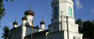
- 2004 – opening of the Holy Trinity Church.
- 2005 – Neftemash foundry is closed. The same thing happened with IZTM. These factories were demolished. The Ishimbay Machine Tool Plant was built on the territory of the former IZTM.
- 2016 – at the request of residents, the city was awarded the title “City of Labor Valor and Glory.”
Victory Park
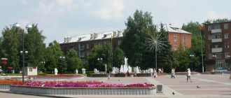
The cultural recreation area was founded in the 60s. Victory Park is located between Gagarin, Revolutionary and Socialist streets. About 7 years ago, a global restoration of the park took place. The square took on a completely different look:
- A variety of flower beds and young trees have been planted.
- Children's playgrounds have been built.
- The main central entrance is modernly decorated.
- There are tiled paths throughout.
Vacationers can look at the constructed memorial complex and at the military equipment installed on pedestals.
Main streets of Ishimbay
- Gubkin Street - One of the main streets of the city. In its center is the Square of the Discoverers of Bashkir Oil. It also passes by the park named after. Yu.A. Gagarin. It starts from the intersection of Mira and Nekrasov streets and goes to Gorky.
- Sovetskaya Street is the oldest street, but this has not lost its importance. There is a park of culture and recreation named after. A.M. Matrosova, CJSC "Hosiery Ishimbay Factory", central market. Starts from the street. Revolutionary and ends on the street. Dokuchaevo. Intersects with Lenin Ave., st. Boulevard.
- Stakhanovskaya Street - Runs parallel to the street. Soviet. Starts from the street. Revolutionary, ends in a dead end. Crosses Lenin Ave., Boulevard Street, Mashinostroiteley Street, Dokuchaevo Street. It is considered one of the most important streets in the city. It demarcates residential areas from the industrial zone. There are administrative buildings, a green zone, and medical institutions here.
- Kinzebulatovskoye Highway - This highway is the exit road from the city. Starts from the street. Bohdan Khmelnytsky. Passes by the central Orthodox cemetery.
- Naberezhnaya Street - Located along the river. Belaya in the left bank part of the city. It turns into Industrial Highway. It is home to several large enterprises: Idel Neftemash LLC, Krovlestom Production Enterprise LLC and others.
- Industrial Highway - Starts at the entrance to the city and ends in front of the bridge over the river. White. This is the central entrance to the city of Ishimbay. It houses industrial buildings of enterprises: JSC Mashinostroitelnaya, LLC Ishimbay Machine Tool Plant.
- Lenin Avenue - The satellite map shows that this is the central street of the city of Ishimbay. Starts from the street. Cosmonauts, ends at st. Chkalova. The width of the avenue is 25 m, length – 2.7 km. The boulevard part stretches along the entire length of the avenue. There are two adjacent squares: them. Lenin and the Discoverers of Bashkir Oil. There are several administrative buildings, cultural and entertainment institutions, educational facilities, shopping centers and others.
Nugush Reservoir
This is the most visited and favorite place of the Ishimbay people. The bright, picturesque region is rich in the presence of rocks, dense forest, and crystal clear water in the reservoir. On the shore there are several camps for schoolchildren and recreation centers, with sandy beaches.
At the Nugush reservoir, visitors go fishing, ride water vehicles (boats, jet skis), and fly kites. Tourists are offered horseback riding and hiking in the wild.
