| Ust-Kut, beginning XXI century |
Ust-Kut
, a city in Russia, the administrative center of the Ust-Kut district of the Irkutsk region, within the Bratsk diocese. Located at the confluence of the Kuta River and the Lena River, 610 km northeast of Irkutsk (by air). The Baikal-Amur Mainline passes through the city. There is a large river port, airport, and railway station here. Population: 44,805 people (2012) [1].
- On the map: Yandex.Map, Google map
One of the oldest settlements on the river. Lena. The city stretches along the river for 40 km, while at the same time being only 1.5 - 2.5 km wide.
Toponymy
Ust-Kut is often called a city with three names, since three toponyms are identified with it: Ust-Kut (city and airport), Lena (railway station), Osetrovo (port).
Settlement
was founded at the mouth of the Kuta River (from Evenk. kuta - wetland).
Hence the name - Ust-Kutsky (in the old spelling - Ust-Kutskaya) fort, later the village of Ust-Kutskoye. Gradually, the shortened name of the village, fixed when the status of the settlement changed, came into common use - Ust-Kut. When the name is declined, the stress is not preserved and goes to the ending: in Ust-Kut, from Ust-Kut
, etc.
Ethnic name: Ustkutians
(masculine and feminine forms:
Ustkutyanin, Ustkutyanka
).
form ,
often used by central and regional media, is considered incorrect.
Lena station
named after the Lena River, which goes back to the Evenk people. elu ene (“big river”).
Port Osetrovo
named after the workers' village included in Ust-Kut in 1954.
Ust-Kutsky district of Irkutsk region
Until 1926.
Ostrog, volost Ust-Kutsk fort was founded in 1631 by a Cossack detachment under the command of Ivan Galkin. The lands around the fort were soon declared a volost and subordinated to the Ilimsk fort.
One of the first leaders of the territory of the Ust-Kut region was Erofey Khabarov. In 1665, with the rank of “son of a boyar,” he was sent to govern the Ust-Kut volost. The appearance of the first arable lands on the Lena and saltworks near the fort (now the resort village of Ust-Kut) is associated with his reign.
Until 1775, the volost was subordinate to Ilimsk as part of the Siberian and Irkutsk provinces.
In 1775, Kirensky district was allocated as part of the Irkutsk province, which included the Ust-Kut volost.
In 1822, Kirensky district was abolished, and Ust-Kutsk volost became part of the Irkutsk district.
In 1856, the Ust-Kut volost became part of the newly formed Verkholensky district (since 1887 - a district).
In 1898, it came under the control of the newly formed Kirensky district (since 1924 - a district).
In 1925 it was enlarged due to the abolition of nearby volosts. The territory of the volost took shape close to the borders of the modern Ust-Kut region.
During this time, the territory of the current Irkutsk region was repeatedly subjected to administrative changes, and the region changed its names. For more details, see the article “Administrative-territorial division of the Irkutsk region.”
Since 1926. Area
On June 28, 1926, during the next reform, on the territory of three volosts of the Kirensky district - Orlingskaya, Markovskaya and Ust-Kutskaya - the Ust-Kutsky district was formed as part of the Kirensky district of the Siberian Territory. The area of the newly formed district was 35,120 square meters. km, it included 68 villages and hamlets with a total population of 11,720 people; the village of Ust-Kut, where at that time there were 92 households, was declared the center of the district. Subsequently, the boundaries of the region underwent only minor changes.
By April 1, 1940, the Ust-Kutsky district, centered in the village of Ust-Kut, included:
- 14 village councils: Basovsky, Boyarsky, Kaymonovsky, Maksimovsky, Markovsky, Nazarovsky, Omoloevsky, Orlingsky, Podymakha, Tarasovsky, Tayursky, Turuksky, Ust-Kutsky, Yakurimsky;
- village of regional subordination Osetrovo.
In 1963, an all-Union reform of regional division took place, during which the districts of the Irkutsk region were divided into rural and industrial. Ust-Kut became a city of regional subordination, the district was abolished. In 1965, the division of districts into rural and industrial was abolished, the Ust-Kutsky district was restored, the administrative bodies of the city and district were united, and the village councils became subordinate to the city council.
By January 1, 1966, the Ust-Kutsky district included 13 village councils: Basovsky, Boyarsky, Kaymonovsky, Maksimovsky, Markovsky, Nazarovsky, Omoloisky, Orlingsky, Podymakha, Tarasovsky, Tayursky, Turuksky, Yakurimsky.
On February 6, 1996, the village of Nebel on the BAM was transferred from the Ust-Kutsky district to Kirensky, and the village of Tira on the Lena River was transferred from the Kirensky district to Ust-Kutsky.
On December 31, 2004, the Ust-Kutsk municipal formation was formed with the status of a municipal district[7], which includes:
- 3 urban settlements: Ust-Kutskoye, Zvezdninskoye, Yantalskoye;
- 5 rural settlements: Verkhnemarkovskoye, Niyskoye, Orlingskoye, Podymahinskoye, Rucheyskoye;
- intersettlement territory.
On September 30, 2008, the Orlingskoye rural settlement was abolished by the decision of the Duma of the Ust-Kut municipality based on the decision of the citizens’ meeting. Its settlements became part of the intersettlement territory[8].
Story
Ust-Kut is the third Russian settlement on the territory of the modern Irkutsk region and the second existing in our time. Of the existing ones, only the city of Kirensk (1630) is older than Ust-Kut. The regional center of Irkutsk was founded 30 years later than Ust-Kut.
Some events in the history of Ust-Kut
| 1631 | Ust-Kutsk fort was founded |
| 1639 | The first saltworks were opened at the salt springs of the Kuta mouth, which gave rise to the famous Ust-Kutsk saltworks, which became the first in Siberia (the plant operated for more than 310 years and was closed in the early 1950s) |
| 1736 | The healing properties of the Ust-Kutsk salt spring were first described by Professor I. Gmelin, a participant in the Second Kamchatka Expedition of V. Bering |
| 1885 | Steamship traffic along the Lena began to operate strictly according to schedule |
| Late XIX | Local industrialists and merchants organize a mud bath at the salt plant, in which several wooden baths are installed. In 1902, the first iron bath used for medicinal purposes was installed. The hospital operated until 1913 |
| 1900 | L.D. is serving his exile in Ust-Kut. Trotsky, later one of the organizers of the October Socialist Revolution |
| 1914 | Engineering surveys have begun for the future railway route on the Taishet - Ust-Kut section |
| 1925 | Ust-Kut becomes the administrative center of the Ust-Kut district, formed on the basis of three volosts of the Kirensky district - Markovskaya, Orlingskaya and Ust-Kutskaya |
| 1928 | At the initiative of the river workers of the Bascomflot of the USSR and the Northern River Shipping Company, the work of the hospital is being resumed on the territory of the Ust-Kut salt plant, which is being transformed into a resort. Osetrovskaya pier was founded. |
| 1932 | Research on the Taishet-Lena railway route has been resumed |
| 1934 | The largest oil products transshipment base is being created near Ust-Kut |
| 1940 | The village of Ust-Kut was transformed into a workers' settlement |
| 1946 | Construction work on the Taishet – Lena railway has been resumed (interrupted by the war) |
| 1950 | The Taishet – Lena railway reaches the village of Osetrovo (the site of the future river port), where the Lena station is being built. Construction of a river port has begun in the village of Osetrovo |
| 1954 | By merging the villages of Ust-Kut and Osetrovo, the city of Ust-Kut was formed. At that time it was a city of district subordination (level). A new station building was built at the Lena railway station |
| 1963 | Ust-Kut becomes a city of regional subordination (level). A new Ust-Kut airport was opened (the previous one, which had been in operation for 15 years, was on the right bank of the Lena, in the area of the modern electronic warfare village) |
| 1974 | Envoys from the 17th Komsomol Congress arrive for the construction of the BAM |
| 1980 | The first nine-story building in the city was commissioned |
| 1985 | Electrification of the Western section of the BAM has been completed |
| 1987 | The first fast train Moscow – Severobaikalsk arrived in the city |
| 2007 | The ESPO oil trunk pipeline was laid north of Ust-Kut |
Russian pioneers appeared at the mouth of the Kuta in the late 1620s. In 1628 (according to other sources - in 1629), the Cossack foreman Vasily Bugor set up a winter quarters here. The year of foundation of the settlement is considered to be 1631, when a detachment led by Ataman Ivan Galkin founded the Ust-Kut fort.
The development of the fort as a permanent settlement is directly related to the name of Erofei Khabarov. In the 1630s, on the outskirts of the Ust-Kut fort, he founded a saltworks, started arable land on the Lena, and organized a pit race.
Located at the end point of the Lensky portage, Ust-Kut has become an important transport hub for the development of Siberia and the Far East. Plank ships were prepared here for the Northern Expedition of Vitus Bering. The expeditions of Dmitry and Khariton Laptev, Vladimir Atlasov and Stepan Krasheninnikov, Grigory Shelikhov, and Gennady Nevelsky passed through the prison.
Already in the 17th century, near the fort on the Lena and Kut, a chain of small villages was formed that made up the Ust-Kut volost. Until the 19th century, Ust-Kut was the site of large fairs. The population of the volost was also engaged in arable farming, worked at the salt plant, and served the communication routes - the Lensky portage and the Yamsk tract.
For many years, Ust-Kut served as a place of exile for political prisoners. In the fall of 1900, Leon Trotsky served his exile in the village. A large number of exiled Poles who took part in the 1863 uprising worked at the salt plant.
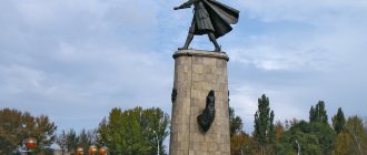
During the Civil War, battles broke out in Ust-Kut for access to the gold mines of the Lena Basin. On November 13, 1919, the village, abandoned by units of the retreating Russian army, was occupied by partisans under the command of Daniil Zverev.
In 1926, a hospital was opened for the first time in Ust-Kut, the village became the center of the newly formed Ust-Kut region. In 1928, on the site of a closed salt plant, the Ust-Kutsky resort was opened, famous for its unique healing mud.
In 1941 - 1945, more than three thousand Ustkut residents took part in the Great Patriotic War, more than a thousand of them did not return. For participation in battles, four residents of Ust-Kut received the title of Hero of the Soviet Union: Ivan Antipin, Mikhail Andreev, Alexey Pesterev, Pyotr Tyurnev.
In 1943, the village received the status of a working settlement (urban-type settlement).
In July 1951, the first train arrived in Ust-Kut on the newly built Taishet-Lena railway line. Also in 1951, the first stage of the Osetrovsky river port, in the future the largest in the USSR, was commissioned. With the completion of its construction, the city becomes a major transport hub on an industrial scale, serving most of the “northern deliveries”.
On July 29, 1954, Ust-Kut was given the status of a city of regional subordination by merging the working settlements of Ust-Kut and Osetrovo. In 1963 - 2004 it was a city of regional subordination.
In 1974, Ust-Kut was declared the starting point of the all-Union Komsomol construction project - the construction of the Baikal-Amur Mainline. The headquarters of the Western Section was located in the city.
In 1996, the city's population reached a historical peak of 62.4 thousand people, after which it began to decrease due to population migration.
Flood 2001
In 2001, the city suffered from the Lena flood. In Ust-Kut, all coastal streets were flooded, including in the city center, and buildings in private sectors were destroyed. Some neighborhoods were deprived of bus service due to flooding of routes. Spills in Kuta also led to short-term flooding of the P419 highway and erosion of the railway embankment in some areas.
Accidents on heating networks 2001
In the winter of the same year, as a result of a number of accidents at boiler houses, the central microdistricts of the city were left without heating. Classes were canceled at schools, residents of multi-storey buildings equipped their apartments with stoves, but the emergency situation was not introduced until December 24, when one of the residents of Ust-Kut got through to the television “Direct Line” with the President of Russia. After the catastrophic situation became known to the general public, the city hastily repaired heating equipment and replaced networks. On December 27, the mayor of the city, Vladimir Korneiko, who was on vacation at that time, resigned.
Despite the fact that Ust-Kut experiences subsequent winters more prosperously, the city has repeatedly introduced a state of emergency due to a lack of fuel, and the expression “freezing Ust-Kut” has become a newspaper cliche.
- Ust-Kutsk fort
- Curse of Forgotten Cemeteries
REGIONAL CENTER
If you draw diagonals from the imaginary “corners” of the perimeter on the map of the Irkutsk region, then at the point of their intersection there will be... Ust-Kut! I've wanted to visit here for a long time. And not just because this is the very geographical center of our vast territory. There are so many things that intersect here that would be enough for the status of the “northern capital” of the region.
FROM POSTROG TO THE “BUILDINGS OF THE CENTURY”
Located at the confluence of Kuta and Lena, the city has its own rich and interesting history. It began with a prison in 1631 - 30 years earlier than Irkutsk . From the very beginning, Ust-Kut was destined to be an important link in the political and economic life of not only the region, but the entire country. Here were the training bases for the northern expeditions of Bering, Laptev, Shelikhov and other famous Russian explorers. In merchant Russia there was a large salt plant and a transshipment base for gold miners and hunters. Among the exiled celebrities was Comrade Trotsky himself, who fled from here with the help of local peasants, and during the civil war this strategic point became a zone of hot hostilities. The troops of Kolchak’s generals Perkhurov and Kappel walked through the local taiga, and the legendary Red commander Daniil Zverev fought with them.
In Soviet times, Ust-Kut also became an important transit hub with the largest river port and shipyard - most of the northern imports and exports were carried out through this city. Well, the significant year 1974, when BAM began from here. And in our time, this area should become part of the new “construction site of the century” - the Vilyuy highway with access to the northern lands all the way to Yakutsk. Well, isn't there a reason to go here?
But here’s the problem: driving an ordinary passenger car to Ust-Kut along the short route through Zhigalovo is unsafe for the car, and little was known about the full picture of the 1000-kilometer route through Tulun and Bratsk. More precisely: the road to Bratsk has been studied, I also had the opportunity to travel along different sections of the BAM, but the 400-kilometer section from Bratsk to Ust-Kut remained incognito. The circle of close acquaintances either knew nothing about it, or knew vaguely, saying that there were unimportant areas, but without details. However, there is a regular flight “Irkutsk-Ust-Kut”, and it is not a “Ural”-rotation bus that runs on it, but an ordinary intercity bus, with a standard travel time of 19 hours. And if so, it means that you can take off in an ordinary car. On the Ford Focus, for example.
NOT A WALK
There was no goal to get there as quickly as possible by bus or train. You could say I was driving in tourist mode, saving fuel and other resources. It turned out in 15 hours. Driving to Tulun is now a relaxing experience; even in the once problematic Tulyushka there is now a smooth section of asphalt. Reconstruction was also carried out in Kuitun. The line to Bratsk is patchy: in some places the asphalt is good, in others it’s rubbish, including a one-way section with two lanes. The concrete is well preserved, and the large potholes along the edges of the slabs show signs of repair and are nothing serious. The well-known fraternal “highway” does not cause criticism, and the roads through the city have a tolerable surface and signs.
And here it is! Soon, behind the monumental dam of the Bratsk Hydroelectric Power Station, like an Egyptian pyramid, a faded sign appeared with the inscription “Ust-Kut 382 km.” A completely unknown section for me begins with the regional highway P-419. At first everything goes well, quite smooth asphalt with visible markings. But after a couple of tens of kilometers it turns into not the most joyful gravel, with a red tint from clay soils. The weather is rainy, the wheels splash through the sticky slush, the car is slowly turning into a kind of “jug” with a characteristic matte “airbrushing”, but the main thing is that the load on the suspension is quite decent. It’s easy here in a big jeep, but it’s hard in a passenger car. Hill after hill, turn after turn, and the rocky ribbed “road” has no end in sight. Then the asphalt again, though partially “bombed”, and that too didn’t last long.
| The Tulun – Bratsk road, 200 km away, although with a hard surface, is only rated “satisfactory”, because even the “advanced” section with one-way traffic has a wavy and “bumpy” profile |
| On a gravel road (and especially near Ust-Kut) there is no time for the beauty of the local nature: you need to keep an eye on the wheels, steer around the stones and find the smoothest parts of the road |
It became clear that out of the 200 billion rubles that the construction of the 2,800-kilometer Vilyuy requires, not a penny has yet been allocated for the Ust-Kutsk section and nothing is foreshadowed yet. There are three uncovered pieces on this route, with a total length of almost 130 km! And the most grueling 70-kilometer route runs closer to Ust-Kut. It is also the most insidious for passenger cars, since this is where such a local natural anomaly as “growing stones” is most manifested. Every year, along with the harvest, summer residents collect pebbles from the garden beds in buckets, which themselves “climb” out of the ground, and large boulders spoil already unimportant roads.
I managed to come into contact with one of these “active” boulders. At that “blind” bend it was absolutely invisible, the speed was about 40, and then there was a strong metal blow in front under the body. “That’s it, the pan is in the trash, the oil is all over the engine or gearbox, or the suspension arm is bent, which is also no better” - these lightning-fast thoughts, a thousand kilometers from the dealership center, made everything inside go cold. I stop, look under the bottom - something is dripping, but it’s not clear whether it’s oil or dirt (it’s raining outside). Near the boulder with a sharp ridge are two pieces of plastic protection for the engine compartment. I'm waiting for the oil pressure light to come on. It doesn’t light up, I move on, the city is still about forty kilometers away.
It’s good that upon arrival in Ust-Kut we immediately had the opportunity to drive onto the overpass and inspect the bottom. I was lucky: the stone landed on the stretcher. The Focus looks durable, made of double layers of steel. All that remains is a scratch and a dent, which cannot disturb the geometry of the suspension. The plastic protection fits tightly onto the subframe in this place, part of the edge of which crumbled from the impact - that’s all the losses.
| Ilim. On the road Bratsk - Ust-Kut this is one of the rare “exits” to open areas |
But even without this adventure, the road from Bratsk to Ust-Kut cannot but be remembered. The feeling of separation from the “mainland” is quite strong - the places here are quite remote. The main part of the route goes along a monotonous taiga corridor - without any Vista points (observation platforms), campsites and other joys of road infrastructure. There are few cars, there are only a few cafes or two, and there are signs like on the moon, except that the signs “Take care of the forest” often flash. There are too many populated areas, and some of them are located away from the road. Cellular communication is only available in their immediate vicinity. There is a picturesque “exit” to nature only on the bridge over the Ilim River, and then the landscape brightens up the hardships of the route only closer to the goal, when the road begins to hug the river and is adjacent to the railway track.
REMAINS OF LUXURY
So, with two elements racing - a train on the left, and the powerful Kuta on the right - you roll into the city, which freely stretches along the beautiful floodplain of two majestic Siberian rivers. The area is surrounded by green meadows and surrounded by relict mountain ranges covered with dense taiga, with a series of intricate rocky outcrops that look like the ruins of ancient fortresses - the nature here is magnificent! But it is harsh: on the very first evening, the famous midge “teared off” the exposed skin until it looked like a smallpox patient, so measures had to be taken. At the same time, the longest days of the year gave this latitude such a romantic phenomenon as white nights - of course, not as light as day, but the sky did not completely darken.
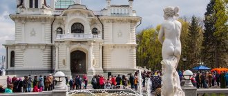
Interestingly, Ust-Kut has its own bypass road, which offers magnificent bird's-eye views of the city. The local bread they bake is tasteless, but the souvenir “Ust-Kut gingerbread” (similar to the Tula one), baked according to an exclusive recipe, is very good. It also has its own resort, famous throughout Russia: nothing remains of the pre-revolutionary salt plant; in its place, back in the 30s, a mud spa sanatorium arose, which is successfully operating to this day.
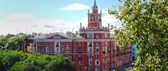
| Lena station with a restored station. From here the construction of the western section of the BAM began. When I took the photo, local security guards almost arrested me - for some reason it’s impossible, it’s a strategically important object! |
Other man-made attractions include the remains of the once largest river port in the USSR, Osetrovsky, as well as the famous river school, where guys from all over the country went.
The airport is located 10 km from the city, on a mountain, with once good asphalt leading to it, but now it has potholes. And of course, the Lena railway station, which went down in the history of the country as the starting point in the 10-year epic construction of the Baikal-Amur Mainline. Actually, BAM was not invented in the 70s. They planned to lay railway tracks in the north of Eastern Siberia and beyond in Tsarist Russia. The real prototype of the current BAM existed in the first five-year plans of the Soviet regime: in the mid-30s, research was carried out in the region and, as an alternative to the Trans-Siberian Railway, hundreds of kilometers of single-track road with two dozen stations were even built in the east. The war prevented further development, and the rails and even the bridge trusses were partially dismantled and sent to Stalingrad. The new, “Brezhnev” BAM was designed anew and started from the western part from Ust-Kut. Before this, the city was a dead end for land transport: from Taishet a railway line came here, launched in the early 50s as a kind of prologue to the BAM, and then cargo and people moved by water or along winter roads.
Since 1974, Ust-Kut has become the “Baikonur” of the all-Union construction; it houses the headquarters of the western section of the BAM, which was built by Komsomol volunteer detachments, and mainly by visitors from the western and southern regions of the country. For example, many young people from Ukraine came here, some of them remained to live here. People were captivated by the strong nature, new relationships were formed, and prospects emerged.
| This beauty captivated many young BAM builders in the 70s, who remained to live here. |
One of the most impressive topics of BAM is its unparalleled contract for the supply of foreign equipment. About 10,000 trucks of the legendary Magirus-Deutz brand, specially prepared by the Germans for the Russian North, mostly “went to war” through Ust-Kut. At one time, the “Magirus” served the Wehrmacht army, and here, in conditions of impassable taiga, bitter frosts and complete impassability, the legion of their descendants “puffed” on the great construction site of once undefeated socialism. Quirks of history!
Soviet propaganda did not advertise this fact, but the orange Magirus essentially became one of the symbols of BAM. Going to Ust-Kut, I thought to see something like a monument or other traces of their “exploits”. But I didn’t find anything like that. Although from time to time, and while still in good health, you can see dump trucks on the roads here with the characteristic unique roar of diesel engines. That’s all the reminder of that epoch-making “mobilization”, and for Magirus-Deutz BAM to some extent became a “demobilization chord”, because it was after this contract that the old German .
Now Ust-Kut cannot be called prosperous: no new buildings are visible, everything bears the stamp of long-term post-Soviet survival. The city's road infrastructure is far from being in the best shape, and suburban roads require off-road vehicles. So, before I had time to recover from the incident with a “broken” bottom on the highway, I had to cross a stream over rocks to get to my friends’ dacha plot. And this was the best of the roads, since the other one to this dacha cooperative was only possible with tractor equipment.
NON-TAIGA DEAD-END
Over the entire period of “modern times”, if anything was heard about the city in the country, it was in connection with cataclysms. In 2001, the residents of Ust-Kutsk experienced two disasters: cold and severe flooding. Due to the defrosted heating system, people in city apartments, like in besieged Leningrad, were forced to heat potbelly stoves. And only a “call to a friend”, when the boy addressed the President live on TV, the situation was quickly resolved. However, the lack of hot water in the summer is still a common occurrence for most areas of the city, and the administration does not seem to care about this.
River management makes a depressing impression. Of several large parts of the river port, only one is operational today; in the cargo terminals of others, only mountains of rusty scrap metal are visible. And the Lena itself is somehow shrunken, shallow, as if in crisis: work on deepening the shipping channel has clearly been suspended. Of the numerous enterprises, including several powerful SMP (construction and installation trains), after layoffs, wild privatization and other social disasters, only a few remained afloat. People, especially young people, leave whenever possible.
| The once largest river port in the USSR, Osetrovsky, is now in a dilapidated state. Even mountains of valuable scrap metal seem to have no one to dispose of yet |
| The majestic Lena (from the Evenk “yelyu ene” - large river) in Siberia is in its significance what the Volga is for central Russia. During floods it can cause a lot of trouble, but in low water its bare shores look pitiful |
However, the city is not dying. The era of alienation is being replaced by something else, illusory for now, but still promising. Some enterprises are functioning, and new jobs are appearing, including on a rotational basis at new northern fields. Someone finds here a platform for developing an honest business. The massive outflow of the population (up to 1,500 people annually!) seems to be decreasing recently, but such a sign of prosperity as the vehicle fleet is clearly growing. Including due to new foreign cars purchased from Irkutsk, and more often even Krasnoyarsk dealers (here, by the way, in general the supply is more and more “Western” than Irkutsk). Only Russian brands have their own dealers.
Yes, the commitment to the domestic automobile industry and, in particular, to jeeps, is still evident, which is understandable. The former and “forced” cult of the Niva on BAM no longer exists; the severe need for SUVs is solved in a much more varied way, but the main sales of classic VAZ models occur in these areas.
Still, I was lucky that I didn’t have to study the infrastructure of car service centers for personal reasons. Well, maybe with some searching on a tip I used a car wash: they washed the clay well, quickly, but the cost was the same as the average in Irkutsk - 200 rubles just for the body. The fuel supply is good, but more expensive. There are different gas stations, including branded ones from large chain stores, where you still risk filling up with high-octane gas.
I ask the gas station attendant directly: “Is your 95 very bad?” At first he hesitated, but then he supported the brand: “No, it’s normal, they’re pouring it in.” I also filled the tank full, and then did not notice any deviations in the operation of the engine. I returned in dry, hot weather. The gravel areas were mercilessly dusty, and the sun was generously hot up to +35. There were no incidents, although there were many other people’s emergencies along the way, most of them shifting with serious consequences. Apparently, the heat has its effect. I believe that one day it will be possible to safely get to Ust-Kut entirely on asphalt. During the construction of the BAM, it was believed that there would be enough railway communication for all occasions. It is now obvious that the North cannot live without the development of roads.
Vasily LARIN, photo by the author
Automarket+Sport No. 08/2011
Geography
Geographical position
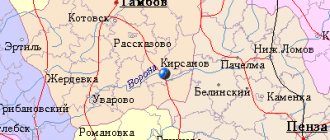
Ust-Kut is located in the central part of the Irkutsk region in the upper reaches of the Lena River at the confluence of the Kuta River.
The city is built primarily along the left banks of rivers. The length from west to east in a straight line is about 28 km; along river beds - about 34 km (excluding Turuk).
Distance from Ust-Kut to Irkutsk:
- by rail - 1385 km (Ust-Kut - Taishet - Irkutsk);
- on roads - 973 km (Ust-Kut - Bratsk - Tulun - Irkutsk);
- by direct air - 510 km.
The nearest cities are Zheleznogorsk-Ilimsky (107 km to the west), Kirensk (174 km to the north downstream of the Lena).
Climate
The climate of the city is sharply continental. The average temperature in January is −25 °C, in July +17 °C. Minimum temperature -58 °C, maximum (in the shade) +42 °C.
Annual precipitation is 350 mm. In winter - in the form of snow. In the off-season (spring and autumn, as well as at the beginning and end of summer), hail is common.
The territory of the city is equated to the regions of the Far North.
Relief and geological structure
The city is located on the territory of the Leno-Angara plateau, among hills covered with taiga, the relief is highly dissected, the absolute heights of the area are from 558 to 757 m above sea level.
Directly on the territory of the city there are reserves of unique healing waters and mud. Therapeutic agents: radon 15 ncurie/l (43 Mache units) sodium chloride brines containing bromine, which are used in diluted form for baths; silt mud of the lake. Treatment of diseases of the organs of movement and support, gynecological, peripheral nervous system[3].
Near the city there are proven reserves of hydrocarbons (oil and natural gas).
Soil cover
The soils are predominantly soddy-carbonate and soddy-podzolic. Meadow and floodplain soils of medium and light loamy mechanical composition.
Map
| Ust-Kut: maps |
Ust-Kut: photo from space (Google Maps) Ust-Kut: photo from space (Microsoft Virtual Earth)
| Ust-Kut. Nearest cities. Distances in km. on the map (in brackets along roads) + direction. Using the hyperlink in the distance , you can get the route (information courtesy of the AutoTransInfo website) | |||
| 1 | Zheleznogorsk-Ilimsky | 101 (136) | Z |
| 2 | New Igirma | 117 (186) | Z |
| 3 | Trunk | 124 (198) | SE |
| 4 | Kazachinskoe | 125 (213) | SE |
| 5 | Ulkan | 160 (241) | SE |
| 6 | Kirensk | 180 (268) | NE |
| 7 | Railway | 217 () | NW |
| 8 | Zhigalovo | 221 (688) | YU |
| 9 | Ust-Ilimsk | 222 (336) | NW |
| 10 | Severobaykalsk | 254 (364) | SE |
| 11 | Nizhneangarsk (Republic of Buryatia) | 260 (389) | SE |
| 12 | Bratsk | 262 (353) | Z |
| 13 | Vikhorevka | 290 (383) | Z |
| 14 | Kachug | 314 (553) | YU |
a brief description of
Located in the north of the Lena-Angara plateau, at the confluence of the river. Kut to Lena, 610 km from Irkutsk (by air). River port (on the Lena). Railway station. River and railway transshipment point cargo.
The climate is sharply continental. The average temperature in January is -25C, in July +17C. Precipitation is 350 mm per year, mainly in summer.
3 km from Ust-Kut there is a balneological and mud resort of the same name. Sanatorium, water and mud baths. Mineral springs were discovered in the 17th century. Russian explorer E.P. Khabarov. Used for medicinal purposes since 1908. The resort was founded in 1925.
Territory (sq. km): 56
Information about the city of Ust-Kut on the Russian Wikipedia site
Historical sketch
In 1628, the foreman Vasily Bugor built a winter hut near the mouth of the Kut River. In 1631, Russian explorers led by Ataman Ivan Galkin founded near the mouth of the river. Kut Ust-Kutsk fort. The hydronym Kuta is associated with the nature of the river valley: Evenki kuta - “peat swamp, swampy place, quagmire.”
In 1639, servicemen E.P. In Khabarovsk, saltworks were opened not far from the prison.
In the middle of the 17th century. The fort, having lost its military significance, became an important pier where cargo coming from Ishim and Upper Lena was concentrated.
Workers' village of Ust-Kut since 1943. City since 1954. Formed by the merger of the villages of Ust-Kut and Osetrovo (urban settlement since 1938, 3.3 thousand inhabitants, 1939).
Economy
Shipyard, timber industry enterprises, dairy plant.
Main enterprises
INLAND WATER TRANSPORT
CJSC "Verkhne-Lenskoye River Shipping Company"
, Irkutsk region, Ust-Kutsky district, Ust-Kut, st.
Proletarskaya, 1 Offers:
Culture, science, education
River School.
Museum of Local Lore.
Monuments: to the partisans who fell for Ust-Kut (1957), to the partisan commander of the Civil War D.E. Zverev (1969) and others.
Universities of the city
Osetrovsky branch of the Novosibirsk State Academy of Water Transport (in Ust-Kut)
666793, Irkutsk region, Ust-Kut district, Ust-Kut, st. Volodarsky, 65
Architecture, sights
Ust-Kut stretches along the Lena River for 30 km and consists of separate microdistricts connected by a single road-street.
| Population by year (thousands of inhabitants) | |||||||
| 1939 | 4.0 | 1992 | 61.8 | 2007 | 45.8 | 2016 | 42.5 |
| 1959 | 21.3 | 1996 | 62.4 | 2008 | 45.3 | 2017 | 42.3 |
| 1967 | 29 | 1998 | 59.6 | 2010 | 44.5 | 2018 | 41.7 |
| 1970 | 33.2 | 2000 | 57.1 | 2011 | 45.4 | 2019 | 41.1 |
| 1979 | 49.6 | 2001 | 56.2 | 2012 | 44.8 | 2020 | 40.8 |
| 1982 | 53 | 2003 | 50.0 | 2013 | 44.3 | 2021 | 40.3 |
| 1986 | 57 | 2005 | 47.6 | 2014 | 43.6 | ||
| 1989 | 61.2 | 2006 | 46.6 | 2015 | 43.0 | ||
Transport accessibility
Ust-Kut is the center of the Osetrovo-Lena transport hub, the largest in Eastern Siberia. Railway and waterways intersect here. Year-round access to the federal highway network is provided.
Ust-Kut is the center of the Osetrovo-Lena transport hub, the largest in Eastern Siberia.
Railways and waterways intersect favorably here. There is an airport capable of receiving large transport aircraft. Year-round access to the federal highway network is provided.
Railway transport
Ust-Kut is located on the East Siberian Railway. The main railway station is Lena. In addition to it, the city is located:
cargo-passenger stations: Ust-Kut, Yakurim, Lena-Vostochnaya;
exclusively cargo stations: Lena-Perevalka, Portovaya, Yakurim-Perevalka. (In a single technological process with the port of Osetrovo.)
Until the end of the 1990s, the Panikha station operated on the western outskirts of the city. Many enterprises have their own access roads.
There are projects for the construction of railway lines to the north (Lena - Nepa - Lensk) and south (Irkutsk - Zhigalovo - Lena).
Passenger service
. Constant passenger service by long-distance trains:
• in a western direction - Moscow, Krasnoyarsk, Irkutsk, Kislovodsk. In the summer - Adler, Anapa, Novosibirsk.
• in the eastern direction - Severobaikalsk, Tynda.
Suburban trains go to the stations: Vikhorevka, Ruchey (to the west), Kirenga (to the east).
The first train arrived at Lena station in 1951 - then Ust-Kut was the end point of the Taisheto-Lena Railway under construction (now this is a section of the Eastern Railway, called Western BAM.) The road was put into permanent operation in 1958. In 1974, Ust-Kut became the starting point the resumed construction of the Baikal-Amur Mainline, the headquarters of the Western section was located here. In 1975, the only railway bridge across the Lena was commissioned today.
Air Transport
Ust-Kut Airport is located 10 km north of the city. Regular flights operate to Irkutsk. As of the end of 2010, transport links between the airport and the city are possible only by taxi and private cars. To serve the airport, route No. 101 “st. Lena is an airport,” but it was not operational during 2010. The question of its restoration is being raised.
River transport
Large river port of Osetrovo on the Lena River (engaged, among other things, in servicing northern deliveries).
Passenger service up the Lena to the village of Zhigalova, down to Peleduy. Carried out by motor ships of the Zarya and Polesie type.
Automobile transport
The road network connecting Ust-Kut with other settlements is poorly developed. The city is connected to the federal highway network via the regional highway P419 (exit to the Baikal highway through Bratsk to Tulun).
In 2007, the P419 highway was transferred to federal ownership and became part of the Vilyuy highway under construction.
To the east of Ust-Kut, a highway runs parallel to the BAM to Zvezdnoye and, formally, to Severobaikalsk (in fact, through traffic on the highway is impossible for most cars due to its poor condition).
Winter roads
. In winter, a winter road passes from Ust-Kut to the north through Mirny, connecting hard-to-reach areas of the Irkutsk region and Yakutia with the federal highway network. Other winter roads are also widely used.
City street and road network
. The central streets have asphalt pavement, while some peripheral streets have concrete pavement. The rest are without coverage. There is a bypass road for transit vehicles.
Bus service
12 city routes have been created in Ust-Kut. There is a network of suburban routes - to the Veteran dachas (Turuka village), the airport, the villages of Kazarki, Verkhnemarkovo, Niya. There is one intercity route - to Irkutsk. In the summer, transportation is also carried out in the direction of holiday villages, year-round to Kirensk by private minibuses. There is no bus station.
Distance from Ust-Kut to Irkutsk:
• by rail - 1385 km (along the Ust-Kut - Taishet - Irkutsk line); • by roads - 973 km (Ust-Kut - Bratsk - Tulun - Irkutsk); • by direct air – 520 km.
Nearest cities: Bratsk - 320 km, Zheleznogorsk-Ilimsky - 107 km to the west, Kirensk - 300 km to the northeast downstream of the Lena).
Religion
Since its foundation, the Ust-Kutsk fort was part of the borders of the Tobolsk diocese.
In the “Description Book” of 1699-1700 there is a mention of the prison-based Spasskaya Church. Over the course of two centuries, the temple was rebuilt several times.
Since December 1721, Ust-Kut was within the independent Irkutsk diocese.
In the 19th century, the Prokopievsky Church was built on the territory of the salt plant.
The people in the Ust-Kut region were little religious. This is stated in the report on the state of the Irkutsk diocese for 1911:
«Moral and religious life, apparently, has long frozen in the Lena expanses and so far nothing has been done to revive it. There are no religious and moral readings and conversations with the people
«.
The report on the state of the Irkutsk diocese for 1915 states that “ in the Kirensky district, for example, as a result of parishioners’ refusal to maintain the church and clergy, the Ust-Kutsk parish was closed
«.
During Soviet times, both Ust-Kut churches were destroyed.
By the early 1990s, a community of Orthodox Christians was founded in Ust-Kut - about 20 people. The community gathered in half of a two-apartment decommissioned house on Kotovsky Street. The head of the community was Ksenia Tarasovna Vitkovskaya.
In 1992, on the feast of the Epiphany, for the first time after a long break, a religious procession was held on the Lena River, in the area of old Ust-Kut.
In 1993, a temple was opened in honor of the Dormition of the Blessed Virgin Mary.
From 2006 to 2008, the local newspaper “Parus” ran a weekly column “The World of Orthodoxy.” During this time, more than 40 articles were published.
On October 5, 2011, the city became part of the Fraternal Diocese.
Temples
- Nicholas the Wonderworker
- Procopy of Ustyug (under construction)
- Church of the Savior Not Made by Hands (under construction)
- “Helper of Sinners” icon of the Mother of God, in the maximum security colony UK-20
- Dormition of the Blessed Virgin Mary
City infrastructure
The city stretches along the Lena and Kuta rivers. Its length along the river beds is 34 kilometers, while the maximum width of the building does not exceed three kilometers.
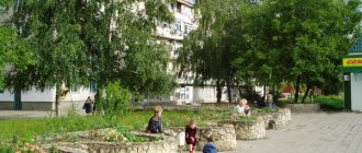
The city is not administratively divided, but in fact Ust-Kut consists of microdistricts and villages. Central microdistricts - Lena and Rechniki. Most of the social and cultural facilities are located here and most of the population is concentrated. The remaining microdistricts and villages are located both downstream and upstream of the Lena, built up mainly along the left bank. The right bank part is small and consists of two microdistricts. Residential areas alternate with industrial areas and abandoned unfinished urban facilities.
It is customary to separately highlight the old part of the city - the former village of Ust-Kut. Currently known as the "old Ust-Kut" microdistrict. The buildings here are predominantly one-story wooden. Historical buildings that are not included in the list of cultural heritage sites have been preserved.
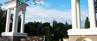
The city is surrounded by taiga; it can be reached from anywhere in the city in no more than 30 minutes. At the mouth of Kuta there is Domashny Island, which is one of the recreation centers for the townspeople.
Above the city along its entire length rise hills with rock formations at the tops. Some of them have names and are the subject of some urban legends, for example, Devil's Rock, Bubnov Stone, Rooster, Peace and others.
Ust-Kut
Fragment from the book by M.A. Vinokurov and A.P. Sukhodolov “Cities of the Irkutsk Region”, 2010 On the website “Pribaikalye” (www.pribaikal.ru) published with the permission of the authors
Ust-Kut is one of the oldest cities in Eastern Siberia. It was founded in 1631 - 30 years earlier than Irkutsk.
It is located at the mouth of the Kuta River (hence the name of the city) at its confluence with the Lena River, 510 km northeast of Irkutsk in a straight line.
It is the administrative center of the Ust-Kutsk region and belongs to the northern cities of the Irkutsk region (together with Bratsk, Bodaibo, Kirensk and Ust-Ilimsk).
The city became the end point of the Taishet-Lena railway, built in 1946-1950, and the starting point of the Baikal-Amur Mainline, built in 1974-1987. Since the second half of the 1970s. it was called the eastern capital of BAM.
During the Soviet period (and until 2006), Ust-Kut was a city of regional subordination (level). Now it is included in the Ust-Kutsky municipal district and classified as a city of the district level (subordination). The area of the city is 56 km2 (5.6 thousand hectares).
Relief.
Ust-Kut is located on the Lena-Angara plateau, in the floodplain valley of the Lena River, at an altitude of 295 m above sea level.
The city is located among taiga-covered hills with absolute peaks ranging from 558 to 757 m above sea level.
On the flat floodplain territory of the Lena and Kuta rivers there are small areas suitable for agricultural activities. The soils here are soddy-carbonate and soddy-podzolic, in the meadow part they are medium and light loamy. These lands were developed by Russian peasants from the second half of the 17th century. and were used for haymaking, grazing livestock, growing vegetables and some grains. Currently, almost all of these areas are occupied by residential development in modern Ust-Kut.
Climate.
The city is located on a territory equated to the regions of the Far North. The climate here is sharply continental. The annual average duration of the frost-free period is 97 days. The first frosts are recorded on September 9, the last - on June 3.
The average monthly temperature in January is -25.5 °C (absolute -52 °C), July +17.6 °C (absolute +38 °C). The average annual temperature is -3.7 °C.
The average annual precipitation is 431 mm, of which 57% falls in May–August.
Population.
The city is home to 44.5 thousand people, or 1.8% of the population of the Irkutsk region (as of 2010). The population of Ust-Kut began to decline rapidly in the mid-1990s. both due to natural decline and as a result of the increased outflow of population during this crisis period. This unfavorable demographic dynamics for the city continues to this day and has not yet been overcome.
The main occupation of residents of Ust-Kut is work at railway and water transport enterprises, in the timber processing industry and budgetary institutions of the city.
Population dynamics of Ust-Kut, thousand people.
| Year | 1960 | 1970 | 1980 | 1990 | 2000 | 2005 | 2010 |
| Population | 23,4 | 33,2 | 50,8 | 61,4 | 57,1 | 47,6 | 44,5 |
Social sphere .
There are 16 secondary, 6 basic, 3 primary schools, 4 additional institutions and 21 preschool educational institutions in the city and region. There are a river school and a vocational school No. 61.
The city has a central library system with a network of branches, a local history museum and a transport history museum, and an art school.
There are about 100 sports facilities and dozens of gyms in the city and region. Many sporting events are held every year.
Healthcare is represented by the Central District Hospital with a clinic, the Osetrovo Hospital (former hospital for water workers), the railway hospital at Lena station with a clinic and a hospital with 80 beds. There are also sanatoriums “Ust-Kut” with 250 beds and “Eiseira” (a former dispensary of the Osetrovsky river port).
Prospects.
The city's future prospects are associated with the integrated development and processing of hydrocarbon raw materials, forest chemical and wood processing production, the preservation of the main repair base of the river fleet operating in the Upper Lena basin, and the strengthening of its position as a key railway and water transshipment hub. The revival of Ust-Kut airport and the increase in the volume of northern air traffic are very important. It is advisable to promote the image of Ust-Kut as a resort town by improving the quality of service in the Ust-Kut and Eiseira sanatoriums. It is also possible to locate a service base for the ESPO main oil pipeline in the city. When developing northern hydrocarbon deposits, it is advisable to create large generating capacities in the area of Ust-Kut and Kirensk (this possibility was considered by OAO Irkutskenergo), which would use associated gas from these deposits.
The appearance of the city.
Ust-Kut stretches in a narrow strip along the banks of the Lena and Kuta for more than 30 km. The width of its building is about 1 km (maximum is about 3 km).
Such an unusual layout of Ust-Kut creates the image of a “city with one street” among visitors. But it is not so. Most microdistricts are connected by a second, bypass road, located just above the urban development. And the Lena River, the main waterway of Ust-Kut, can also be called the main transport street of the city, just like the railway. Although the city is located on both banks of the Lena and Kuta, its main part is located on the left banks of these rivers. There are only two microdistricts on the right bank. Both parts of the city are connected by two arched metal bridges - a road and a railway.
The city is not administratively divided, although in reality it consists of separate, largely independent microdistricts, connected by a single road-street. Residential areas alternate with industrial areas and abandoned temporary settlements.
The core of Ust-Kut is two microdistricts - Lena and Rechniki. They are built up with modern stone multi-storey and fully equipped houses. The bulk of the population of Ust-Kut lives here, and the most important socio-cultural facilities are located here. The city center is the square between the railway and river stations. The remaining microdistricts and villages are located from the center downstream and upstream of the Lena. The old part of the city (the former village of Ust-Kut) is located at the mouth of the Kuta River. Domashny Island is also located here, a favorite vacation spot for the townspeople. On the outskirts and in the old part, wooden one-story houses predominate, built at the beginning and middle of the last century. Historical buildings have been preserved. Relatively recently, two remote villages were included in the city - Mingan (in 1995) and Turuka (in 2004).
Ust-Kut is surrounded by mountains and taiga. Some mountain slopes form rocky cliffs that have names and are covered in urban legends (for example, Rock of Love, Devil's Rock, Bubnov Stone, Peace, etc.).
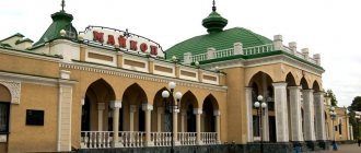
The city greets its guests with different names (Ust-Kut is known as a city of three names): train passengers - Lena station, those arriving by water - Osetrovo port, and those arriving by plane - Ust-Kut airport.
Coat of arms
Ust-Kut was approved by the City Duma in 2009. Its green shield depicts a golden sable, an anchor and a fort tower. The confluence of the Lena and Kuta rivers is shown as an inverted letter “U”. The authors of the new coat of arms are A. Polovikova (Ust-Kut), K. Mochenov (Khimki), O. Fefelova (Balashikha), K. Perekhodenko (Konakovo). Included in the heraldic register of the Russian Federation (No. 4833)
Heraldry
Coat of arms
near Ust-Kut first appeared in 1974 (officially it was not a coat of arms, it had the status of a sign). It was an emerald shield with images of a marten, an anchor and the inscription “1631.” against the background of a stylized image of the river mouth.
On February 10, 2009, a new coat of arms was adopted. The green shield depicts a golden sable, an anchor and a tower, symbolizing a prison. Heraldic description: “In a green field there is a silver raised left belt, once wavy curved (concave on the right), connected at the bottom left with a right belt of the same metal, also once wavy curved (concave on the right). The baldrics are accompanied at the top by a golden walking and turned sable, at the bottom by an anchor (like a sea anchor), also golden, and on the left by a log tower of the same metal, having a pointed roof and an arch without a threshold, with a smaller baldric running over the right support of the arch and behind the bottom of the left support.” .
Flag
city, also adopted on February 10, 2009, repeats the design of the coat of arms.
Population
Population dynamics of Ust-Kut
| 1875 | 1959 | 1960 | 1967 | 1970 | 1979 | 1980 | 1982 | 1986 | 1987 |
| 278 | 21 343 | 23 400 | 29 000 | 33 197 | 49 647 | 50 800 | 53 000 | 57 000 | 58 000 |
| 1989 | 1990 | 1992 | 1996 | 1998 | 2000 | 2001 | 2002 | 2003 | 2005 |
| 61 165 | 61 400 | 61 800 | 62 400 | 59 600 | 57 100 | 56 200 | 49 951 | 50 000 | 47 600 |
| 2006 | 2007 | 2008 | 2009 | 2010 | 2011 | 2012 | 2013 | 2014 | 2015 |
| 46 600 | 45 800 | 45 300 | 44 832 | 45 375 | 45 290 | 44 805 | 44 301 | 43 552 | 42 971 |
| 2016 | 2017 | 2018 | 2019 | 2020 | |||||
| 42 498 | 42 272 | 41 689 | 41 149 | 40 783 |
Demographic situation
Until the mid-20th century, Ust-Kut remained a large village with a predominantly peasant population, including families of exiles who settled here. The 1940s became a turning point, when the construction of the Osetrovsky river port and the Lena Railway began, for the construction of which workers flocked from nearby settlements and other regions of the USSR. In 1943, Ust-Kut acquired the status of a workers' village, and in 1954 it became a city with a population of about 20 thousand people, mostly workers. With the resumption of construction of the BAM in the 1970s, the city is experiencing a second wave of migration - thousands of young professionals are settling here, many from the Stavropol and Krasnodar territories, who patronized the Lena station. Following the builders, geologists arrive in Ust-Kut as part of several geological expeditions.
The city's nominal population continued to grow until 1996, when it reached a historical peak of 62.4 thousand people. (These data, however, do not reflect the real dynamics of natural growth and migration: in 1996, the working settlement of Yakurim was included in the city.) Since that time, there has been a massive outflow of population, reaching its maximum in 2001 - 2003: in two years the population of Ust-Kut decreased by 6.2 thousand people (more than 10% of the population). From 2010 to 2021, the population of Ust-Kut decreased by almost 5 thousand people.
Most of the city's residents work at water and railway transport enterprises, in state and budgetary organizations of the city, trade, as well as in the timber processing industry1.
Economy
The economy of Ust-Kut is based on the extraction of natural resources, forestry and the activities of enterprises at the railway-port transport hub.
Main enterprises:
• in the oil and gas complex - UKNG LLC (formerly UstKutNeftegaz OJSC - a subsidiary of Irkutsk Oil Company LLC; oil depot
• in the transport complex - Osetrovsky river port, Verkhne-Lenskoye river shipping company, OJSC "Alrosa-Terminal", ESR enterprises;
• in the forestry complex - Mikura LLC, Lenalesservice LLC, Veles CJSC, Lenaexportles CJSC, OIK-51.
The main branches of industrial production in order of decreasing volumes are mining, manufacturing, thermal power engineering. Most of the extracted natural resources are exported to other regions of Russia and China. The range of final products produced in the city is very small - mainly lumber and wood products. In addition, food industry enterprises—a bakery, private bakeries, and a dairy—produce products for the city’s needs.
Social sphere
Education
As of 2021, 12 general education institutions operated in Ust-Kut. Also available:
• State budgetary professional educational institution of the Irkutsk region “Ust-Kutsk Industrial College”;
• Branch of non-state educational vocational education “Irkutsk Humanitarian and Technical College”;
• Ust-Kutsk Institute of Water Transport (branch) of the Siberian State University of Water Transport (SGUVT)1.
Healthcare
Municipal healthcare institutions as of 2018:
• Central district hospital;
• Railway line hospital, including an ambulance station.
Private medical institutions:
• Doctor LLC (Rebrova-Denisova St., 8);
• Stomkomfort LLC (45 Rechnikov St.),
• ultrasound diagnostic room of Grigorieva I.N. (Kirova St., 124),
• LLC “Sanatorium “Eiseira” (Rechnikov St., 1a),
• LLC “Dental Clinic Proskokov IK” (Kirova St., 90 apt. 45) and others1.
Culture
The city has cultural centers, libraries, a museum, a children's art school, and a cinema.
River workers (city house of culture, Ust-Kut city)
Sport
As of 2021, the city had: one stadium, two children’s and youth sports schools, 42 gyms1.
Natives and residents
- Zadorozhnaya Elena Anatolyevna, Bolsun Elena Ivanovna - track and field athletes, Olympic participants, natives of Ust-Kut.
- Akulich Oleg Aleksandrovich is a Russian and Belarusian actor who spent his childhood and youth in Ust-Kut. Graduate of the Osetrovsky River School.
- Markov Nektary Konstantinovich - Honored Teacher of Russia, local historian, in 1955–1984 director of Ust-Kutsk Secondary School No. 2, holder of the Order of the Red Banner of Labor, honorary citizen of the city of Ust-Kut.
- Trotsky Lev Davidovich - Russian politician, one of the leaders of the October Revolution, served exile in Ust-Kut in 1900.
Heroes of the Soviet Union (participants of the Great Patriotic War):
- Andreev Mikhail Alexandrovich;
- Antipin Ivan Nikolaevich;
- Pesterev Alexey Ivanovich;
- Tyurnev Pyotr Fedorovich.
Heroes of Russia:
- Rudykh Alexander Vitalievich is a participant in combat operations in Afghanistan and other “hot spots”.
- Sherstyannikov Andrey Nikolaevich - participant in the anti-terrorist operation in Chechnya.