| district[1] / municipal district[2] | |
| Balashikha district | |
| 55°48′00″ n. w. 37°56′00″ E. d.HGYAO | |
| A country | Russia |
| Entered | Moscow region |
| Included | 13 settlements |
| Adm. center | Balashikha |
| History and geography | |
| Date of formation | 1941 |
| Date of abolition | 2006[3] / 2011[4] |
| Height | 167 m |
| Population | |
| Population | ↗187,988[5] people (2002) |
Balashikha District
is an abolished administrative-territorial unit and former municipal entity of the same name (municipal district) in the Moscow region of Russia.
Existed from 1941 to 2011 (with the exception of 1963 to 1965). In 1929-1941 it was the Reutov district
.
The center of the Balashikha district was the city of Balashikha, while the former regional center, the city of Reutov, was part of the Balashikha district until 1970.
Since 2005, the territory of the former Balashikha district belongs to the Balashikha urban district.
Story
On July 12, 1929, the Reutovsky district
with its center in the working village of Reutovo. The district included the following territories of the former Moscow province:
- from the Razinsky volost of the Moscow district: the working villages of Reutovo and Balashikha; holiday villages Nikolsko-Arkhangelsky and Saltykovka; village councils Abramtsevo, Golyanovsky, Ivanovsky, Izmailovsky, Kaloshinsky, Kuchinsky, Leonovsky, Nikolsko-Arkhangelsky, Nikolsko-Trubetskoy, Pehra-Pokrovsky, Temnikovsky, Feninsky and Shchitnikovsky
- from Vasilyevskaya volost of Bogorodsky district: working village of Savino; holiday villages of Vishnyakovo and Obiralovka; village councils Dyatlovsky, Kopninsky, Novomiletsky, Novsky, Poltevsky, Savvinsky, Sobolikho-Purshevsky and Chernovsky.
Borders of the Reutovsky district for 1939-40 On
May 20, 1930, the Kopninsky s/s was transferred to the Ukhtomsky district.
On January 7, 1934, the Nikolsko-Trubetskoy s/s was abolished.
On May 10, 1935, the workers' villages of Izmailovo, Kaloshino and Kuchino were formed. At the same time, Izmailovsky, Kaloshinsky and Kuchinsky village councils were abolished.
On November 10, 1936, the working village of Izmailovo was included within Moscow.
On December 4, 1938, the holiday village of Obiralovka was transformed into the working village of Zheleznodorozhny.
On May 26, 1939, the working village of Balashikha was transformed into a city of regional subordination. On June 7, the workers' village of Kaloshino was included within Moscow. On August 21, the working village of Reutovo was transformed into a city of regional subordination of Reutov.
On June 20, 1940, the dacha settlement of Vishnyakovo was annexed to the dacha settlement of Nikolsko-Arkhangelskoye.
On May 19, 1941, the district center was moved to Balashikha, and the district was renamed Balashikha District
.
On August 16, 1946, the settlement of Kupavna received the status of a holiday village.
On August 7, 1952, the city of Balashikha received the status of a city of regional subordination and was removed from the district. At the same time, the working village of Zheleznodorozhny was transformed into a city of regional subordination.
On June 14, 1954, Abramtsevo, Dyatlovsky, Leonovsky, Poltevsky, Savvinsky, Sobolikho-Purshevsky, Temnikovsky and Shchitnikovsky s/s were abolished.
On June 3, 1959, the cities of Losino-Petrovsky and Fryazino were annexed to the Balashikha region; working villages of Sverdlovsky, Fryanovo and Chkalovsky; village councils Amerevsky, Aniskinsky, Bulakovsky, Golovinsky, Zhegalovsky, Kablukovsky, Maltsevsky, Medvezhye-Ozersky, Mishnevsky, Nikiforovsky, Novsky, Ogudnevsky, Oseevsky, Ryazantsevsky and Trubinsky from the abolished Shchelkovsky district. On July 31, Amerevsky and Novsky s/s were merged into Grebnevsky s/s, Kablukovsky and Ogudnevsky - into Vorya-Bogorodsky. Mishnevsky and Nikiforovsky s/s were abolished. Bulakovsky s/s was renamed Staropareevsky. On August 8, the working village of Chkalovsky was included in the city of Shchelkovo.
In 1960, the Shchelkovsky district and the city of Zheleznodorozhny were separated from the Balashikha district, which became a city of regional subordination. Part of the Balashikha district went to the city of Moscow (including the Golyanovsky village council (now the Moscow district of Golyanovo); the Ivanovsky village council (now the Moscow district of Ivanovskoye), as well as the reassigned workers' village (settlement) Stalinsky (since 1961 - Vostochny). On the remaining territory of the district the city of Reutov; the holiday villages of Nikolsko-Arkhangelsky and Saltykovka; the village councils of Nikolsko-Arkhangelsky, Pehra-Pokrovsky and Feninsky remained.
On February 1, 1963, the Balashikha district was abolished. The cities and towns that were part of it were transferred to the subordination of the city of Balashikha, and the village councils were transferred to the Mytishchi enlarged rural district.
January 22, 1965 Balashikha district
was restored. It included the city of Reutov, the holiday villages of Nikolsko-Arkhangelsky and Saltykovka; village councils Nikolsko-Arkhangelsky, Novomiletsky, Pehra-Pokrovsky, Feninsky and Chernovsky. The center of the region was the city of regional subordination of Balashikha.
On October 1, 1970, the city of Reutov received the status of a city of regional subordination and was removed from the district.
On February 2, 1982, the Feninsky village council was abolished in favor of Chernovsky. At the same time, the Novsky village council was created.
In accordance with Decree of the President of the RSFSR dated August 22, 1991 No. 75 “On some issues of the activities of the executive branch in the RSFSR,” the executive committee of the Balashikha City Council ceased its activities, and its functions from January 4, 1992 were transferred to the created Administration of the Balashikha District.
On February 3, 1994, village councils were transformed into rural districts[6].
By Decree of the Governor of the Moscow Region of June 10, 2003 No. 128-PG, several settlements: the dacha village of Nikolo-Arkhangelsky, the dacha village of Saltykovka, the village of Nikolsko-Arkhangelskoye, the village of Gorbovo, the village of Nikolsko-Trubetskoye, the village of Pehra-Pokrovskoye, the village of Lukino, the village of Bezmenkovo and the village of Novaya - were included in the city limits of Balashikha. At the same time, the Nikolsko-Arkhangelsk and Novsky rural districts were abolished[7].
By Decree of the Governor of the Moscow Region of October 15, 2003 N 195-PG, the Novomiletsky rural district was abolished in favor of Chernovsky [8].
By Decree of the Governor of the Moscow Region dated August 27, 2004 No. 180-PG, the village named after. On May Day, the village of Shchitnikovo and the village of Abramtsevo. At the same time, the Pehra-Pokrovsky rural district was abolished[9].
By the law of December 29, 2004, the municipal formation “Balashikha District of the Moscow Region” with the status of a municipal district from January 1, 2006 was transformed into the municipal formation of the Balashikha
[10].
By the law of July 14, 2006, the last rural district (Chernovskaya) was excluded from the registration data of administrative-territorial and territorial units of the Moscow region from January 1, 2007 [11].
In 2011, the Balashikha district as an administrative-territorial unit was also abolished, and in its place an administrative-territorial unit was formed - a city of regional subordination with an administrative territory.
City of Reutov
Home page /
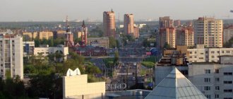
The city's territory, amounting to 892 hectares, is limited by the Nizhny Novgorod and Nosovikhinskoe highways - roads of federal importance. Therefore, the city can only grow upward. According to the population census as of October 14, 2010, 87.4 thousand people live in the city, the average age of residents is 40 years.
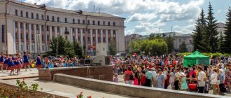
The city is a municipal entity within the Moscow region. In 2004 it received the status of a city district. By Decree of the President of Russia No. 1530 of December 29, 2003, the city of Reutov was given the status of Science City of the Russian Federation.
Local government bodies are represented by the City Administration and the City Council. — The head of the city is elected by the Council of Deputies from among the candidates presented by the competition commission based on the results of the competition.
The city-forming enterprise is NPO Mashinostroeniya, created by Academician V.N. Chelomey in 1955 on the site of the Reutov Mechanical Plant.
At the end of 2003, Reutov became the winner of the All-Russian Golden Ruble competition and received the title of “Best Medium-Sized City” in the Central Federal District. Based on the results of his work in 2004, he was among the top three winners. Based on the results of work in 2007, it was recognized as the most comfortable city in the Russian Federation in the category of cities with a population of up to 100,000 people.
The city has a developed social infrastructure. There are 20 m2 of housing per resident. A program to demolish dilapidated housing is being implemented. 100,000 m2 of housing are commissioned annually.
The education system includes 30 general education institutions, including 20 preschool education institutions. The schools employ 830 teachers and educate about 7,000 children. 75% of school graduates continue their studies at universities and secondary educational institutions in the city and Moscow. There are branches of many Moscow universities (s) in the city. Among them: MAMARMEN Academy, Law Academy, Russian State Social Institute and others.
The city has created an effective system of social protection of the population. In Reutov, about 20 thousand citizens, or more than a quarter of the city’s population, are recipients of various social support measures.
In 2009, a new building of the surgical building of the city hospital was put into operation.
Numerous sports facilities and sections are very popular among residents: a stadium with 2 football fields, a swimming pool, a multifunctional sports hall at the Sports Center, 14 gyms, more than 40 equipped sports grounds in the courtyards. Construction of the Sports Palace will begin soon.
The network of cultural institutions includes: a children's musical theater, 2 music schools, a children's art school, a city art gallery, a local history museum, a municipal drama theater, 6 libraries.
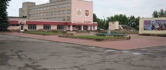
143966, Reutov MO, st. Lenina, 27,
print version
Settlements
From 1929 to 1970 the area included Reutov. From 1952 to 1992 Balashikha was not part of the district, being a city of regional subordination. In 1959-1960 the district temporarily included the territory of the Shchelkovsky district, again restored in 1960 (thus, the cities of Losino-Petrovsky and Fryazino, as well as the towns of Sverdlovsky and Fryanovo, Kuchino and Savvino left the Balashikha district [17]); At the same time, the city of Zheleznodorozhny[17] was removed from the Balashikha district (became a city of regional subordination). In 1970, the city of Reutov[17] left the district (became a city of regional subordination).
In 1970-2003. The external boundaries of the district did not change. The internal composition also did not undergo major changes, with the exception of the abolition of the Feninsky village council and the formation of Novsky in 1982, the return of Balashikha to the district in 1992 (became a city of district subordination), and the renaming of village councils into rural districts in 1994.
As of 2002, the Balashikha district included the city of regional subordination of Balashikha, 2 urban-type villages (dacha villages) Nikolsko-Arkhangelsky and Saltykovka, as well as 5 rural districts: Nikolsko-Arkhangelsky, Novomiletsky, Novsky, Pehra-Pokrovsky and Chernovskoy.
| Administrative-territorial unit | Population (persons) 2002[5] | Locality | Population np (persons) 2002[5] |
| city of regional subordination Balashikha | 147909 | Balashikha | 147909 |
| urban-type settlement Nikolsko-Arkhangelsky | 18637 | urban-type settlement Nikolsko-Arkhangelsky | 18637 |
| urban-type settlement Saltykovka | 4611 | urban village Saltykovka | 4611 |
| Nikolsko-Arkhangelsk rural district | 462 | village of Nikolsko-Arkhangelskoye | 462 |
| Novomiletsky rural district | 3197 | village of New Milet | 670 |
| Sobolikha village | 228 | ||
| village of Rusavkino-Romanovo | 82 | ||
| village of Rusavkino-Popovshchino | 54 | ||
| village of Purshevo | 2163 | ||
| Pehra-Pokrovsky rural district | 5391 | Pehra-Pokrovskoe village | 442 |
| Lukino village | 183 | ||
| Gorbovo village | 59 | ||
| Nikolsko-Trubetskoye village | 387 | ||
| village of Shchitnikovo | 479 | ||
| Abramtsevo village | 767 | ||
| State Farm village named after 1st of May | 3074 | ||
| Novsky rural district | 1112 | Novaya village | 855 |
| Bezmenkovo village | 257 | ||
| Chernovsky rural district | 6669 | Chernoe village | 5803 |
| Fedurnovo village | 231 | ||
| Poltevo village | 136 | ||
| Pestovo village | 97 | ||
| Fenino village | 157 | ||
| Pavlino village | 66 | ||
| Dyatlovka village | 179 |
In 2003-2004 2 urban-type settlements (dacha villages) Nikolsko-Arkhangelsky and Saltykovka, all rural settlements of the Nikolsko-Arkhangelsk, Novsky and Pehra-Pokrovsky rural districts were included in the city limits of the city of Balashikha, and the Novomiletsky rural district was merged into the Chernovsky rural district.
As of December 2004, the Balashikha district included the city of regional subordination of Balashikha and the Chernovsky rural district, which consisted of 12 rural settlements[10]:
| № | Locality | Type of settlement | Population (persons) 2002 |
| 1 | Balashikha | city, administrative center | ↗147 909[5] |
| 2 | Dyatlovka | village | ↘179[18] |
| 3 | New Miletus | village | ↗670[18] |
| 4 | Pavlino | village | ↘66[18] |
| 5 | Pestovo | village | ↗97[18] |
| 6 | Poltevo | village | ↘136[18] |
| 7 | Purshevo | village | ↗2163[18] |
| 8 | Rusavkino-Popovschino | village | ↘54[18] |
| 9 | Rusavkino-Romanovo | village | ↘82[18] |
| 10 | Sable | village | ↘228[18] |
| 11 | Fedurnovo | village | ↘231[18] |
| 12 | Fenino | village | ↘157[18] |
| 13 | Black | village | ↗5803[18] |
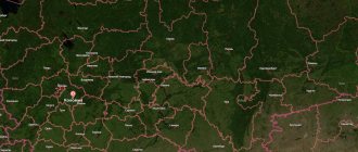
Reutov on the map of Russia, geography, nature and climate
The city is located in the Meshchera Lowland. There is only one large body of water in Reutov - Factory Pond. Since the water in it does not meet sanitary and hygienic requirements, the facility is used only for a recreation area, but not for swimming. The Chechera River flows on the border with Balashikha.
The city of Reutov is located in a zone of temperate continental climate, characterized by cold winters and hot summers. In the winter months, the average temperature is minus 10 degrees, in the summer months – plus 18-22 degrees.
Routes on the map of Reutov. Transport connection
If you look at the map of Reutov from a satellite, you can see how the city is divided into two parts by the Gorky direction of the Moscow Railway. Passengers board and disembark at the Reutovo station and the Stroika platform of the Balashikha line.
As for internal transport, buses, trolleybuses and minibuses travel around the city. Thus, residents have access to 15 bus, 16 route and 2 trolleybus routes.
A distinctive feature of Reutov is its own Novokosino metro station, opened on August 30, 2012. There are plans to build another one in the future.