Memorial complex Malaya Zemlya
Small Earth.
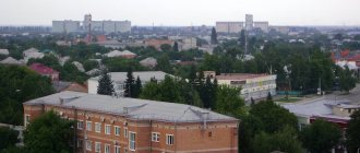
Monument to “Our Heroes” / photo from wikipedia.org Where is it located
Novorossiysk, Admiral Serebryakov embankment.
Why is this interesting?
A visit to this memorial complex is a tribute to the feat of Soviet soldiers during the Great Patriotic War.
The memorial was created on the site of the bridgehead, the defense of which lasted 225 days. Here in 1943 the operation to liberate the city began.
To defend this small piece of land, 70 thousand Soviet soldiers were sent here. The exact number of deaths is still unknown.
The central object of the complex is a memorial in the shape of the bow of a ship.
Its halves meet at a height of 22 m above the ground. There is a museum inside.
An alley of 225 poplars leads to the memorial, one for each day of defense.
On the ground around the memorial there are traces of trenches and trenches.
Despite the large number of visitors, it is always quiet and peaceful here. On the other side of the bay you can see the city. The panorama of the city looks especially attractive after sunset, when the lights come on.
How to get there
The memorial and other historical attractions of the Krasnodar Territory can be reached by public transport, the nearest stop is “Malaya Zemlya”. It is reached by buses No. 1 and 41m, trolleybus No. 7, minibuses No. 7, 10, 21, 22, 27, 28, 31, 38.
Abrau
Symbol of the beginning of the Caucasus Range (Main Caucasus). Because the named ridge starts on the peninsula of the same name (everything that was to the north-west is, in fact, just hills). But you will find the largest freshwater reservoir in the Krasnodar region closer to the sea, already at an altitude of only 84 meters, in the eastern half of the peninsula. Territory of the municipality of Novorossiysk. The size of the water mirror is 2,930 by 940. And the maximum depth is 10 m.
Russian Gate - a monument of Ottoman architecture
Russian Gate in Anapa
Where is it located?
In the southern part of Anapa, on the territory of the 30th Anniversary of Victory Park.
Why is this interesting?
These gates became Russian only in 1828, when Anapa was liberated from the Ottoman yoke.
This is all that remains of the fortress, built in 1783. The fortress was the main stronghold of the Ottoman Empire in the North Caucasus. The slave market operated here, and military operations to capture cities were controlled from here.
Russian troops sought to destroy the fortress, but it was not easy to break through the numerous fortifications. In 1791, Anapa fell, which forced the Turkish side to conclude a peace treaty. Under the terms of this treaty, Crimea was ceded to Russia, and Anapa remained part of the Ottoman Empire.
With their aggressive foreign policy, the Turks repeatedly violated the terms of the treaty. This led to Russia declaring war on the Ottoman Empire in 1827. In 1828, the Russian army took the fortress and the city. Since 1829, Anapa became part of Russia.
On the territory of the Russian Gate there are many monuments dedicated to the events of those years. The fortress gates themselves received the status of a monument of Ottoman military architecture.
How to get there
The path through the territory of the 30th Anniversary of Victory Park to the Russian Gate passes through the embankment. You can get to the park by minibuses No. 2, 7, 25.
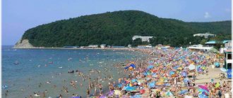
Agur waterfalls
This is the “business card” of the mid-mountain part of the Khostinsky urban district of Sochi (a resort stretching along the sea for as much as 145 km). The name itself says that you need to climb to the tract along the Agura. Up the gorge formed by this stream. To the east is the Big Akhun observation tower. And to the west is a huge monument dedicated to the Greek Prometheus (myths claim that it was here that Hephaestus chained him to a rock on the orders of Zeus, and an eagle pecked at his liver - that’s why the rocks there are Eagle). Now to Agura itself. This refers to the cascade in its upper reaches. There are 3 noticeable steps. The highest is 30 m (the next attraction after the Devil’s Font).
Holy Trinity Cathedral - the oldest temple in Krasnodar
Inside the Holy Trinity Cathedral / photo from the official website
Where is it located?
Krasnodar, central microdistrict.
Why is this interesting?
This is the oldest cathedral in the city.
The first thing a tourist will appreciate is the uniqueness of the architecture. Red brick walls with exquisite patterns, green domes and tower tops make the temple unlike other cathedrals.
The first house of worship was opened here in 1902.
The ceremonial consecration of the entire temple took place in 1910. In 1934, the temple was closed due to religious repression. During the Great Patriotic War, the Germans opened the temple, but at the end of the war it was closed again. The Soviet government took away all the relics from the clergy: icons, jewelry, even furniture and candelabra.
In those years, many icons were destroyed, frescoes on the walls and stained glass windows were also damaged. The return of the building to the status of a church is the merit of local residents. They achieved this in 1990. Unfortunately, part of the spiritual heritage has been irretrievably lost, but at the moment the cathedral has been restored to its former majesty.
How to get there
The cathedral is located in the city center, near the Kuban embankment.
The nearest stops are “st. Gogol" along Kuban embankment and Oktyabrskaya, "st. Gorky" after Oktyabrskaya, "Oktyabrskaya" after Gorky, "Pashkovskaya" after Kirov. These stops can be reached by any transport that runs through the central microdistrict of Krasnodar.
Lermontov House-Museum in Taman
Exposition of the Lermontov House Museum in Taman / photo from the museum website
Where is it located
In Taman, near the bus station.
Why is this interesting?
Mikhail Lermontov stayed here in 1937 on his way to military service.
Lermontov himself spoke unflatteringly about this city and called Taman “the worst little town of all seaside cities” (quote from “A Hero of Our Time”).
The poet’s mood is understandable; the upcoming service was actually an exile. He displeased the tsar with his poem “On the Death of a Poet,” which he dedicated to Pushkin. Later, Lermontov would make Taman one of the settings for A Hero of Our Time. The main character Pechorin also ends up in these regions with exile.
The museum opened in 1976. At first there were few exhibits: 30 paintings and an old Cossack chicken coop.
Now the museum has a large exhibition. There are manuscripts and drawings by Lermontov. In one house, household items used by the poet are preserved: from furniture and dishes to towels and icons.
How to get there
The nearest stop is the Archaeological Museum. You can get there by minibus No. 453.
Read about the natural attractions of the Krasnodar region here.
Stone Sea
In Kuban there is not only the Black Sea, but also the “stone” sea. Latitude: 44.017632 Longitude: 39.989548. On the border with the Republic of Adygea, this is the point for your first visit. The ridge christened with this nickname is like a bridge between Azish-Tau and Oshten. The highest elevation of the chaotic limestone massif is 1,750 meters. The most interesting corner is the zone of deep craters and Lake Cave. As a rule, one gets here by road starting from the ecological resort of Dakhovskaya (Maikop district, Adygea). The road ends at the point of the Lago-Naki plateau, from where a trail leads higher.
As a conclusion, it remains to add that of all the regions of the Fatherland, it is in the northwestern Caucasus that there are the most dolmens - the mysterious megaliths of antiquity. What is this? Graves? "Portal"? Maybe some kind of temples in honor of the natural forces that created all the beauty described above?
Dolmens of the Krasnodar region
Dolmens are the most mystical historical attractions of the Krasnodar region.
Dolmens of the Krasnodar region are known throughout the world. In total there are about 2.5 thousand dolmens.
Not all dolmens are well preserved; from some only piles of stones remain. These are the most ancient historical sights of the Krasnodar region.
Below I will list the largest surviving dolmens.
Dzhubga dolmen - the most accessible
Where is
The village of Dzhubga, Tuapse district.
Why is this interesting?
This dolmen appeared in the 3rd century AD. e.
The size of the structure is 2.5 m x 1.5 m x 2 m. There is a round window in the stone.
According to one version, the dolmen served as a place for the funeral ceremony of the ancient Circassians.
How to get there
It’s easy to find the dolmen; it’s only 500 meters from the bus station.
You can only get to Dzhubga by car. There is no railway here. The dolmen is located on Kooperativnaya street. This is the territory of a former sanatorium not far from the Dzhubga tourist center.
Volkonsky dolmen is the only monolithic one
Where is
Not far from the village of Volkonka, Lazarevsky district.
Why is this interesting?
According to some reports, this is the only surviving monolithic dolmen in the world.
Such structures are called megaliths . This is a solid piece of sandstone, in which a cavity, a hole in the wall and a ladder to this hole are hollowed out.
The height of the dolmen reaches 4 m, with a flat platform on top. According to researchers, it is about 9.5 thousand years old.
Dolmens are considered acoustic structures. Volkonsky confirms this theory.
According to one version, wind enters the cavity through a round window. This produces sounds of different tones. The Volkonsky dolmen really hums, you can hear it. In addition, it is located in a seismically active zone, which makes sound waves resonate more strongly.
Next to the large dolmen there is another, smaller one.
One of the local legends says that these dolmens are brothers.
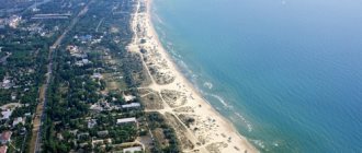
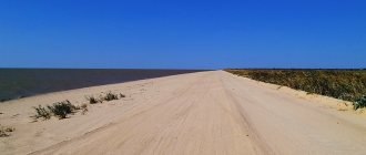
Khan Lake
The conversation is about the lake “zest” of the Yeisk region (which occupies the very northwestern end of the Kuban). The picturesque closed reservoir is located between the isthmus of Yasensky Bay, the Beysugsky Estuary and the mouth of the Yasen River (the entire “wet” settlement was named after it). The length of the water surface is 28 (including floodplains), and the greatest width is 7.7 km. Throughout the entire period, Khanskoye is surrounded by reeds, small floodplain bushes, and agricultural areas. And also tourist centers, for the sake of which guests of the Krasnodar region end up here. They are located on a small part of the perimeter facing the estuary (there are beaches consisting of a mixture of sand and shell rock).