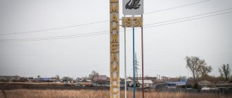
Dolinsk
(Sakhalin region)
OKATO code:
64212501
Founded:
1884
City since:
1946 City of regional subordination
Center:
Dolinsky district
The city was formerly called:
| Galkino-Vrasskoe | 1884 | 1905 |
| Ochiai | 1905 | 1946 |
| Telephone code (reference phone) | |
| 42442***** | — |
Deviation from Moscow time, hours:
8
Geographical latitude:
47°19′
Geographical longitude:
142°48′
Altitude above sea level, meters:
20 Sunrise and sunset times of the Sun and Moon in the city of Dolinsk
Climate
- Average annual air temperature - 3.3 °C
- Average wind speed - 6.7 m/s
| Climate of Dolinsk | |||||||||||||
| Index | Jan. | Feb. | March | Apr. | May | June | July | Aug. | Sep. | Oct. | Nov. | Dec. | Year |
| Average maximum, °C | −8,4 | −6,6 | −1,3 | 6,8 | 13,8 | 19,7 | 23,1 | 23,1 | 18,3 | 10,8 | 1,3 | −6,1 | 8,0 |
| Average temperature, °C | −12,6 | −11,4 | −6,1 | 2,3 | 8,7 | 14,1 | 17,6 | 18,1 | 13,6 | 6,7 | −2 | −9,8 | 3,3 |
| Average minimum, °C | −17,2 | −16,8 | −11,5 | −2 | 3,7 | 9,1 | 12,9 | 13,7 | 9,4 | 2,9 | −5,2 | −13,5 | −1,1 |
| Precipitation rate | 62,1 | 51,5 | 59,8 | 62,1 | 81,7 | 77,6 | 88,7 | 114,9 | 119,4 | 110,2 | 95,5 | 80 | 1001,8 |
| Source: [sakhalin-meteo.ru/dolinsk/pivot/temperature Meteorological statistics for the Sakhalin region] [www.worldclimate.com/cgi-bin/grid.pl?gr=N47E142 World Climate] | |||||||||||||
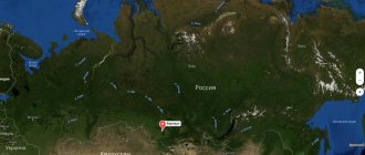
Map
| Dolinsk: maps |
Dolinsk: photo from space (Google Maps) Dolinsk: photo from space (Microsoft Virtual Earth)
| Dolinsk. Nearest cities. Distances in km. on the map (in brackets along roads) + direction. Using the hyperlink in the distance , you can get the route (information courtesy of the AutoTransInfo website) | |||
| 1 | Yuzhno-Sakhalinsk | 41 (44) | YU |
| 2 | Chekhov | 62 () | Z |
| 3 | Kholmsk | 64 (125) | SW |
| 4 | Aniva | 70 () | YU |
| 5 | Tomari | 74 () | NW |
| 6 | Korsakov | 76 (86) | YU |
| 7 | Nevelsk | 101 (127) | SW |
| 8 | Gornozavodsk | 111 () | SW |
| 9 | Krasnogorsk | 133 (292) | NW |
| 10 | Makarov | 144 (260) | WITH |
| 11 | Uglegorsk | 203 (362) | WITH |
| 12 | Shakhtersk | 210 () | WITH |
| 13 | Poronaysk | 212 (334) | WITH |
| 14 | Sovetskaya Gavan | 261 (431) | NW |
a brief description of
Located on the eastern coast of Sakhalin Island, 43 km north of Yuzhno-Sakhalinsk. Railway station.
Territory (sq. km): 2442
Information about the city of Dolinsk on the Russian Wikipedia site
Historical sketch
Founded in 1884 as the village of Galkino-Vrasskoye.
In 1905, in accordance with the Portsmouth Peace Treaty, it was transferred to Japan, and in 1945 it was returned to Russia. Liberated on August 25, 1945 by troops of the 2nd Far Eastern Front during the Yuzhno-Sakhalin operation.
Until 1946 it was called Otiai. The city of Dolinsk since 1946. The name may be from the Japanese ochi “valley, hollow,” which is apparently due to its location in the valley of the river. Susunay (Ainu nai “river, valley”) at the confluence of the river. Dolinka. In the past, the Ainu village of Siancha was located on the site of the city.
Economy
Pulp and paper mill, mechanical plant. Forestry (with arboretum). Fishing industry enterprises, production of building materials.
In the Dolinsky district - coal mining (Bykov village); vegetable growing, meat and dairy cattle breeding.
Architecture, sights
Near Dolinsk there is one of the most picturesque places in Sakhalin - Lake Lebyazhye (a waterfowl reserve).
| Population by year (thousands of inhabitants) | |||||||
| 1959 | 14.8 | 1998 | 14.5 | 2008 | 11.6 | 2016 | 11.8 |
| 1967 | 15 | 2000 | 14.0 | 2010 | 11.5 | 2017 | 11.7 |
| 1970 | 13.7 | 2001 | 13.8 | 2011 | 12.2 | 2018 | 11.8 |
| 1979 | 14.8 | 2003 | 12.6 | 2012 | 12.0 | 2019 | 11.7 |
| 1989 | 15.7 | 2005 | 12.0 | 2013 | 11.9 | 2020 | 11.9 |
| 1992 | 15.9 | 2006 | 11.7 | 2014 | 11.8 | 2021 | 11.8 |
| 1996 | 15.0 | 2007 | 11.6 | 2015 | 11.7 | ||
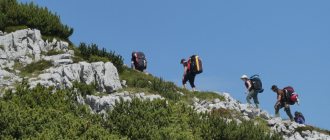
Hiking around Dolinsk
15:51 November 23, 2016
Tourism, Weekly, Dolinsk
The city of Dolinsk, like Yuzhno-Sakhalinsk, is located directly at the foot of the Susunaisky ridge. That's why I like to go there periodically and walk around its surroundings.
In the western part of this ridge, adjacent to the Susunai Valley, there are many interesting places: mountains, rivers, waterfalls. But the settlements between Yuzhno-Sakhalinsk and Dolinsk: Bereznyaki, Starorusskoye, Sokol are 2-5 km from the foot of the ridge, so before reaching the mountains and forests from them, you have to make “stupid” and boring crossings across fields. It’s different in Dolinsk: the town is small, you get to its eastern border and immediately find yourself in the forest!
There are many routes from there, and there are a number of attractions. For clarity, I will provide a map of the area east of Dolinsk.
Mount Pinda
I don’t know where it got such a funny name from. There are plenty of funny names on the map of Sakhalin that appeared after 1946.
Previously, there were locators on this mountain, like Mount Moskovskaya near Yuzhno-Sakhalinsk and Mount Bykov east of the village of Bereznyaki. Therefore, its common name is “Dolinskaya locator”. The locators have been gone for a long time, but the road to them remains, and their ruins remain.
The duration of the journey from Dolinsk station to the top of this mountain is 6.4 km. I will give a fragment of my description of the route up the mountain:
You should go east along Pobedy Avenue, which from the west ends at the Dolinsk railway station. After passing a small local hillock, the road crosses the Everon river creek and rises to the other side along a serpentine road, then passes between the ATP and the polytechnic center. Soon there will be a fork, you should turn right along it. Further, near the towers, there will be another fork, along which you should turn left. The road will leave the city and go a little down to a large stream, shown on detailed maps as Dolinka (not to be confused with the Dolinka River, which flows into the Sea of Okhotsk north of the village of Lesnoy - again the costs of the hasty renaming of geographical objects in 1946-47!).
After crossing the tributary of the stream and the stream itself, the road will begin to rise. There will be a fork, its height is 168 m above sea level. From there you should turn right. Next comes a long climb to the top itself.
The very top of this mountain is already 391 m above sea level - thus, on the remaining 2 km of the path there will be a climb of 223 meters.
For a long time there was no access to this mountain while locators were on it. And only in 2012, while in those parts, I somehow noticed that the locators had been removed. Well, I visited that mountain with my comrades for the first time on November 25 of that year. Here are a few photos from that trip.
Ruins on a terrace near the top of the mountain. At the very top there are skeletons of towers (currently only one tower has survived).
The foundation of one of the domes (there are 5 such foundations in total).
It was low cloudy at the time, so there were no views from the top of the mountain.
A week later we discovered another route to that mountain. We went together with Marina Shishmareva.
There are now 2 parks in Dolinsk - it’s rare to find such a city on Sakhalin! The new park was created several years ago, on the site of the arboretum territory that was once closed and founded by the Japanese. Being surrounded on all sides by buildings, it leaves the impression of an ordinary square, of which there are plenty in other cities. But the old park, which naturally turns into a forest and organically fits into the natural landscape, like the park named after Yu. A. Gagarin in Yuzhno-Sakhalinsk, is located at the top, behind Pionerskaya Street. Now it is just a forest area, seemingly deprived of park status. It also has ski slopes.
Then we walked through the old park to the southeast, along a path laid on the watershed between the Izluchnaya and Everon rivers. Having walked 2.9 km from the city border, we came to a fork. From there, to the left, to the northeast, the path crosses the Everon River ford, and, being heavily overgrown, leads to the slope of Mount Pinda, 500 m above the fork, from which, following the main road, you should turn to the top. It’s interesting that that road is so overgrown that when climbing to the top along the main road, its exit is simply impossible to notice if you don’t know it!
2 years have passed. I began to remember places where I had once been, but I would like to visit again. Eureka! I remembered this mountain, and all the more I wanted to visit its peak in good weather. I suggested it to my acquaintances, and they suggested it to their acquaintances, and as a result, a decent number of people wanted to visit that mountain, of which only me and two more of my comrades had previously been there. We are all residents of Yuzhno-Sakhalinsk.
We left for Dolinsk on November 16, 2014 by regular bus, and there were as many as 17 of us! Fortunately, the bus was big and could accommodate everyone.
We reached the top of the mountain along the main road, as we did the first time, its track was recorded in my navigator. This time the weather allowed us to see beautiful panoramas, which we were deprived of 2 years ago. Moreover, neither foliage nor grass got in the way. Except that there was a cold wind at the top, from which we took refuge in the ruins during lunch.
View to the east, to Mount Kiselevka. It is slightly higher than Pinda and has a height of 427 m above sea level.
View to the southeast, to the Susunaisky ridge.
View to the north - people are examining the remaining frame of the structure with interest. In the background is the Sea of Okhotsk.
Another 2 years passed, and on November 5, 2021 I visited there again. This time there were four of us, and three of my companions had not been there before. We walked along the main road. And the weather made us even happier: even at the top it was completely calm! Taking our time, we fully enjoyed the beautiful views.
Mount Kiselevka again. As a result of the hurricane that took place on October 2, 2015, its western slope was littered with windbreaks
But what does Mount Pinda itself look like? It is visible from Dolinsk, but poorly.
On November 29, 2014, walking along the right bank of the Naiba River along its lower reaches, I saw this landscape. In the foreground: on the left is Mount Kiselevskaya, on the right is Mount Pinda with a flat top, in the background are two higher mountains of the Susunaisky range.
An interesting pattern - I visited Mount Pinda strictly in November. But in its vicinity there are many more interesting places, which will be discussed further.
From the pass the shortest route to the coast
As described above, before reaching the top of Mount Pinda, there will be a fork along the way at a height of 168 m above sea level. A total of 3 roads lead from it. If you look in the direction of travel, then go right towards the mountain itself. To the left is some kind of logging road. But directly from it, to the northeast, the road, after about 2 km, will lead to the pass between the Pinda and Sayanetskaya mountains, its height is 205 m above sea level.
At the pass itself there is another fork. If you turn left from it, the path goes around Mount Sayanetskaya and drops steeply down to the Pchelina River, then it spreads out into dead ends.
You can go off-road along the Pchelinaya riverbed on the coast of the Sea of Okhotsk: it is best in the second half of May or late autumn, when there is no grass. As a result, you come to a fishing camp located on the right bank of the river - this area is colloquially known as “Rure”. From there you can walk to Starodubsky in 2-2.5 hours.
The last time we went like this was on November 30, 2013, it was just the two of us with Viktor Boyko.
Having left Yuzhno-Sakhalinsk for Dolinsk at 7:30 am, we reached Starodubskoye by 16:30.
Author on the river Pchelina. Using the navigator, I figured out how much was left to the mouth.
Along the way, some ruins were discovered near the shore.
From the pass east to the coast
On many maps, even old 2-kilometer maps (i.e., scale 1 cm 2 km), from the above-mentioned pass 205 m above sea level, a path to the east is shown, leading to the coast of the Sea of Okhotsk already 1.5 km south of the cape Senyavin. In total, the route from Dolinsk to the coast this way is 13 km.
Yes, the route is long, then you have to return, for example, to Starodubskoye. I walked along it back in 1992, and then I was able to leave thanks to the fact that a direct train to Yuzhno-Sakhalinsk left Starodubsky at about 20 o’clock. Now there is no trace left of the section of the railway between Dolinsk and Starodubsky - it has been completely swallowed up by trees and bushes.
I once discussed the possibility of taking that route with some tourists I knew. But here’s the problem: even if you leave Yuzhno-Sakhalinsk for Dolinsk early in the morning, you can only get to Starodubskoye at 20 o’clock. How can you get out of there then? All buses would be guaranteed to be missed. In this case, we needed transportation by registered transport at least to Sokol, from where we could transfer to the train going from Bykov to Yuzhno-Sakhalinsk late in the evening.
I created a topic on the forum about this. A resident of Dolinsk, Pavel, responded. He didn’t mention himself in that thread, but wrote me a personal message: “I can also offer my services in delivering a group from Starodubskoye to Sokol. A Delica minibus is available. But in this case, I will need to know about this in advance, a couple or three days in advance, in order to give you a specific answer.”
Within a few days, we decided on the date of the route: it was scheduled for August 2, 2014. Pavel had 8 seats in the minibus, and there were just 8 of us tourists.
We arrived in Dolinsk around 9 o'clock in the morning. At the station square we met with Pavel and agreed that he would arrive at the gate of the fishing camp near the mouth of the Pchelina at 18:00: we calculated that we would have to arrive there by then. After which we set off. This time we turned right from the pass, and after a steep descent we went down a long, gentle section with the intersection of small streams.
We reached the coast after 13:00. 1.2 km south of where we went there, i.e. a little off the route, there is a beautiful waterfall near the mouth of the Lukoshka river, I have known about it for a long time. He suggested we take a walk to see him; we had to meet the allotted time.
Those who wished took a swim in the hole under the waterfall, after which we had lunch and turned north. We easily went around Cape Senyavin along the bottom.
And exactly at 18:00 we passed the gates of the camp, where Pavel was already waiting for us. He took us to Dolinsk, where we boarded a regular bus heading to Yuzhno-Sakhalinsk.
It was a good hike: a fairly long route, through beautiful places, and even in warm, comfortable weather.
Shore of waterfalls
A waterfall near the mouth of the Lukoshka River can be unknowingly confused with Finnova Falls, described in the book “Waterfalls” by A. Klitin, P. Brovko and A. Gorbunov, published in 2013. Information about the latter is given there on page 38: it is located at the mouth of an unnamed stream and is named after the writer Mikhail Finnov, who lived for some time in a hunting hut located somewhere higher along this stream and wrote a number of his works there. No other waterfalls in that area are mentioned in the book.
Finnova Falls itself is located 1.6 km southeast of the mouth of Lukoshka.
In fact, there is an entire “Coast of Waterfalls” in that area! Daniil Demkin told me about the waterfalls on the Listvennaya and Berezovaya rivers, and Victor Volyanuk told me about the waterfall on the Uda River.
The four of us, including Finnova Falls, examined them on June 21, 2015.
If you walk 2.6 km to the southeast from Finnova Falls, you will come to a waterfall near the mouth of the Listvennaya River.
Another 800 m to the southeast, on the Berezovaya River, 100 m from the mouth there is a waterfall. Its structure resembles the iconic so-called “Cheremshansky” waterfall on the Yellow River in the Tomarinsky district.
After 600 m to the southeast, on the Uda River there is a three-cascade waterfall. The photo shows a fragment of it: due to the folds of the terrain, it was not possible to photograph this entire waterfall.
On the map given at the beginning of the material, all these waterfalls are marked in red.
How to get to them in a rational way?
If you focus on the road starting on the southern outskirts of Dolinsk and passing by Cape Ostroy to the mouth of the Sima River, then east of the pass through the ridge a side road departs from it to the northeast, leading to the mouth of the Elm River. From it, all the described waterfalls are easily accessible on foot: to Uda to the southeast, and to Lukoshka to the northwest.
You can also take another side road to the mouth of the Kema River, from there it is 400 m to Lukoshka.
And finally, the main road itself from Dolinsk, at the intersection with the Uda River, comes quite close to the coast.
***
There are still many mysteries in that area.
For example, is it possible to climb Mount Kiselevka? My friends, with some of them we went to Mount Pinda, recently did this successfully. But the route is quite difficult and exhausting: on the way back there was again a steep climb.
It is possible that waterfalls exist near the mouths of the Dozornaya and Minutka rivers, a little north of Cape Ostrogo.
Well, the main mystery: a mysterious waterfall in the Izluchnaya River basin. Information about him was received from several people. It was last observed in November 2012. I was told its approximate location. If on the road from the southern outskirts of Dolinsk, which leads to the mouth of the Sima River, you pass the “Warm Valley” dacha area, then after 3 km there will be a turn to the quarry. After the turn, the main road rises up along the Izluchnaya River. That waterfall was seen on one of its tributaries near the road. Several friends and I combed that area twice in the second half of October 2021, when there was no longer any foliage or grass, but... we didn’t find the waterfall! Who knows: maybe it turned out to be covered with windfall formed as a result of recent hurricanes? Or maybe as a result of a flood or some cyclone, the channel of that tributary changed? I believe that the search can be resumed no earlier than mid-May, which is what I urge concerned readers to do.
Valery Khmara.
News Agency Sakh.com
- 13844
- 6
- 18
- 2
- To favorites
- Send
- Error
- Share
- Link
Story
At the current site of the city there was an Ainu settlement of Ziancha
until 1884, when the Russian village of
Galkino-Vraskoe
(named after Mikhail Galkin-Vraskoe) was founded.
[ citation needed
] The Treaty of Portsmouth placed it under Japanese control in 1905 along with the rest of southern Sakhalin.
The Japanese gave it the status of a machi
(city) called
Ochiai
.
The Red Army regained control of all of Sakhalin in 1945, during the closing stages of World War II. In 1946, the city received its current name, which roughly translates to city in the valley
.
Since the 1940s, the city's population has dropped by more than half, from 25,135 people in 1941 to 12,200 residents recorded in the 2010 census.
Excerpt characterizing Dolinsk
Rostov let his horse go and wanted to ride on. A wounded officer walking past turned to him. -Who do you want? – asked the officer. - Commander-in-Chief? So he was killed by a cannonball, killed in the chest by our regiment. “Not killed, wounded,” another officer corrected. - Who? Kutuzov? - asked Rostov. - Not Kutuzov, but whatever you call him - well, it’s all the same, there aren’t many alive left. Go over there, to that village, all the authorities have gathered there,” said this officer, pointing to the village of Gostieradek, and walked past. Rostov rode at a pace, not knowing why or to whom he would go now. The Emperor is wounded, the battle is lost. It was impossible not to believe it now. Rostov drove in the direction that was shown to him and in which a tower and a church could be seen in the distance. What was his hurry? What could he now say to the sovereign or Kutuzov, even if they were alive and not wounded? “Go this way, your honor, and here they will kill you,” the soldier shouted to him. - They'll kill you here! - ABOUT! what are you saying? said another. -Where will he go? It's closer here. Rostov thought about it and drove exactly in the direction where he was told that he would be killed. “Now it doesn’t matter: if the sovereign is wounded, should I really take care of myself?” he thought. He entered the area where most of the people fleeing from Pratsen died. The French had not yet occupied this place, and the Russians, those who were alive or wounded, had long abandoned it. On the field, like heaps of good arable land, lay ten people, fifteen killed and wounded on every tithe of space. The wounded crawled down in twos and threes together, and one could hear their unpleasant, sometimes feigned, as it seemed to Rostov, screams and moans. Rostov started to trot his horse so as not to see all these suffering people, and he became scared. He feared not for his life, but for the courage that he needed and which, he knew, would not withstand the sight of these unfortunates. The French, who stopped shooting at this field strewn with the dead and wounded, because there was no one alive on it, saw the adjutant riding along it, aimed a gun at him and threw several cannonballs. The feeling of these whistling, terrible sounds and the surrounding dead people merged for Rostov into one impression of horror and self-pity. He remembered his mother's last letter. “What would she feel,” he thought, “if she saw me now here, on this field and with guns pointed at me.” In the village of Gostieradeke there were, although confused, but in greater order, Russian troops marching away from the battlefield. The French cannonballs could no longer reach here, and the sounds of firing seemed distant. Here everyone already saw clearly and said that the battle was lost. Whoever Rostov turned to, no one could tell him where the sovereign was, or where Kutuzov was. Some said that the rumor about the sovereign’s wound was true, others said that it was not, and explained this false rumor that had spread by the fact that, indeed, the pale and frightened Chief Marshal Count Tolstoy galloped back from the battlefield in the sovereign’s carriage, who rode out with others in the emperor’s retinue on the battlefield. One officer told Rostov that beyond the village, to the left, he saw someone from the higher authorities, and Rostov went there, no longer hoping to find anyone, but only to clear his conscience before himself. Having traveled about three miles and having passed the last Russian troops, near a vegetable garden dug in by a ditch, Rostov saw two horsemen standing opposite the ditch. One, with a white plume on his hat, seemed familiar to Rostov for some reason; another, unfamiliar rider, on a beautiful red horse (this horse seemed familiar to Rostov) rode up to the ditch, pushed the horse with his spurs and, releasing the reins, easily jumped over the ditch in the garden. Only the earth crumbled from the embankment from the horse’s hind hooves. Turning his horse sharply, he again jumped back over the ditch and respectfully addressed the rider with the white plume, apparently inviting him to do the same. The horseman, whose figure seemed familiar to Rostov and for some reason involuntarily attracted his attention, made a negative gesture with his head and hand, and by this gesture Rostov instantly recognized his lamented, adored sovereign. “But it couldn’t be him, alone in the middle of this empty field,” thought Rostov. At this time, Alexander turned his head, and Rostov saw his favorite features so vividly etched in his memory. The Emperor was pale, his cheeks were sunken and his eyes sunken; but there was even more charm and meekness in his features. Rostov was happy, convinced that the rumor about the sovereign’s wound was unfair. He was happy that he saw him. He knew that he could, even had to, directly turn to him and convey what he was ordered to convey from Dolgorukov. But just as a young man in love trembles and faints, not daring to say what he dreams of at night, and looks around in fear, looking for help or the possibility of delay and escape, when the desired moment has come and he stands alone with her, so Rostov now, having achieved that , what he wanted more than anything in the world, did not know how to approach the sovereign, and he was presented with thousands of reasons why it was inconvenient, indecent and impossible. "How! I seem to be glad to take advantage of the fact that he is alone and despondent. An unknown face may seem unpleasant and difficult to him at this moment of sadness; Then what can I tell him now, when just looking at him my heart skips a beat and my mouth goes dry?” Not one of those countless speeches that he, addressing the sovereign, composed in his imagination, came to his mind now. Those speeches were mostly held under completely different conditions, they were spoken for the most part at the moment of victories and triumphs and mainly on his deathbed from his wounds, while the sovereign thanked him for his heroic deeds, and he, dying, expressed his love confirmed in fact my. “Then why should I ask the sovereign about his orders to the right flank, when it is already 4 o’clock in the evening and the battle is lost? No, I definitely shouldn’t approach him. Shouldn't disturb his reverie. It’s better to die a thousand times than to receive a bad look from him, a bad opinion,” Rostov decided and with sadness and despair in his heart he drove away, constantly looking back at the sovereign, who was still standing in the same position of indecisiveness. While Rostov was making these considerations and sadly driving away from the sovereign, Captain von Toll accidentally drove into the same place and, seeing the sovereign, drove straight up to him, offered him his services and helped him cross the ditch on foot. The Emperor, wanting to rest and feeling unwell, sat down under an apple tree, and Tol stopped next to him. From afar, Rostov saw with envy and remorse how von Tol spoke for a long time and passionately to the sovereign, and how the sovereign, apparently crying, closed his eyes with his hand and shook hands with Tol. “And I could be in his place?” Rostov thought to himself and, barely holding back tears of regret for the fate of the sovereign, in complete despair he drove on, not knowing where and why he was going now. His despair was the greater because he felt that his own weakness was the cause of his grief. He could... not only could, but he had to drive up to the sovereign. And this was the only opportunity to show the sovereign his devotion. And he didn’t use it... “What have I done?” he thought. And he turned his horse and galloped back to the place where he had seen the emperor; but there was no one behind the ditch anymore. Only carts and carriages were driving. From one furman, Rostov learned that the Kutuzov headquarters was located nearby in the village where the convoys were going. Rostov went after them. The guard Kutuzov walked ahead of him, leading horses in blankets. Behind the bereytor there was a cart, and behind the cart walked an old servant, in a cap, a sheepskin coat and with bowed legs. - Titus, oh Titus! - said the bereitor. - What? - the old man answered absentmindedly. - Titus! Go threshing. - Eh, fool, ugh! – the old man said, spitting angrily. Some time passed in silent movement, and the same joke was repeated again. At five o'clock in the evening the battle was lost at all points. More than a hundred guns were already in the hands of the French. Przhebyshevsky and his corps laid down their weapons. Other columns, having lost about half of the people, retreated in frustrated, mixed crowds. The remnants of the troops of Lanzheron and Dokhturov, mingled, crowded around the ponds on the dams and banks near the village of Augesta. At 6 o'clock only at the Augesta dam the hot cannonade of the French alone could still be heard, who had built numerous batteries on the descent of the Pratsen Heights and were hitting our retreating troops. In the rearguard, Dokhturov and others, gathering battalions, fired back at the French cavalry that was pursuing ours. It was starting to get dark. On the narrow dam of Augest, on which for so many years the old miller sat peacefully in a cap with fishing rods, while his grandson, rolling up his shirt sleeves, was sorting out silver quivering fish in a watering can; on this dam, along which for so many years the Moravians drove peacefully on their twin carts loaded with wheat, in shaggy hats and blue jackets and, dusted with flour, with white carts leaving along the same dam - on this narrow dam now between wagons and cannons, under the horses and between the wheels crowded people disfigured by the fear of death, crushing each other, dying, walking over the dying and killing each other only so that, after walking a few steps, to be sure. also killed. Every ten seconds, pumping up the air, a cannonball splashed or a grenade exploded in the middle of this dense crowd, killing and sprinkling blood on those who stood close. Dolokhov, wounded in the arm, on foot with a dozen soldiers of his company (he was already an officer) and his regimental commander, on horseback, represented the remnants of the entire regiment. Drawn by the crowd, they pressed into the entrance to the dam and, pressed on all sides, stopped because a horse in front fell under a cannon, and the crowd was pulling it out. One cannonball killed someone behind them, the other hit in front and splashed Dolokhov’s blood. The crowd moved desperately, shrank, moved a few steps and stopped again. Walk these hundred steps, and you will probably be saved; stand for another two minutes, and everyone probably thought he was dead. Dolokhov, standing in the middle of the crowd, rushed to the edge of the dam, knocking down two soldiers, and fled onto the slippery ice that covered the pond. “Turn,” he shouted, jumping on the ice that was cracking under him, “turn!” - he shouted at the gun. - It’s holding!... The ice was holding it, but it was bending and cracking, and it was obvious that not only under a gun or a crowd of people, but under him alone, it would now collapse. They looked at him and huddled close to the shore, not daring to step on the ice yet. The regiment commander, standing on horseback at the entrance, raised his hand and opened his mouth, addressing Dolokhov. Suddenly one of the cannonballs whistled so low over the crowd that everyone bent down. Something splashed into the wet water, and the general and his horse fell into a pool of blood. No one looked at the general, no one thought to raise him.
Notes
- ↑ 123
www.gks.ru/free_doc/doc_2016/bul_dr/mun_obr2016.rar Population of the Russian Federation by municipalities as of January 1, 2021 - [www.russianpost.ru/PostOfficeFindInterface/FindOPSByPostOfficeID.aspx?index=694051 Information about the post office on the Russian Post website]
- [dolinsk-sakh.narod.ru/index.html Website of the city of Dolinsk]
- [www.dolinsksite.ru/history History of the Municipal Municipality "Dolinsky"]. 2011-01-13
. Administration of the municipal district "Dolinsky". Retrieved June 30, 2012. [www.webcitation.org/69gM8E9IO Archived from the original on August 5, 2012]. - [dolinsk-sakh.narod.ru/geo-dolinsk.html city of Dolinsk]. Website of the city of Dolinsk (April 1, 2010). Retrieved October 24, 2014. [www.webcitation.org/68f5rvbZ8 Archived from the original on June 24, 2012].
- Administration of the governorate of Karafuto.
[kindai.ndl.go.jp/info:ndljp/pid/975896 1925 Census Results: Households and Population]. - Toyohara, 1926. - pp. 18-27. — 30 s. - Administration of the governorate of Karafuto.
[kindai.ndl.go.jp/info:ndljp/pid/1462110 1935 Census Results: Households and Population]. - Toyohara, 1936. - pp. 15-19. — 25 s. - [demoscope.ru/weekly/ssp/rus59_reg2.php All-Union Population Census of 1959. The size of the urban population of the RSFSR, its territorial units, urban settlements and urban areas by gender] (Russian). Demoscope Weekly. Retrieved September 25, 2013. [www.webcitation.org/6GDOghWC9 Archived from the original on April 28, 2013].
- ↑ 1234567891011
www.MojGorod.ru/sahalin_obl/dolinsk/index.html People's encyclopedia “My City”. Dolinsk - [demoscope.ru/weekly/ssp/rus70_reg2.php All-Union Population Census of 1970 The size of the urban population of the RSFSR, its territorial units, urban settlements and urban areas by gender.] (Russian). Demoscope Weekly. Retrieved September 25, 2013. [www.webcitation.org/6GDOiMstp Archived from the original on April 28, 2013].
- [demoscope.ru/weekly/ssp/rus79_reg2.php All-Union Population Census of 1979 The size of the urban population of the RSFSR, its territorial units, urban settlements and urban areas by gender.] (Russian). Demoscope Weekly. Retrieved September 25, 2013. [www.webcitation.org/6GDOjhZ5L Archived from the original on April 28, 2013].
- [demoscope.ru/weekly/ssp/rus89_reg2.php All-Union Population Census of 1989. Urban population]. [www.webcitation.org/617x0o0Pa Archived from the original on August 22, 2011].
- [www.perepis2002.ru/ct/doc/1_TOM_01_04.xls All-Russian Population Census 2002. Volume. 1, table 4. Population of Russia, federal districts, constituent entities of the Russian Federation, districts, urban settlements, rural settlements - regional centers and rural settlements with a population of 3 thousand or more]. [www.webcitation.org/65AdCU0q3 Archived from the original on February 3, 2012].
- [www.gks.ru/bgd/regl/B09_109/IssWWW.exe/Stg/d01/tabl-21-09.xls Number of permanent population of the Russian Federation by cities, urban-type settlements and districts as of January 1, 2009]. Retrieved January 2, 2014. [www.webcitation.org/6MJmu0z1u Archived from the original on January 2, 2014].
- [sakhalinstat.gks.ru/wps/wcm/connect/rosstat_ts/sakhalinstat/resources/b7451680420c302db621fe2d59c15b71/5.pdf All-Russian Population Census 2010. Sakhalin region. Population of urban districts, municipal districts, urban and rural settlements, urban settlements, rural settlements]. Retrieved July 28, 2014. [www.webcitation.org/6RPB9plO8 Archived from the original on July 28, 2014].
- www.gks.ru/dbscripts/munst/munst64/DBInet.cgi?pl=8112027 Sakhalin region. Estimated resident population as of January 1, 2011-2016
- [www.gks.ru/free_doc/doc_2012/bul_dr/mun_obr2012.rar Population of the Russian Federation by municipalities. Table 35. Estimated resident population as of January 1, 2012]. Retrieved May 31, 2014. [www.webcitation.org/6PyOWbdMc Archived from the original on May 31, 2014].
- [www.gks.ru/free_doc/doc_2013/bul_dr/mun_obr2013.rar Population of the Russian Federation by municipalities as of January 1, 2013. - M.: Federal State Statistics Service Rosstat, 2013. - 528 p. (Table 33. Population of urban districts, municipal districts, urban and rural settlements, urban settlements, rural settlements)]. Retrieved November 16, 2013. [www.webcitation.org/6LAdCWSxH Archived from the original on November 16, 2013].
- [www.gks.ru/free_doc/doc_2014/bul_dr/mun_obr2014.rar Table 33. Population of the Russian Federation by municipalities as of January 1, 2014]. Retrieved August 2, 2014. [www.webcitation.org/6RWqP50QK Archived from the original on August 2, 2014].
- [www.gks.ru/free_doc/doc_2015/bul_dr/mun_obr2015.rar Population of the Russian Federation by municipalities as of January 1, 2015]. Retrieved August 6, 2015. [www.webcitation.org/6aaNzOlFO Archived from the original on August 6, 2015].
- Skibina A.G.
[encsakhalin.ru/object/1804669741?lc=ru Orlov Nikolay Kozmich, doctor, Honorary Citizen of Dolinsk].
Healthcare/Personnel
. Encyclopedia of the Sakhalin region. Retrieved November 30, 2013. [www.peeep.us/8407240a Archived from the original on November 30, 2013].