For other places with the same name, see Vyazemsky (populated area).
City in Khabarovsk Krai, Russia
| Vyazemsky Vyazemsky | |
| City [1] | |
| Administrative building, Vyazemsky | |
| Location of Vyazemsky | |
| Vyazemsky Location of Vyazemsky Show map of Russia Vyazemsky Vyazemsky (Khabarovsk Territory) Show map of Khabarovsk Territory | |
| Coordinates: 47°31′30″N 134°45′26″E / 47.52500°N 134.75722°E / 47.52500; 134.75722 Coordinates: 47°31′30″N 134°45′26″E / 47.52500°N 134.75722°E / 47.52500; 134.75722 | |
| A country | Russia |
| Federal subject | Khabarovsk region [1] |
| Administrative region | Vyazemsky district [1] |
| Based | 1895 [2] |
| City status from | 1951 |
| Government | |
| • Mayor | Victor Shashkun |
| Height | 60 m (200 ft) |
| population size (2010 Census) [3] | |
| • General | 14 555 |
| Administrative status | |
| • Capital from | Vyazemsky district [4] |
| Municipal status | |
| • Municipal district | Vyazemsky municipal district [5] |
| • Urban village | Vyazemsky urban village [5] |
| • Capital from | Vyazemsky municipal district [5], Vyazemsky urban settlement [5] |
| Timezone | UTC+10 (MSK+7[6]) |
| Postal code [7] | 682950 |
| Dialing code(s) | +7 42153 |
| OKTMO ID | 08617101001 |
| Web site | Vyazemsky .habkrai .ru |
Vyazemsky
(Russian: Vyazemsky) is a city and the administrative center of Vyazemsky District in Khabarovsk Krai, Russia, located 130 km (81 mi) southwest of Khabarovsk, the administrative center of the region, near the Ussuri River and on the border with China. Population: 14,555 (2010 census); [3] 15,760 (2002 census); [8] 18,426 people (1989 census).[9]
Links[edit]
Notes[edit]
- ^ abcd Resolution No. 143-pr
- ^ ab Encyclopedia of Russian Cities
. Moscow: Great Russian Encyclopedia. 2003. p. 98. ISBN 5-7107-7399-9. - ^ a b Federal State Statistics Service (2011). “All-Russian Population Census 2010. Volume 1" [All-Russian Population Census 2010, vol. 1]. All-Russian Population Census 2010 [All-Russian Population Census 2010]
. Federal State Statistics Service. - ^ ab State Committee of the Russian Federation on Statistics. Committee of the Russian Federation for Standardization, Metrology and Certification. No. OK 019-95 January 1, 1997 “All-Russian classifier of objects of administrative-territorial division. Code 08 217”, ed. changes No. 278 / 2015 of January 1, 2021. (Goskomstat of the Russian Federation. Committee of the Russian Federation for Standardization, Metrology and Certification. No. OK 019-95 January 1, 1997. Russian classification of administrative divisions) (OKATO).
Code 08 217 , as amended by Amendment No. 278/2015 dated 01/01/2016). - ^ abcde Law No. 191
- "On the Calculation of Time". Official Internet portal of legal information
. June 3, 2011. Retrieved January 19, 2021. - Post office. Information and computing center of OASU RPO. ( Post office
).
Search for postal service objects ( postal Search for objects
) (in Russian) - ↑
Federal State Statistics Service of Russia (May 21, 2004).
“The population of Russia, the constituent entities of the Russian Federation as part of federal districts, urban settlements, settlements, settlements of 3 thousand or more people” [Population of Russia, its federal districts, federal districts, districts, urban settlements, rural settlements - administrative centers and rural settlements with a population of more than 3,000 people] (XLS). All-Russian Population Census 2002
. - “All-Union Population Census of 1989. The current population of union and autonomous republics, autonomous regions and districts, territories, negative phenomena, urban settlements and rural district centers” [All-Union Population Census of 1989: current population of union and autonomous republics, Autonomous regions and districts , territories, regions, districts, towns and villages performing the functions of district administrative centers. All-Union Population Census of 1989 [All-Union Population Census of 1989]
.
Institute of Demography of the National Research University: Higher School of Economics [Institute of Demography of the National Research University: Higher School of Economics]. 1989 - via Demoscope Weekly
.
LiveInternetLiveInternet
VitaleGo
all posts by the author
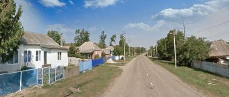
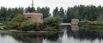
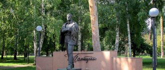
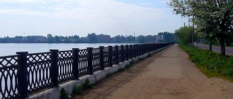
District center The district center is the city of Vyazemsky (founded in 1951), which is located 130 kilometers south of Khabarovsk. The city is spread out on the terraces of two small rivers - the First and Second Seventh, near their confluence with the Ussuri. The city received its name in honor of the Russian engineer O.P. Vyazemsky, the leader of the construction of the Ussuri Railway. General information Vyazemsky district is the southern region of the Khabarovsk Territory. The distance from the regional center is 130 kilometers”>130 kilometers, with which it is connected by the railway and the Khabarovsk-Vladivostok highway. In the north and east it borders with the districts named after. Lazo, in the south with the Bikinsky district, in the west along the Ussuri River with the People's Republic of China. Vyazemsky district was formed on July 22, 1934. Attractions of the area The main attractions of the area are Lotus Lake in the village of Sheremetyevo, Vidnoye, a mineral water spring in the village of Shumny, a warm spring.
lotus lake
Famous people of the region Usenko Nikolai Vasilievich, Honored Forester of the RSFSR, Honorary Member of the All-Russian Society for Nature Conservation, Honorary Citizen; Aspidov Ivan Fedorovich - artist; Baglay Nikolai Trofimovich - artist; Okolov Viktor Leonidovich - Doctor of Medical Sciences (former graduate of school No. 3 of the city of Vyazemsky), lives in the city of Yesentuki; Zeki Oleg Georgievich – academician of medical sciences (former graduate of school No. 2 in the city of Vyazemsky); Murashev Alexander Mikhailovich - professor of the Far Eastern People's Academy of Sciences (former graduate of school No. 3 in the city of Vyazemsky); Vlasenko Valery Vasilievich - Lieutenant General of the Railway Troops; Efremova Raisa Davydovna - Honorary Citizen of the city of Vyazemsky, Honored Teacher of the RSFSR. Brief history The history of the development and settlement of the Vyazemsky region is inextricably linked with the history of the settlement of the entire Amur region and Primorye; it is interesting and original. A lot of valuable information about the progress of the settlement of the Far East in the first years after its final inclusion in Russia is reported by the famous Russian traveler and geographer M.I. Venyukov, whose name is given to one of the villages of the Vyazemsky district, this village was one of the first to arise in the region, along with the villages: Kukelevo, Budogosskoye (now Zabaikalskoye), Kedrovo and Sheremetyevo in 1859, they still exist today, and Dolchenko, Kiselevo, Trekhsetitelskaya – these villages no longer exist. They were located along the bank of the Ussuri River. M.I. Venyukov walked on foot from the Ussuri post (now Khabarovsk) to the Sea of Japan. The scientist was the first to give a geographical description of the Ussuri region and drew the first accurate map of the Ussuri River, in the basin of which our Vyazemsky district is located. In 1858 M.I. Venyukov compiled a “Overview of the Ussuri River and the lands east of it to the sea” and a map that included a description of the Vyazemsky region. The Vyazemsky district is one of the most tempting corners of the Far East for an archaeologist. There are many remains of ancient settlements here: rock paintings (Petrogryphs) and a settlement with a defensive moat, inside which are the remains of semi-underground dwellings with pits - pits from the hearth near the village. Sheremetyevo. The process of development of the Amur and Primorye regions by Russian explorers began back in the 40s of the 17th century, when, in a short time, a party of enterprising Cossacks led by V.D. Poyarkova, E.P. Khabarova, O.S. Stepanova, N.R. Chernigovsky and others brought the local population into Russian citizenship, who suffered from the bondage of the militant Manchus. During these years, in our area along the coast of the river. The Ussuri and at the mouths of its tributaries lived separate camps of Nanais (Golds), who were engaged in fishing and hunting. They had a tribal system. Active settlement by Russians of the Vyazemsky district, as well as the entire Khabarovsk Territory, began in the mid-19th century. This was explained by the need to strengthen the new borders of Russia - the lands of the Far East. The construction of the railway further revitalized the Far Eastern region, and it did not bypass the Vyazemsky district. Part of the territory along the Ussuri River between Khabarovsk and Vladivostok falls in the Vyazemsky district, where the Ussuri railway ran, the construction of which was carried out on both sides. It was headed by engineer Orest Polienovich Vyazemsky, who shortened the construction time (by a year), reduced costs by 2 million gold rubles, shortened the route by 17 km and diverted it from the Ussuri River in the Bikinsky district. The Vyazemsky district bears the name of this wonderful man. One of the first peasant villages in the region, Vyazemskoye, was founded in 1895. It was then that 17 households arrived and settled here, among them 15 peasants - migrants and exiles, and 2 Cossacks. In 1899, the Cossack administration moved 3 more Cossack families into the village and filed a petition for the official formation of the Cossack settlement of Glenovsky here, named after the ataman. This is how the settlement was divided into peasant (Vyazemsky) and Cossack (Glenovsky). In the early years, the permanent population of both villages grew slowly. So at the end of 1900, only 36 householders lived here, of which 17 peasants, 8 Cossacks, 5 exiled settlers. 20 years after its founding, the population of Vyazemskaya consisted of 885 people, and the population of the Vyazemskaya volost before the revolution was a total of 8179 people. In 1901, Kapitonovka, Tigrovo, and Krasitskoye arose from the settlers of the Poltava province. In 1908, settlers from Kamenets-Podolsk founded Yaroslavka. At the same time, Kotikovo and Sobolevo were settled. In 1909, the Roskoshansky area (the villages of Roskosh and the villages of Vinogradovka) was populated. The new settlers found themselves in much worse conditions compared to the old-timers - the Cossacks who took the developed lands, and the peasants were pushed into the taiga. Under pressure from the peasants, the tsarist authorities in 1913 transferred part of the lands assigned to the Cossacks to the resettlement management fund. All the peasants of the village at this time were united into two volosts: Vyazemskaya and Dormidontovskaya. They also belonged to the Khabarovsk district. The final construction of the Siberian Railway allowed not only peasants and Cossacks to move to the Far East, but also the “Growing” working class, which our region needed. Until 1917, Vyazemtsy had neither real industrial nor agricultural production. The entire economy of the region was represented by a locomotive depot and several handicraft workshops. Culture, healthcare, education in the pre-October period were in a deplorable state, the working population suffered from kulaks, entrepreneurs, not only their own, but also foreign ones. Industry was backward and private in nature. After the revolution in 1917, Soviet power was established in all peasant and Cossack villages of the Vyazemskaya volost. In February, the Vyazemsk volost government was dissolved and the volost Council of Workers, Peasants and Cossack Deputies began to work. The Vyazemskaya volost was not spared by the civil war and intervention, which brought hunger and ruin to all villages and villages. With the establishment of peaceful life in the Far Eastern lands, the people began a creative life, increasing the wealth of their native land. In the late 20s and early 30s, the economy was aimed at developing the timber industry and creating a food base. During the first five-year plans, new industrial enterprises were created in the region: a power station, repair shops, a bakery, a brick factory, a printing house, the Dormidontovsky sawmill, the Vyazemsky, Voroshilovsky and Dormidontovsky timber industry enterprises. The economy of the region began to develop rapidly in the post-war years, new enterprises were created - a wood processing plant, a dairy plant, a vegetable canning plant, a repair and mechanical plant, eight new workshops, two industrial boiler houses, and a refrigerator were put into operation. Until 1934, there was a constant change in the composition and area of the Vyazemskaya volost, as well as its name. In 1924, the Vyazemskaya volost was renamed Leninskaya, and in 1925, the Leninsky district was formed. In 1932 - renamed the district named after P.P. Postysheva. In 1933, Postyshevsky and Nekrasovsky were merged into Prigorodny. And only on July 22, 1934, the Vyazemsky district was formed, the 70th anniversary of which we celebrate on July 22, 2004. Geographical data The territory of the Vyazemsky district is located in the region of mid-altitude folded mountains and intermountain plains in the south of the Far East. The eastern and southeastern parts of the region are represented by the spurs of the Sikhote-Alin, the western and northeastern parts of the region are a plain with a large number of swampy and muddy depressions. The gentle slopes of hills, ridges and their smoothed tops are used for arable land, but they are dangerous for erosion, so when developing them it is necessary to follow agricultural techniques. The development of flat areas is hampered by swampiness and tussocks; the reclamation of such inconveniences is associated with significant material costs; the fight against the formation of ravines also requires certain costs. The Vyazemsky district occupies an area of 4,318 square meters, which is 0.55 percent of the total area of the Khabarovsk Territory. The population is 25.8 thousand people or 1.8 percent of the region’s residents. The distance from the regional center of the district center is 130 kilometers. According to the administrative-territorial division, the Vyazemsky district is divided into 18 rural and settlement municipalities, which include 22 settlements. Climate The climate on the territory of the Vyazemsky region is monsoon, marked by seasonal changes in winds that carry streams of sea humid air. The strongest winds are observed in April and November. The direction of the wind and the distribution of precipitation are greatly influenced by the Sikhote-Alin. The average annual temperature is 0.2 degrees. The duration of the frost-free period ranges from 136 to 158 days. The average annual precipitation ranges from 600 to 750mm. Summer rains are torrential in nature, sometimes accompanied by thunderstorms, hail, and hurricane winds, which causes enormous damage to the national economy, and heavy rains lead to soil compaction. This firstly complicates the air exchange of plants and leads to yellowing of the leaves. Along with waterlogging of soils, dry wind phenomena are also observed in the area. The first frosts occur in the last ten days of September, early October. Prolonged bad weather in summer and early autumn interferes with the main work of farmers - harvesting. In general, the climatic conditions of the Vyazemsky region contribute to the development of both livestock and crop production. Transport The road network of the Vyazemsky region is represented by railways and roads. The Trans-Siberian Railway crosses the region from north to south. A locomotive depot, communications workshops and other specialized railway transport enterprises operate in the city of Vyazemsky. The federal highway Khabarovsk - Vladivostok runs parallel to the railway. The length of public roads is 277 km. All roads are paved. The city is connected to settlements of the region located at a distance from the highway by local roads. The municipal enterprise “Vyazma Passenger Motor Transport Enterprise” is engaged in road transportation in the region. Coat of arms of the Priroda district. Natural resources The territory of the region is located in the region of mid-altitude folded mountains and intermountain plains in the south of the Far East. The eastern and southeastern parts of the region are represented by the spurs of the Sikhote-Alin, the western and northwestern parts of the region are a plain with a large number of swampy and muddy depressions. The gentle slopes of hills, ridges and their smooth tops are used for arable land, but they are dangerous for erosion, so when developing them it is necessary to follow agricultural techniques. The development of flat areas is hampered by swampiness and tussocks; the reclamation of such inconveniences is associated with significant material costs; the fight against the formation of ravines also requires certain costs. In the Vyazemsky district, the state balance of mineral reserves takes into account 10 mineral deposits, of which 7 building materials, 1 colored stones and 2 peat. The mineral resources explored in the area are mainly construction raw materials. It is represented by a number of deposits. Vyazemsky deposit of fusible (brick) clays, operational reserves in category A+B+C – 7.8 million cubic meters. Operated. Vyazemsky limestone deposit for the production of construction lime, reserves 20.6 million tons. Belongs to the category of the largest. Use is designed. Vyazemskoye deposit of sand and gravel mixture. Reserves 4.5 million cubic meters. Use is designed. Quarry deposit of building stone, reserves 1.4 million cubic meters. Exploited. The Vyazemsky deposit of fluxing limestone has been explored, 17 km southeast of the city of Vyazemsky. Among other minerals, noteworthy is the presence of peat, which is necessary for agriculture in the region. Its reserves in the region are quite large. Of the above mentioned minerals, the clay deposit on the basis of which JSC Keramik operates is more fully used. Sectors of the economy The main sectors of the economy of the region: industry (forestry, food and processing, mining, construction materials); Agriculture; railway transport. The Vyazemsky district is part of the main agricultural zone of the Khabarovsk Territory, specializing in the production of soybeans, grain, potatoes, vegetables, dairy farming, and beekeeping. Population and nationalities The population according to the latest census at the beginning of 2004 was 25.9 thousand people, which is 1.8 percent of the region's population. The population living in rural areas is 8.4 thousand people. The population in the region decreased by 4.1 thousand people or 13.7% compared to 1998, which naturally influenced a significant change in the demographic situation in the region. Settlements of the region Vyazemsky, village. Prepaid expense. Otradnoye, from Venyukovo, from Sheremetyevo, from Kedrovo, from Vidnoye, with. Krasitskoe, Dormidontovka village, Kukelevo, Shumny village, Medvezhiy village, Sadovoye, s. Transbaikal. source: https://www.khabkrai.ru/about/viazemsky.html photos: https://www.mojgorod.ru/habarov_kraj/vjazemskij/
https://www.brant.kz/Photogallery/alternative.html place on the map: HERE
Vyazemsky
(Khabarovsk region)
OKATO code:
08217501
Founded:
1894
Urban settlement since:
1938
City since:
1951 City of district subordination (Vyazemsky district, Khabarovsk Territory)
Center:
Vyazemsky district
Telephone code (reference phone)
| 42153***** | — |
Deviation from Moscow time, hours:
7
Geographical latitude:
47°32′
Geographical longitude:
134°45′
Altitude above sea level, meters:
70 Sunrise and sunset times in the city of Vyazemsky
