Nyazepetrovsk
(Chelyabinsk region)
OKATO code:
75244501
Founded:
1747
Urban settlement since:
1932
City since:
1944 City of district subordination (Nyazepetrovsky district, Chelyabinsk region)
Center:
Nyazepetrovsky district
Telephone code (reference phone)
| 35156***** | 21-35-2 |
Deviation from Moscow time, hours:
2
Geographic latitude:
56°03′
Geographic longitude:
59°36′
Altitude above sea level, meters:
330 Sunrise and sunset times of the Sun and Moon in the city of Nyazepetrovsk
How has the population of Nyazepetrovsk and the district changed from the 18th century to the present day?
Each population census conducted on the territory of our country is unique and has its own characteristics. Our story is about how the population of Nyazepetrovsk and the surrounding area has changed from the 18th century to the present day...
At the beginning of the 18th century, a new form of tax was introduced in the Russian Empire - the poll tax. For this purpose, in the 18th - 19th centuries, permanent or temporary commissions were created to compile the so-called revision tales - lists of persons subject to capitation tax and serving conscription duty. Persons belonging to the tax-paying classes were included in the revision tales: peasants, including appanage and state ones, townspeople, odnodvortsy, bobyli, coachmen, working people, wandering clergy, free “walking” people and others. The lists did not include nobles, clergy, and officials as classes not subject to taxes. A total of 10 revisions were made.
We find information about the presence of serf working people in the Nyazepetrovsky plant in the audit tales based on the results of the second audit for 1743 - 1747. At that time, 131 male souls were assigned to the Nyazepetrovsky plant. In 1795, according to the 5th revision, 436 serfs already lived in the Nyazepetrovsky plant, in 1811 - 1416, in 1816 - 1503, in 1834 - 2057 serfs.
The last, 10th revision was carried out in 1858 according to the “Charter on the production of the 10th national census” dated June 3, 1857. According to this revision, 9038 souls of both sexes were taken into account at the Nyazepetrovsky plant, and 1900 souls at the Shemakha plant (Sorokinskaya pier) . It was the results of the 10th revision that formed the basis for the preparation of the Statutory Charter after the abolition of serfdom in 1861.
In 1863, the Central Statistical Committee was formed under the Ministry of Internal Affairs. From January 1, 1864, P. P. Semenov-Tyan-Shansky became its director. He invited prominent Russian scientists to work on the committee, which allowed him to begin collecting and processing information on a scientific basis using specially developed programs. Information on the Perm province was received by the Central Statistical Committee in 1869 and was published in 1875 in the 31st volume of Lists.
According to this information, in the territory now occupied by the Nyazepetrovsky district, the following villages are listed, indicating the number of households and residents of both sexes: Araslankova - 60 households, 400 inhabitants; Mezhevoy Klyuch - 23 yards, 147 inhabitants; Nyazepetrovsky (Uraimsky) plant - 1225 households, 9038 inhabitants; Shemakha plant (Sorokinskaya pier) - 343 yards, 1900 inhabitants; Yuldasheva - 11 households, 62 inhabitants.
On June 5, 1895, in St. Petersburg, Emperor Alexander III approved the Regulations on the first general census of the Russian Empire. It was initiated by the outstanding Russian scientist P.P. Semenov Tian-Shansky.
This census represents the only source of reliable data on the size and composition of the population of Russia at the end of the 19th century.
According to the results of the 1897 census, 13,473 residents lived in the Nyazepetrovsky plant (for comparison: 6,427 people lived in the district town of Krasnoufimsk, 18,087 people lived in the Kyshtym plant, 14,723 people in the Kasli plant, 8,425 people in the Verkhneufaleysky plant), 3,924 in the Shemakha plant resident, in the villages of Belyankovo volost: Tashkinovo - 228 residents, Staro-Yuldashevo - 137, Aptryakovo - 146, Yusupovo - 89, resettlement settlements: Kinyov - 63, Kalinin - 365, Kulikov - 139, Lobanov - 24, Chepurov - 163, Bragin - 61, Baleyevsky - 54, Ustyugovka - 82, Verkhnyaya Vaselga - 199 inhabitants, in the villages of Potashinsky volost: Upper Argancha - 92 inhabitants, Middle Argancha - 268, Lower Argancha - 98, Mezhevoy Klyuch - 61 inhabitants, lived in the village of Araslankovo, Shokurovsky volost 558 inhabitants.
After the October Revolution, a course was set for a radical breakdown of the old administrative-territorial division of the country. This fully affected the territory now occupied by the Nyazepetrovsky district. On March 20, 1919, according to the “Agreement of the central Soviet government with the Bashkir government on Soviet Autonomous Bashkiria”, Belyankovskaya (Aptryakovo, Yusupovo, Yuldashevo) and Shokurovskaya volosts (Araslankova) of the Krasnoufimsky district of the Perm province were transferred to Little Bashkiria, which became part of the Kushchinsky canton, and later, on October 5, 1922, it became part of the Mesyagutovsky canton.
According to the All-Russian Census conducted in 1920, in the Nyazepetrovskaya volost 2,652 households with a population of 11,209 people were counted, in the Shemakha volost - 1,192 households with a population of 6,681, in the newly formed Maygashinskaya volost in 1919, which included all resettlement settlements ( Kinyovka, Kalinovka, Kulikovka, Lobanovka, Chepurovka, Baleyevka, Ustyugovka, Verkhnyaya Vaselga, Bragin) 388 households and 2089 residents were registered.
During the check of the census data provided by the volost boards, it turned out that in the Nyazepetrovsk volost the population living on the estates was not taken into account. Taking into account this population, according to the Yekaterinburg Provincial Statistical Bureau, 15,488 people lived in the Nyazepetrovsk volost.
On January 1, 1921, Maygashinskaya, Nyazepetrovskaya and Shemakha volosts were transferred from Krasnoufimsky district to Yekaterinburg district, the villages of Verkhnyaya Argancha, Srednyaya Argancha and Mezhevoy Klyuch remained part of the Potashinsky volost of Krasnoufimsky district.
By a resolution of the All-Russian Central Executive Committee of March 1, 1923, the Shokurovskaya volost of the Mesyagutovsky canton of the Bashkir Autonomous Soviet Socialist Republic was transferred to the Krasnoufimsky district of the Ekaterinburg province.
During the administrative structure of the province in the fall of 1922, the village of Tashkinovo, the village of Tyulgash, the Araslanovo station, the villages of Skaz and Tsypyshev were included in the Shemakha volost.
On February 27, 1924, the Presidium of the Ural Regional Executive Committee of the Councils of Workers' and Peasants' Deputies, having considered the issue of zoning, approved a network of districts of the Ural Region. Among the approved 16 districts of the Yekaterinburg district was the Nyazepetrovsky district. The region includes the settlements of Nyazepetrovskaya and Maygashinskaya volosts. Shemakha, Shokurovskaya volosts, as well as the villages of Verkhnyaya Argancha, Srednyaya Argancha and Mezhevoy Klyuch became part of the Mikhailovsky district. Araslanovsky, Tashkinovo, Shemakha and other village councils were formed.
On June 7, 1926, in accordance with the decree of the All-Russian Central Executive Committee on changes in the outlines of the borders between the Bashkir Autonomous Soviet Socialist Republic and the Ural region, the following settlements were transferred from the Mesyagutovsky canton to the Sverdlovsk district of the Ural region: Obvintsevo, Braginsky, Ustyugovka, Chepurovka and adjacent farmsteads located in the Mesyagutovsky canton the Vas-Elga River (although in fact they were already considered part of the Kalinovsky village council of the Nyazepetrovsky district), as well as interstriated villages of the same canton: Staroe Yuldashevo, Aptryakovo and Yusupovo (Shuranka). Aptryakovo and Yusupovo became part of the Grivensky village council, and Staroye Yuldashevo became part of the Nyazepetrovsky village council.
The USSR population census in 1926 was carried out as of December 17 of this year. This was the first All-Union population census, covering the entire population of the country. The 1926 census was designed at a high level and carried out by experienced specialists who came mainly from zemstvo statistics. It was distinguished not only by its well-thought-out method of obtaining information, but also by the wealth of data collected, especially on the social composition of the population and families. Its materials were necessary for the country; they formed the basis of the first national economic plan for the development of the economy and culture of the USSR.
For the first time, within the framework of the census, the family, literacy and ethnographic composition of the country's population were studied, questions were asked in detail about occupations and means of subsistence, and it was necessary to indicate the main and secondary occupations, position and specialty, and position in the occupation. In addition, the family card noted the composition of the family, the duration of the marriage and living conditions. The scientific nature and validity of this census data have never been questioned.
The census began on December 17 and lasted two weeks in rural areas and a week in cities. Preliminary results were published already in 1927, brief results - in 1927 - 1929, and complete results - in 56 volumes in 1928 - 1933. According to the census, in the Nyazepetrovsky district there were 5,187 households and 20,448 people lived, including 10,801 in the factory village, 3,272 on the farmsteads of the Nyazepetrovsky village council, 1,761 in the Grivensky village council, 2,223 in the Kalinovsky village council, and 2,382 people in the Unkurdinsky village council. There were 294 settlements in the region, of which 274 were settlements and farmsteads. Such a huge number of settlements and farmsteads were not found in any district of the Ural region.
In the village councils of the Mikhailovsky district, which became part of the Nyazepetrovsky district on January 1, 1932, in Araslanovsky there were 127 households and 618 people lived, in Tashkinovsky there were 307 households with a total number of residents of 1560 people, in Shemakha there were 1004 households and 4764 people lived, in the most Shamakhi had a population of 4,589 people. These village councils included 39 settlements, including 31 settlements, a farmstead, a cordon and a railway barracks.
On March 4, 1935, the Presidium of the Chelyabinsk Regional Executive Committee granted the petition of the residents of the villages of Big and Small Badazhi and transferred the Ushatovsky Village Council from the Ufaleysky District to the Nyazepetrovsky District.
The population census carried out on January 6, 1937 was the only one-day census in the history of the USSR and Russia, which was declared “defective” by a resolution of the Council of People’s Commissars of the USSR, and its materials were classified, since the data obtained on the population did not correspond to the official forecasts of the USSR State Planning Committee. Our district archive preserves the preliminary results of this census, according to which 31,275 people lived in the district, including 16,782 people aged 16 to 50 years. In the working village of Nyazepetrovsk and the administratively subordinate rural area there lived 15,320 people, Araslanovsky village council - 642, Grivensky - 2091, Kalinovsky - 1726, Kurginsky - 1726, Tashkinovsky - 1493, Unkurdinsky - 4112, Ushatovsky - 963, Shemakha - 3577 people.
On March 25, 1938, in the rural area of the working village of Nyazepetrovsk, Novo-Ufimsky, Ilyinsky and Kukazarsky village councils were formed. At the same time, the Valuevsky Village Council was separated from the Unkurdinsky Village Council, and the Ayushsky Village Council was separated from the Shemakha Village Council. The Novo-Ufa village council included the railway village, the villages of Staraya and Novaya Ufa, and Uraimskie Tomilki. Thus, in 1938, in the territory of the Nyazepetrovsky district there were 12 village councils: Araslanovsky, Ayushsky, Valuevsky, Grivensky, Ilyinsky, Kalinovsky, Kukazarsky, Kurginsky, Novo-Ufimsky, Tashkinovsky, Shemakha, Ushatovsky and one village council - Nyazepetrovsky.
In 1939, several settlements of the Nizhneserginsky district of the Sverdlovsk region were transferred to the Ayushsky village council of the Nyazepetrovsky district, in particular, Maniska, Nyazinsky stoves, Pilnikova zaimka.
Unlike the 1937 census, which took into account only the existing population, the 1939 census took into account the permanent and existing population. From January 12 to 16, for the first time, enumerators conducted a preliminary walkthrough of their sites. Filling out census forms using the survey method began on January 17 and lasted 7 days (from January 17 to 23) in urban settlements and 10 days (from January 17 to 26) in rural areas.
The All-Union Population Census of 1939 was distinguished by a broad scientific program that ensured the completeness and accuracy of recording both the size and composition of the population. The census program contained the following questions: gender, age, nationality, native language, marital status, literacy, level of education, occupation, place of work, membership in a social group.
In the Nyazepetrovsky district, 297 people were involved in the 1939 population census, including 56 controllers and 238 enumerators. 7 instructor sites were created. The census covered 250 settlements. According to the 1939 census, 33,803 people were counted in the region, including a permanent population of 33,041. 13,152 people lived in Nyazepetrovsk (men - 6,063, women - 7,089), in rural settlements - 20,696 people (men - 10,111, women - 10,585). There were 20,584 people aged 18 years and older: in Nyazepetrovsk - 8,922, rural settlements - 11,592.
Large settlements were: Shemakha - 2137 inhabitants, Unkurda - 1082, Araslanovo - 782, Aptryakovo - 603, Kalinovka - 539, Hryvenka - 454, Art. Araslanovo - 403, Sitsevo - 333, Nesterovo - 324, Yusupovo - 285, Novosyoly - 258, Mezhevaya - 226, Goldyrevka - 211, Tashkinovo - 187.
The 1959 All-Union Population Census was carried out as of January 15, 1959. The census made it possible to establish changes that occurred in the size, composition and distribution of the population during the war years and the post-war restoration of the national economy of the USSR. By this time, 40,425 people lived in the region, including in Nyazepetrovsk (a city of district subordination since 1944) and the territories administratively subordinate to the City Council - 22,497 people, in rural settlements - 17,928 people. At the same time, there were 3,700 more women than men.
The 1970 All-Union Population Census began at 8 a.m. on January 15 and continued until January 22 inclusive. The population count was carried out as of 12 o'clock at night from January 14 to January 15, local time. According to the census, by this time there were 54 settlements in the Nyazepetrovsky district, 35,319 people lived, including 19,937 people in the city, 15,382 people in the village, of which 2,743 people lived in the Grivensky village council, 773 in Kurginsky, 6,013 in Unkurdinsky, Shemakha - 5853 people.
The 1979 All-Union Population Census was carried out as of January 17, 1979. The development of census materials in full was completed in 1981. In the Nyazepetrovsk district, according to census data, 30,622 people lived, including 17,617 people in Nyazepetrovsk itself, and 13,005 people in rural areas.
The 1989 All-Union Population Census was the last census of the entire Soviet Union.
The census was carried out over 8 days, from January 12 to 19, 1989, through a survey at the place of actual residence of citizens. The survey and recording of answers in census forms were carried out by specially trained census workers recruited from enterprises, institutions, and organizations. Information was recorded from the words of the respondents without requiring documents confirming the correctness of the answers.
3 months after the end of the census - in April 1989 - preliminary results on the size and distribution of the population in individual regions of the country were published. At the beginning of 1990, based on automated processing of census forms, final results were obtained on the size and age composition of the population, marital status, number and size of families, level of education, nationality and languages, and sources of livelihood.
According to the census data, the population in the region was 27,829 people, including 17,070 people in Nyazepetrovsk, and 10,759 people in rural settlements. There were 4,323 children living in the area. Of these, 3,790 students studied in schools, including 2,169 in the city and 1,531 in the countryside.
After the collapse of the USSR, the next Russian census, scheduled for 1999, was postponed due to financial instability after the 1998 crisis. It was carried out only on October 9, 2002. The motto of this census was the phrase “Write yourself into history!” According to its results, 21,527 people lived in the Nyazepetrovsky district: in the city - 13,405, in rural areas - 8,122 people. At the same time, there were 1609 more women than men (9959 men - 46.3%, 11568 women - 57.3%). During the 90s of the last century, the population of the region decreased by 6,302 people.
The 2010 All-Russian Population Census was held from October 14 to 25 under the motto “Everyone is important to Russia!” According to preliminary census results announced in March 2011, the population of Russia was 142,905,200 people. Since the 2002 census, Russia has moved from 7th to 8th place in population in the world.
The population of the Nyazepetrovsky district was 18,261 people, including 8,475 men (46.4%) and 9,786 women (53.6%). At the same time, 12,451 people lived in Nyazepetrovsk, and 5,810 people lived in rural areas. 1,229 people lived in the Grivensky rural settlement, 460 in Kurginsky, 1,707 in Unkurdinsky, 2,381 in Shemakha (in Shemakha itself there were only 713 people). Since the previous census in 2002, the population of the district has decreased by 3,266 people: in the city by 954, in the village by 2,312 people.
But how many residents live in the Nyazepetrovsky district today will be known based on the results of the 2021 census.
N. KISLOV, researcher at ICC
Share:
Map
| Nyazepetrovsk: maps |
Nyazepetrovsk: photo from space (Google Maps) Nyazepetrovsk: photo from space (Microsoft Virtual Earth)
| Nyazepetrovsk. Nearest cities. Distances in km. on the map (in brackets along roads) + direction. Using the hyperlink in the distance , you can get the route (information courtesy of the AutoTransInfo website) | |||
| 1 | Verkhniy Ufaley | 39 (44) | Z |
| 2 | Mikhailovsk | 52 (134) | NW |
| 3 | Novobelokatay (Republic of Bashkortostan) | 55 () | SW |
| 4 | Polevskoy | 57 (110) | NE |
| 5 | Verkhniye Sergi (Sverdlovsk region) | 66 (187) | WITH |
| 6 | Snezhinsk | 70 (130) | IN |
| 7 | Kyshtym | 70 (89) | SE |
| 8 | Nizhniye Sergi | 71 (167) | WITH |
| 9 | Karabash | 73 (137) | SE |
| 10 | Kasli | 73 (88) | IN |
| 11 | Ozyorsk | 77 (106) | SE |
| 12 | Arti (Sverdlovsk region) | 77 (92) | NW |
| 13 | Degtyarsk | 78 (152) | NE |
| 14 | Kusa | 80 (224) | YU |
| 15 | Bolsheustikinskoe (Republic of Bashkortostan) | 83 (176) | Z |
| 16 | Revda | 85 (178) | WITH |
| 17 | Novogorny | 87 (115) | SE |
| 18 | Mountain Shield (Sverdlovsk region) | 90 () | NE |
| 19 | Sysert | 90 (167) | NE |
| 20 | Upper Kigi (Republic of Bashkortostan) | 94 (114) | SW |
| 21 | Bisert (Sverdlovsk region) | 94 (230) | WITH |
| 22 | Pervouralsk | 98 (192) | WITH |
| 23 | Zlatoust | 98 (211) | YU |
| 24 | Argayash | 101 (133) | SE |
| 25 | Mesyagutovo (Republic of Bashkortostan) | 101 (139) | SW |
| 26 | Bilimbay (Sverdlovsk region) | 102 (205) | WITH |
| 27 | Big Istok (Sverdlovsk region) | 103 () | NE |
| 28 | Berdyaush | 103 (200) | YU |
| 29 | Aramil | 104 (181) | NE |
| 30 | Novoutkinsk (Sverdlovsk region) | 104 (229) | WITH |
a brief description of
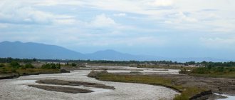
Located in the southern part of the western slope of the Middle Urals, on the river. Nyazya (tributary of the Ufa), 339 km northwest of Chelyabinsk. Railway Nyazepetrovskaya station.
Territory (sq. km): 1134
Information about the city of Nyazepetrovsk on the Russian Wikipedia site
Historical sketch
It was founded in 1747 as a village in connection with the construction of an iron smelting and ironworks by merchant Pyotr Osokin, named Nyazepetrovsky, after the name of the river and the name of the owner. Hydronym from the Bashkir dialect of the name “spruce”.
In 1894, 10.6 thousand people lived in the factory village, there were 18 shops, and there was a hospital.
At the beginning of the 20th century. The plant, which specialized mainly in the production of sheet iron, came under the jurisdiction of the joint-stock company Kyshtym Plants.
PGT from 01/01/1932 City from 06/27/1944
Economy
Machine-building plant, woodworking industry enterprises.
Culture, science, education
Museum of Local Lore.
Universities of the city
Branch of the South Ural State University in Nyazepetrovsk
456970, Chelyabinsk region, Nyazepetrovsk district, Nyazepetrovsk, st. Sovetskaya, 5
Museums, galleries, exhibition halls
Museum and Exhibition Center of Nyazepetrovsk 456970, Chelyabinsk region, Nyazepetrovsky district, Nyazepetrovsk, st. Sverdlova, 21
Architecture, sights
The planning structure of the city developed as a radial-ring structure. Monuments of industrial architecture from the early 19th century have been preserved.
| Population by year (thousands of inhabitants) | |||||||
| 1939 | 13.0 | 1996 | 15.5 | 2007 | 13.0 | 2015 | 12.1 |
| 1959 | 22.5 | 1998 | 15.1 | 2008 | 13.0 | 2016 | 11.9 |
| 1967 | 22 | 2000 | 14.5 | 2010 | 13.0 | 2017 | 11.8 |
| 1970 | 18.6 | 2001 | 14.1 | 2011 | 12.5 | 2018 | 11.7 |
| 1979 | 17.7 | 2003 | 13.4 | 2012 | 12.3 | 2019 | 11.5 |
| 1989 | 17.1 | 2005 | 13.0 | 2013 | 12.2 | 2020 | 11.4 |
| 1992 | 16.9 | 2006 | 13.0 | 2014 | 12.1 | 2021 | 11.3 |
