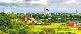
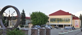
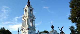
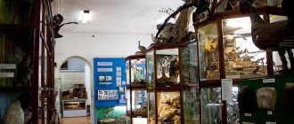
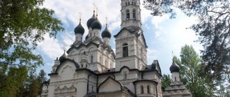
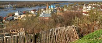
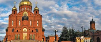
Found artifacts indicate the presence of ancient sites on Kaluga land back in the 10th-6th centuries. BC. In the 12th century There were feudal wars and constant clashes between the Lithuanian and Moscow principalities. Kaluga was the largest defensive point for several centuries. In history, the events of 1480 - “Standing on the Ugra River” - became especially famous. Thanks to him, Rus' was delivered from the Tatar-Mongol yoke. The emergence of the Moscow sovereign state dates back to this period.
The museums of the Kaluga region have collected numerous evidence that in the 16-17 centuries. Trade and crafts actively developed in Kaluga. From a small defensive point to the 18th century. Kaluga has become an example of Russian urban planning and a center of trade intermediation between major cities of Russia and neighboring countries.
Numerous monuments testify to the courage of the liberators of Kaluga land from the fascist invaders. In addition to historical and cultural attractions, the Kaluga region will surprise you with its nature: waterfalls, caves, etc.
Cities and villages
Kaluga
The city is located on the banks of the Oka. The road to Moscow is about 2 hours. The first mention of the city dates back to 1371.
Kaluga was rebuilt as a guard post on the way of foreigners to the Moscow state. Thanks to the Kaluga warriors, Tatar raids on Moscow were stopped. Events of the early 17th century. entered the history of the city as the Time of Troubles. False Dmitry I and II found refuge in Kaluga. A dark page in the history of the city was the invasion of Kaluga by the troops of Hetman Sagaidachny. The Zaporozhye Cossacks not only ravaged the city, but also practically destroyed its inhabitants.
In the middle of the 17th century. Most of the population died from the epidemic. The surviving 1000 people had to make considerable efforts so that already at the beginning of the 18th century. the city became a major trading center. In the 18th century Kaluga became deserted several times as a result of famine, severe fires, and plague. Catherine II played a decisive role in turning the city into a center for the development of trade and industry. Trade was carried out both with the cities of Russia and with England, China, Holland, etc. In the 18th century industrial production began.
Today, many monuments of architectural history have been preserved, testifying to the heyday of Kaluga. In the 19th-20th centuries. Industrial construction continued in the city. Much here is connected with the development of astronautics and the name of the outstanding scientist K. E. Tsiolkovsky. Here he made his most outstanding discoveries; his grave is in Kaluga.
Today in the city you can visit:
- State Museum of the History of Cosmonautics named after K. E. Tsiolkovsky. The world's first space museum was opened in 1967 with the personal participation of S.P. Korolev and Yu.A. Gagarin. In addition to the works of K. E. Tsiolkovsky, the museum presents in detail the entire history of the development of Russian cosmonautics. The pride of the museum is its modern planetarium model, thanks to which every visitor has the opportunity to take a “virtual” journey to the stars.
- Chambers of Korobovs. The building is an example of 17th century architecture. According to one legend, the treasures of Marina Mnishek, the wife of False Dmitrys I and II, are hidden in the secret basements of the building. Treasure hunters have been puzzled by their search for several centuries. The exposition of the local history museum is located here.
- Zolotarev's estate. The time of construction of the estate dates back to the 18th - early 19th centuries. There is an opinion among local historians that the estate was built for Catherine II and other high-ranking persons. The value of this estate lies in the original landscape details and interior items preserved in a single copy.
- The central city park of Culture and Recreation attracts vacationers not only with lush greenery - some protected specimens of trees are more than 600 years old - but also with historical monuments. In the depths of the park there is a voivode's hut, not far from it is the Trinity Cathedral - built in the 18th - early 19th centuries. The observation deck offers the best view of the Oka River in the city. The park has a dance floor, a brass band, and attractions.
Interesting facts and useful information about these and other attractions of Kaluga.
Borovsk
The date of foundation of the city is not known for certain. Artifacts found at the Borovsky settlement indicate the presence of a settlement in this place already in the 11th-13th centuries. The most ancient religious sites have survived to this day.
The city suffered greatly during the invasion of Napoleon's troops and fire in the 19th century. The city was actively upset in the 19th century. 20th century You can plunge into a bygone era while walking along the city streets. Among the architectural monuments one can highlight: the buildings of the Ezhekov factory, merchant houses with shops, the building of the city almshouse, the “lace” house of the Shokhinovs, etc.
The history of the city is connected with the name of K. Tsiolkovsky. Here he lived and taught for 12 years.
In the city you can see:
- Pafnutyevo-Borovsky Monastery. Its history begins in 1444 and is associated with the tragic events of the destruction of the Old Believers. In the monastery you can book a tour, during which the guide will tell you about the imprisonment of Archpriest Avvakum and the death of the noblewoman Morozova. If you wish, you can climb the bell tower, wander through the archimandrite’s chambers, and visit the Cathedral of the Nativity of the Virgin.
- Church of the Intercession of the Mother of God on Vysokoye. People come here not only to look at the wooden church built without a single nail. Near the temple there is a healing spring with fonts.
- Several Old Believer churches have been preserved in the city: the Vvedenskaya Old Believer Church, the All Saints Old Believer Church (it houses a museum and exhibition center), and the Cathedral of the Intercession of the Blessed Virgin Mary. City in the 17th century. became the center of the Old Believers. In it, Princess Urusova and noblewoman Morozova were martyred for their faith.
- Museum of the History of Borovsk. It displays the artistic works of fellow countrymen and tells about the history and traditions of the city. The exhibition includes authentic household items of the townspeople, and a collection of old photographs and maps.
- House-Museum of K. E. Tsiolkovsky. Tsiolkovsky lived in this house for more than 10 years. The real situation was recreated, the scientist’s original belongings were collected. The exhibition tells about the discoveries that were made by the scientist while living in Borovsk.
There is a separate article about Borovsk on our website, where these and other attractions are interestingly described.
Tarusa
The name of the city comes from the name of the Tarusa River. Slavic tribes settled on its banks starting from the 11th-12th centuries. The city was first mentioned in chronicles in 1246. Geographical proximity to the Moscow Principality predetermined the city's fate as a defense against foreign attacks. By the end of the 18th century. the city was almost completely burned down. By order of Empress Catherine II, the city was rebuilt according to a master plan that has survived to this day. By the end of the 19th century. The buildings in the city were predominantly wooden. The population was engaged in trade and crafts.
The nature of Tarusa inspired the work of the artist D. Polenov. He lived and worked near the city for several years. His canvases depict water meadows, Russian birches, etc. M. Tsvetaeva, K. G. Paustovsky, poet N. A. Zabolotsky, pianist S. T. Richter and many others came to Tarusa for a summer holiday. It is not for nothing that the city is called the Russian Barbizon (by analogy with the Parisian suburb, where the brilliant French created their masterpieces).
In Tarusa you can visit:
- Tarusa Art Gallery. A collection of Russian paintings and porcelain, arts and crafts items has been collected. The basis of the exhibition is the collection of N.P. Rakitsky donated to the museum. Thanks to him, you can admire the works of K. Bryullov, I. Aivazovsky, B. Kustodiev, M. Vrubel, A. Ostroumova-Lebedeva. The museum displays works by contemporaries and foreign masters.
- Tarusa Museum of Local Lore. The most ancient exhibits found during excavations are demonstrated. It tells about the history of the city, its traditions and the most striking events. Visitors are introduced to the biography of famous residents of Tarusa.
- Tarusa Museum of the Tsvetaev Family. Tells about the work of the famous poetess and the biography of her family. The museum hosts literary readings.
Read more about Tarusa and its interesting places
Obninsk
The first mention of the city dates back to the end of the 16th century. The city received its modern name in honor of its famous fellow countryman - writer V.P. Obninsky. The publicist described the events on the eve of the revolution and the life of the imperial family.
The nature of Obninsk is presented in the works of I. Levitan, V. Serovov, K. Korovin, V. Polenov and others. Dachas in the Obninsk region were photographed by musicians F. Chaliapin, N. Medtner, and poet V. Bryusov.
The modern history of the city is connected with the development of atomic physics and energy. The world's first nuclear power plant was built in the city, and there is a museum on its territory.
In the city you should visit:
- Museum of the History of Obninsk. It opened in 1965. The exhibits tell about the ancient history of small villages that later became part of the city. Household items of the population are presented, and the culture and traditions of the region are described. The central place of the exhibition is occupied by documents on the creation of secret scientific laboratories in the period 1940-1990. Today, there are 12 research institutes operating in the small town. The museum constantly displays an exhibition of paintings by famous and young Russian masters.
- Church of Boris and Gleb. Construction of the temple ended in 1773. After the 30s. 20th century a fertilizer warehouse was built here; almost nothing has survived from the artistic painting using the grisaille technique. The church building is traditional for the Catherine era. The restoration of the temple began in the late 80s. last century. An Orthodox library is open at the temple, and you can listen to the church choir.
There are many other interesting places in Obninsk; you can read about them in our guide to the city and its surroundings.
Maloyaroslavets
The settlement appeared on the site of the modern city in the 14th century. He was given a name in honor of the son of Prince Vladimir - Yaroslav. A monument was erected by contemporaries to the founder of the city, Prince Vladimir Donskoy.
The Russian army, under the command of Kutuzov, fought against the troops of Napoleon, gained fame in these places. A monument to the heroes of 1812 was erected in the city center. History buffs can learn about the battle and heroes of 1812 at the Military History Museum.
In the city you can visit:
- Nikolaevsky Chernoostrovsky monastery of the 14th century.
- Church of the Kazan Icon of the Mother of God. It was erected in 1708. At the beginning of the 20th century. destroyed. In n. 21st century restoration work has been carried out. Today the blue domes are visible from anywhere in the city.
That's not all, there are more interesting places with stories in the guide to Maloyaroslavets.
Event tourism
One of the art objects is Beaubourg, at the festival of land art architects “ArchStoyanie”
The Kaluga region is located not far from the capital, so residents of the Moscow region love to come here to take part in mass holidays and festivals. Twice a year, the Nikolo-Lenivets art park hosts an unusual land art festival “ArchStoyanie”. It attracts connoisseurs of landscape design, park sculpture and architecture not only from Russia, but also from different European countries
. Especially for the festival, architects create original art objects from hay, wood, wicker and snow. The most durable of them become part of a large art park, laid out on the left bank of the Ugra.
Every summer the popular biker festival “MotoYaroslavets” welcomes guests. Over the course of four days, musical groups perform on several stages and stunt and light theater shows are held. Festival participants can watch performances by reenactor clubs, as well as take flights on airships, trikes and hot air balloons.
St. George's Meshchovsky Monastery in the village. Spark
The Kaluga region regularly becomes the center of large-scale music festivals - the festival of ethnomusic lovers "Wild Mint", the festival of the S. Richter Foundation and the music festivals "World of Guitar" and "Play the Horn". From year to year, experts in the traditions of North American peoples “Tipifest” and participants in the healthy food festival “Vegfest” gather on Kaluga land.
There is a large influx of tourists in October, when reconstructions of historical battles of the Patriotic War of 1812 are carried out in the region. Every year military history buffs gather near Maloyaroslavets and Tarutino. They gather to watch the “battles” between Russian and French troops, and take part in costume parades, balls, concerts and holiday fairs.
Natural attractions
Ugra National Park
Visitor center address: Kaluga, st. Lenina, 124 Phone: Opening hours: 9.00-18.00, closed on Monday Website: https://parkugra.ru/contacts/ Coordinates: 54.696893, 35.906937
The park was created to preserve the unique natural and historical landscapes of the Kaluga region. On its territory there are the remains of defensive structures of the 16-17th centuries, various temple and religious buildings, noble estates, military graves, etc.
Natural and cultural landscapes covering an area of more than 153.8 thousand hectares are under state protection. Within the park, accommodation is available in several tourist campsites. They are located in the following settlements: Sukovka, Ressa, Beldyagino, Papaevo, Mokroe, Natalinka, Pakhomovo, Lublinka, Valley of Love, Dretovo, Gordikovo. Accommodation in mini-hotels and ecological bases is possible.
Permission to visit the park must be obtained at the visitor center.
Damn town
Address: Ugra National Park. Eco-trail “Devil's Settlement”. How to get there from Kaluga: about 90 km along the P94 highway in the direction of Kozelsk. Further to the town of Sosensky, about 4 km on foot. Phone: (4842) 277-027 Coordinates: 54.075807, 36.035137
On the banks of the river Chertovskaya is formed by rocky outcroppings of sulfur quartz sandstone. An ancient settlement was discovered there. Archaeologists date it back to the 3rd-5th centuries. Artifacts dating back to the 9th-10th centuries were found. At this time, the upper reaches of the Oka began to be developed by the Slavs.
According to one version, the name of the settlement is associated with the characteristic depressions in the stones of natural origin. Another version is mythological.
The legend tells how Lyubushka outwitted the devil who planned to take her as his wife. The girl said that she would become the devil's wife if he built a huge stone castle. The devil called all the dark forces to help. Lyubushka lit up the night sky with a torch. The roosters woke up and began to crow. The evil spirits fled, and instead of a castle, the devil built walls with labyrinths and underground passages. He did not complete the task - the girl did not become his wife.
Tourists may be interested in the pentagonal well in the stones; the water in it is considered miraculous. The place is loved by ufologists who talk about temporary gaps in the settlement.
Rainbow Waterfall
How to get there from Kaluga: about 110 km in the direction of Obninsk, Papino village Coordinates: 55.211905, 36.954474
They say that the waterfall is especially beautiful in autumn: its waters reflect the bright foliage in all the colors of the rainbow.
From a height of 3-4 m, water descends from the cliff. There are several springs near the waterfall.
Koltsovo Caves
How to get from Kaluga: about 60 km to the village of Koltsovka, then 6 km to the Lyubovets ravine Coordinates: 54.426890, 36.647231
Abandoned since the 19th century. construction limestone was mined in adits. Carts moved freely in the caves of the adits. Horses carried stone blocks to the surface. After processing, the stone was carried down wooden chutes to the river directly to the barges.
The length of the underground passages reaches 800 m. Traces of the work of stonemasons are preserved on the walls, and nodules of crystalline gypsum are found.
Fans of mysteries claim that in the adits there are secret rooms of the warlock Count Vorontsov, who created an entire underground city here. There he practiced witchcraft. The legend was not confirmed by speleologists.
Souvenirs
Savior Not Made by Hands deserts in c. Klykovo
Kaluga land is rich in master craftsmen. The city of Tarusa, located on the Oka River, is famous for its skilled embroiderers. Tarusa embroidery is made in red and white colors with the addition of yellow, green and blue. As a souvenir of their trip to the Kaluga region, tourists are happy to buy beautiful napkins, towels, oven mitts, dresses and tablecloths. Most of these items are machine embroidered, but textiles with elaborate hand embroidery can be found in gift shops.
Since the 19th century, the region has developed a craft for making clay toys. Khludnev whistles and figurines stand out with their bright colors and original painting. On them you can see intricate stripes, sun signs and diamonds. Nowadays, the secrets of making clay toys are held by craftsmen from the village of Khludnevo, the village of Duminichi and the city of Kaluga.
St. Nicholas Chernoostrovsky Convent in Maloyaroslavets
As delicious souvenirs from the Kaluga region they bring dark liqueur made in Kaluga, beautifully packaged Kaluga dough and fragrant curly gingerbreads. In addition, space-themed souvenirs are popular among travelers - original “space” nesting dolls, miniature models of the first spacecraft and gift books about space.
| ← RUSSIA | EUROPE → |
Historical places
Museum of the Strategic Missile Forces in Balabanovo
Address: Balabanovo, st. Dzerzhinskogo, 77, military unit 42337 Balabanovo-1 Opening hours: by appointment
In the museum you can get acquainted with previously classified missile samples (R-36M “Satan” or RSD-10), see the work of the crew of the missile launch control post, and get acquainted with the vehicles of the Strategic Missile Forces.
The tours are conducted by members of the Missile Forces Academy.
Military History Museum "Zaitseva Gora"
Address: Zaitseva Gora Telephone: Opening hours: 10.00-17:00, closed on Monday Coordinates: 54.494152, 34.445840 Ticket prices: from 50 to 100 rubles
During the Second World War, fierce battles were fought for the strategic heights of Zaitseva Gora. They managed to defeat the Nazis using military stratagem. Soviet soldiers planted powerful explosives in the dug tunnels. The diameter of the explosion crater is more than 100 m, and the depth is about 20 m.
The museum displays exhibits found at the battle sites. Personal belongings and photographs of soldiers, original military documents were collected. Visitors will be able to get acquainted with military equipment.
Museum-diorama Great Stand on the Ugra
Address: pos. Palaces Telephone: Opening hours: 09.30-17.00, closed on Monday Website: https://diorama-ugra.ru/ Ticket prices: from 100 to 300 rubles
The museum exposition tells about the events of 1480. The Battle of the Ugra River became decisive in the liberation of Ancient Rus' from the Mongol-Tatar yoke.
The museum's diorama recreates the details of the battle under the command of Grand Duke John III over the troops of the Horde Khan Akhmat. The visual effect of viewing is enhanced by the soundtrack, which conveys the atmosphere of the battle.
Avchurino Estate
Address: s. Avchurino How to get from Kaluga: 22 km by car towards Tarusa or by bus No. 121 Kaluga - Avchurino
The name of the village comes from the transformed nickname of the defender of the Moscow principality Vasily Ovts.
Once upon a time there was a large estate in this place where Arabian horses were bred. Emperors visited the rich Poltoratsky Estate.
From the estate, one house in the neo-Gothic style has survived to this day. The building is in disrepair.
Manor Baryatino
Address: s. Baryatino How to get there: 22 km from Tarusa
The Russian-style estate at different times belonged to the princely families of the Golitsyns, Baryatinskys, and Gorchakovs. The last owner collected a collection of porcelain, paintings by great masters (Watteau, Rubens, Proudhon), silverware, rare books, etc.
After the revolutionary events, the collection was partially looted. Some items from the collection were added to the museum funds of the Hermitage and the Tretyakov Gallery. The Gorchakov collection became the basis for the exhibition of the Kaluga Art Museum.
The estate is in need of restoration; a park with rare trees has been preserved.
Vorobyovo estate in Kaluga region
Address: Vorobyovo village How to get there: about 60 km along Kievskoye Highway, or by train stop. 140 km, then 4 km on foot
The estate was built in 1904. Today, the two-story mansion with an attic, balconies, and an elegant tower is in need of restoration.
The ceramic tiles were partially lost, the forging and wooden parts decorating the façade were destroyed. Today you can spend several hours walking in the park with a pond.
Manor Panskoe
Address: s. Panskoe How to get there: about 70 km along the Kievskoe highway, 5 km northwest of Maloyaroslavets
Kudryavtsev's house was completed in 1814. The two-story wooden mansion is well preserved. This is a typical “noble nest”.
The estate was built in the traditions of Russian architecture of the 19th century. The house is decorated with elements of stone architecture, columned porticos, rustication, stucco friezes and medallions. Around the estate there are preserved alleys with centuries-old trees.
Estate Stepanovskoe
Address: Pavlishchev Bor village How to get there: about 60 km along the P 132 highway
Construction of the manor complex began in the 17th century. The main buildings with the park ensemble were completed in the 19th century.
A.P. Chekhov, M. Gorky, I.V. Tsvetaev, etc. visited the estate at different times.
Currently, the park contains a house with a mezzanine that belonged to the manager, outbuildings, and pylons with sculptures of deer. Near the river you can see the pavilion for storing boats - “Arsenal”. The estate is in need of restoration.
Linen plant
The third planned point was the village of Polotnyany Zavod . It is approximately 35 kilometers from Kaluga.
The emergence of the settlement is associated with the founding of a sailing and linen factory by the personal order of Peter I in 1718 by the Kaluga merchant T. Filatov-Karamyshev (hence the name of the village). In 1720, he, in company with G. Shchepochkin and A. A. Goncharov (great-great-grandfather of A. S. Pushkin’s wife), founded a paper mill.
First I drove up to the G.I. estate. Shchepochkina. It was built in the second half of the 18th century. From 1909 until 2007, the main building of the estate housed a secondary school. At the same time, the building has well preserved historical interior decoration, paintings, 18th-century parquet, and stucco.
The main manor house was built in the 30s of the 18th century. Unfortunately, no documents have survived from which one could find out the name of its architect, but there is an assumption that he could be the great B. Rastrelli. Initially, the house had only two floors, was dark red in color with snow-white details of lush baroque decor. In the 40-50s. it was repainted azure, and in the 70s. rebuilt in the style of classicism that was then dominant in architecture.
The reconstruction of the house was carried out according to the design of the Moscow architect K.I. Blanca. By the end of the 18th century, it was a three-story, light-colored house with risalits along the main facades. This is exactly what this house looked like in the 30s. XIX century, who came to the Linen Factory A.S. Pushkin. The Goncharov estate was one of the largest in size and richest in decoration of Russian estates. Source
Here I had a great time, had a delicious lunch and took almost 300 pictures inside and outside, so I’ll tell you about this worthy place in detail in a separate article.
I'm going back along the same road. Stopped to take a photo of a Soviet monument dedicated to milkmaids. There has never been such an example in my collection of sculptures.
Parks, entertainment and more
Tourist complex Ethnomir
Address: s. Petrovo Opening hours: from 9.00 to 21.00 Telephone: Ticket price: 250 rubles Website: https://ethnomir.ru/etno/
On the territory of the largest ethnographic park in Russia, you can become familiar with the culture of the peoples of Russia and world culture through architecture, customs and way of life, folklore and mythology, national cuisine and crafts.
The complex constantly hosts exhibitions, meetings, and concerts of folklore groups. There are folk craft workshops, colorful shows, etc. There is a museum of Russian stoves and irons. Pavilions of India, Asian peoples, etc. were opened.
Art Park Nikola-Lenivets
Address: Nikola-Lenivets village How to get from Kaluga: 80 km towards the city of Kondrovo Telephone: 3 Ticket price: 200 rubles Website: https://nikola-lenivets.ru
The only art park in Russia houses 31 works by Russian and foreign authors.
All objects are made from natural materials and fit into the landscape.
In the park you can book walking, horseback and bicycle excursions. The workshop is working.
Bird Park "Sparrows"
Address: Voroby village, pobeda pobeda Opening hours: 10.00-21.00 Telephone: Ticket price: from 100 to 500 rubles Website: birdspark.ru
The park has an impressive collection of birds (African ostriches, parrots, swans, Chinese ducks, etc.).
You can also see African antelopes in the park. There is a mini-farm with dwarf horses and domestic animals.
Vacationers can wander around the rock garden. The stones were brought from many parts of Russia. You can go fishing in the pond. Various master classes are held.
Kaluga, State Museum of the History of Cosmonautics
Of course, next year, when the second stage finally opens to visitors, the museum will become twice as large and, accordingly, twice as interesting. But even now it is the first and largest space museum in the country, and in Kaluga it is the main museum of the regional capital. Unique exhibitions tell the story of the origin and development of means to overcome gravity and explore outer space. Having paid attention to the lunar rover, climbed aboard the life-size orbital station, and tasted the cosmic menu, you should definitely attend a session in the planetarium, where a unique apparatus operates that combines optical-mechanical and digital projections, which creates an indescribable feeling of being in space.
How to get there?
By car, by public transport
: Kaluga, st. Academician Koroleva, 2
Official site
Churches, cathedrals and temples
Optina Pustyn
Address: Kozelsk Phone: Website: https://www.optina.ru/
The monastery was founded in the 15th century. The main temple is the cathedral of the Entry into the Temple of the Blessed Virgin Mary, around which churches are arranged in a cross pattern.
The monastery complex includes a skiff, where monks pray around the clock. Access for lay people is closed.
The monastery has a tragic history. In 1939, more than 5 thousand Polish prisoners of war were placed on its territory; during the Second World War, it housed a hospital and a testing and filtration camp.
In 1987, Optina wasteland was transferred to the Orthodox Church. The monastery is currently operational and has been completely restored.
In addition to the monastery, Kozelsk has a lot of interesting things - museums, ancient ruins, churches.
Chernoostrovsky Monastery
Address: st. Kutuzova, 2, Maloyaroslavets Phone: Website: https://stnikolamon.ru/
The history of the monastery began in the 14th century. from the construction of the Church of St. Nicholas in them. In the 17th-18th centuries. There was a small monastery here, in which several brothers labored.
In n. 19th century The monastery was upset thanks to the philanthropic activities of the merchant T. E. Tselibeev. Napoleon's troops caused great damage to the church.
There is a legend that during the battle an image of the Virgin Mary appeared in the sky. She showed Napoleon the way to the north with her hand. This is regarded as a harbinger of the death of the French army. It is also stated that an old man on a horse with a fiery sword appeared to our warriors. The fleeing French told with horror how Saint Nicholas helped the Russians.
The monastery was rebuilt again in AD. 20th century. Years of godlessness led to the plunder of the monastery. Its restoration began in the late 20th century. An orphanage has been opened at the monastery. Services are taking place.
Shamordino Monastery
Address: Kozelsky district, village. Shamordino Visiting hours: 8.00-20.00 Telephone:
The fifteen-domed cathedral was built in the Russian style at the end of the 19th century. After the revolution, the abbess of the monastery, in order to save it from complete ruin, asked to rename the monastery a labor commune. This delayed its disbandment for several years. Abbess Valentina did not see the destruction of the shrines and the painful death of the nuns - she died in 1919.
It can be considered a miracle that when a hospital was established on the territory of the monastery during the Second World War, not a single wounded person died. By the time the monastery returned to the jurisdiction of the Moscow Patriarchate, the monastery was destroyed.
The restoration of the monastery ended in 2005. All the stained glass windows and beaded frames were made by the hands of nuns.
On the territory of the complex there is a bathhouse at the “Life-Giving Spring”. In the refectory you can try monastery food.
St. Tikhon's Hermitage
Address: Dzerzhinsky district, village. Lev Tolstoy, st. Sovetskaya, 19 Phone: 8(48434) 4-43-11 Website: www.diorama-ugra.ru
The monastery was founded in the 15th century. Depending on its ownership, the deserts had different names: Maloyaroslavetskaya, Medynskaya, Kaluga. The monastery became famous for its healings at the holy spring and at the shrine of St. Tikhon.
At the beginning of the 20th century. There were 7 churches in the monastery. Believers especially revered the gigantic oak tree, in the hollow of which the Monk Tikhon performed his feat of solitude. In 1838, on the site of an oak tree broken by a thunderstorm in 1830, a chapel was built in which the remains of the tree were stored.
After the revolution, the monastery was plundered. Restoration began at the end of the 20th century. Currently there are 20 monks working in the monastery.
If you have not yet chosen where you will live and want to save money when booking, we recommend using the RoomGuru service. Firstly, it contains hotels, apartments and guest houses from many different booking systems, so you won’t miss out on a worthwhile option. Secondly, you can immediately compare prices for one place in different services and book where it is cheaper (this is not always Booking!).
Borovsk
Recently, among small towns in the region, it was Borovsk that took the palm of tourism championship from Tarusa. Located on the picturesque banks of the Protva River, ancient Borovsk tells its rich history in a completely unique way - with wall paintings, and this is not just an open-air gallery, but rather a city of parallel reality. To get into the spirit of Borovsk, after a walk you need to do two things: sit over aromatic tea on the veranda of the House of Happiness, inspired by the panoramic view opening from the site, and visit the Borovsk fortress - the Pafnutiev Monastery complex.
How to get there?
By car – 85 km. from Salaryevo metro station. By public transport from Balabanov.
Address: Kaluga region, Borovsk.
Gostiny Dvor
The luxurious courtyard is a building made in the ancient Russian style. It was built in the shape of a quadrangle. The landmark has recently undergone restoration work. Here you can visit a fair of Kaluga residents’ crafts, admire talented works, and buy unique souvenirs as a keepsake.
Location: Kaluga, Lenin street - 126.
Geography
The Kaluga region is located in the central part of the East European Plain. The territory of the region is located between the Central Russian (with average heights within the region above 200 m and a maximum elevation of 275 m in the southeast of the region), the Smolensk-Moscow uplands and the Dnieper-Desninskaya province.
Most of the region is occupied by plains, fields and forests with a variety of flora and fauna. The center of the region is located on the Baryatinsko-Sukhinichi Upland. In the western part of the region, within the glacial plain, the Spas-Demenskaya ridge stands out. To the south of it there is an elevated outwash plain, which is part of the Bryansk-Zhizdra forest, the average heights of which are up to 200 m. In the north-west of the region there is a moraine plain with ozokam formations. From north to south, the Kaluga region stretches for more than 220 km from 53°30′ to 55°30′ northern latitude, from west to east - for 220 km. The area of the territory is 29.777 thousand km². The most important international highways and railways pass through the territory of the region: Moscow - Kaluga - Bryansk - Kyiv - Lvov - Warsaw. The Kaluga region borders the Bryansk, Smolensk, Moscow, Tula, Oryol regions, and the city of Moscow (since July 1, 2012).
There are 303 municipalities in the region, including 24 districts, 2 city districts, 26 urban settlements and 251 rural settlements. The largest in area is the Ulyanovsk district, the smallest is Tarussky.
Cities of the Kaluga region: Kaluga, Balabanovo, Belousovo, Borovsk, Ermolino, Zhizdra, Zhukov, Kirov, Kozelsk, Kondrovo, Kremenki, Lyudinovo, Maloyaroslavets, Medyn, Meshchovsk, Mosalsk, Obninsk, Sosensky, Spas-Demensk, Sukhinichi, Tarusa, Yukhnov.
Relief, geological structure and minerals
The modern relief of the Kaluga region repeats the pre-glacial one: hilly, with river valleys, gullies and hollows. Some glacial lakes have survived to this day, for example, the deepest lake in the Kaluga region - Bezdon.
The region is located between the Central Russian and Smolensk-Moscow uplands. On the territory of the region there are both low plains - up to 200 m above sea level, and elevated ones - more than 200 m high. The southeast of the region is occupied by the Central Russian Upland, the extreme northwest - the Spas-Demenskaya ridge. These hills are separated from each other by the Ugorsko-Protvinskaya lowland. In the extreme southwest of the region is the Bryansk-Zhizdra Polesie, and in the center is the Baryatinsko-Sukhinichi Plain.
The highest point of the region's relief is at an altitude of 279 m within the Spas-Demenskaya ridge (Zaitseva Gora), the lowest is in the Oka River valley (120 m above sea level). Thus, the amplitude of the relief reaches 160 m. The Kaluga region is located in the central part of the East European Platform. The thickness of the upper (sedimentary) structural layer varies from 400–500 m in the south to 1000–1400 m in the north. Most of the sedimentary cover is composed of Devonian deposits. Their share in the south of the region exceeds 80% of the thickness of the entire sedimentary sequence (including Quaternary formations). On the territory of the Kaluga region, 4 geological and economic regions are distinguished: North-Eastern, Central, Southern and North-Western.
The specific value of the subsoil of the Kaluga region is more than 8 million rubles/km². In the region, 550 deposits of solid minerals have been identified and explored for 19 types of mineral raw materials, 131 deposits of fresh groundwater and 13 deposits of mineral groundwater. The mineral resources of the region are represented by phosphorites, brown coals, mineral paints, gypsum, building stones, chalk for construction work, carbonate rocks for liming soils and the pulp and paper industry, refractory and refractory clays, fusible clays for the production of bricks and expanded clay, tripoli for the production of bleaching agents lands and thermolite gravel, clays for drilling fluids, sand and gravel material, glass and molding sands, sands for construction work and the production of silicate products, peat, sapropel and mineral waters.
There are 24 deposits in the region with industrial reserves of more than 220 million m³ of clay, of which 14 deposits are being intensively developed today. The Ulyanovsk deposit of refractory and ceramic clays is one of the largest in Russia and has not yet been developed by industry. It accounts for 16.2% of refractory clay reserves in the Central Federal District. Such clays are used for the production of refractory products used in metallurgy, cement, glass and other industries in which production processes involve high temperatures. With stable development of construction in the Central Federal District, the demand for clays from the Ulyanovsk deposit will be 600-700 thousand tons per year. The Ulyanovsk deposit has every prospect of becoming the main raw material base for enterprises in the construction complex and refractory industry not only in the Kaluga region. The total balance reserves of the brown coal deposit of the Moscow Region coal basin are 1,240 million tons, including: Vorotynskoye (410 million tons), Severo-Ageevskoye (151 million tons), Seredeyskoye (150 million tons), Studenovsky areas (103 million t.) and others. Despite the low quality of coal, the raw material is of interest due to its proximity to large consumers. The balance reserves of peat amount to about 24 million tons. The mineral resource potential of the region makes it possible to meet the needs of enterprises for the main types of non-metallic minerals (building stones, sand and gravel material, building and silicate sands, fusible clays and loams for the production of bricks and expanded clay).
As of 2013, in the Kaluga region there are 109 licenses for the right to use subsoil for the purpose of developing construction materials.
Hydrography
There are 2,043 rivers flowing in the region with a total length of 11,670 km. Of these, 280 rivers are more than 10 km long, with a total length of 7455 km, and there are 1763 rivers and very small watercourses (streams) less than 10 km long in the region. Their total length is 4215 km. The average density of the river network is 0.35 km/km². The basis of the water system is the Oka River, other large rivers of the region are the Ugra, Zhizdra, Bolva, Protva, Vorya, Ressa, Shanya, Yachenka. There are 19 reservoirs in the region with a total volume of more than 1 million m³ each. The total volume of reservoirs is about 87 million m³, of which 30 million m³. Reservoirs - Lompad (Upper Lyudinovskoye) on the Nepolot River (a tributary of the Bolva), located in the Lyudinovo district with a surface area of 870 hectares; Verkhne-Kirovskoye on the Pesochnya River (a tributary of the Bolva), located in the Kirovsky district with a surface area of 215 hectares; Brynskoye on the Bryn River in the Duminichsky district (tributary of the Zhizdra) with an area of 790 hectares; Milyatinskoye on the Bolshaya Vorona River (tributary of the Ugra) in the Baryatinsky district with an area of 458 hectares; Yachenskoe reservoir on the Yachenka River with an area of 230 hectares. The number of lakes in the region is small, among them we can highlight lakes Bezdon, Svyatoe, Galkino, Bezymyanoye, Sosnovoe (Baryatinsky, Dzerzhinsky, Yukhnovsky, Kozelsky, Zhizdrinsky districts). There are about 500 peat bogs in the region. The area of most of them does not exceed 100 hectares. The area's swampiness is less than 1%. Swamps are concentrated mainly in the north and west of the region. The largest swamps are Ignatovskoe, Kalugovskoe, Krasnikovskoe, Shatino.
Soils
The predominant soils in the region are soddy-podzolic soils (occupying approximately 75.6%). Soddy-highly podzolic soils are common in watersheds. In the northern part of the territory in the east and southeast, the regions are predominantly soddy-slightly podzolic, while in the river floodplains they are alluvial. In the south, soddy-podzolic gleyic and gleyic soils are widespread. In the central part and in the east there are predominantly gray and light gray soils (occupying about 12.4%).
Vegetation
Forests occupy 45% of the territory of the Kaluga region. The total timber reserve is 269 million m³. 30% are conifers, 67% are soft-leaved.
According to data for 2013, the permissible volume of timber harvesting is 3 million 136.9 thousand m³ per year. Development of the estimated logging area is carried out at the level of 30%. The annual growth of plantings is 4.8 million m³.
The forest zone of the region includes two subzones: coniferous-deciduous and broad-leaved forests. The subzone of coniferous-deciduous forests is dominated by various types of spruce forests. The tree layer in such forests is composed of Norway spruce with an admixture of pine, birch, aspen, linden, and pedunculate oak. In the broad-leaved forest subzone, primary forests occupy a small area in the interfluves of the Vytebet, Zhizdra and Oka rivers. The edificatory species in such forests are mainly pedunculate oak, cordate linden, common ash, and elms. These forests, unlike coniferous ones, are polydominant and have up to 7-8 tiers. An admixture of birch and aspen in the second tier, plain maple, wild apple, and mountain ash in the third tier is common. A layer of shrubs is developed. The grass cover is dominated by early spring ephemeroids and perennial plants.
Extrazonal vegetation in the region is represented by pine and small-leaved forests, swamps and meadows. Scots pine forms forests on sandy sediments of ancient alluvial plains, on sandy terraces of river valleys, and swampy peaty soils. These are white moss forests, green moss forests, sphagnum forests, and complex forests. The tree layer of small-leaved and derivative mixed forests is formed by silver birch, downy birch, aspen, goat willow, spruce, pine and oak. Meadows are divided into floodplain and continental.
Swamps are unevenly distributed throughout the region. The most swampy areas are the northwestern and western regions (the Ugra River basin), as well as the Bryansk-Zhizdra Polesie.
Animal world
Over the two-century period of study, several thousand species of invertebrates and 396 species of vertebrates were recorded on the territory of the Kaluga region.
132 species of vertebrate animals are listed in the Red Book of the Kaluga Region, including 36 from the corresponding list of protected objects of the Russian Federation.
68 species of mammals have been recorded within the region. Among them are typical forest animals: brown bear, lynx, elk, wolf, white hare, squirrel. As well as representatives typical of the steppes: hamsters, large jerboa, speckled ground squirrel, and common marmot.
Over the past decades, hunting farm workers have resettled animals with low numbers in the region. Among them are the Russian muskrat, beaver, wild boar, and roe deer, which have taken root well and increased their numbers.
Animals that had not previously lived in the region were acclimatized: raccoon dog, muskrat, sika and red deer, which in a fairly short time reached commercial numbers. Bison sometimes began to enter the southern regions of the region after their recent release into the Oryol Polesie National Park.
Among the inhabitants of the waters of the region, 2 species of lampreys and 41 species of bony fishes were noted. The diversity of ichthyofauna is associated with a large difference in living conditions. Thus, the brook lamprey lives in the Oka basin, and the Ukrainian lamprey lives in the Desna and its tributaries. Gold and silver crucian carp, tench and many other species are common in standing reservoirs. Pond farms produce carp, silver carp, grass carp and sometimes peled. Of the valuable commercial species, the largest share is bream. Among the rare species you can find sterlet, Russian bystryanka, and sculpin goby, which are listed in the Red Book of Russia. Among the 11 species of amphibians, crested and common newts, red-bellied toads, common and green toads are common, and lake, pond, sharp-faced and grass frogs are numerous.
Reptiles are represented by 7 species, including snakes: the poisonous ones are the common viper, the harmless ones are the common grass snake and the copperhead. The most common lizards are the nimble and brittle spindle, which lacks limbs and is often confused with snakes.
267 species of birds have been recorded on the territory of the region, of which 177 were recorded at nesting sites, 58 only on migration, 32 flew irregularly. There was an increase in the proportion of wintering birds to 93 species, which is associated with anthropogenic transformations of landscapes. The most important habitats for birds of prey are located on the territory of the Kaluzhskie Zaseki Nature Reserve and in the area between the Vytebet and Resseta rivers. The most numerous are: among waterfowl - mallard; semi-aquatic - black-headed gull; forest inhabitants - chaffinch, chiffchaff; along the river banks - shore swallow; in populated areas - rock pigeon, black swift, rook, tree sparrow.
Nature conservation and ecological condition
According to the state report “On the state and protection of the environment of the Russian Federation,” published annually by the Ministry of Natural Resources and Ecology of the Russian Federation, the Kaluga region is one of the cleanest regions of the Central Federal District in environmental terms.
Based on the results of 2012, out of 85 cities in Russia, Kaluga is in the top 10 in terms of air quality. Environmental assessment, regulation, licensing and state control in the field of environmental protection in the Kaluga region are carried out by several authorized state bodies.
Since 2008, a territorial environmental monitoring system (TSN) has been operating in the region. The territorial information resource of data on the state of the environment is in open access mode on the official website of the Kaluga region.
In 2013, the Investment Council under the Governor of the Kaluga Region decided to create an Eco-Technopark. When designing the park, the best technologies will be used to ensure sanitary and environmental safety. The priority is to solve problems of environmental protection from sources of pollution of surface and groundwater, storage and disposal of industrial and household waste, radiation safety, and reduction of emissions of harmful substances into the air.
The share of the Kaluga region in the total volumes of emissions of pollutants into the atmospheric air and discharges of contaminated wastewater into water bodies of the Central Federal District is insignificant. In terms of the capture and neutralization of harmful substances, the region is in third place, behind the Bryansk and Belgorod regions. The largest part of harmful emissions into the atmosphere occurs in Kaluga, Kirov, Obninsk, Lyudinov and Dzerzhinsky district.
As a result of the Chernobyl disaster, the southern and southwestern parts of the region were exposed to radioactive contamination. Radiological monitoring is carried out in 9 districts. The radiation background corresponds to the current radiation situation. In the region, active work is underway to receive, store, move and process scrap non-ferrous and ferrous metals, glass, and waste paper.
Non-waste technologies are being introduced at enterprises in the region. Primary waste sorting is carried out at the polygon municipal enterprise (Obninsk), etc. In the Kaluga region, several ecological settlements have been created and are successfully developing: the Kaluzhskie Zaseki Nature Reserve, the Ugra National Park, the Tarusa Nature Reserve, the Kaluzhsky Bor Natural Monument "
Rainbow Waterfall
This unique natural landscape is located in the Zhukovsky district of the region, the village of Papino. This wonderful place stands out due to the fact that the spray, combined with the rays of the sun, form an arc. The distance from which water enters the river is about five meters.
It's spectacular and exciting. The slope of the mountain is covered with dense greenery in the form of moss. Here you can see how a huge waterfall combines with small cold springs and a large number of springs.
Ilyinsky line
This year is marked by special attention to the Ilyinsky frontier - a film created specifically for the 75th anniversary of the Victory is dedicated to this heroic story. The military-historical complex with a museum is located on the territory of a bloody battle - it was here in October 1941 that cadets of Podolsk military schools “at any cost” tried to delay the German army approaching Moscow. The filming took place very nearby - for this purpose, the filmmakers built a village and created a landscape that replicated the surroundings of Ilyinsky. The story of the “red cadets” is now told by several objects: a museum, a memorial, including anti-tank pillboxes preserved from the war, and the location of the Voenfilm film studio.
How to get there?
By car – 120 km: from the Salaryevo metro station along the Kievskoe highway to Obninsk, then along the Warsaw highway. By public transport from Maloyaroslavets.
Regional Drama Theater
One of the first theaters in Russia. The theater began its existence in 1777 - 239 theater seasons . When the very first season opened, many people gathered. The guests were gathered from various Russian cities. Spectacular performances and talented actors will greet all theater guests.
Location: Theater Square - 1.
