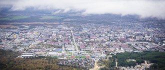
Adygea is one of the most beautiful regions, which is rightfully proud of its history, culture and natural monuments. It is located within the territory of the Krasnodar Territory and borders this region on all sides. The most beautiful miraculous places of Adygea, captured in the photo, have long become the hallmark of the republic. Fossilized remains of marine life are often found on its territory, and this is not surprising, because once upon a time, millions of years ago, the entire territory of Adygea was the seabed.
Here forest-steppes give way to oak forests and beech-fir forests. The landscapes are stunning, and the diversity of water resources is simply immeasurable. The water in mountain rivers, lakes and waterfalls is so clean and transparent that you can see everything that happens in the underwater world. One of the most famous places in Adygea created by nature is the Lago-Naki plateau, through which all tourist routes pass.
Lagonaki Plateau (Lago-Naki)
The plateau with an area of about 800 square meters is located in two regions at once: Adygea and Krasnoyarsk Territory. Once upon a time, a trade route connecting the North Caucasus and the Black Sea coast passed through it.
Today, tourists can admire the pristine nature of this place: rich vegetation, unique topography, breathtaking views and stunning glaciers. Landscapes from lush greenery to cold ice can change quite quickly in a short period of time.
There are many caves in this area, the deepest of which is the “Soaring Bird”, which goes 517 meters deep. And here the sites of ancient people and traces of massacres between the Tatars and mountain tribes were discovered.
Mount Fisht
The ancient Adyghe people named the highest mountain on the Lago-Naki plateau in honor of the gray-haired warrior Fisht, who, according to legend, saved his people from enemies. Its height is 2868 meters and climbing to the top shrouded in clouds is a rather difficult and dangerous undertaking. Those who reach the goal discover the wonders hidden within the mountain, nicknamed Treasure Island.
The territory of Adygea was once the seabed and confirmation of this is the coral island that has preserved the fossilized flora and fauna of the ancient Tethys Ocean.
One of the highest waterfalls in Russia - Pshekhsky - is also located here, its height is 250 meters.
Observation deck "Iron"
Before reaching the Lago-Naki checkpoint
The visit is free. From the parking lot to the observation deck it is about 300 m. Parking is available
When moving towards the Lago-Naki checkpoint, there are a large number of observation platforms. All of them are worthy of attention, but the best one, in our opinion, is on the “Iron” rock. The view from here is striking in its picturesqueness, and the convenient platform helps organize a tea party and encourages you to linger in this place.
Observation deck on the rock "Iron", Lago-Naki
Devil's Gate Pass, Mount Acheshbok
The composition created by nature, consisting of two mountains, captivates with its appearance and intriguing name. The fact is that the mountain peaks curved towards each other look like the devil’s horns, as they are depicted in fairy tales, and griffon vultures nest in the rocks of Acheshbok - representatives of the family of birds of prey, listed in the Red Book.
Local residents can tell many legends associated with this place. According to their custom, they call the Western and Eastern Acheshbok mountains the Right and Left Gates. In ancient times, the route to high mountain pastures passed through the Devil's Gate pass. Thanks to frequent grazing of livestock, a small passage was created under the pass, which local residents immediately named the Devil's Gate.
Route by car
Many tourists who are not ready for multi-day hikes with a backpack are interested in the opportunity to get to Bolshoy Thach by transport. Fortunately for a natural object, there is no such possibility.
If you start your journey from Novoprokhladny, then here you can hire a GAZ-66 truck (tourists call it “shisharik”), which will take you to the confluence of the Maly and Bolshoi Sakhray rivers - the Taiwan parking lot. This is where the logging road ends. This will save energy and time to cover 10 km of the journey. Renting such a vehicle is not cheap (about 5,000 rubles one way), but if you are going in a group, it will be profitable.
© Natalia Semchina
Passenger cars will not be able to pass. Partly, the path may be traversed by UAZ vehicles or powerful ATVs (which, however, is quite risky). You need to understand the main thing: no matter what vehicle you rent, you can only drive it to Taiwan (10 km). Further only on foot.
During Soviet times, an equestrian tourist route passed through the natural park. If you are interested in this type of travel, contact private tour organizers.
©
White River (Shaguashe)
The Belaya River originates from the snow-capped peaks of Mount Fisht. Having made its way through the rocks, the water stream made its way through mountains, valleys and forests.
Along the entire length of the river, which is more than 260 kilometers, the nature of the flow changes all the time. In the valleys it is calm, in the mountains it is swift, and in the forests it is moderately fast.
The Adyghe name of the white river is Shkhaguashe. That was the name of the princess whom her father wanted to force into marriage, but she was able to escape. There are many legends about why the river is called Belaya. According to one version, it got its name in honor of Bela, a young Georgian captive whom the Abadzekh prince wanted to marry. The servants threw her into the water because she had stabbed their master.
What is important to know before going
There is no entrance fee to the park. Also, you do not have to issue a special pass or register. However, you should take documents with you on your hike just in case.
Along the route there will be places with drinking water. For example, supplies can be replenished in the Sakhray River, as well as in numerous streams. There are many places for rest and overnight stays along the route. There is a large wooden gazebo in the Taiwan parking lot. Tourist booths with stoves are located at the Yubileiny and Vetrenny shelters and in the Shestakov glade. In the forest you can find clearings with fireplaces. A popular place to stop and spend the night is Knyazheskaya Polyana.
© Natalia Semchina
Special trekking poles will be very useful on a hike. They will make it easier to climb and descend along clay paths and areas with loose powder.
On the section from the village to Knyazheskaya Polyana you will have to overcome more than 10 fords. The rivers are shallow in summer and the water is cool. It is important to think about how and what you will change your shoes into so that you don’t have to walk in wet boots.
Rufabgo Falls
Picturesque waterfalls are located in the gorge of the Rufabgo River, which flows into the Belaya River. They are strikingly different from each other, but together they form a unique composition and each has its own name.
“Cascade” is called so because the water falls over 3 cascades.
“Heart of Rufabgo” got its name because of the stone in the shape of a human heart, from under which a stream of cold water rushes.
The highest waterfall is called “Lace” or “Maiden’s Braid”, its length is 20 meters. The flow at the Maiden's Braids waterfall is divided into three streams, which look like 3 strands of hair intertwined into a braid.
In “The Cup of Love,” streams of the purest water seem to flow into a stone container from a height of five meters.
Temperature and composition of water from thermal springs in the village. Tula
Source data is provided in the table:
| Sources | Water temperature | Compound |
| Water Riviera | from +34°С to +40°С | Source of low mineralization, rich in sodium, silicon, belongs to boron medicinal water |
| Cedar forest | +40°С | The water is filled with bicarbonate and sodium and has bactericidal properties. |
| White Nights | up to +38°С | Low mineralization water containing sodium and silicon |
| Aqua Thermo | from 36°С to 41°С | The mineral spring comes from a depth of more than 2500 m and contains sodium and silicon. |
| Mountain fun | +38°C | Water with high silicon content |
Lake Psenodakh
A characteristic feature of Adyghe lakes is their ability to appear and disappear according to unknown laws of nature. One of them is Lake Psenodakh in the shape of a crescent 165 meters long. It is located on the site of an old glacial bowl at an altitude of 1938 meters and is fed by streams and springs flowing through underground channels.
The unusual name is translated from Circassian as “beautiful well”, and from Adyghe – “beautiful lake”. Its maximum depth reaches only 80 centimeters, and the water is so clean that the smooth surface of the lake looks like a polished lens. Sometimes you can see turbulence on the water surface of the lake when the water begins to go into underground channels.
Medical indications and contraindications for visiting thermal springs in the village. Tula
Tula thermal springs are an excellent opportunity to get rid of long-standing diseases and illnesses. It has been proven in practice that bathing in hot springs helps cure diseases associated with joints, the musculoskeletal system, gynecology, urology, as well as various skin diseases. The unique composition of water has a wonderful effect on the condition of the skin.
Procedures using mineral waters help rejuvenate the skin. This occurs through hydration, nutrition and comprehensive care, which allows you to maintain the elastic properties of the skin. Swimming in pools with hydromassage gives an anti-cellulite and firming effect.
In addition, useful properties of the sources include:
- prevention of respiratory diseases;
- strengthening the immune system;
- saturating the body with useful microelements;
Before going on vacation to the thermal springs, you should be examined by a doctor to determine if there are any contraindications. In the health complexes of Tula, settlers are first examined in order to prescribe the correct treatment. But this does not mean that only people with certain ailments can swim.
Those who are absolutely healthy can also take a bath here, as the hot springs give vigor and strength, and also strengthen the body.
For what diseases is a visit recommended:
- diseases of the genitourinary organs;
- skin diseases;
- wounds and bruises;
- joint problems;
- respiratory tract diseases;
In what cases is visiting not recommended:
- elevated hypertension;
- post-operative period;
- pregnancy;
- tumors;
- in the presence of fungal diseases;
- diabetes;
- asthma;
- for kidney diseases;
- epilepsy;
- leukemia;
Khadzhokh Gorge (Tuapch Canyon)
This attraction is unique for its unique topography, unpredictability of water and dangerous steep cliffs. Tesnina is located in the southwest of the village of Kamennomostsky, which is also called Khadzhokh.
The gorge is a rocky gap through which the Belaya River flows. Its length is 400 meters, and its depth in some places reaches 40 meters. Due to the very strong noise that occurs as a result of constant collisions of water flows with stones and ledges, the gorge is called Noise.
Tuapch Canyon is also one of the symbols of the gorge on maps. While walking through this amazing and picturesque area, tourists are treated to beautiful views of the fast-moving river, beating against rapids and centuries-old boulders.
Hiking route to Bolshoy Tkhach
Hiking paths in the Bolshoy Thach Natural Park are marked. In dangerous areas there are bridges, fences, and ropes. They are kept in good condition by rangers.
The nearest settlement to the park from the Krasnodar Territory is the village of Uzlovoy, and from the Adygea side is the village of Novoprokhladnoye. Tourist routes start from them. The paths have many branches, so it is better to install a navigator program on your mobile phone.
Big Thach, © Sergei81
From Novoprokhladnoye
This is the most popular route to Bolshoy Thach Mountain. It falls into the category of medium difficulty.
First, the tourist has to get to the Taiwan parking lot (10 km from the village). You will have to move along a logging road, which is severely washed out during rains. The elevation difference in this area is small - 250 m, but there are fords and bridges across the river. There are few attractions on this stretch; 3 km from the village you will see the Mankin Shum waterfall.
The next section of the route is 7 km from Taiwan to Princely Polyana. To go along this route, you need to choose the upper path - along the Small Sakhray River. There is already a fairly large difference in elevation, 900 m. First, we move through the forest along a path with a significant slope, then exit to Firsova Polyana. 2.3 km from it there will be Knyazheskaya Polyana.
Tourists most often stay here overnight. And some stay for several days: there is something to see in the surrounding area. For example, you can make radial hikes to the Lagerny grotto (tourists sometimes spend the night there), Izumrudny or to the Crystal Cave.
© Natalia Semchina
The next day - an ascent to the “back” of Big Thach, 4.5 km long and with a height gain of 650 m. Trekking through open terrain - alpine and subalpine meadows.
Sometimes tourists go to Bolshoy Thach lightly and return to Knyazheskaya Polyana for the night. But there is another option. After admiring the panoramas, go down to the Vetrenny booth and set up camp there - overlooking the wall of Big Thach.
At this point you can complete the hike and return along the same route to Novoprokhladny or continue the journey by visiting Maly Tkhach.
From Krasnodar region
Less popular, but also a very beautiful route. Start from the village of Uzlovoy. First, 19 km along the Khodz River to Baronova Polyana. From there it is another 10 km to the top of Big Thach with an altitude gain of 900 m.
© Nikita Belov
Granite Canyon (Blockhouse Gorge)
The canyon appeared literally by the will of nature. Many years ago, powerful streams of the Belaya River began to cut stone blocks and turned the entire massif into an amazing and colorful natural monument.
Lush green vegetation hanging over the abyss against a background of bright red stones - this place seems to have been painted by an artist. The rocky hills are covered with a green carpet, “woven” from various types of trees: chestnuts, barberries, pines and beeches.
On the right bank of the canyon there is the Zolotoy spring, from which the stream of the same name flows, and it is named so for a reason. Once upon a time, local residents panned for gold here, and the places where the stream flows were the most profitable for mining.
Khadzhokhsky quarry
This quarry was once a thriving mining operation for limestone, selenite, yellow-white gypsum and small calcite crystals. Now here you can see the remains of a once thriving industry overgrown with grass.
Not far from the quarry there are dilapidated buildings with pipes. These are old lime kilns. Nearby there is a new mobile plant for processing rocks mined in the vicinity of the village of Kamennomostsky.
At the very bottom of the quarry there is Lake Krasnoe, fed by springs. The reservoir got its name because of the reddish hue of the stones. The water in it is always cold, but at the same time very clean, despite its cloudy color.
Best time to visit thermal springs
Hot springs can be visited throughout the year, but the best time is from November to March. In the winter season, the difference in air and water temperatures in the pool gives an even greater healing effect.
Opening hours of health-improving complexes:
- Water Riviera. Anyone can swim in thermal water from 9 am to 10 pm. For guests, the time spent in the water is unlimited.
- White Nights. You can improve your health at the base from 9 a.m. to 10 p.m., but entering after 7 p.m. is prohibited.
- Cedar forest. You can use the services of the base from 9 to 10 pm. Please note that Mondays are a sanitary day.
- Aqua thermo. The complex welcomes its guests from 9 a.m. to 11 p.m., seven days a week.
- Mountain fun. The base's services can be used from 9 to 11 pm.
Great Azish Cave
This attraction is located in the southern part of the Azish-Tau mountain range in the Krasnodar Territory, but it is always associated with Adygea due to its close location next to the official border of the regions.
The cave officially became a natural monument only in 1973. Its length is 690 meters, and its depth is 37 meters. Traveling through the corridors of the cave, you can endlessly admire the stalactites, stalagmites, sintered forms and columns.
Some of them have their own names, for example, the “Sword of Damocles” - a stalagmite in the shape of a real sword hangs menacingly from the ceiling, and the “Wish Palm”, which grew in this cave, is no different from a real southern tree.
Cave Through
According to legend, the evil giant Rufabgo lived in this cave and, looking at its gigantic size, I want to believe it. You can find it near the Shum waterfall in the valley of the river named after the giant.
The cave got its name “Through” because of its elongated shape and the presence of two exits on the north and south sides. Having a length of 25 meters, it is sufficiently well ventilated, preventing the formation of leaks.
Thanks to the karst hole at the top of the cave, it is quite light inside during the day and you can walk through it even without being an experienced speleologist. The hole in the hole is shaped like an eye, and the back wall of the rock is hidden under Colchian ivy.
Dolmen Hadzhokhsky
The Khadzhokh dolmen is one of the most mysterious archaeological sites in Adygea. Scientists still do not stop arguing about the purpose of these buildings. Some claim that they were used for rituals and burials, others believe that these are the first residential buildings of ancient people who inhabited the area thousands of years ago.
You can find the Khadzhokhsky dolmen in the north of the village of Kamennomostsky. Its height reaches 1.7 meters and width – 2.8 meters. This structure was approximately built in the 3rd century BC.
Next to the dolmen there is another unusual phenomenon of local nature - a tree with 14 trunks from one root.
Let's go eat
Cheese is the main culinary brand of Adygea. The national cuisine is famous for dairy products, but it is even ahead of ayran in popularity. Soft Adyghe cheese is prepared according to a special recipe: it does not ripen, and during its production the milk protein is precipitated using whey. Thanks to this technology, the calorie content of the product is even lower than that of feta cheese, and it retains useful minerals and vitamins. The Adygs try to preserve the centuries-old traditions of cheese making; every year they organize a regional cheese festival . Farmers, entrepreneurs, and representatives of dairy production take part in it. Adyghe cheese goes well with herbs and vegetables; it is used in dumplings, national pies guubat and halyuzhi. The day of halyuzh - a pie with cheese filling - is celebrated in June; craftswomen from all regions of the republic take part in the holiday.
But the ancient traditions of winemaking in the region could not be preserved. Although ancient sources claimed that local wine tasted similar to Greek. But the rich vineyards first fell victim to the dry Muslim law, and later to the Caucasian War. During this destructive confrontation, orchards and vineyards were cut down en masse. Now Adyghe winemakers are not trying to compete with the Greeks, but they are still entering the regional market. The most popular low-alcohol drink in the republic is local beer. The first brewery appeared here in 1882, the business was started by invited Czech brewers. Apparently, this is why experts note a certain similarity between the Czech and Adyghe foamy drink.
Cossack stone
A huge block of stone, 35 meters high and 27 meters wide, is located between the village of Kamennomostsky and the Dakhovskaya station. Once upon a time, due to natural circumstances, perhaps an earthquake or strong winds, it broke off from the wall of the Una-Koz ridge, fell in this place and still blocks the path for tourists.
Like all the sights of Adygea, the stone is shrouded in myths and legends. According to one legend, it got its name because of the unusual greeting of the Cossack chieftain, sitting on horseback at the very top of the boulder. The leader of the camp thus welcomed the Kuban inspection. This stone is also called Circassian, Shaitanov or Maiden.
Tourist shelters and camps of Adygea
Partizanskaya Polyana The route to the Partizanskaya Polyana, and from it to Mount Fisht and the Lagonaki Plateau, is one of the most popular routes, starting in the village of Guzeripl in Adygea. It is located at the foot of the Stone Sea ridge, at an altitude of 1600 meters above sea level. Read more…
Yavorovaya Polyana 6 kilometers from Partizanskaya Polyana at an altitude of 1575 meters is Yavorovaya Polyana. The asphalt road from Guzeripl ends here. The clearing got its name from the sycamore tree that grows here – the broad-leaved maple. Read more…
Tour shelter Fisht Tour shelter Fisht is located on the territory of the Caucasus Natural Biosphere Reserve, between the Belorechensky and Armenian passes in a picturesque clearing along which the Belaya River flows, and on the north-western side are the peaks of Fisht and Oshten. Read more…
See also the sights of Kamennomostsky and the sights of Maykop.
Caucasian State Natural Biosphere Reserve
Officially, the territories on the southern and northern slopes of the Western Caucasus became a reserve on May 12, 1924. Today it is the second largest in Europe, located simultaneously on the territory of Adygea, Krasnodar Territory and Karachay-Cherkessia. Its total area is about 280 hectares.
This unique area with rich flora and fauna is included in the list of UNESCO World Heritage Sites.
There are more than 3,000 plant species in the reserve. Every fifth representative of the local flora is a relict or endemic, growing only in this area.
The fauna of the reserve is also very diverse. Many animals have lived here since the territory of Adygea ceased to be the seabed.
Dendrological Park named after P.V. Bukreev
The history of this park begins in 1970 with the Berezovaya recreation center. 16 years later, the area where tourists and local residents rested, admiring the charming landscapes of grown seedlings, officially received the status of “Natural Monument”. Today there are about 350 species of trees in the park. Its area is about 20 hectares.
This park has a beautiful pond with islands. On its shores you can find ammonites - the fossilized remains of huge sea mollusks.
There are also unusual stones of bizarre shapes in the park. No one can explain where these miraculous stone sculptures came from, but local legends speak of their alien origin.
Where to eat
There are many cafes and restaurants in the nearby settlements. For example, the Daur restaurant in the village of Dakhovskaya has good reviews. What makes it special is the beautiful views.
In addition, cafes are located at some recreation centers near the plateau. All of them are famous for herbal tea with honey and pancakes, which are baked in front of visitors. Here tea is prepared in samovars. However, if you want to save money, then it is advisable to purchase everything you need, for example, at Magnit or Pyaterochka, which are located in the nearest village of Kamennomostsky.
Vishya in rum is a hit this season!
St. Michael's Monastery of Athos
The monastery is located on the outskirts of the village of Pobeda and occupies a mountain plateau on the northern spurs of the Greater Caucasus Range. In clear and sunny weather, magnificent views of the Caucasus Mountains open from the territory of the monastery. Today this place is a major tourist center, whose doors are open to tourists and pilgrims.
On the territory of the monastery there are churches: Holy Trinity, Assumption, Archangel Michael and others.
One of the buildings deserves special attention - this is the mass grave of disabled people killed by the Nazis.