Demographic indicators are one of the most important criteria for assessing the well-being of regions. Therefore, sociologists closely monitor the size and dynamics of the population not only in the country as a whole, but also in its individual subjects. Let's consider what the population of the Leningrad region is, how it is changing and what are the main demographic problems of the region.
Geography of the Leningrad region
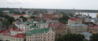
The region is located in the north-west of the Russian Federation. The area of the region is almost 84 thousand square kilometers. According to this indicator, it ranks 39th in the country. The region is located on the East European Plain, there are no mountains, but there are many different bodies of water. 9 rivers flow through the region, there are 13 fairly large lakes, most of the land is swampy and poorly suitable for human life. The location near the coastline gives rise to an Atlantic-continental climate, with mild winters and cool summers, and the area receives quite a lot of rainfall all year round. This weather is not conducive to farming. This contributed to the fact that throughout the history of their existence, these territories were poorly populated by people. There are few large settlements in the region. The cities of the Leningrad region, whose population has exceeded 50 thousand, can be counted on one hand: there are only 7 of them.
Comparison with other cities
St. Petersburg is a city of great military glory and the largest historical and cultural center. The huge settlement, which has the character of a federal center, is the main administrative facility for the entire Northwestern Federal District. In addition to its historical and cultural significance, St. Petersburg is an important scientific, economic, industrial and transport hub.
The city is home to the Constitutional Court of the Russian Federation, and the CIS Parliamentary Assembly also functions. The building of the Heraldic Council under the President of the Russian Federation, as well as many important administrative buildings, were built here. On the scale of Russia, St. Petersburg undoubtedly plays a special role, being in the status of the second capital of the country - both in terms of population and in the development of urban infrastructure.
Comparison of the population of St. Petersburg with other Russian cities.
| № | Locality. | 01.01.2019. | 01.01.2018. |
| 1 | Moscow | 12 615 882 | 12 506 468 |
| 2 | Saint Petersburg | 5 383 890 | 5 351 935 |
| 3 | Novosibirsk | 1 618 039 | 1 612 833 |
| 4 | Ekaterinburg | 1 483 119 | 1 468 833 |
| 5 | Nizhny Novgorod | 1 253 511 | 1 259 013 |
Thanks to the analysis of the data presented, it can be noted that St. Petersburg is in second place in the country in terms of the growth rate of the electorate. This means that the number of residents of the settlement is increasing at a tremendous speed, much faster than in Perm, Volgograd, etc. The only rival of St. Petersburg is the capital of Russia, Moscow.
History of settlement of the Leningrad region
The first human sites on the territory of the modern Leningrad region date back to Mesolithic times. In the first millennium BC, in the places that are today known as the Leningrad region, the population began to lead a sedentary lifestyle. People were engaged in cattle breeding, hunting, gathering; these were representatives of the Finno-Ugric tribes. In the 6th century AD, the Slavs came to this territory, settling along the Luga and Oredezh rivers and near the lakes. But so far settlement has been very fragmented. With the development of the Novgorod state, the number of residents of the future Leningrad region is growing. Defense fortifications are built here against raids by northern tribes. At the end of the 15th century, these lands were annexed to the Moscow kingdom, and then a more systematic settlement began. Part of the territory is ceded as a result of Swedish military actions, and a large migration of Scandinavians is added to the Slavs. In the 18th century, after returning the lands of Russia, Peter the Great began to build a new capital here, which led to a surge in the arrival of new people from all over the Russian Empire and the departure of many Swedes and their descendants. Later, almost no significant events occurred on the territory of the Leningrad region that affected the migration of the population, except for the deportation of the Finnish population in 1929 from the annexed Karelian lands. After World War II, these lands were actively developed, new settlements appeared, and the number of residents increased.
Russians
The main inhabitants of the Leningrad region are Russians. Their ancestors, ancient Slavic tribes, came to the territory of the north-west from more southern territories in the 6-7 centuries. They settled along the banks of the Luga and Volkhov rivers. The Slavs were engaged in agriculture and grew bread. They adopted the experience of hunting and fishing from the local population. They built warm and strong houses. Among the Russians there were many skilled joiners and carpenters. They traded with visiting merchants.
Around 750, on the banks of the Volkhov River, the ancient Russian city of Ladoga was built by Slavic tribes. 100 years later, during the reign of Prince Rurik, a fortress was built here and Ladoga became the capital of northern Rus'. In the 9th century, the territory began to be more actively settled by Russians. They plowed and sowed fields, built villages, and erected tall churches. The path “from the Varangians to the Greeks” attracted the Slavs to these territories.
Old Russian princes brought Christian culture to these lands and united all peoples into the Novgorod state. The unification of the Veps, Slavic, and Varangian peoples led to the formation of the Russian nationality. Fortresses were built to protect state territories. This is how Kaporye, Ivan the city, Yam, Oreshek, and the Tiver town arose.
With the start of construction of St. Petersburg in 1703, Russian settlers from all over Russia were added to the Russian old-timers. The tsar's associates were given lands in the St. Petersburg province, some of them brought their serfs here. The region's territory began to develop as a metropolitan region. Many Russian immigrants from other territories of Russia settled the lands of the north-west after the Great Patriotic War.
Administrative-territorial division of the Leningrad region
Before the revolution, the territory of the modern Leningrad region was home to five provinces: St. Petersburg, Pskov, Cherepovets, Murmansk and Novgorod. Later, the system of territorial division undergoes various changes. In Soviet times, there were 17 districts and 19 cities of regional subordination. Since 2006, a new, two-level system of administrative division of the constituent entities of the Russian Federation was introduced. In the Leningrad region, one urban district and 17 municipalities, 61 cities and 138 villages were allocated. At the same time, St. Petersburg is a federal district and, despite its organic connection with the region, exists in an administrative sense separately from it. Therefore, it is worth considering separately the residents of the region and the population of St. Petersburg.
Throughout its history, the Leningrad region has had to endure numerous changes in administrative division. New units appeared, some disappeared, and renaming occurred periodically. The population of the Leningrad region is accustomed to the fact that they periodically have to change their addresses.
Settlement system and urbanization processes
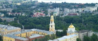
The urban population of the Leningrad region in 2011 is 1128.8 thousand people, the level of urbanization is 66%, which is slightly lower than the Russian average (73%). There are 31 cities and 32 urban-type settlements in the region. The largest city is Gatchina (93 thousand people), the smallest population is in Vysotsk (1.2 thousand people). In the region, the construction of new cities is underway: Ust-Luga in the Kingisepp district and Kudrovo in Vsevolozhsk. The largest urban-type settlements are Roshchino, Siversky and Vyritsa. A number of villages received the status of cities in the late 1990s - Sertolovo, Volosovo, etc.
The rural population is 585.6 thousand people. There are 31 rural settlements in the region with a population of more than 3 thousand people, and a total of 139.9 thousand people live in them. Basically, large rural settlements are located in the vicinity of St. Petersburg. The largest rural settlements in the region are Novoye Devyatkino (which is de facto an urbanized area with urban development), Kamenka and Gorbunki. Many of the rural settlements have a variable population depending on the season due to the presence of a large influx of summer residents from St. Petersburg. Many villages are actually depopulated in winter, since there are no permanent residents left in them.
Dynamics of the urban and rural population in 1995-2011. shown in Fig.5.2.13.1.
Rice. 5.2.13.1. Dynamics of the urban population of the Leningrad region 1995-2011, thousand people.
Rice. 5.2.13.2. Dynamics of the rural population of the Leningrad region 1995-2011, thousand people.
Figures 5.2.13.3, 5.2.13.4 show the shares of the rural and urban population in the Leningrad region for 1995 and 2011.
| Rice. 5.2.13.3. Share of urban and rural population of the Leningrad region in 1995 |
| Rice. 5.2.13.4. Share of urban and rural population of the Leningrad region for 2011 |
Based on official statistics, the share of the urban and rural population has been relatively stable over the past decade. Fluctuations in numbers do not exceed 3%. However, the actual structure of urban and rural populations may differ significantly from official statistics. Real indicators of urbanization of the population are higher. The differences are due to the fact that citizens of working age, having registration in the Leningrad region, either actually live in St. Petersburg or spend most of the time in St. Petersburg (where places of work or study are located), or in nearby areas (included in the core or the first belt of satellite cities of the St. Petersburg urban agglomeration). The structure of the urban and rural population that arises in this case remains unaccounted for by the authorized executive authorities and state statistics. Permitting registration on dacha plots, which are numerous in the region's areas near St. Petersburg, can also significantly affect the statistics of the urban and rural population. In this case, the formal structure of the urban and rural population will influence the parameters of the budget revenues of the region and municipalities, but in fact will not correspond to the settlement of the population and their use of social benefits at their place of residence, which can lead to an overload of elements of the social sphere in some areas of the region and unnecessary costs for the maintenance of unclaimed facilities in other areas of the region. This conflict must be resolved within the framework of active permanent interaction between the regional executive authorities and Petrostat, which should result in the creation of a population monitoring system adequate to the realities of human settlement. The system should not be based on checking the number on formal grounds (the number of registrations in a particular locality), but on checking the number on the merits, that is, on the real number of people living in the localities during the reporting period, based on a different system of indicators, than the current one.
The problem of actual settlement of people and providing them with social and communal benefits will be extremely relevant in the medium term, also in connection with the implementation of a number of investment projects for the integrated development of territories in the regions of the Leningrad region closest to St. Petersburg. This conflict is realistic for resolution provided that it actively influences the development of the St. Petersburg agglomeration towards the formation of its polycentricity.
The population distribution throughout the Leningrad region is largely uneven. This is due to the fact that part of the region belongs to the St. Petersburg urban agglomeration, which is the second largest and most important Russian agglomeration after Moscow, the “capital” of the federal district, an undeniable interregional center of socio-economic development and attraction for the North-West of Russia. The process of agglomeration development in the next 5-10 years will become the main factor determining the settlement parameters and urbanization processes in the Leningrad region. The significance of other operating factors in the medium term (development of new industrial zones, political decisions on the transfer of regional capital functions to another city, migration restrictions, etc.) will be significantly lower.
The St. Petersburg agglomeration is monocentric (all settlements within the agglomeration are significantly inferior in size and importance to St. Petersburg). The core includes the territory of St. Petersburg within high-density, almost continuous, buildings. The approximate core area is 550 km². The population in 2011 exceeded 4 million people, and the average density was about 7,300 people/km².
The first belt of satellite settlements (second- and third-level agglomeration subcenters) of the agglomeration core includes the territories of St. Petersburg that are not part of the agglomeration core, as well as the adjacent densely populated territories of the Leningrad region. In the north-west, the border of the first belt of satellite settlements is Roshchino, in the north - Agalatovo, Leskolovo and Sertolovo, in the north-east - Murino and Toksovo, in the east - Mga, Shlisselburg, Vsevolozhsk, Kudrovo, Otradnoye, Kirovsk and the village named after Morozov, on in the south - Tosno, Fornosovo and Gatchina. The external border of the first belt almost completely coincides with the external borders of the forest park protective belt of St. Petersburg. The area of the first belt is approximately 4840 km², the population is about 1150 thousand people, the population density is 240 people/km², the level of urbanization is almost 80%.
The second belt of satellite settlements (distance approaching or slightly exceeding 50 km from the core of the agglomeration) includes the following territories of the Leningrad region:
- northern part of Lomonosovsky district (west of Bolshaya Izhora)
- Sosnovy Bor town
- part of the Vsevolozhsk region, not included in the first belt of satellite settlements
- the middle part of the territory of the Gatchina region (south of Gatchina)
- part of the Tosnensky district (southeast of Tosno)
- part of the Kirovsky district (west of Mga and Kirovsk)
- south-eastern part of the Vyborg region (except Roshchino)
- southern part of the Priozersky district (to Sosnovo)
- northeastern part of the Volosovsky district (up to Volosovo)
The area of the second belt is approximately 6200 km², the population in 2002 is 220 thousand people, the population density is 35 people/km², the level of urbanization is approximately 53%.
Thus, the municipal districts of the Leningrad region and the Sosnovoborsky urban district, included in the process of development of the agglomeration, find themselves within the framework of socio-economic processes and phases of development of the urban agglomeration common with St. Petersburg. Settlements located within the first and second belts of the agglomeration are included in the general labor market of the agglomeration, a unified system of transport communications, and are united within the framework of territorial production nodes.
In its development, this agglomeration went through two phases of development. The first phase was associated with the consolidation of the labor market, the catalyst of which was a sharp decline in industrial production in the 1990s. It manifested itself in its most dramatic form in small industrial cities. As a result, the service sector throughout the 1990s. remained practically the only direction that simultaneously ensures employment growth and an adequate level of income for the population. The most dynamic center for the development of the service sector was St. Petersburg, which began to “reassemble” the management of the flow of goods, information, capital and labor resources within the framework of the new capitalist economic model. The consequence of this was an increase in labor commuting to St. Petersburg from the suburbs, including those belonging to the Leningrad region. This became typical for St. Petersburg in the mid-1990s. - and remains at a high level even now. At the same time, labor commuting from the suburbs to the center is superimposed on consumer commuting. As a result, the outbound highways and suburban electric trains of the metropolis are overloaded, especially during peak hours. According to some estimates, up to 50% of the population of a city like Gatchina (about 40 kilometers from St. Petersburg) goes to work in the neighboring metropolis every day. All this led to the formation of a virtually unified, more powerful in all respects, labor market of the emerging agglomeration.
The second phase of development of the St. Petersburg agglomeration (currently relevant) is the transition to post-industrial agglomeration and consists of the formation of unified markets for retail, residential and industrial real estate. At this stage, a number of functions of the “core” of the agglomeration (consumption, entertainment, production) are moving to the periphery and to subcenters (satellite settlements) - there is an increasing demand for land and basic infrastructure (heat, electricity, water supply, as well as road infrastructure) . In the St. Petersburg agglomeration, these processes proceeded extremely intensively and led to the formation in a short period of time of powerful consumption centers in the suburbs directly adjacent to the “outbound” highways.
A characteristic feature of this phase is the growth in the well-being of the population and, as a consequence, the growth in motorization and mobility of residents. Now they are ready not only to make long trips out of town for shopping, but are also more willing to change their place of residence. As a result, the Ring Road (Ring Road) in St. Petersburg performs not only and not so much the function of bypass roads, but are actually an element of a single transport framework of the agglomeration: belts of shopping and entertainment (TRK) and logistics complexes are formed on the Ring Road. Such shopping and entertainment centers are also appearing in the main satellite cities. Manufacturers locate new factories aimed at the St. Petersburg market mainly in remote areas of St. Petersburg (Shushary, Kolpino) or in the Leningrad region (Gorelovo, Maryino, Doni-Verevo area, etc.), trying to reduce land costs, real estate and labor resources. Since the late 2000s. The St. Petersburg agglomeration has adopted the boom in integrated residential development from the Moscow agglomeration. An example of similar processes in the Leningrad region is the integrated residential development projects of Kudrovo (Vsevolozhsk district), the city of Yuzhny (Gatchina district), etc.
The second phase of agglomeration development is also associated with the processes of reorganization, modernization and, in fact, degeneration of the industrial complex of St. Petersburg. In particular, the processes of moving industrial enterprises from the city center to the region beyond the ring road with their simultaneous modernization are gaining momentum, or direct renewal is taking place when old factories go bankrupt and new investment projects are implemented in suburban areas. This is exactly how projects are currently developing in the car assembly cluster of St. Petersburg. It must be taken into account that we are talking about fundamentally new production facilities, which are “processing” centers. Their deployment directly depends on the level of development of the transport and logistics module of the economy of the region and St. Petersburg and the formation of an “office empire” in the core of the agglomeration, necessary for the proper placement and execution of management processes.
The third phase of the formation of the St. Petersburg agglomeration involves the complication of internal functional connections of individual spatial elements of the agglomeration. In particular, direct connections between agglomeration subcenters will develop, the capacity and diversity of markets will increase—the volume and quality of demand for all types of infrastructure in agglomeration centers and corridors between them will increase—airports, roads, telecommunications, engineered areas. According to experts, this phase has already partially begun and will end in 2020-2025.
Thus, today the St. Petersburg urban agglomeration has become a natural center for the socio-economic development of the macro-region, which includes St. Petersburg and a significant part of the Leningrad region. The stages of its development determine key indicators of the quality of life and well-being of millions of people (indigenous people and migrants), as well as urbanization processes over the long term. This agglomeration is characterized not only by the integrity of production and settlement systems, but also by the integrity of markets: labor, real estate, land, as well as the level of functional connectivity of its individual elements. The formation of agglomeration has powerful preconditions and occurs in the natural course of things, but the processes underlying it seem to be controllable. Considering the significance of agglomerative structures in the context of the socio-economic development of the Russian Federation, the North-West and the Leningrad region, this explains the motive to update and strengthen the available tools for managing the processes of formation and development of the St. Petersburg urban agglomeration as a center of the post-industrial economy[16] in the interests of socio-economic development Leningrad region.
Mechanisms for managing the development of an agglomeration lie mainly in the area of infrastructural development of territories and the institutional arrangement of the main markets. However, due to the complexity of implementing large interregional and intermunicipal infrastructure projects and the problems of maintaining a single legal and regulatory space, it is necessary to solve a whole range of administrative issues, such as the configuration of the boundaries of new regions and districts, prospects for their unification, delimitation of powers and mechanisms for joint implementation of infrastructure projects in the territory both subjects of the federation, etc.
In the absence of active participation of the Leningrad region in shaping the development policy of the St. Petersburg urban agglomeration in the future 2016-2018. development processes will come to a mature phase of development of a monocentric agglomeration without taking into account regional interests. Then the situation with the growing difference between the development of regional areas and settlements included in the agglomeration, and areas remote from it, can significantly accelerate. As of the end of 2011, the difference in average nominal accrued wages in the Vsevolozhsk and Lodeynopolsky districts is 1.7 times, and in population density it is almost 14 times. With the transition of agglomeration to a mature phase, this difference may increase significantly and areas of the Leningrad region remote from the metropolis will almost completely fall out of the process of socio-economic development of the region. The agglomeration will attract all possible human resources of the surrounding areas, which can lead to the depopulation of a significant number of settlements in the region, accumulate financial and organizational resources, which will entail stagnation and subsequent degradation of the socio-economic systems of remote areas. That is, a pessimistic scenario for the development of the Leningrad region will be realized, in which it will be impossible to talk about equalizing the standard of living throughout the entire region, but it will be possible to state the fact of depopulation of a number of territories and a significant decrease in their economic potential with a simultaneous increase in urbanization and socio-economic development of the regions within agglomeration.
The development of a scenario in which the Leningrad region will not actively intervene in the process of agglomeration development, in the medium term, will also strengthen the trend of people settling along the most important transport arteries (roads and railways) on an interregional scale, which is a characteristic feature for Russian and foreign agglomerations. Thus, areas remote from transport routes are obviously placed in a situation of reducing their attractiveness and further reducing their socio-economic potential without taking into account the possibilities of its use. The key factor influencing settlement here will be the transport accessibility of the agglomeration core or its subcenters in the first belt of satellite cities.
To overcome the process that is developing naturally, the Leningrad region, within the framework of the Development Program for 2012-2016. should provide for the implementation of measures to form a polycentric development model of the St. Petersburg urban agglomeration and correct centrifugal phenomena in the region. The goal of implementing measures should be to increase the controllability of the processes of human settlement and urbanization in the region. Such activities should include:
· Formation of a procedure for concluding interregional and intermunicipal agreements on the coordinated territorial development of areas remote from St. Petersburg,
· Promotion of business development in settlements of the Leningrad region, which are subcenters of the agglomeration, primarily in the second belt of satellite villages for the purpose of integration into the economic, transport, cultural and other agglomeration systems of remote territories of the region,
· Promoting equalization of the standard of living in areas of the Leningrad region, especially in rural areas, in comparison with urban settlements (including on the basis of general living standards);
· Increasing the attractiveness of agricultural labor (wages and living conditions);
· Development of new economic centers in the Leningrad region (as part of the creation of new industrial zones);
· Ensuring transport accessibility for residents of remote areas of socio-cultural and economic centers in the region, especially outside the agglomeration.
The implementation of measures within the framework of this direction to improve the controllability of the processes of human settlement and urbanization in the region is possible if the region’s policy in this area is described in the Territorial Development Scheme of the Leningrad Region, reflected in municipal development programs for districts and individual settlements, and is also approved in within the framework of the agreement agreed with St. Petersburg on the prospects for the development of the St. Petersburg urban agglomeration.
An essential condition for the correctness of regional policy in the field of urbanization and settlement should be the introduction to the use of the term “agglomeration” and concepts describing its structure and principles of its development. Failure to comply with this condition may lead to wastage of efforts and budgetary funds on activities that will not be able to provide the necessary effect and achieve the goals of the region for the medium and long term in the specified area of activity.
Total population
The history of observations of the number of inhabitants in Russia begins during the Tatar-Mongol invasion. However, separate information on various subjects, including the Leningrad region, appeared only in Soviet times. Due to the fact that the region changed its borders several times during the years of Soviet power, there is no definitively reliable figure on the number of residents. Today, the total population of the Leningrad region is 1,778,890 people (according to statistics for 2021).
Urban population of Russia 2021: ranking by region
By tradition, we compiled ratings by federal district. But first, let's look at the regions with the maximum and minimum number of urban residents.
The subject of the Russian Federation with the largest urban population is, of course, Moscow. According to Rosstat, as of January 1, 2021, the capital is home to 12.45 million citizens.
The second line of the ranking is occupied by the Moscow region, the number of urban residents of which is 6.29 million people (see the best cities for living in the Moscow region).
The second largest city in the country, St. Petersburg, was only in third place. There, Rosstat counted 5.38 million urban residents.
The top 5 also includes the Sverdlovsk region and the Krasnodar region, where 3.65 million and 3.15 million citizens live, respectively.
The five regions of Russia with the smallest number of urban residents currently look like this:
| The subject of the Russian Federation | Urban population, people. |
| Republic of Kalmykia | 124616 |
| Jewish Autonomous Region | 106873 |
| Altai Republic | 64504 |
| Chukotka Autonomous Okrug | 35242 |
| Nenets Autonomous Okrug | 32948 |
As you can see, the smallest number of city residents live in the Nenets Autonomous Okrug - only about 33 thousand people.
See also, the fastest growing cities in Russia >>
Rating of regions by urban population 2021
By federal district, according to Rosstat as of January 1, 2021
Central Federal District
| The subject of the Russian Federation | Urban population, people. |
| Moscow | 12455682 |
| Moscow region | 6296406 |
| Voronezh region | 1567046 |
| Tula region | 1082882 |
| Vladimir region | 1049234 |
| Belgorod region | 1041310 |
| Yaroslavl region | 1011966 |
| Tver region | 950071 |
| Bryansk region | 833197 |
| Ivanovo region | 807364 |
| Ryazan Oblast | 793275 |
| Kaluga region | 758763 |
| Kursk region | 752748 |
| Lipetsk region | 729043 |
| Smolensk region | 663281 |
| Tambov Region | 611901 |
| Oryol Region | 483431 |
| Kostroma region | 459063 |
Show more ↓ Northwestern Federal District
| The subject of the Russian Federation | Urban population, people. |
| Saint Petersburg | 5384342 |
| Leningrad region | 1274208 |
| Arkhangelsk region without car O. | 855948 |
| Vologda Region | 837220 |
| Kaliningrad region | 792070 |
| Murmansk region | 675190 |
| Komi Republic | 637072 |
| Republic of Karelia | 494545 |
| Pskov region | 440010 |
| Novgorod region | 424638 |
| Nenets Aut. O. | 32948 |
Southern Federal District
| The subject of the Russian Federation | Urban population, people. |
| Krasnodar region | 3159354 |
| Rostov region | 2850790 |
| Volgograd region | 1915787 |
| Republic of Crimea | 966232 |
| Astrakhan region | 664210 |
| Sevastopol | 479394 |
| Republic of Adygea | 217846 |
| Republic of Kalmykia | 124616 |
North Caucasus Federal District
| The subject of the Russian Federation | Urban population, people. |
| Stavropol region | 1652707 |
| The Republic of Dagestan | 1419922 |
| Chechen Republic | 569730 |
| Kabardino-Balkarian Republic | 452074 |
| Rep. North Ossetia Alania | 445605 |
| The Republic of Ingushetia | 287222 |
| Karachay-Cherkess Republic | 199645 |
Volga Federal District
| The subject of the Russian Federation | Urban population, people. |
| Republic of Tatarstan | 2994450 |
| Nizhny Novgorod Region | 2534833 |
| Samara Region | 2514764 |
| Rep. Bashkortostan | 2510951 |
| Perm region | 1957552 |
| Saratov region | 1813408 |
| Orenburg region | 1182109 |
| Udmurt republic | 988602 |
| Kirov region | 977563 |
| Ulyanovsk region | 927075 |
| Penza region | 892116 |
| Chuvash Republic | 768955 |
| The Republic of Mordovia | 498861 |
| Mari El Republic | 455577 |
Ural federal district
| The subject of the Russian Federation | Urban population, people. |
| Sverdlovsk region | 3650725 |
| Chelyabinsk region | 2846995 |
| Khanty-Mansiysk Autonomous Region o.-Yugra | 1563020 |
| Tyumen region without car O. | 1045906 |
| Kurgan region | 510098 |
| Yamalo-Nenets Aut. O. | 459078 |
Siberian Federal District
| The subject of the Russian Federation | Urban population, people. |
| Kemerovo region | 2266449 |
| Krasnoyarsk region | 2217054 |
| Novosibirsk region | 2207966 |
| Irkutsk region | 1851196 |
| Omsk region | 1388531 |
| Altai region | 1312993 |
| Tomsk region | 771542 |
| The Republic of Khakassia | 372203 |
| Tyva Republic | 179471 |
| Altai Republic | 64504 |
Far Eastern Federal District
| The subject of the Russian Federation | Urban population, people. |
| Primorsky Krai | 1453396 |
| Khabarovsk region | 1068308 |
| Transbaikal region | 720040 |
| Rep. Sakha (Yakutia) | 651070 |
| The Republic of Buryatia | 582600 |
| Amur region | 530465 |
| Sakhalin region | 400322 |
| Kamchatka Krai | 245188 |
| Magadan Region | 133607 |
| Jewish auto. region | 106873 |
| Chukotka Autonomous Republic O. | 35242 |
These rankings show the total number of urban residents in different regions of Russia. It is also interesting to know the percentage of citizens in each subject of the Russian Federation.
See also: regional rankings by share and size of rural population >>
Population dynamics and density
Since 1926, relatively regular statistics on population dynamics in the USSR have been kept. Over the years, the number of residents has changed several times. Initially it was 2.8 million people, in 28 this figure increased (thanks to the annexation of Karelia and Leningrad) to 6 million. And in 1959 it sharply decreased to 1.2 million people due to military losses and the exclusion of Leningrad from the region. In Soviet times, the Leningrad region, whose population was growing steadily, showed good growth figures - approximately 1 thousand inhabitants per year. During the era of perestroika, as throughout the country, negative dynamics were noted in the region. And only since 2010 the number began to grow gradually. The population density in the Leningrad region is currently 21.2 people per square kilometer. This is 45th place in Russia out of 85 possible. The highest density is observed in the St. Petersburg agglomeration; the eastern part of the region is the least populated.
Izhorians
Research by scientists has proven that the ancestors of the Izhorians were the first people who came to these lands after the melting of the glacier. Since the 13th century, the Izhorians, together with the Novgorodians, have stood up to defend their territories from attacks by the Swedes, Finnish tribes, and Livonian knights. The Scandinavians and Balts, precisely from the name Izhora, called the entire territory of the north-west Ingardia or Ingermalandia.
“Ingerin maa” means Izhora land. At the end of the 19th century, there were more than 20,000 Izhorians. In the early 30s of the 20th century, the first Izhora schools were created. During the Great Patriotic War, the Izhors, like the Vods, were exported as labor to Finland. After returning to their homeland, they were sent to settlements in other regions of the country; not all of them later returned to their native places.
The character of the Izhors was consistent; they differed from other peoples in their composure and calmness. The main industry was sea fishing and the sale of fish. Even women often did fishing.
The Izhoras have a rich folklore; 100,000 songs, many proverbs, riddles, and lamentations are written in their language. You can get acquainted with the history and culture of Izhora in Izhora museums, which are located in the village. Vistino and Bolshoye Kuzemkino, Kingisepp district, Leningrad region.
According to 2010 data, there are about 169 Izhorians in the region, many of them speak their native language.
Ethnic composition
The population of the Leningrad region begins to be analyzed on the basis of “nationality” only in 1959. At this time, the region was already completely Russified; the times of great ethnic diversity were a thing of the past. On average, during Soviet times, about 90% of the region's population was Russian. In the 2000s, this figure decreased slightly - to 86%, apparently due to people from Central Asia who came to work. In second place in terms of numbers are Ukrainians - 1.8%, in third place are Belarusians (around 1%), followed by small groups of various ethnic groups: Tatars, Armenians, Uzbeks, Azerbaijanis, Finns, etc.
National composition
The national composition of the electorate of St. Petersburg is the subject of heated debate and discussion. Despite the huge tourist flows, the subject does not experience any problems with self-determination. The largest percentage, as expected, belongs to the Russians. Next come the Ukrainians, Belarusians, Jews, Tatars and Armenians. We invite you to familiarize yourself with the full table showing the national composition of St. Petersburg at the beginning of 2021.
| Nationality | Number (persons) |
| Russians | 3 949 623 |
| Persons who did not indicate nationality | 367 996 |
| Ukrainians | 87 119 |
| Belarusians | 54 484 |
| Jews | 36 570 |
| Tatars | 35 553 |
| Armenians | 19 164 |
Gender model
The Leningrad region, whose population in terms of indicators is close to similar characteristics of other regions, according to the age and gender parameters of its residents, belongs to the aging type. The number of citizens under working age is about 16%, and residents over working age are about 23%. Due to the fact that the increase in the birth rate has not yet covered this difference, we can say that the prospects for population rejuvenation are still very weak. Sex distribution in the Leningrad region also generally coincides with trends throughout the country. The number of women exceeds on average the number of men by 1.2. The majority of adults are married (about 55%), while there are 5 times more widows than widowers. There are also more divorced women than men.
Vepsians
The most ancient people inhabiting the North of Europe are the Vepsians. The Tale of Bygone Years describes how the ancestors of the Vepsians - Vesi and Chud, together with Slavic tribes and Varangians, formed the first Russian state, the capital of which was Ladoga. One of the revered saints of the Russian Orthodox Church, Alexander Siversky, was a native of the Vepsian people and the founder of many monasteries in the North.
Most Vepsians converted to Orthodoxy, but paganism remained among the people for a long time. Vepsians have a rich cultural and spiritual heritage. The pagan culture of the Vepsians dates back to the people's careful ecological attitude towards nature. The Vepsians gained a reputation as skilled woodcutters and experienced hunters.
Vepsians lived in large families of up to 30 people. They had large houses covered with a single roof with other outbuildings.
Veps folklore festivals and holidays of Veps culture are held annually in the Leningrad region. Currently, approximately 1,380 Vepsians live in the region.
Demographics
Fertility is the most important demographic indicator that demonstrates the degree of well-being of a region. Social protection of the population of the Leningrad region is a pressing issue. The relevant committee notes that since 2011, the birth rate in their territory has been growing, albeit at a very slow pace, by about 2 people per 1000 inhabitants. But, according to sociologists, the birth rate will decline slightly in the coming years.
The second most important indicator is mortality. For several years in a row in the 21st century, a decrease in mortality was observed in the Leningrad region. But since 2014, the number of deaths began to increase again, and it is expected that this trend will continue in the next 5 years. Thus, in the Leningrad region there is a natural population decline, by approximately 5 people for every thousand inhabitants. Migration growth has been increasing in recent years; sociologists note that quite a lot of women of childbearing age are coming, this allows us to hope that the situation with the birth rate will soon improve. The largest sources of migrants are Ukraine, Belarus, Kyrgyzstan, and Moldova. Sociologists predict a slight decrease in the number of arrivals due to problems in the labor market.
Life expectancy is the third most important criterion for the well-being of a region. How are things going with him in the subject of the Russian Federation we are considering? The average life expectancy in the Leningrad region is 70.2 years: women live approximately 75 years, men - 64 years.
All these data allow us to say that the Leningrad region, whose population is gradually aging, fits into the general trends of Russia. The region cannot yet move to a productive, youthful type, and there are many socio-economic reasons for this.
Gender and age
Every city in the world can be characterized by a general description of its demographic pattern. Important indicators of the assessment system are gender and age indicators of the population. The average gender and age parameters of St. Petersburg residents have not undergone any significant changes recently. There is a noticeable trend of a slight increase in the number of young people (however, in general, middle ages still predominate). The high percentage of women in the population, traditional for Russia, also stands out.
The average age of St. Petersburg residents is 41 years. There are 1,208 women per 1,000 men, with an electorate of 5,398,064 people. Such indicators are similar for all major cities of the Russian Federation. St. Petersburg, in terms of gender and age of the population, is a classic federal center of Russia.
Population distribution
Today, the main population of the districts of the Leningrad region lives in cities. According to statistics, the urban population is 1,142,400 people, and the rural population is 636,500 people. At the same time, most of the residents settle closer to St. Petersburg, where they can find higher-paying jobs. The region's settlements, by Russian standards, are generally small in size. In the Leningrad region there are only 31 cities with a population of more than 10 thousand people, and there is not a single one where more than 100 thousand inhabitants are registered.
Lithuanians
The time at which Lithuanians began to settle on the coastal territories of the Baltic Sea is not precisely known. These people were regularly drawn into military conflicts with their neighbors. Striving for a peaceful life, Lithuanians built houses deep in the forests.
By 1905, there were about 3 million Lithuanians and Latvians in Russia. But initially the Lithuanians were more numerous. Since ancient times, Lithuanians occupied a territory that reached as far as the Vistula in the west, and as far as the Gulf of Finland in the north. Lithuanians were engaged in arable farming, cattle breeding, beekeeping, fishing, blacksmithing, wood carving, and pottery.
From the 13th-14th centuries, the Baltic peoples were oppressed on both sides, from the southwest by German knightly orders, from the northeast by Russian principalities. The people of the Grand Duchy of Lithuania were based not on modern Lithuanians, but on Litvins, Western Slavs - the ancestors of modern Belarusians. The proximity to Poland determined their religion and cultural differences from the Russians.
In 1795-1815, Lithuanian territories became part of the Russian state.
The Republic of Lithuania was formed in 1918, and since 1940 it has been part of the USSR. Since 1991, Lithuania has been an independent state.
In modern times, about 535 Lithuanians live in the Leningrad Region.
Employment
According to social protection services, in 2021, employment of the population of the Leningrad region remains within the framework of all-Russian indicators, but there are also differences. Unemployment is 4.6 percent, slightly lower than the rest of the country. There are forecasts that this figure will soon increase to 5.1% due to economic difficulties in the country.
The employment structure is as follows: 21% of the population works in the manufacturing industry, 11% of the region's residents work in trade, 9% each in construction and transport, 8% in education, 7% each in healthcare and agriculture. In general, the employment structure corresponds to the Russian average, but the hospitality sector is poorly developed in the region, which could increase the number of jobs.
Share of urban population in Russia in 2021
On average in Russia, the share of the urban population, as mentioned above, currently amounts to 74.7 percent of the total number of residents. But this figure varies quite a lot depending on the region.
The maximum share of the urban population, of course, is in the capitals, which are independent subjects of the Russian Federation. These are St. Petersburg, where 100 residents are city dwellers, and Moscow, where Rosstat considers only 98.4 percent of the total number of inhabitants to be urban residents. Obviously, this is due to the fact that Moscow, as a subject of the Russian Federation, also includes a number of rural areas. For example, in Sevastopol, which is also an independent subject of the Russian Federation, Rosstat considers only 94% of the population to be citizens.
If we leave federal cities out of the picture, then the top 5 subjects of Russia in terms of the share of urban population, according to Rosstat as of January 1, 2021, include:
| The subject of the Russian Federation | Share of urban population, % |
| Magadan Region | 96,1 |
| Khanty-Mansiysk Autonomous Okrug-Yugra | 92,6 |
| Murmansk region | 92,1 |
| Kemerovo region | 86,1 |
| Sverdlovsk region | 85,1 |
But the regions with the minimum share of urban residents are currently:
| The subject of the Russian Federation | Share of urban population, % |
| Republic of Kalmykia | 46,2 |
| The Republic of Dagestan | 45,3 |
| Karachay-Cherkess Republic | 42,9 |
| Chechen Republic | 38,0 |
| Altai Republic | 29,2 |
As we can see, the region of the Russian Federation with the minimum share of the urban population today is the Altai Republic. There, the percentage of city residents does not even reach 30.
Rating of regions by share of urban population 2021
By federal district, according to Rosstat as of January 1, 2021
Central Federal District
| The subject of the Russian Federation | Share of urban population, % |
| Moscow | 98,4 |
| Ivanovo region | 81,8 |
| Moscow region | 81,7 |
| Yaroslavl region | 81,5 |
| Vladimir region | 78,2 |
| Tver region | 76,3 |
| Kaluga region | 75,8 |
| Tula region | 74,7 |
| Kostroma region | 73 |
| Ryazan Oblast | 72,2 |
| Smolensk region | 72 |
| Bryansk region | 70,4 |
| Kursk region | 68,7 |
| Voronezh region | 68 |
| Belgorod region | 67,6 |
| Oryol Region | 66,7 |
| Lipetsk region | 64,6 |
| Tambov Region | 61,5 |
| Central Federal District | 82,4 |
Show more ↓ Northwestern Federal District
| The subject of the Russian Federation | Share of urban population, % |
| Saint Petersburg | 100 |
| Murmansk region | 92,1 |
| Republic of Karelia | 81,2 |
| Arkhangelsk region without Nenets Autonomous Okrug | 79,1 |
| Arhangelsk region | 78,9 |
| Komi Republic | 78,3 |
| Kaliningrad region | 77,8 |
| Nenets Autonomous Okrug | 74,2 |
| Vologda Region | 72,7 |
| Novgorod region | 71,7 |
| Pskov region | 70,9 |
| Leningrad region | 67,3 |
| Northwestern Federal District | 85,0 |
Southern Federal District
| The subject of the Russian Federation | Share of urban population, % |
| Sevastopol | 94 |
| Volgograd region | 77,4 |
| Rostov region | 68,2 |
| Astrakhan region | 66,6 |
| Krasnodar region | 55,6 |
| Republic of Crimea | 50,8 |
| Republic of Adygea | 47 |
| Republic of Kalmykia | 46,2 |
| Southern Federal District | 63,0 |
North Caucasus Federal District
| The subject of the Russian Federation | Share of urban population, % |
| Republic of North Ossetia-Alania | 64,3 |
| Stavropol region | 59,2 |
| The Republic of Ingushetia | 55,7 |
| Kabardino-Balkarian Republic | 52 |
| The Republic of Dagestan | 45,3 |
| Karachay-Cherkess Republic | 42,9 |
| Chechen Republic | 38 |
| North Caucasus Federal District | 50,4 |
Volga Federal District
| The subject of the Russian Federation | Share of urban population, % |
| Nizhny Novgorod Region | 79,8 |
| Samara Region | 79,7 |
| Kirov region | 78,2 |
| Republic of Tatarstan | 76,9 |
| Ulyanovsk region | 76,1 |
| Perm region | 75,9 |
| Saratov region | 75,7 |
| Penza region | 69,1 |
| Mari El Republic | 67,5 |
| Udmurt republic | 66,2 |
| The Republic of Mordovia | 64 |
| Chuvash Republic | 63,7 |
| Republic of Bashkortostan | 62,6 |
| Orenburg region | 60,8 |
| Volga Federal District | 72,3 |
Ural federal district
| The subject of the Russian Federation | Share of urban population, % |
| Khanty-Mansiysk Autonomous Okrug-Yugra | 92,6 |
| Sverdlovsk region | 85,1 |
| Yamalo-Nenets Autonomous Okrug | 83,9 |
| Chelyabinsk region | 82,7 |
| Tyumen region | 81,2 |
| Tyumen region without autonomous okrugs | 67,8 |
| Kurgan region | 62,3 |
| Ural federal district | 81,7 |
Siberian Federal District
| The subject of the Russian Federation | Share of urban population, % |
| Kemerovo region | 86,1 |
| Novosibirsk region | 79,3 |
| Irkutsk region | 77,9 |
| Krasnoyarsk region | 77,6 |
| Omsk region | 72,9 |
| Tomsk region | 72,1 |
| The Republic of Khakassia | 70 |
| Altai region | 57,2 |
| Tyva Republic | 54,3 |
| Altai Republic | 29,2 |
| Siberian Federal District | 74,3 |
Far Eastern Federal District
| The subject of the Russian Federation | Share of urban population, % |
| Magadan Region | 96,1 |
| Sakhalin region | 82,4 |
| Khabarovsk region | 82,1 |
| Kamchatka Krai | 78,7 |
| Primorsky Krai | 77,4 |
| Chukotka Autonomous Okrug | 71,2 |
| Transbaikal region | 68,3 |
| Jewish Autonomous Region | 68,3 |
| Amur region | 67,8 |
| The Republic of Sakha (Yakutia) | 66,3 |
| The Republic of Buryatia | 59,1 |
| Far Eastern Federal District | 73,0 |