History of Mikhailovsk
The emergence of the city is associated with the appearance of the plant. The Mikhailovsky plant was immodestly named after its founder, Mikhail Gubin. Oddly enough, this settlement was not renamed during Soviet times (but it was named after a capitalist!).
The Mikhailovsky plant was launched in August 1808. Previously, this particular date was considered the city’s birthday (as in most other settlements in the Urals, which began with the plant). But in the 2000s, city authorities decided to consider 1805 as the birth date of Mikhailovsk, when construction of the plant had just begun. Although it was possible to “age” Mikhailovsk even more.
The first inhabitants in this area appeared under Nikita Nikitich Demidov in the 1740s. They worked at a saw mill on the Cuba River, built barges, loaded them with iron from the Serginsky factories and sent them from the Ufa pier to Central Russia. The length of the barges reached 54 meters and the width was 8 meters. The carrying capacity was 40 thousand pounds. The Ufa River was calmer and safer than Chusovaya with its numerous fighting rocks. Although the barges sometimes fought here too. Basically, the barges with metal traveled to Nizhny Novgorod, where the products were successfully sold at the Nizhny Novgorod Fair.
The bulk of the population was transferred from the Nizhneserginsky plant to work at the plant. But some of the workers came from the Voronezh province. This is how the Voronino microdistrict arose on the right bank of the Serga. Also in Mikhailovsk there are microdistricts Center and Ufimka (it is located on the Ufa River, where the Ufimskaya pier used to be).
The Mikhailovsky plant was auxiliary. Sheet iron was produced from ingots brought from the Nizhneserginsky plant. The main products were bar and roofing iron; nails were also produced. Cast iron, fused in Ufa from the Ufaley factories, was also used.
Due to unprofitable production, the plant temporarily closed in 1910. Many Mikhailovites moved to work at the Verkh-Isetsky plant. Production recovered during the First World War, then stopped again. The Mikhailovsky plant started operating again only in July 1925. Here they began producing roofing iron again. By the way, many buildings in Sverdlovsk at that time were covered with Mikhailovsky iron, including famous buildings in the constructivist style.
During the Great Patriotic War, the plant was repurposed to produce metal for military equipment, including bimetal for aviation. After the war, the plant underwent a complete reconstruction. A foil rolling shop was launched, and in the 1950s the production of aluminum cookware began. Since then, the life of Mikhailovsk has become connected not with iron, but with the “winged metal” - aluminum.
In 1961, the village of Mikhailovsky received the status of the city of Mikhailovsk.
In 1980, the first rolling mill appeared in Mikhailovsk, making it possible to produce the thinnest foil with a thickness of 7-9 microns. The Mikhailovsky Plant once occupied a leading position in the field of foil rolling.
Unfortunately, now many of the old buildings of the plant have been destroyed, others are ruins. The stone building of a warehouse for technical materials built in 1815, which is an architectural monument, was also damaged.
Another milestone in the history of Mikhailovsk is connected with the paper mill. In 1863, on the Cuba River (at the so-called Anastasyevskaya dam), the Englishman I.E. Yates leased a plot of land from factory owner Mikhail Gubin and built a stationery factory. Yates' products were famous for their quality and were repeatedly awarded medals at exhibitions. In 1884, the factory burned down, but was rebuilt. However, ten years later, in 1894, Yates built a new stationery factory on the Pyshma River, near the village of Kurya. The Mikhailovskaya factory was mothballed.
In 1900, it was bought by local resident Mikhail Filippovich Zakharov. Six years later, he built a new stationery factory on the left bank of the Ufa River opposite the pier. The old factory in Cuba was closed. Then a steam mill and a sawmill operated here, and a water turbine operated. There is still a pond in Cuba; it is called Pilnitsky. It was stocked with carp and trout.
According to local historian Nikolai Khrushchev, in the fall of 1954, in the fall of 1954, in the quarry of a brick factory on Pilnitsky Pond, while excavating clay with an excavator at a depth of 5 meters, a mammoth bone about 60 centimeters long was found. It was not possible to save it and transfer it to the museum, because by order of the master it was thrown away and lost.
The paper mill operated in Ufimka during Soviet times. Typewritten, poster, wrapping, opaque paper, parchment, and fiber were produced here. These days, the factory has closed and ceased to exist.
During the Civil War, a large partisan detachment was hiding from the White Guards in the forests near Mikhailovsk. From time to time, the partisans carried out acts of sabotage, including those that led to the derailment of trains on the nearby Western Ural Railway. And one of the tragic episodes of the civil war took place on Mikhailovsky Pond.
The most famous native of Mikhailovsk is singer and actor Vladimir Troshin (1926-2008). Those who are older, of course, remember his famous “Moscow Evenings”, which became Vladimir Troshin’s calling card. In total, he performed more than two thousand songs. Troshin could make a hit even from a simple song.
According to the 2010 census, 9.8 thousand people live in Mikhailovsk these days. Due to economic problems, the city's population is declining. But there are more and more summer residents who are attracted by picturesque places and relatively favorable environmental conditions. For their beauty, these places are deservedly called the Ural Switzerland.
Sights of Stavropol and Mikhailovsk - parks, squares, gardens, alleys
Victory Park
Victory Park, spread over an area of over 200 hectares, is one of the main leisure attractions of both the industrial region of Stavropol and the city as a whole.
Residents and guests of the region come here for a walk; the developed infrastructure of the park allows you to alternate active recreation with quiet. Sounding fountains illuminated in the dark, about 50 types of attractions, a skating rink, a water park, bicycle paths, a roller skating rink, art objects, alleys with comfortable benches - all this attracts thousands of people every day.
For athletes there are chess and equestrian clubs, gyms, and a swimming pool. A network of summer cafes spreads throughout Victory Park.
In spring and summer, the park is especially beautiful: many plants listed in the Red Book appear, the most delicate magnolia blooms, and an exotic palm tree proudly rises above the flowerbed.
At any time of the year you can visit the petting zoo, where raccoons, wolves, various artiodactyls, lions and other animals live, causing great delight among children.
The exact coordinates of Victory Park: 45.022813, 41.921846.
Alexandrovskaya Square
Alexander Square in Stavropol is located in the very center of the city, surrounded by many shops and cafes. It is believed that it owes its name to the great emperor-liberator Alexander II, who once made a promenade here.
Local residents often call this attraction Angel Square, which is also correct: the monument “Guardian Angel of the City of the Cross” is installed on it.
Alexander Square resembles a fairy garden; it is not for nothing that even a flower festival was held here. Beautiful bright flower beds, “herbal” figures, pleasant coolness emanating from the pools surrounding the Angel, cozy benches - all this attracts thousands of citizens. Every day you can see photographers, couples and those who simply love walking here.
The exact coordinates of Alexander Square: 45.045266, 41.968958.
Central Park
The Central Park of Culture and Recreation is located in the central part of the city and is a natural monument carefully protected by the state.
Previously, on the site of the park there was a forest called “Black”; some trees were so large that even several people could hardly grasp them. Now it is a sesquicentennial park, freely spread over 12 hectares and attracting visitors with its quiet paths framed by chestnuts and maples. The highlight of Central Park is rightfully considered to be the pond, on the mirror of which white swans swim, majestically raising their heads, and sometimes you can see turtles.
For lovers of abandoned buildings, the building of the former Kolos restaurant is of particular value. The once snow-white columns support the roof, under which there is stunning stucco. Behind the bars are hidden from everyone wicker chairs, a dilapidated barbecue and a lot of other interesting things. Despite its disrepair, this “castle” is an excellent backdrop for photo sessions.
There are a few attractions for children in Central Park.
Exact coordinates: 45.043938, 41.977228.
Botanical Garden
For those who want to get into a wonderful fairy tale, see the blooming of beautiful water flowers: nut-bearing lotuses, nymphs and water lilies, including the giant Amazonian Victoria, a visit to the Botanical Garden is what you need.
In addition, in the garden there are daylilies, angustifolia lavender, irises, a chic collection of clematis, roses of all colors and shades, peonies and much, much more.
Today, the Botanical Garden, with an area of 132.8 hectares, is the largest introduction institution in the South of Russia, both in terms of the composition of its collection funds and in terms of scientific developments.
Wedding and graduation photo sessions are often held in the Botanical Garden of Stavropol.
Exact coordinates: 45.036340, 41.907770.
Arboretum SNIISKH
The Arboretum of the Stavropol Scientific Research Institute of Agriculture (SNIISH) is a landmark located in the city of Mikhailovsk. It was founded in 1963 on the initiative of one of the first directors - academician Alexander Nikonov, in whose honor a memorial was erected and even a street passing there was named.
On the territory of the arboretum there is a wooden temple of the Holy Prince Alexander, opposite a font and a small pond with fish and turtles. The territory of the arboretum is “guarded” by a cat, clearly demonstrating the results of heterochromia of the eyes.
More than 500 species of trees and shrubs grow in the arboretum of the SNIISKh.
Exact coordinates: 45.133133, 42.057644.
Admiral Park in the Admiral district
Despite the fact that Mikhailovsk is by no means a port city, there is also a maritime attraction - a park with colonnades, twelve busts of great admirals and a full-size monument to Fyodor Ushakov. The ideological inspirer of the creation of the park and a single composition was the philanthropist, veteran of the Marine Corps and special services Arkady Dranets:
Ship modeling exhibitions are held in the park. If you see radio-controlled boats floating on the surface of the fountain pool, it means young ship modelers are playing sea battle.
The total area of the Admiral's Park is 8.8 hectares, on which 1,784 trees and shrubs are planted, which corresponds to the year of Mikhailovsk's founding. It is believed that the composition with busts can be used to study the history of the Russian fleet.
Exact coordinates: 45.145395, 41.978229.
Alley of Swallows in the residential area "Harmony"
Alley of Swallows in the residential area "Harmony" is a landmark of Mikhailovsk, which got its name thanks to the first inhabitants - swallows. It is recognized as one of the longest alleys in Europe: its length is 2,700 km.
The Alley of Swallows is divided into thematic areas: the square of love, the square of memory, the square of good deeds, and the Planet of Childhood.
Square of love
- a place for wedding photo shoots and romantic dates, fortunately there are many objects here: LOVE, a tree of wishes, where lovers and newlyweds tie ribbons for good luck and hang locks, symbolizing the strength and inviolability of the union. Benches and a table allow you to sit culturally, sculptures of angels create a special atmosphere. A little further from the park there is another art object: a magpie with a large ruby.
In the memory park
there is a memorial “Fire of Eternal Glory” and a monument to the Soldier-Liberator. Patriotic events often take place here.
The improvement of Swallow Alley is ongoing, thanks to which there is everything you need: modern strength training equipment, vending machines with food, coffee and other drinks.
The exact coordinates of Swallow Alley: 45.151621, 42.037252.
Mysterious explosion
On May 1, 1957, a mysterious incident occurred in Mikhailovsk. Local historian Nikolai Khrushchev wrote about him in detail.
After the May Day demonstration, the city fell silent. Suddenly, at 4 o’clock in the afternoon, a dull explosion was heard on Mount Kukan, near Mikhailovsky Pond. Although no blasting work was carried out. A funnel formed on the mountain, from which a dirty stream of liquid clay with pieces of rock burst down the slope... In the evening of the next day, a new explosion was heard, even more powerful. The vegetable gardens located below suffered from the consequences of the explosion.
Details of this case and its explanation can be read in the book “The Serga River”.
Sights of Stavropol and Mikhailovsk - monuments and art objects
Monument to the Founding Merchant
The bronze monument to the founding merchant - a landmark at the intersection of General Ermolov Boulevard and Golenev Street - was erected in 2021 in honor of Stavropol City Day.
A two-meter tall merchant stands leaning against a pot-bellied barrel, in his hands he has a tray of food, and next to him a cat and a dog are rubbing their legs.
This monument is, first of all, gratitude to the merchant ancestors for the city fountains, schools and hospitals, the first theater in the Caucasus, the Tiflis Gate and the famous Tuapse railway in the region.
You may think that there is nothing interesting in this monument, but we will tell you a little secret: if you shake a merchant’s hand or rub his wallet, good luck will follow you in everything. In general, try it, just don’t tell anyone, it’s a secret.
Exact coordinates: 45.049688, 41.983469.
Art object stele at the entrance to Mikhailovsk
The art object stele at the entrance to Mikhailovsk was installed on September 17, 2016 in honor of the celebration of the Shpakovsky District Day.
It represents two symbolic hearts, one of which depicts a map of the region, the other - the coats of arms of settlements. At night, the stele is illuminated, which makes it noticeable and especially beautiful.
Location: at the entrance to the Izvestatelny village.
Well and cart on BAM
BAM —
This is a forgotten landmark in the center of Mikhailovsk along the Chla River.
You can understand why BAM after knowing the history of this place. In the area of the bridge along Pochtovaya Street, in 1975, a children's playground for go-karts, a small administrative building, the "Veterok" attraction, pedestrian bridges, and trees were built.
Then a children's highway was opened here from Pochtovaya Street to the Pond stop. It was possible to move around on trolleys from the airport. The converted tractor was pulling two small trailers.
The territory of BAM looked so modern and well-maintained that it was shown to foreign delegations coming to the Stavropol region.
Today, the only objects reminiscent of the former prosperity are the cart, the well and the statue of a shepherd and shepherdess.
Sights of Mikhailovsk
The main decoration of the city is Mikhailovsky Pond . The pond dam was built in 1806. This is the largest pond on the Serge River. Here is what they wrote about Mikhailovsky Pond in the Ural press of the 19th century:
“In terms of its size and beauty, this is the only pond in the surrounding factories: it stretches 9 miles in length and reaches 3 in width. Its banks are picturesque, rocky mountains, on the tops of which centuries-old pine trees have survived” (“Perm Provincial Gazette”, no. 1, 01/01/1896).
The Mikhailovsky Pond dam is perhaps the most beautiful and most impressive among other similar hydraulic structures in the Sverdlovsk region. It has three gateways. All three are opened only in the spring, draining spring water.
Behind the dam there is a place called a buchil. In front of him stand massive concrete bulls. There is good fishing here, which always attracts many fishermen.
When the pond was created, extensive bays were formed along the Serga and Demid rivers. And in the southern part the Kuba River flows into the pond.
The width of the pond reaches 800 meters. The surface area is 9 km², and the useful volume of the reservoir is estimated at 31.6 million cubic meters. The maximum depth reaches 9 meters. The water's edge is located at an altitude of 256.4 meters above sea level.
There are fish in the pond: roach (locally called chebak), bleak, perch, ruffe, pike, bream, and occasionally a chub. But every year there are fewer and fewer fish.
In the past, from time to time, a strange fish was caught on Mikhailovsky Pond - white fish. This is the largest representative of the whitefish group from the salmon family. Reaches a size of more than 120 cm and a weight of up to 15 kg. It spends the first years of its life in the Caspian Sea, and upon reaching sexual maturity it goes into the rivers. Apparently, she rose so far from the Caspian Sea.
“One of the most interesting and rare, even mysterious fish in the Mikhailovsky factory pond is the whitefish. It is caught only with nonsense and no more than 2-3 pieces per summer. None of the fishermen really knows about her life. The old people say that they learned about this fish in 1915-1917: before it was not found in the pond. Belorybitsa is not found either in the Serge River or in the Ufa River. White fish is valued as a tasty, fatty fish: white fish pie is a rare dish,” wrote local historian Nikolai Khrushchev.
The pond is divided into two unequal parts by the embankment of the railway, which connects the Mikhailovsky plant with the railway station of the same name. It was laid in 1972.
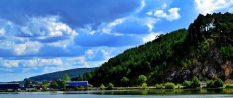
The right bank of Mikhailovsky Pond is steep, steep in places, and covered with spruce, fir and pine forest. Between the rivers First and Second Key, the bank breaks into the water with picturesque limestone cliffs. On the rocks you can clearly see the fall of the limestone layers at an angle of about 45 degrees. The rocks are a geomorphological and botanical natural monument. A complex of rock flora grows on them. You can find needle-leaved carnation, common chinstrap, and purple sedum.
They are also interesting from a geological point of view. Limestones are interbedded with dolomites and quartz sandstones. Local regional stratigraphic units of the Silurian system have been established here: Shemakha, Voronin, Cuban and Demidov layers, in the lower Devonian - the Mikhailovsky horizon. Fossils are found on the rocks: corals, brachiopods, trilobites, ostracods.
There are legends about a cave hidden in the rock as a result of rising water during the creation of the Mikhailovsky Pond.
Role-playing games were repeatedly held on the banks of Mikhailovsky Pond. The role players liked the beauty of Mikhailovsky. People came from all over the country to participate in the games. And in some places in the forests, wooden fortresses still stand.
The city is located in a basin, surrounded on all sides by mountains. It is always colder here in winter. An excellent panorama of Mikhailovsk opens from Voroninskaya Mountain , towering above the dam. From here the city is visible at a glance. In winter, there is a ski center on the slopes of this mountain.
In the center of Mikhailovsk is the Church of the Ascension . The first church, built in the 1830s, was wooden. But in the 1880s, it either burned down in a fire or simply became very dilapidated. A new stone temple was founded. The construction was led by Krasnoufima tradesman Thaddey Nikolaevich Malkov. He was known as an experienced builder. In September 1892, the main part of the temple was built and consecrated. Later, the boundaries were built and consecrated in honor of the Nativity of the Virgin Mary and in honor of the Presentation of the Lord. The temple had a bell tower 40 meters high. The weight of the largest bell was 175 pounds (about 3 tons). The sound of the temple bells could be heard for many kilometers.
On December 20, 1935, the Ascension Church was closed. The bells were removed and the bell tower was dismantled. The process was not easy. Workers partially dismantled the brickwork and propped up the bell tower with logs. It turned out that the bell tower stood on wooden pillars. Then a large fire was lit to set the supports on fire. As a result, the bell tower collapsed.
In 1937, a metallurgists' club with a cinema opened here, and since the 1970s there has been a museum here. Now the temple has been restored and is functioning.
Nearby, at the beginning of Kirov Street, there are the ruins of a two-story brick building. A vocational school built in 1902 was located here Berg, who was then the guardian of the Serginsko-Ufaleysky factories, donated part of the estate for the construction of a vocational school. Now there are only walls left, on which trees have already grown.
And next to these ruins is a wasteland. In the past, there was a wooden house of the plant manager here. Unfortunately, about twenty years ago the old house burned to the ground. All that remained was a cellar, made of old brick and rubble stone in the depths of the mountain.
Several old merchant houses have been preserved in Mikhailovsk. One of them houses the Museum of History and Local Lore . It opened in 1972. It occupies the former estate of the merchant Varentsov of the second half of the 19th century, located near the bus station (Kirova St., 30). Museum phone number (34398) 5-12-92.
In the western part of the city rises Vlaskina Mountain , named after a local resident. Until recently, this flat and vast mountain was completely bare. In recent years, the hills surrounding Mikhailovsk have begun to be overgrown with young pine trees. So Vlaskina Mountain is covered with the bristles of coniferous trees. Gradually there are more and more of them.
In 1855, a harbor-pier was built under this mountain for the construction of barges and loading of products from the Mikhailovsky plant.
Downstream of the Sergi River (on the outskirts of the Voronino microdistrict) limestone cliffs rise. The two rock massifs are approximately equally divided by the bypass road bridge.
In the lower rocks there is a picturesque Voronin grotto and Voroninskaya cave . The grotto is clearly visible even from the bridge, but you will have to look for the cave. It is not visible from below. The approximate length of the cave is 10 meters. The cave has two entrance holes (the second of them is very small). It has two small grottoes: the first is covered with earth and rubble, the second with clay. From the second grotto there is a narrow hole. The vaults of the cave are heavily smoked by torches.
There is an interesting legend associated with this cave about a treasure hidden in it. You can read more in the book “The Serga River” (as well as about many other interesting places that are not included in this article).
Sights of Stavropol and Mikhailovsk - unique museums and galleries
Museum of caskets world of caskets
The Museum of Caskets on Dzerzhinsky Street, a unique institution for Stavropol, opened in September 2021.
The first of the boxes presented in the museum was purchased in 1990 as a souvenir at an exhibition. Then, from her travels, the founder of the museum, Anzhelika Shestakova, brought only boxes, but for her personal collection. As a result, she managed to collect more than 2,700 exhibits from 105 countries, all continents are represented except Antarctica, since boxes are not yet made there.
If you really are a connoisseur of such trifles, then reading three books by the author presented in the museum will help you delve deeper into the topic.
There are three halls in the museum:
- The first is devoted to types and forms;
- In the second room there are boxes of continents;
- The third hall is the dream of all children. It features boxes in the form of cartoon and fairy tale characters, as well as musical ones that you can listen to.
The exact coordinates of the museum of caskets are: 45.042739, 41.952525.
Historical Park “Russia – My History”
The historical park “Russia – My History” in Stavropol is not just a local attraction. This is a part of a large-scale exhibition complex in Russia.
Here, the history of Russia from the formation of statehood to modern times is presented interactively. On the information stands you can read many interesting facts about each stage of the country’s development. Those who wish to test their knowledge by participating in an exciting quiz, or take a virtual tour of the ancient fortress “Arkaim”.
In one of the halls of the historical park “Russia – My History”, sitting comfortably on bean bags, you can endlessly admire the projection of the starry sky, watch the history of the baptism of Rus', the birth of Christ and much more.
This attraction definitely deserves attention. A whole day is hardly enough to go around all the halls.
Exact coordinates: 45.021882, 41.895420.
Art gallery “Your story”
Attraction The art gallery “Your History” is the cultural center of Mikhailovsk. Despite the fact that it was opened only in the spring of 2021, it has already become popular among residents and guests of the city.
The gallery displays carved panels and icons made by one of the companies that are part of the Third Rome Construction Group. Here you can also see the works of local artists.
Exact coordinates: 45.157957, 42.052227.
Picture gallery of landscapes by Pavel Grechishkin
The art gallery of landscapes by the honored artist of Russia Pavel Grechishkin is one of the departments of the Stavropol State Museum-Reserve.
The exhibition is a gift and includes over 500 works. It is noteworthy that the art gallery is located in the building of a former mosque, designed by the architect Grigory Kuskov.
The gallery regularly hosts concerts, meetings, seminars, lectures, and creative evenings.
A visit to the landscape art gallery will be interesting for adults and children. The artist’s tourist route is traced on the canvases: from the steppes of Stavropol, the Caucasus mountains, the Urals, central Russia, Lake Baikal to India, Egypt, Nepal, France
Exact coordinates: 45.041096, 41.961514.
Museum of Local Lore
The Stavropol State Museum-Reserve named after G. N. Prozritelev and G. K. Prave is a multifaceted landmark of Stavropol, which has a convenient location: right on the central square of the city.
The museum presents: 2 skeletons of the Southern Elephant, and one of them is the most complete of the four existing in the world. The permanent exhibition includes dolmens, butterflies, halls of paleontology and mineralology.
You can walk around the hall for several hours; it will be interesting for both adults and children.
Exact coordinates: 45.044879, 41.968126.
V.A. Vesnovsky about Mikhailovsk
Local historian and journalist V.A. Vesnovsky in 1917 in the Perm Provincial Gazette wrote about the Mikhailovsky Plant:
“The village is located not far from the Ufa River, along the narrow and deep valleys of the Sergi River and the streams flowing into it, and mainly along the banks of a vast and beautiful pond, surrounded by a frame of high and rocky banks... The plant is famous for its roofing iron...
The surrounding area of the village has many extremely picturesque corners. One of them is the Urkan cliff [Kukan - author's note], lying on the shore of the factory pond. There are many different legends about this rocky cliff among the local population, connected with the treasure of some robber. It is said that on certain nights a fire burns at the top of the cliff, lit by no one. The brave souls, having heard enough stories about a rich treasure hidden in the mountain, tried to go “to the light”, to the top of the mountain, but no one was able to fulfill their intention, as they strayed from well-known paths and wandered through the forest until the morning...
Nature in the vicinity of the Mikhailovsky Plant sparkles with the colors of the South Urals. The tones and lines here are softer, the contours of the mountains are more sloping, and the fertile fields on the beautiful black earth soil are more visible. Fields and birch groves are enlivened by the singing of birds, numerous streams and rivulets caress the eye..."
Architectural monuments in Stavropol
Railway station building
The railway station building, decorated with intricate stucco, is a landmark of our time.
Stavropol (Stavropol-Rostovsky) is an operating station, a dead-end branch of the Mineralovodsk region of the North Caucasus Railway.
It serves suburban rail buses going to Kavkazskaya and Palagiada stations, and the only long-distance train to Moscow.
It is noteworthy that the Stavropol railway station is shown in the 1982 Soviet film “Men!”, as well as in a fragment of the modern series “Secrets of the Institute of Noble Maidens”.
Stavropol-Rostovsky is one of two railway stations that once operated on the territory of Stavropol. The second, affectionately nicknamed Tuapsinka, is now in a depressing state, and nothing reminds of its former significance.
The exact coordinates of the existing railway station: 45.055507, 41.999730.
Tiflis Gate
The triumphal arch in Stavropol, in other words the Tiflis Gate, is a completely atypical building for the Ciscaucasia of the 19th century. It is believed that this landmark was erected in honor of the 30th anniversary of the victory in the Patriotic War of 1812.
Tiflis Gate is located on Karl Marx Avenue almost opposite the Circus. Now they are simply a decoration of the city, but at one time they served as the eastern gate of the fortress, through which crews departed for Georgievsk, Vladikavkaz, as well as the capital of Georgia, Tifliss, which gave them such a symbolic name.
Unfortunately, in the pre-war period, the 30s of the last century, the monument was completely destroyed. Its restoration began only in 1998 on the initiative of local residents.
As historians of our region confirm, old drawings were used in the construction of the Arc de Triomphe, which made it possible to preserve the original appearance.
Exact coordinates: 45.052454, 41.993084.
Fortress Mountain
Fortress Mountain in Stavropol is a favorite place for both local residents and visitors. From the observation deck you can clearly see the panorama of the city.
The memorial complex “Fortress Mountain” is a striking example of the fusion of antiquity and modern times: the remains of the barracks wall of fortress No. 8 of the Azov-Mozdok defensive line are replaced by a modern singing fountain and a monument to the Red Guard Soldier.
Nearby there is a bust of the great commander Alexander Suvorov; historical monuments such as a cascade of stairs and the building of the first power plant in the city have been preserved.
A little further from the Soldier, the golden domes of the restored Cathedral in the name of the Kazan Mother of God are gilded.
Recently, another attraction has appeared on Fortress Hill. During the improvement of the observation deck, the largest structure of the Stavropol fortress was discovered - the foundation of the commissariat, as well as an extension not listed in the documents of the 19th century, and storage facilities.
After assessing the archaeological find by specialists from the local history museum-reserve and the research museum, it was decided to create an open-air museum.
The memorial complex “Fortress Mountain” is included in the list of historical and cultural monuments of federal significance.
Exact coordinates: 45.048741, 41.974197.
Church of the Holy Great Martyr Artemy
One of the most popular tourist sites in Mikhailovsk has recently become the Church of the Holy Great Martyr Artemy, which was erected in honor of the Great Martyr Artemy, who publicly denounced Emperor Julian for wickedness.
The temple is a unique attraction of its kind not only in the region, but also in the South of Russia as a whole. Pilgrims call it a man-made miracle, since the decoration of the temple: numerous icons, carved iconostasis, various church utensils, choirs, altar - everything is made of solid wood of different species, including valuable ones.
Exact coordinates: 45.157106, 42.041030.
German Bridge
Another attraction of Stavropol - the German Bridge in the Mamaysky Forest and its brothers in different parts of the city serve as the remains of a once great railway (narrow gauge railway) called "Tuapsinka".
It seems that today there is not a single Stavropol resident who has never heard legends about this majestic structure, soaring 20 meters into the air.
The German Bridge is hidden in the dense massif of the Mamaysky Forest, and finding it for those who are not familiar with the area is not always easy. On Saturdays and Sundays, you can just follow the scream: rope jumpers are jumping from the bridge, splashing out their emotions. While some “fly” on a rope, others storm the bridge supports, climbing to the very top using climbing equipment. It is worth noting that the German Bridge is the most accessible and budget-friendly climbing facility in the Stavropol Territory. You don’t need anything other than equipment and a reliable company.
The bridge was made from local shell rock with virtually no concrete used. He lost his “brothers” in the Chapaevsky microdistrict and on the section between the Tatarka - Novokavkazsky stations, the western shoulder of the former Tuapse - Armavir - Stavropol railway.
The height of the Novokavkazsky (German) bridge is 26 meters, the Chapaevsky bridge does not exceed 16-18 meters. They are less popular with tourists. Perhaps due to the fact that the first one is collapsing quite badly, some of its flights threaten to crush unlucky extreme sports enthusiasts, while Chapaevsky looks depressing.
The climb to the German Bridge is very easy, which cannot be said about the Chapaevsky Bridge, which can only be climbed by leaning on a tree and deftly pulling yourself up on iron loops screwed into the support by local ropers.
You can get to the Big German Bridge, which is located in the Mamaysky Forest, from the Razin House stop, from where you will have to walk at least 3 km. First, straight along the street, passing the river and the barrier, then going around the Elagin pond, you move along the dacha cooperatives. The landmarks are the sign “Rozovaya Street”, parallel to which you need to continue moving; on the right is an old wooden house painted bright yellow. On the left side as you move along there will be unfenced houses without doors, next to which there is a pile of old windows in rotten wooden frames. There are few dogs along the way, the road is straight almost all the time, if you are not sure about the correctness, you can ask passers-by and summer residents.
It's not a long walk, the road becomes very muddy after rains, it is advisable to use rubber boots. Oddly enough, all this does not stop people from going to the German Bridge; on the contrary, every year more and more people go to explore this unique architectural monument. Some take photographs, some cook barbecue, have a picnic. In short, everyone finds something to their liking.
Exact coordinates: 45.013600, 41.970342.
How to get to Mikhailovsk?
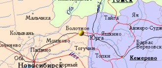
The city of Mikhailovsk is located in the southwest of the Sverdlovsk region. Regular buses go here from the Southern Bus Station of Yekaterinburg (travel time is approximately 2.5 hours).
By car you need to drive along the Yekaterinburg - Perm highway, then turn at the sign for Nizhnye Sergi and go to Mikhailovsk.
In the vicinity of Mikhailovsk there is the popular natural park “Oleniy Ruchi”, and then there is the Skaz cave. Also, many tourists raft on the Serge River, finishing the rafting in Arakaevo or Mikhailovsk.
You can learn more about these amazing places from the book “The Serga River”, which was published as part of our project “Uralist”.
© Pavel Raspopov
UraloVed.ru
See also:
- Old photos of the Nizhneserginsky plant
- History of the name and logo of the Oleni Ruchi natural park
- Serga River
How to get there?
Coordinates for GPS navigator
56.435805, 59.120491
Mikhailovsk on the map
Used sources
- Book by E. Vorobyova “On the Path to the 21st Century” / Factual database “Information about the Sverdlovsk Region”
- Mikhailovsk / Wikipedia
Interesting on the topic
MIKHAILOVESK & ARAKAEVO
The first time we were here in the furry year was for a performance in the winter night on New Year's holidays. All I remember is… Read more
Lovers of photography and travel are invited to a photo tour of the Urals!
Do you have a camera or phone and a great desire to become a photographer, but no knowledge? Then a photo tour is what you need! With… Read more
Women's tour: “Three paths to expanding horizons - choose yours!”
BRIGHT TOUR invites you to replenish the balance of vitality and fill yourself with positive energy. We devote the whole day, surrounded by the picturesque beauties of the Urals... Find out more
Oleniy Ruchi in autumn: weekend route
My first trip to Oleniy Ruchi Park took place in early autumn, when nature was just beginning to transform and change its color. We... Read more
Olenyi Ruchi Natural Park: attractions, how to get there, routes, photos
“Oleniy Ruchi” is a natural park located in the lower reaches of the Sergi River in the Sverdlovsk region. It was created in 1999 and ... Find out more
Weekend route: Arakaevo and Mikhailovsk
This time, two settlements were included in the weekend route list: the village of Arakaevo and the city of Mikhailovsk. The beginning of the route is ... Find out more
Tales of the Mitka Lakes
I’ve been to Oleniye Ruchi many times, but I always dreamed of walking the untrodden path – to the Mitkinsky mines. Finally the dream has come true! We... Read more
Mikhailovsky Museum of Local Lore
The first Mikhailovsky Museum of Local Lore was a public organization founded by a group of war and labor veterans on August 5, 1970 ... Read more
