- October 12, 2018
- Directions
- Nadezhda Kurchenok
Descriptions of the natural places of Karelia can be found both in paintings and in works of fiction. Having been here once, it is simply impossible to forget it. But the question may arise: is Karelia Russia or not? The republic is part of the Northwestern Federal District of the Russian Federation and borders Finland.
Where are the borders of the northern republic in Russia?
Karelia is located in the north-west of Russia. The main landmark for you on the map should be Petrozavodsk - this city is the capital of the republic. Petrozavodsk stretches along the coast of Lake Onega.
On the western side, Karelia borders on Finland, on the north it neighbors the Murmansk region, on the east – on the Arkhangelsk region, and on the south – on the Leningrad region. The total area of the region is about 180 thousand square kilometers (and most of this area is occupied by reservoirs and forests).
You can view the train schedule to Petrozavodsk in the search form below:
Population and indigenous people
According to the latest demographic data, the following nationalities live in Karelia:
- Russians (about 82.2% of the total population);
- Karelians (7.4% of the population);
- Belarusians (3.8% of the population);
- Ukrainians (about 2% of the population);
- Finns (1.4%);
- Vepsians (only 0.5% of the population).
Despite all the demographic changes taking place in the world, in Karelia you can still meet representatives of the indigenous peoples of the region: Karelians, Vepsians and Sami.
The most numerous of the trinity are the Karelians. Another indigenous people of Karelia are the Vepsians. They belong to the group of Baltic-Finnish peoples who once inhabited large areas of Mezhozerye (the land between Onega, White and Ladoga lakes).
And the smallest people of the republic, who have practically disappeared in Karelia, are the Sami. Now in the world there are only about 63,000 descendants of those same ancient Sami. They are scattered throughout Karelia, Finland, Norway and Sweden.
Weather and climate
The climate in Karelia is not much different from the climate of most northern regions. Really hot summers are rare, autumns are rainy, and winters are quite cold.
Average temperatures (summer):
- June: during the daytime – +19..+20, at night – +10..+14;
- July: during the daytime – +20..+22, at night – +14..+16;
- August: during the daytime – +20..+22, at night – +13..+15.
Precipitation in summer falls mainly in July–August, but is usually not prolonged. Also, the period from May 26 to July 17 in Karelia is the period of white nights.
Autumn comes to the region strictly according to the calendar - at the end of August-beginning of September. The nights become sharply colder, the rains begin to fall longer (sometimes for several days in a row).
Winter in Karelia is snowy and frosty, as befits the northern region. The coldest month is January. February is a time of heavy snowfalls and strong winds, which, with high humidity, is felt worse than in areas with drier air.
Average temperatures (winter):
- December: during the daytime – -5..-6, at night – -8..-10;
- January: during the daytime – -9..-12, at night – -14..-18;
- February: during the daytime – -10..-13, at night – -15..-16.
Spring in Karelia is as short as autumn. March refers to spring indirectly here - it is another month of winter. Even in April, there is still snow in most regions of the republic. As May approaches, temperatures begin to rise and snow begins to give way to rain, but the danger of frost remains high until summer.
Birds and animals
The fauna of Karelia includes many species. The most numerous are hares, squirrels and beavers. A little less often you can see wolves, brown bears, badgers, and lynxes. Minks, martens and otters live near the reservoirs.
In the southern regions, you can often find forest ferrets, raccoon dogs, as well as representatives of species introduced into the territory, for example, the American mink, which has perfectly adapted to local climatic conditions.
Previously, reindeer could be found in almost all regions of the republic, but now they can only be seen on the borders of Porosokhero - Segozero - Pyalma - Pudozh.
Common representatives of the local fauna include wild boars and moose.
As for birds, everything is more prosaic. The most common types are:
- hazel grouse;
- black grouse;
- wood grouse;
- white partridges;
- loons;
- ducks;
- waders;
- seagulls;
- eider (especially prized for its unique white fluff).
conclusions
Karelia will appeal to all tourists, regardless of the purpose of the trip and the nature of the visitors. This northern, uniquely beautiful Russian region has a rich history and is distinguished by special, ancient cultural traditions. For lovers of active recreation, there are special programs for trips on snowmobiles, dog sleds, and in the summer you can take advantage of exciting trips on off-road vehicles or rafting along mountain rivers. This region beckons and leaves no one indifferent!
Mushrooms, berries and forest plants
But Karelia is not only famous for its fauna. Those who like to go mushroom and berry picking will definitely find something to do here.
The most common representatives of the Karelian flora: Scots pine, Karelian spruce, Siberian larch, juniper, lady's slipper, black alder, buckthorn, bird cherry, common hazel, downy birch, warty birch, gray alder, smooth elm, small-leaved linden, maple, aspen.
Mushroom pickers here will be able to profit from the following species:
- White mushroom;
- boletus;
- boletus;
- milk mushroom;
- chanterelles;
- Russula;
- honey mushrooms;
- wave
The first mushrooms usually appear at the end of June, so you can go hunting at this time. But the main species will appear closer to mid-July and will grow until the beginning of September.
But most tourists love Karelia for its berry diversity. The berry picking here begins in July.
Main types of berries:
- cloudberry (beginning of collection - July);
- strawberries (beginning of harvest - July, August);
- blueberries (can be picked in August);
- lingonberries (you can start picking at the end of August);
- cranberries (ripe in September);
- blueberries (can be picked in September).
Fauna
In the south of Karelia spruce and pine forests predominate. Closer to the north, only pine trees are found. It is worth noting that many different berries grow in the republic. For example, in the south these are raspberries, cranberries, blueberries, blueberries and lingonberries, and in the north – currants and strawberries.
To protect nature, two reserves have been created - Kostomuksha and Kivach. Scientific tourism is carried out in the protected area, and natural museums and ecological routes have been created. In addition to nature reserves, three parks have been established in the republic:
- Kalevalsky;
- Paanajärvi;
- Vodlozersky.
Much attention is paid to the state forest fund. One of the richest republics of the Russian Federation in this regard is Karelia, where forest occupies about 85% of the total territory. In total, there are 17 forest districts in the republic.
Hunting and fishing in spring and summer
Hunting in Karelia is organized on the territory of various private lands. These are usually coniferous and mixed forests with abundant undergrowth and small clearings interspersed with swamps and lakes.
You can only go hunting with a huntsman; some recreation centers offer tourists ready-made hunting tours in groups of 5 hunters.
These tours most often take place all year round. In autumn they hunt mainly for wild boar (from a tower or from the approach), red deer and deer (the latter are hunted both in winter and early spring, but most often it is trophy).
Fishing is much easier. Fish are caught almost everywhere, but the most popular are the areas of Lakes Ladoga and Onega. Fishing tours with a guide and the possibility of renting gear are organized for tourists.
You can choose a suitable hotel here:
Main cities with photos and names
The list of the largest cities of the Republic of Karelia includes ten settlements.
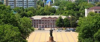
Petrozavodsk
It was founded by decree of Peter the Great back in 1703. It is the capital of the republic and the only large city on its territory. Located on the coast of Lake Onega, it has direct access to five seas (through rivers and canals). Population: 279,000 people.
Read about what architectural monuments and natural beauties you can see in the capital here.
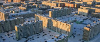
Kondopoga
It is located approximately 50 km from Petrozavodsk, on the coast of Lake Onega. The city was first mentioned in 1495 in chronicles. In the 18th century, deposits of ore and marble were discovered, and a hydroelectric power station was built in 1929. The status of a city was assigned to the settlement in 1938. Population: 30,000 people.
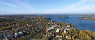
Kostomuksha
It is located approximately 30 km from the border with Finland. Initially it was a settlement built near an ore deposit, but in 1983 it received the status of a city. The Kostomuksha Nature Reserve and the Kalevalsky National Park are located on the territory. Population: 29,000 people.
Segezha
It stands on the river of the same name not far from Vygozero. Founded in 1914, it was originally a small railway station on the Murmansk road; in 1943 it received city status. Population: 26,000 people.
Sortavala
The city was founded by the Swedes in 1632 (before that, there had been a Karelian settlement on this territory since approximately the 12th century). Until 1918, the town was called Serdobol. Until 1940 it was administered by Finland.
It is located on the coast of Lake Ladoga and is the only city in the republic that has managed to preserve ancient buildings. It has the status of a historical city. Nearby is the Ruskeala Nature Park and the island of Valaam. Population: 18,000 people.
Read about the sights of Sortavala in this article.
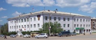
Medvezhyegorsk
Founded in 1916. Until 1938 it was called Bear Mountain (the local railway station is still called that today). It is located 152 kilometers from Petrozavodsk on the northwestern tip of the Bolshaya Bay of the Povenets Bay of Lake Onega. The area of this city is famous for its rich shungite deposits.
In Medvezhyegorsk you can visit the museum of the history of the railway station, a waterfall on the Vichka River, and the defensive fortifications of the Finnish occupation forces “Karkhumaki Castle”. Population: 14,000 people.
Kem
Translated, the name of the city means “Big River”. The settlement was founded in the 14th century and received city status in 1785. Managed to preserve several interesting historical buildings. Population: 11,000 people. Read what interesting things you can see in Kemi and its surroundings here.
Pitkäranta
Until 1940 it was part of Finland, in the same year it officially became a city. Located on the coast of Lake Ladoga. Population: 10,000 people.
Belomorsk
Located at the mouth of the Vyg River. The first mention of the settlement dates back to 1419. It is a major railway and maritime hub. Located near the Solovetsky Islands. Population – 9,600 people.
Suoyarvi
Founded in the 16th century. Until 1940 it was part of Finland. The territory includes the Talvojärvi nature reserve, as well as a network of lakes and swamps. Population – 8,900 people.
Republic of Karelia
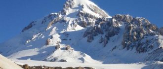
The Republic of Karelia is a federal subject in the north-west of the European part of Russia. The relief of the region is a hilly plain, along the western border of which stretches, starting in Finland, the Maanselkä ridge, the eastern spur of which is the West Karelian Upland - three chains of ridges stretching from northwest to southeast. In the interridge depressions there are lacustrine-glacial plains, lakes, and in some places swamps. The highest region of the republic is located in the extreme north-west, the relief of this area is highly dissected, and there is practically no swampiness. Landforms of glacial origin are widespread throughout the republic, among which the so-called ram's foreheads, curly rocks, eskers similar to railway embankments and fairly high hills - kamas are well known.
The Republic of Karelia is part of the Northwestern Federal District. The administrative center is Petrozavodsk.
The region's territory is 180,520 km2, the population (as of January 1, 2021) is 627,083 people.
Surface water resources
The watershed between the basins of the Arctic and Atlantic Oceans passes through the Republic of Karelia - most of the territory belongs to the drainage basin of the White Sea of the Arctic Ocean, the smaller part belongs to the drainage basin of the Baltic Sea of the Atlantic Ocean (about 60% and 40% of the territory, respectively); A small territory in the southeast of Karelia belongs to the Caspian Sea basin. A narrow watershed between the ocean catchments crosses the central part of the territory in a west-northwest direction.
The river network of Karelia is represented by about 27.6 thousand rivers with a total length of about 83 thousand km (the density of the river network is 0.46 km/km2). The river network of Karelia is represented mostly by small rivers and channels that connect numerous lakes, forming lake-river systems, while even the largest rivers have a relatively short length. The river systems of Karelia are characterized by weak incision of river channels, deep drainage of watersheds by lake basins, underdevelopment of stepped river valleys, large specific falls and large lake content of watersheds. A peculiar feature of the Karelian rivers is the bifurcation of the flow, which usually occurs when the river leaves the lake. The rivers of Karelia are characterized by mixed feeding with a predominance of snow and rain (40% and 35%, respectively). The rivers of the region belong to the Eastern European type of water regime; they are characterized by spring floods, summer-autumn low water, interrupted by rain floods, and low winter low water. Due to the high regulation of the rivers of Karelia by lakes, the phases of the water regime are rather weakly expressed. Karelian rivers freeze in November - December and open in April - early May. In areas with rapids, many rivers do not freeze. The largest rivers of Karelia are Vodla, Vyg, Kem, Kovda and Shuya.
The average long-term river flow is 56 km3/year. In 2015, river flow in the Republic of Karelia amounted to 66.7 km3/year, which is 19.11% higher than the long-term average. Below is the dynamics of river flow in the Republic of Karelia from 2010 to 2015.
According to the Institute of Lake Science of the Russian Academy of Sciences, on the territory of Karelia there are over 73,000 lakes and artificial reservoirs with a total area of more than 36 thousand km2 (lake content 19.96%), including over 28,000 lakes with an area of more than 0.01 km2 and a number of smaller lakes size. About 17 thousand km2 are located in parts of the water areas of Lakes Ladoga and Onega located within the republic. Most of the large lakes in Karelia are glacial-tectonic in origin - their basins are formed in cracks and faults of hard rock and reshaped by the erosive activity of the glacier. A significant part of the lakes are glacial lakes, which appeared as a result of the erosive activity of a glacier, and dammed river lakes, which appeared as a result of the blocking of river valleys by glacial sediments. Oxbow lakes and swamp lakes (lakes) are also widespread. All large, medium and many small lakes of Karelia are flowing or drainage; among the small lakes there are overgrown and swampy drainless lakes. Many large lakes in Karelia are backed up by reservoirs, some of the lakes are completely absorbed by reservoirs, others have partially retained their isolation. The largest lakes in Karelia are the largest freshwater lakes in Europe - Ladoga and Onega. Also included in the category of large lakes are Topozero, Vygozero, Pyaozero, Segozero, Vodlozero, Keret, Syamozero, Tikshozero, the system of lakes Upper, Middle and Lower Kuito, Nyukozero, Pyhäjärvi and others. There are significantly more natural reservoirs than artificial ones (about 99%), which are used mainly for the purposes of hydropower, water supply to populated areas, water transport, recreation, etc. The largest reservoirs in Karelia are the Iovskoye, Kumskoye, Vodlozerskoye and other lake reservoirs. Lake Onega is backed up by the large Verkhnesvirsky reservoir, the dam of which is located on the Svir River, which flows in the Leningrad region. Among the regions of the federal district, the Republic of Karelia ranks first in terms of the area of lakes and artificial reservoirs and the lake content of the territory; among the regions of Russia, it ranks first in terms of lake content and fourth place in terms of the area of lakes and artificial reservoirs.
Swamps and wetlands occupy 19.63% of the territory of the Republic of Karelia - 35,436 km2. There are many swamps and swamp systems here, the largest of which are the Yupäuzhsuo swamp in the center and the Vazhinskoe swamp in the south of the Republic. The islands of the Onega Bay of the White Sea are included in the list of wetlands of international importance under the Ramsar Convention. Among the regions of the Federal District, Karelia ranks second in terms of swampiness after the Murmansk region.
The area and number of lakes and artificial reservoirs, swamps and wetlands are variable; they depend on natural (water regime, climatic phenomena, etc.) and anthropogenic (drainage of territories, flow regulation, construction of new dams, etc.) factors.
One of the largest waterways in Russia, the White Sea-Baltic Canal, passes through the territory of Karelia, connecting the basins of the White and Baltic seas.
Groundwater resources
The predicted groundwater resources of the Republic of Karelia are 137 thousand m3/day (0.12% of the total volume of predicted groundwater resources of the Northwestern Federal District and 0.02% of Russia). Among the regions of the Federal District, Karelia ranks last in terms of the volume of predicted groundwater resources.
The republic's groundwater reserves as of January 1, 2015 amounted to 107.8 thousand m3/day, which corresponds to a degree of study of 78.69% - the third figure among the regions of the federal district after the Murmansk and Kaliningrad regions.
According to data as of January 1, 2015, 30.1 thousand m3/day were produced and extracted from underground water bodies in Karelia over the year, including 3 thousand m3/day in the fields. The degree of development of groundwater reserves is 2.78 - the minimum indicator among the regions of the federal district.
Provision of population with water resources (according to 2015 data)
The provision of the population of the republic with river flow resources is 105.894 thousand m3/year per person, which is higher than both the Russian average (31.717 thousand m3/year per person) and the indicator of the Northwestern Federal District (44.057 thousand m3/year per person) .
The provision of predicted groundwater resources is only 0.218 m3/day per person, which is significantly lower than both the Russian average (5.94 m3/day per person) and the federal district indicator (8.496 m3/day per person). According to this indicator, the Republic of Karelia ranks last among the regions of the federal district and in Russia as a whole.
Below is the dynamics of provision of the population of Karelia with river flow resources in 2010–2015.
Water use (as of 2015)
Abstraction of water resources from all types of natural sources in Karelia – 202.23 million m3. Most of the water is taken from surface water sources – 171.81 million m3 (84.96%), which is 0.26% of the region’s annual river flow. Below is the dynamics of fresh water intake in Karelia in 2010–2015.
The total water losses during transportation in Karelia are 5.5 million m3 or 2.72% of taken water, which is lower than both the federal district (4.7%) and the Russian average (11.02%). Below is the dynamics of water losses during transportation in Karelia in 2010–2015.
Direct-flow water consumption – 167.91 million m3. Most of the water was used for industrial, as well as drinking and domestic needs (65.21% and 17.74%, respectively), agricultural water supply accounts for 0.33%. Below is the dynamics of water consumption in the region in 2010–2015.
Domestic water consumption per capita in Karelia amounted to 47.279 m3/year per person, which is lower than both the Russian average and the federal district indicator (56.205 and 57.941 m3/year per person, respectively). Below is the dynamics of domestic water consumption per capita in the region in 2010–2015.
The volume of circulating and re-sequential water consumption in the region is 965.47 million m3 or 85.19% of the total water consumption in the region. Below is the dynamics of direct-flow and recycling and re-sequential water consumption in the republic in 2010–2015.
Discharge of wastewater into water bodies of Karelia is 249.54 million m3, of which only 17.73% is conditionally pure and standardly treated wastewater and 82.27% is polluted and insufficiently treated. The republic generates 7.79% of the total volume of polluted and insufficiently treated wastewater in the Northwestern Federal District and 1.42% in Russia. Below is the dynamics of water disposal in the region in 2010–2015.
Water quality (based on 2014 data)
In 2014, in the centralized water supply systems of Karelia, non-compliance with standards for sanitary and chemical indicators was recorded in 36.7% of samples taken, and for microbiological indicators - in 5% of samples. In non-centralized water supply systems, the quality of 44% of samples for sanitary-chemical indicators and 15.4% of samples for microbiological indicators did not meet the standard. Below is the dynamics of the corresponding indicators in the region in 2010–2014.
Water management
The Republic of Karelia is in the area of responsibility of the Neva-Ladoga Basin Water Administration of the Federal Agency for Water Resources of Russia.
The functions of providing public services and managing federal property in the field of water resources in the region are carried out by the Water Resources Department of the Neva-Ladoga Bank of Water Resources in the Republic of Karelia.
The powers in the field of water relations transferred to the constituent entities of the Russian Federation, the functions of providing public services and managing regional property in the field of water resources in the region are carried out by the Ministry of Natural Resources and Ecology of the Republic of Karelia.
The state program “Reproduction and use of natural resources and environmental protection in the Republic of Karelia” for 2014–2020 is being implemented in the region, the objectives of which include ensuring the protection of the population and economic facilities from the negative impact of water, increasing the capacity of river beds, subject to the preservation aquatic ecosystems, improving the state of the environment in the Republic of Karelia and others.
When preparing the material, we used data from the State reports “On the state and protection of the environment of the Russian Federation in 2015”, “On the state and use of water resources of the Russian Federation in 2015”, “On the state and use of land in the Russian Federation in 2015”, “On the state of the environment of the Republic of Karelia in 2015”, collection “Regions of Russia. Socio-economic indicators. 2016". The rankings of regions for surface and underground water resources do not take into account the indicators of federal cities - Moscow, St. Petersburg and Sevastopol.
Travel route from Moscow and St. Petersburg
You can get to Karelia in several ways:
- By plane. Flights are accepted at Besovets Airport in Petrozavodsk. The schedule varies from season to season.
- By train. If you are coming from Moscow, then the easiest way is to take the Murmansk train No. 092 or the branded Karelian train No. 18. Both arrive in Petrozavodsk. But Lastochka trains run from St. Petersburg to Petrozavodsk and Sortavala. There is a night train No. 011, but the comfort of the cars here leaves much to be desired.
- By car. The P-21 “Kola” highway leads from St. Petersburg to Petrozavodsk. You can get from Moscow to Karelia along the M-11 highway, from which you will also need to turn to Kola.
Detailed information on how to get to Karelia by car and a Google map with a description of the trip can be found here for Muscovites, and here for residents of the northern capital. Read about independent travel to Petrozavodsk using all types of transport in this article.
You can view the flight schedule here:
How to get to Karelia
The central Karelian airport is located in the vicinity of the capital of the region - Petrozavodsk, at a distance of 12 km from the city. This is an international airport that annually receives a large number of tourists both from Russia and from other countries.
It will take about an hour and a half to fly to Karelia from Moscow. The airport also has helipads.
By the way, there are landing spots for helicopters even in sparsely populated areas of the republic. You can also get to unique places by train. The railway line runs along the Karelian Isthmus, and along the way passengers can admire the beauty of the White Sea.
The republic has well-developed bus services. You can take a tourist flight from various Russian cities: Novgorod, St. Petersburg, Vologda, etc. If you want to travel on your own, Muscovites should know that the distance from Moscow to Karelia is 1,017 km along the highway, and 695 km in a straight line. The main road - highway M18 (St. Petersburg - Murmansk) has excellent coverage. But secondary roads, especially in remote places, are bumpy.