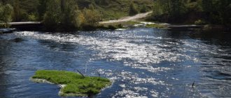
The Bryansk region is a region located on the border of three countries, which has been part of more than one state throughout its history, and today is one of the most valuable tourist destinations. Its rich historical heritage and culture, which has absorbed the traditions and values of many peoples, played a role in this. Ecotourism has also gotten off to a good start in the region. The famous Bryansk wilds, which once gave the name to the capital city, have always been and will be popular for travelers. After all, they contain not only natural attractions, but also ancient settlements, places of military glory and even pathogenic territories.
Reservoirs and waterfalls of the Bryansk region
The region's water resources are numerous. Many large rivers and very small streams flow through its territory. There are 49 large lakes and ponds here alone. And how many small and unaccounted for ones? And you can’t count them! What there are no waterfalls here. And that’s only because there are no mountains either. But one, although artificial, was still discovered.
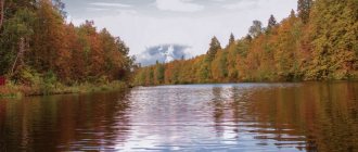
Orekhovoye (Kolyanoye) Lake
- Coordinates on the map: 53.498828, 33.673106.
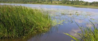
The reservoir is considered one of the largest in the Bryansk region. Its area is about 12.5 hectares, and its depth reaches 2.5 m. But it is popular for a completely different reason. At the bottom of the lake you can find real thickets of chilim (water chestnut), which is called the water chestnut here because of its horn-like processes.
Truly this amazing plant is a relict, it has been preserved here since pre-glacial times and gave the name to the reservoir. You can make interesting souvenirs from chilims, which is what the locals do, and even eat them. Since 1992, the lake has been classified as a Natural Monument of regional significance.
Vytebet River
- Coordinates: 53.106368, 35.224598.
The right tributary of the Zhizdra originates in the Karachevsky district, near the village of Yakovlevo. It does not flow through the territory of the Bryansk region for long, but its path flows through historical places. The forest wilds of its banks hid partisans during the Second World War and were part of the Zasechnaya Line from the time when Bryansk was still called Debryansk.
Due to the fact that the Vytebet flows through sparsely populated areas, it is not as polluted as reservoirs located near megacities. Today the river is considered one of the cleanest in the Bryansk region.
Lake Convolvulus
- Coordinates: 52.780868, 32.258845.
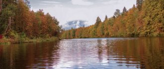
A cozy, but not at all small, lake is located in the former garden of manufacturer Sapozhkov. Nowadays, it has the status of a specially protected area, and the estate is given to a children's sanatorium. Previously, there was no ancient park, no lake, much less an estate, which today is a landmark.
In the 19th century there was an impassable swamp until G.K. Sapozhkov did not intend to build a country house. In this regard, it was decided to improve the surrounding area. The lake was dug by peasants from neighboring villages, and the soil from it was transported to the territory of the future park.
So the new landowner solved two problems. He built a picturesque pond and drained the swamp, raising the ground level. After the work was completed, the lake was filled with water and a small boat was launched. On it, guests of the estate took pleasure trips to a small island built in the southwestern part of the reservoir.
Galoe swamp
- GPS coordinates: 53.356962, 33.230692.
An amazing natural monument - a raised bog with cranberry trees - is located in the Kletnyansky district. It is also considered the largest in the region, its area is 720 hectares. It got its name either from the word “naked”, or from the soil, colored red, almost rusty. Even the moss growing in the swamp has a reddish tint. The place is treeless, that is, the trees come almost close to it, but the swamp itself remains completely open and can be seen far ahead.
Its uniqueness lies in its inhabitants. It is here that gray cranes, listed in the Red Book of the Bryansk Region, fly in the spring, and the eagle owl has made the swamp its permanent habitat.
Of the plants, Traunsteiner's palmate root deserves special attention; it is considered rare not only for the region, but also for Russia. White water lilies also bloom here. Local residents believe that mermaids live in their thickets and can drag them to the bottom. Indeed, it is very easy to get entangled in slippery rhizomes and drown, so you need to behave in the swamp with caution.
Lake Krugloe
- Coordinates: 53.436794, 34.291192.
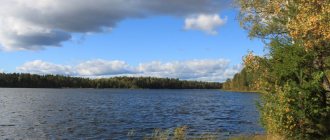
The lake of karst origin got its name for its almost perfect circle shape. It is located on the territory of the Fokinsky forestry. The lake is not too large, the area of the water surface is slightly more than 5 hectares, but it is deep. The depth increases gradually, from the shores to the center, reaching 16 m.
Despite the fact that its shore is almost entirely swampy, the water is clean and transparent. Perhaps because of this, the lake is sometimes called Holy (Light). The reservoir is suitable for both swimming and fishing.
Desna River
- Coordinates: 52.717221, 34.020538.
The most important and most important river for the Bryansk region at all times was the Desna. Water trade routes to the Don and Oka went from it. In the 20th century, the climate has already changed significantly, the water level has decreased, today this significance of the river has been lost. Now it is of interest only to tourists and historians.
The first ones come to the picturesque shores to relax in silence from the bustle of the city or go rafting. The latter are looking for places where our distant ancestors lived. One of these places is Khotylevo, 20 km from Bryansk. It is famous for the fact that objects belonging to the Gravettian culture, atypical for these places, were found here.
Lake Bezdonnoe
- Coordinates: 53.539858, 33.962759.
The bottomless lake not far from the village of Staroye Lavshino is so called because of its great depth. In the middle it reaches 20 m. Like all lakes in the Bryansk region, it is of karst origin and was formed as a result of the washing out of softer rocks by groundwater.
Previously, there was a children's camp on its shore, but now only ruins remain. Although the surroundings of the lake are picturesque and very suitable for cultural recreation. There is even a sandy beach and piers. The forests around the pond are full of mushrooms and berries, and the lake itself is home to fish.
Dam on the Snezhet River
- Coordinates: 53.235833, 34.558333.
This river itself is quite interesting because its banks are covered with white sand, which from a distance resembles snow. That's why it got its name. Even at the beginning of the 20th century, Snezhet was navigable; after the revolution, a power plant was installed on it and several dams were built.
One of them, built in the 20s in the Beloberezh desert, has survived to this day. Moreover, it still functions and is used for its intended purpose. In the place where the dam blocks Snezhet, a waterfall has formed, spanning the entire width of the river. It is this, and also the snow-white beaches, that attract vacationers here.
Lake Belogolovl
- Coordinates: 53.389811, 33.608282.
The reservoir, which is actually just a pond, is named after the village in which it is located. Most often you can see fishermen here, and if you come to relax with your family, you need to look for a parking lot. After all, most of the residential buildings are located right on the shore of the pond.
Some locals even have their own piers. However, there is also a public beach. The surrounding area of the lake is very beautiful. There is even an apple orchard. In general, if you want a cozy holiday, you should definitely come to Belogolovl.
Interesting mountains and hills of the Bryansk region
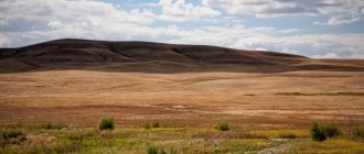
There are no mountains here in the traditional sense. In the Bryansk region, any hill, any hill, even just a few meters, is considered a mountain.
Bokhonova Mountain
- Coordinates: 53.631625, 33.419078.
The highest point of the Bryansk region, which can hardly be called a mountain, has a height of only 288 m. It has always attracted travelers. One of the legends tells about a tree that grew at the foot of the mountain. It was so powerful and spreading that it could cover all travelers under its branches.
But one day a thunderstorm broke out and lightning struck the tree, and right from that place a spring began to flow, which would later be called Thunder. After some time, people noticed that the water in it was healing and pilgrims flocked to the source. Every year, the ceremony of consecrating water on the Ascension Day is held at this place.
Desnyanskie Zhiguli
- Coordinates: 52.405000, 34.047000.
Flowering chalk slopes, about 30 m high, on the banks of the Desna River are considered a natural monument. They are of great importance for the region. Here is the habitat of animals listed in the Red Book, and a wonderful vacation spot, and sites of ancient man, and wild rare species of vegetation, not counting the Desna floodplain itself. Any type of human economic activity is prohibited in this area, but you can relax, pick mushrooms and berries, and fish.
Geography
The Bryansk region lies in the western part of the East European Plain, occupying the middle part of the Desna basin and the forested watershed between it and the Oka.
Extreme points: northern 54°02′ N. sh., southern 51°50′35″ N. sh., western 31°14′30″ E. d., east 35°19′42″ E. d.
Nature
The climate is moderate continental. The average January temperature is −7…−9 °C, the average July temperature is +18…+20 °C.
A significant part of the region (about a quarter of the total area) is covered with forests. Forests of a wide variety of types: coniferous, mixed and broad-leaved, as well as forest-steppe.
Minerals: deposits of sand, clay, chalk, marl and other building materials, as well as phosphorites.
Springs and springs of the Bryansk region
In the region they are given great importance; it is not for nothing that holy springs are found here at every step. Where else could they be if not in the places where Christianity began to emerge, the first saints and monasteries appeared.
Source of the Svensk Icon of the Mother of God
- Address: Suponevo village.
It is located in the village of Suponevo, very close to the ancient Svensky Monastery. It appeared in the 13th century, and perhaps even earlier. At least, for the economic needs of the monastery, water from the source was always used, which was considered healing. During Soviet times, the monastery was closed, and the source gradually began to fall into disrepair.
It was only in 1992 that work began on its restoration. The spring was cleaned out and enclosed in a pipe, and a brick font was installed. After the consecration, which took place in 2006, pilgrims and believers from the surrounding area and neighboring regions regularly come to see it.
Spring Silver Key
- Coordinates: 52.962931, 32.435903.
Not far from Klintsy, in a ravine in the middle of a coniferous forest, there is a spring with amazing silver water. The water temperature in it remains at +40 degrees in both winter and summer. It is not known for certain when it was formed, but old-timers say its age is 300 years.
According to the stories of the ancestors, first the earth began to hum in that place, and then two fountains began to flow. The underground hum subsided, the streams from the two springs gradually united and became one, and the place was declared holy.
Source of the Martyrs Cosmas and Damian
- Coordinates: 52.502946, 34.344054.
In the 18th century, there was a monastery on this site, where monks came in search of peace and solitude. Next to it, numerous keys were beating, which local residents enclosed in a log house. This created a small pond. The monks consecrated it in honor of the Roman saints - the brothers Cosmas and Damian, who became famous for treating people for free.
Local residents consider the water not only healthy, but also healing. Despite the low temperature, about 70 C, those who decided to swim here have never caught a cold.
In addition, there were known cases of healing from diseases after ablution. He is also considered a saint by newlyweds who come to attach a small souvenir to the chapel above the source - wooden hearts connected to each other - as a sign of their endless love.
Square named after P.L. Proskurina
Proskurinsky Square is located next to Partizan Square and is its continuation.
In a small area there is an alley and boulevard where residents of Bryansk can stroll or sit on benches under the shade of trees.
Proskurina Square is a very quiet and peaceful place. There are no attractions or playgrounds here, so it is suitable for those who want to spend time in nature without too much fuss.
The decoration of the square is spruce trees - tall and green, they give the small park a special atmosphere.
Bryansk region: important archaeological sites
Who, if not they, will tell about the history of these places? The appearance of the first people, cities, power, wars for territory. The Bryansk region is of great interest to archaeologists, because people have settled here since the beginning of time. Excavations in the region are still ongoing, but very, very little is known so far.
Yudinovsky Museum Complex
- Coordinates: 52.663056, 33.267500.
The ancient village of Yudinovo was first mentioned in chronicles of the 15th century. However, back in the last century it was proven that people began to settle in these places much earlier. It all started in 1934. Village residents were digging a cellar to store potatoes and discovered a bone at a depth of 2.5 m. After comparing it with the remains of all known farm animals, the find was sent to the regional center, where the local newspaper published a note about it.
The note fell into the hands of a Belarusian scientist, and then archaeologists, who began to dig further and carefully study the finds. Naturally, there was no longer any talk of any cellar. During the excavations, it was found that once upon a time, a very long time ago, there was tundra in this place. The climate was so harsh that animal bones served as construction material and fuel for fires. There was no vegetation here at all.
It was decided to leave the Paleolithic site in the form in which it was found, without recreating its appearance. These are two Cro-Magnon dwellings, built from mammoth bones and the remains of a fireplace between them. Every year Yudinovo is crowded. Archaeologists come to the village to continue excavations and discover something equally interesting.
Chashin Kurgan
- Coordinates on the map: 53.282773, 34.336242.
It is called the “Heart of Bryansk”; the city once began with it. It must be said that the ancients chose a very convenient place. The intersection of two rivers turned Bryansk into a large trading city, and the forests and ravines around it protected it from enemies. Moreover, we still had to climb to the fort. Even now, after so many centuries, the height of the mound remains about 8 m. By the way, it was called Chashin because the mounds form a round bowl with high edges and a flat bottom.
Little has reached our time, but based on these finds we can conclude that ancient Bryansk was a very rich place. For example, trade equipment, glass beads and even mirrors.
In addition, artisans' tools, weapons, Christian crosses and pagan idols have been preserved. Despite the fact that most of the residents have already converted to Christianity, they have not yet abandoned the faith of their ancestors. After the Mongols destroyed the ancient city, its inhabitants decided to start over, but on Pokrovskaya Mountain. And the memory of the place from which it all began remained not only in history, but also in the hearts of people.
Village Vshchizh
- Address: village Vshchizh.
Despite the fact that mentions of the ancient city are found in chronicles dating back to the 9th century, few people knew its exact location. Historians only knew that there was such a city and that Batu burned it in 1238 during his campaign against Rus'. And only before the start of the Second World War, in 1942, the remains of Vshchizh were discovered on the banks of the Desna, which refuted everything that was known about it before, starting with the fact that its inhabitants were illiterate and wild.
The ancient settlement was distinguished by a very high level of development and culture. Crafts were widespread here, trade flourished, and many household items were decorated with inscriptions. Moreover, the city was not poor. The items found included both glass and silver jewelry. And glass at that time was an expensive material and was highly valued.
The most interesting finds from Vshchizh are considered to be a wooden boat, about 12 m long, and the remains of an ancient Russian temple with a large human skeleton inside. Chelny is now kept in the Bryansk Museum of Local Lore, but only the foundation remains of the temple. An Orthodox cross was installed in its place.
Sevskoye settlement
- Coordinates: 52.160312, 34.496946.
Local residents most often call it the Town. It is believed that this is what remains of the ancient Russian Sevsk, which was mentioned in 1146 in the Tale of Igor’s Campaign. The settlement stands on a high hill at the confluence of Maritsa and Sev. Previously, it was a mound with embankments on which wooden city walls stood.
They have not survived to this day and today this place is used as a festive city site. During excavations, things no older than the 12th century were discovered here. These are glass jewelry and pottery.
Mounds in the village of Eliseevichi
- Coordinates: Eliseevichi village.
Excavations that shed light on the life of ancient Slavic tribes are still ongoing in this settlement. The oldest finds date back to the 11th century. Based on them, archaeologists concluded that the main Slavic tribe living in these places was the Radimichi tribe. In addition, the remains of northerners, Vyatichi and Krivichi were discovered.
The main finds are considered to be burial mounds with burial birch trees. These tribes had a widespread custom of cremation, so human remains were found only in the form of ashes. But in some mounds, preserved women's jewelry made of carnelian was found.
Rope factory of merchant Martynov
Many of us drive past a seemingly inconspicuous building every day in the very center of Bryansk. There is a dilapidated building at the bus station. However, few people know that this is a real ancient monument and a masterpiece of architecture.
The surviving monuments of the Russian style in general in our city are few in number, but quite expressive and original. These include the Rope Factory, built in the 2nd half of the 19th century. The factory, which belonged to the merchant Martynov, was also built on what was then the outskirts of the city, and is now Krasnoarmeyskaya Street, 61. It was built of brick and painted on the masonry, the parts were whitewashed. A unique example of an industrial building from the eclectic period, made under the influence of the Russian style. So don’t rush to say that it’s time to demolish this building. It has long needed to be restored and shown to tourists. But for now, it is important that the townspeople know their history, which is very close!
Anomalous places in the Bryansk region
Like everywhere else, the Bryansk region has its own mysterious places that scare tourists and, sometimes, even local residents are afraid of.
Lake Svyatoe
- Coordinates: 53.447703, 33.856497.
The picturesque lake in the Zhukovsky district is one of the four “holy” reservoirs of the Bryansk region. Like all of them, it has a karst origin, which became the reason for legends and rumors. Its exact depth is unknown, but it is believed to be at least 18 m. The bottom is covered with a thick layer of silt, and the water is very clear and clean.
There are many legends about him. The most famous one is about a church that suddenly went under water, and now at night local residents can hear the bell ringing. There are also people who have seen aliens here, and a huge column of water shooting up. Even the Loch Ness monsters must be found here, and they are found because eyewitnesses claim that they exist.
Witch forest
- Coordinates: 53.029444, 34.384722.
A patch of forest near the village of Sinezerki amazes with strangely curved, gnarled pine trees. Scientists attribute this to poor soil and moose, of which there are many here. But local residents claim that this is the most anomalous place.
In general, the Bryansk region is considered one of the places of power, the land of witches, and this forest is even more so. Here, temporary portals are formed, communications are cut off, car engines stall, and people can wander around the same place for hours. Even the air is filled with something incomprehensible and inexplicable.
Perhaps this is due to the fact that since ancient times all witchcraft objects that had already served their purpose, as well as things filled with negative energy, were brought here. They gave the effect that our ancestors sensed, but we, living in a world devoid of witchcraft and magic, cannot figure it out.
Historical heritage of the Bryansk region
The war that raged throughout the world left orphans and inconsolable mothers and wives in every home here, who never received their sons and husbands. It wiped out many populated areas from the face of the earth and took the lives of many worthy people. Residents of the Bryansk region will remember it forever, because it was because of this war that the entire region turned into one big mass grave. Monuments and memorials that are installed not only in cities, but also in forests and highways remind us of this.
Memorial complex Hatsun
- Address: Karachevsky district, Khatsun village.
On October 25, 1941, in a small village called Khatsun, the Nazis shot 318 people, among whom were not only local residents, but also refugees from Bryansk, as well as nearby settlements. Today, on the site of the mass grave there is a museum and memorial complex. Here you can learn about the fate of the occupied territories, the difficult fate of the civilian population in wartime, and other settlements that, like Hatsun, became the grave for their inhabitants.
Memorial complex Partizanskaya Polyana
- Address: Lesnaya st., 16, village of Belo-Berezhsky Sanatorium Turbaza.
The place where in 1941 a partisan detachment led by D. E. Kravtsov defeated the Nazis in an unequal battle is today a museum and memorial complex. It was opened on September 17, 1969, and 8 years later it included the Museum of Partisan Glory, which is now considered the largest in Russia.
In the center of the memorial is the Memory Wall, warmed by a hot partisan fire. The names of 8,000 defenders of the Motherland are immortalized on it. Banners made of bronze bowed in their honor. The complex is complemented by partisan dugouts hidden in the canopy of oak trees, an exhibition of military equipment and an eternal flame burning in memory of the fallen national avengers.
Monument to Warrior Drivers
- Coordinates: 53.198428, 34.529119.
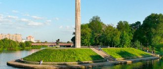
At 112 km of the Oryol-Bryansk highway, a little before reaching Bryansk, in a place called Osinovaya Gorka, you can see an unusual monument. This is a stele with a rearing car and a soldier standing on its running board.
His eyes peer into the distance, and his hands tightly grip the steering wheel. The monument was opened in 1968. It is considered the first in the Soviet Union, dedicated to the millions of military drivers who, in any weather, fulfilled their duty to their Motherland on thousands of roads.
Museum-Estate of A.K. Tolstoy
One of the most popular places in the Bryansk region is the museum-estate of A.K. Tolstoy in Krasny Rog. Originally a beautiful manor built in the mid-18th century. and surrounded by a park belonged to Count Razumovsky, and in 1836 it passed to the writer’s family.
Alexei Konstantinovich Tolstoy spent his childhood and adolescence in Krasny Rog, the proximity of the estate to the Bryansk forests and the rich folk epic of these beautiful places are reflected in many of the writer’s works. In 1859, Tolstoy moved to the estate for permanent residence, where he died in 1875. A literary museum was opened in this place in 1967; one of the buildings of the complex, the Hunting House, was destroyed during the Second World War, but it was restored in 1993.
Reserves and natural parks
Nature is a national treasure of the Bryansk region. Today, the authorities, led by World Organizations, are making every effort to ensure that the descendants of our descendants see these forests.
Bryansk Forest Nature Reserve
- Coordinates: 52.500000, 34.000000.
The reserve is located on the territory of two districts of the Bryansk region - Suzemsky and Trubchevsky, and covers an area of 9654 hectares. Since 2001, UNESCO has included it in the list of biosphere reserves.
The area between the Desna and Nerussa rivers, where the reserve is located, is a forest untouched by man, the main asset of the Bryansk region. By preserving it, people save the lives of its inhabitants, many of which are especially valuable, endangered species. Only here all 10 species of European woodpeckers live.
The most common animals are white hares, lynxes, bears, and wild boars. There are a lot of wood grouse. And in 2011, bison were brought into the reserve. At first there were only 7 heads, but by now their number is approaching 80.
Kletnyansky Nature Reserve
- Address: Suzemsky district, Nerussa station, Zapovednaya street, 2.
It neighbors the Bryansk Forest Nature Reserve, but was created much earlier, in 1946. Its main goal was to preserve the population of black grouse and brown bear, as well as other animals. The position of the reserve was slightly shaken during the period of perestroika and after it. They began to cut down the forest here, and hunting was allowed.
But after 2009, the situation changed for the better, when the Ministry of Natural Resources and Environment took over the issue. The reserve received the federal status of a specially protected area and today about 20 species of rare animals live here, such as hazel dormouse, gray crane, lynx, chipmunk and others.
Trubchevsky partisan forest
- Coordinates: 52.549121, 33.883334.
Here during the Second World War there were fierce battles between partisans and fascist invaders. But in addition to historical, the forest also has another, environmental value. This is not only a place of military glory, but also a habitat for animals and birds.
Rare even for Russia, the black stork and capercaillie, the common chipmunk and the short-eared snake eagle found shelter under the branches of over-aged pines, which are still found here in large numbers.
And how many important and rare plants that people simply must preserve grow here. The reserve belongs to specially protected areas of regional significance, and in addition, is part of the Biosphere Reserve Nerusso-Desnyanskoye Polesie.
Lokot stud farm
- Coordinates: Lipovaya Alley street, village. Elbow.
The stud farm in Lokta, a village in the south of the Bryansk region, begins its history in 1842, when the estate was founded here. Its owner was Count Apraksin. He also founded the first stables, which have survived to this day.
Some time later, the estate with stables was bought by the royal family. In 1895 they were given the official title of Factory. From the very beginning to the present, some of the best horses in the country have been bred here. Under the Soviets, the Russian Trotter became the main breed, and today it is the largest center for its cultivation and breeding.
Every year in September, the Lokot Stud Farm holds a large-scale event that attracts horse breeders from all over the country. This is not only a wonderful holiday, but also an exhibition of the best representatives of the breed, and horse races with their participation.
Guerrilla Oak
- Coordinates: 52.691649, 34.198322.
All the years of the war, this spreading tree on the banks of the Navlya River served as an observation post for the partisans. The tree has already crossed its 250-year mark, and not so long ago received the status of a Natural Monument of regional significance. Today it, along with the Museum of Partisan Glory, monuments to soldiers and partisans, as well as holy springs, is part of the tourist center, which is called “Around the Partisan Oak”.
Limonary
- Address: Dobrun village.
The village of Dobrun, very close to Bryansk, is a real exotic paradise. Where else, in these latitudes, can you see so many tropical plants collected in one place? Mangoes and passion fruits, coffee and date palms, and lemons with fruits weighing more than 1 kg grow successfully here. There are about 20 plant species in total.
But the miracles don't end there. Throughout the lemonarium there are aviaries in which birds live. There are decorative chickens, pheasants, and peacocks here. There are also a lot of waterfowl: mandarin ducks and mute swans, common geese and ducks. You can use the services of a guide and learn more about each plant, but the excursion must be arranged in advance.
See also reviews of the most interesting places neighboring the Bryansk regions - Smolensk, Kaluga, Oryol and Kursk
The Bryansk region is an interesting region from all sides, which you won’t recognize even in your entire life. Every time you come here, you can only slightly lift the veil of mystery with which it is covered. And every time, this mystery will attract again and again, providing a reason to return to this ancient protected land.
