Located at the extreme northeastern tip of the Eurasian continent. It occupies the Chukotka Peninsula, the adjacent part of the mainland and a number of islands: Wrangel, Ayon, Ratmanov, etc. It is washed by the East Siberian and Chukchi Seas in the north and the Bering Sea in the east. It borders on the Republic of Sakha (Yakutia), the Magadan Region and the Kamchatka Territory, and has a maritime border with the United States in the east. Part of the Far Eastern Federal District. The administrative center is the city of Anadyr. It is the only autonomous region of the Russian Federation that is not part of another subject.
Formed on December 10, 1930 as the Chukotka National Okrug as part of the Far Eastern Territory (since 1934 - as part of the Kamchatka Region of the Far Eastern Territory). In 1938-1953 was part of the Khabarovsk Territory, and from December 1953 - the Magadan Region. In 1977 it was transformed into the Chukotka Autonomous Okrug. On June 17, 1992, it left the Magadan Region and received the status of an independent subject of the Russian Federation.
Minerals: gold (Kupol, Mayskoye, Valunistoye deposits, etc.), coal (Anadyrskoye, Nagornoye), silver, tin, tungsten, mercury, natural gas, oil, etc.
Main sectors of the economy: mining (mining gold, silver, hard and brown coal), fishing industry, energy. The gold mining industry is the main component of the district's economy; its share in the region's industrial production is more than 40%. About 10% of Russia's explored gold reserves are concentrated in the region. Enterprises: Zolotorudnaya LLC, Severnoe Zoloto CJSC, Chukotka Mining and Geological Northern Tin CJSC, Nagornaya Mine OJSC, Sibneft-Chukotka LLC, Chukotrybpromkhoz State Unitary Enterprise, Bilibino NPP, Chukotenergo OJSC.
Agriculture specializes in reindeer husbandry, fur farming, hunting, marine hunting (seal, walrus) and fur farming, and fishing.
The main types of transport are sea (not used in winter) and air. There are 5 seaports (Anadyr, Beringovsky, Pevek, Provideniya, Egvekinot). Chukotka airports have air connections with Moscow, Khabarovsk and Magadan, regional centers and national villages are connected by local air lines. Part of the cargo processed at the ports is delivered by road along road networks and winter roads (unpaved roads on which movement is possible only in winter on compacted snow). There are no railways in the area.
Wrangel Island, part of the reserve of the same name, is included in the list of UNESCO World Heritage Sites.
Chukotka Autonomous Okrug
Chukotka Autonomous Okrug is located in the extreme northeast of Russia. It occupies the entire Chukotka Peninsula, part of the mainland and a number of islands (Wrangel, Herald, Ayon, Ratmanova, etc.). This is the only region in Russia, part of which (the entire Chukotka Peninsula and the eastern part of Wrangel Island) is located in the Western Hemisphere.
It is washed by the East Siberian and Chukchi seas of the Arctic Ocean and the Bering Sea of the Pacific Ocean.
On the territory of the district there are the extreme points of Russia: the eastern point is Ratmanov Island, the eastern continental point is Cape Dezhnev. Here are located: the northernmost city of Russia - Pevek and the easternmost - Anadyr, as well as the easternmost permanent settlement - Uelen.
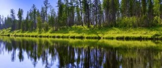
Over 900 species of higher plants, over 400 species of mosses and over 400 species of lichens grow in Chukotka. In the continental part of Chukotka, unique floristic relics have been preserved for this region - Telekayskaya and Tnekveemskaya groves.
Chukotka is home to lemmings, voles and shrews, squirrel and flying squirrel, chipmunk and mountain hare, ermine and sable, black-capped marmot and Beringian ground squirrel, wolverine, river otter and sea otter, elk and reindeer, polar and brown bears, foxes and arctic foxes, polar wolf and lynx. The Yakut bighorn sheep lives in the mountainous regions, and on Wrangel Island there is a musk ox, which was brought here as an experiment for the reintroduction of musk oxen that previously lived here and has successfully taken root - now its population is about 1000 individuals. The coastal waters of Chukotka are inhabited by 9 species of cetaceans (gray, bowhead and humpback whales, fin whales, minke whales, beluga whales, killer whales, harbor porpoises and white-winged porpoises) and 6 species of pinnipeds (Pacific walrus, Far Eastern bearded seal, larga (spotted seal), lionfish (striped seal) seal), Akiba (ringed seal) and Steller sea lion (northern sea lion)), as well as 7 more species of marine mammals (blue and southern right whales, sei whale, narwhal, sperm whale, northern swimmer and northern fur seal). The Bering Sea alone is home to 402 species of fish, of which more than 50 are commercial. About 30 species of freshwater fish live in the district's inland waters. The district is home to 42 species of land mammals and approximately 220 species of birds.
On the territory of the Chukotka Autonomous Okrug there are two protected areas of federal significance - the Wrangel Island State Nature Reserve and Beringia National Park, as well as 26 protected areas of regional significance - 5 reserves and 21 natural monuments.
The wildest places in Russia: a great guide to Chukotka
Border zone. Russians do not need a pass to Chukotka from the summer of 2021. It must be issued if you are going to Wrangel, Ratmanov and Herald islands. Citizens of another country need to obtain a pass in advance because it can take up to 60 days. But you can order online.
Clothing and equipment. I took with me two pairs of light pants, thermal underwear, top and bottom, wool socks, a fleece jacket, a softshell jacket, a membrane waterproof jacket, a hat, and trekking boots. I had a light tent, a sleeping mat, a sleeping bag for temperatures down to minus 5 degrees, a burner and a pot. All equipment fit in a 65 liter backpack.
Connection. My Tele2 operator was useless in Chukotka: there was practically no connection or internet. Kostya’s Yota SIM card somehow caught the Internet in cities. MTS and Megafon have connections not only in cities, but also in villages.
Food. When camping, we ate mainly buckwheat and wheat cereals. They are convenient because they do not need to be boiled. It is enough to bring the water to a boil - and the cereal itself is saturated with water and swells. We also poured cold water over the buckwheat overnight - and by morning it was ready. Be sure to take with you spices, vegetable oil, coffee, dried fruits, and something sweet, such as halva or kozinaki. Don’t carry stewed meat in cans - it’s heavy and impractical. Buy dry vegetables as soon as you find yourself in Chukotka: they will make your food taste better.
Money. Prices in Chukotka are on average two to three times higher than in Central Russia. Travel to such remote places can be afforded by people who have a lot of money or a lot of time. Both of these resources are interchangeable. My trip along the route Voronezh - Chukotka - Voronezh cost 60,500 rubles and took 113 days. On average, I spent a little over 500 rubles a day.
Wild animals. For almost three months that I spent in Yakutia, Kolyma and Chukotka, I only once met bears, which we caught up with in a truck, moving along the Kolyma highway. Chukotka after Bilibin is a tundra that can be seen for many kilometers around, so you won’t get an unexpected encounter unless you’re specifically looking for it. But you should still follow the rules so as not to meet a bear. Being noisy, not smelling of fish and blood (this is why bears attack hunters), lighting a fire whenever possible so that you can smell the smoke - this will be enough to protect yourself.
The hunting supervision department of the Magadan region has prepared a booklet with advice on “How to behave in nature so as not to meet a bear. And what to do if a meeting cannot be avoided.” To reinforce the tips, you can listen to a lecture by experienced hiker Dmitry Arbuzov. Among the animals, I met wild deer, rodents, wolverine, beluga whale and seals in the Anadyr estuary.
Anadyr: the end of the earth or the crossroads of the world?
Anadyr is the capital of the Chukotka Autonomous Okrug. This is perhaps the only reliable knowledge about the city for most Russians.
My personal acquaintance with Anadyr took place in February of this year. What did I know about the city before? The same as everyone else, essentially nothing. Administrative center, the easternmost city of Russia. Back in the 80s, my cousin went to Anadyr to work as an aircraft mechanic. I remember my feeling: somewhere very far away and no certainty. My brother asked to buy him Oleg Kuvaev’s book “Territory”, which, of course, was not on sale. Therefore, I based my idea of Chukotka on the works of Yuri Rytkheu and the Ergyron ensemble, whose performances were often shown on TV.
In fact, there is much more certainty in Anadyr than in many other cities of the Russian Federation, even compared to cities located in the European part of the country. Rarely does anyone come to Anadyr for an undefined purpose. The city lives a life in which many things are determined, because you cannot rely on chance in a populated area, which, although it has regular year-round air connections with Moscow, Khabarovsk and the populated areas of Chukotka, can at any moment be cut off from the “mainland” due to bad weather or for any other reason indicated on the departure board.
“For the information of passengers, flight UT533/534 on the route Moscow-Anadyr-Moscow of UTair Airlines on April 10, 2021 was canceled by decision of UTair Airlines. The airline apologizes."
This is exactly what happened to us, employees of the Agency for Strategic Development "CENTER". In February, a plane flies to Anadyr from Moscow twice a week. We planned to stay there from Monday to Friday, but the blowing north-east wind with gusts of up to thirty meters per second forced us to stay for another four days. I don’t know about my colleagues, but it was during these days that I realized that Anadyr is a place where you need to be alone with yourself in order to understand that the complex is in the simple, the simple is in the important, the important is in the main... And so on until infinity until the plane arrives.
Pondering my impressions of the city, I caught myself thinking that in my mind I practically do not separate Anadyr from the Chukotka Peninsula and the Chukotka Autonomous Okrug, unlike, for example, Yakutsk, which has replaced the idea of the Republic of Sakha as a whole. In my opinion, Anadyr is:
- Chukotka
- End of the earth
- Aviation
- Change of dates
- Wind, blizzard
- Fish, caviar
- "Ergyron"
- Along the gold
- North-Eastern Siberia
- White Silence
None of these concepts can be correlated exclusively with Anadyr, and not Chukotka as a whole, including “Ergyron” - the only professional song and dance ensemble in the Chukotka Autonomous Okrug, recognized as a particularly valuable object of cultural heritage of the peoples of Chukotka, embodying its identity.
Anadyr turned out to be in my mind a barely distinguishable element of the integral system of Chukotka, which is not surprising given the Eurocentric view of the world, which has withstood the onslaught of higher geographical education.
It’s interesting that friends on the social network Facebook feel Anadyr almost the same way as I do. When asked what the city is associated with, the expected answers were received:
- End of the earth (light)
- Far - very far - well, very far
- Expensive tickets
- Sparsely populated, small peoples
- Town
- Snow – mountains of snow – blizzard
- Cold (and even dog cold)
- Permafrost
- Delicious fish, caviar
- polar night
- Northern Sea Route
- Whales, walruses
- Reindeer, reindeer herders, subsistence farming
- "Territory"
That is, we all perceive Anadyr, first of all, as a part of geographical space (location, sea, climate, wildlife), and much less as a mental space for the life of a social individual. We have a clear geographical image formed in our heads: Anadyr is a seaside town, located very far (from Moscow?), with a very cold climate.
The sociocultural image of this city is more vague: sparsely populated, expensive tickets, delicious fish and caviar, deer and reindeer herders. Chukotka again, but not the city of Anadyr. Just like two more atypical images evoked by the toponym - the Northern Sea Route and “Territory” by Oleg Kuvaev, also indirectly connected with the city.
You can clarify the image of Chukotka for yourself in the Museum, which was formed in 2002 by merging the Chukotka District Museum of Local Lore and the State Center for the Protection and Restoration of Historical and Cultural Monuments of the Chukotka Autonomous Okrug. The museum center traces its history back to the Bureau of Local History, created in 1931, and is housed in a specially built building, shaped vaguely like a polar bear. In the unique exhibition of the Museum Center, which contains more than forty thousand exhibits, you can see not only prints of fossil flora dating from the Late Cretaceous - Paleocene, a rotary harpoon of the ancient Eskimo civilization and other artifacts of the culture of the indigenous peoples of the peninsula, but also attributes of modern history, for example, a tent Papanin or the engraved fang “New Life at the Beginning of the Century” by T.A. Pechetegina, who depicted the plot of the arrival by helicopter to the village of the governor of the Chukotka Autonomous Okrug, Roman Abramovich.
Exhibits of the Museum. The fossil flora, dated to the Late Cretaceous (Paleocene), is classified as the Temlyan fossil flora and includes over twenty-one species of higher plants.
The museum exhibition will introduce you to the history and culture of the peninsula, but will not make you aware of the role of cities in the development of Chukotka.
It is surprising that the capital of the Chukotka Autonomous Okrug is associated among residents of the European part of the Russian Federation with subsistence farming and reindeer, although the circumpolar city is mentally more of a city than any small city in central Russia, its way of life connected with the countryside.
And yet, what is Anadyr like, which acquired the status of a city only in 1965?
Anadyr became recognizable thanks to the publications of bloggers: facades of residential buildings painted in bright colors, banners with images of local animals (see photo of the splash screen), a statue of St. Nicholas:
And the Gulf of Anadyr with port cranes:
The seaport of Anadyr is the largest in the region and has connections with Petropavlovsk-Kamchatsky, Vladivostok, Magadan and other ports.
The compactly located city occupies an area of about ten square meters on the shore of the estuary of the same name. km and has a population of just over sixteen thousand people. The administrative center of the Chukotka Autonomous Okrug is, in fact, a single-industry town, the main function of which is management and administration.
A seaport, a coal mine in a neighboring village with the telling name “Coal Mines”, the airport “Ugolny”, and military bases - perhaps these are all the most significant residents of the Anadyr urban district and the Anadyr region. However, in the period from 2012 to 2017, the volume of investments in the city amounted to 32 billion rubles.
The seaport and airport in the Coal Mines village are the only gates to the city. Four months of navigation in the Bering Sea and four air routes to the “mainland” (Moscow, Khabarovsk, Petropavlovsk-Kamchatsky, Magadan-Yakutsk). There is also the federal highway A384, 23 km long, connecting the city with the airport, partially passing along the winter road of the Anadyr Estuary. “Russian Post” here is an integral part of life, communication with the “mainland”, which, however, is carried out by the same airlines, depending on weather conditions.
Anadyr Bay. Highway A384 , winter road on the ice of the estuary.
Based on the results of 2016-2017. the city has a positive migration population growth, in contrast to the Chukotka Autonomous Okrug as a whole. Moreover, the Anadyr urban district is the only municipal entity in the autonomous region showing positive migration growth. The age structure of the population of Anadyr differs from the gender and age structure of the Russian Federation in a higher proportion of the population of working age due to a lower proportion of the population older than working age. The reason is not the high mortality rate, but especially migration processes: like many other polar cities, Anadyr is for many only a temporary refuge where they can earn money to live on the “mainland.”
Not the least role in this is played by the subarctic maritime climate with cold, windy and cloudy winters and short, cool and also cloudy summers. Weather observations in Anadyr have been carried out since 1889 (on the initiative of the founder of the Novo-Mariinsk Post, L.F. Grinevetsky). In accordance with meteorological observations from the weather station located on Cape Observation, the average annual temperature here is -6.9 degrees; the absolute minimum was recorded in 1913, when thermometer readings dropped to -46.8 degrees. The extreme climate is caused not only by the temperature regime: the discomfort is aggravated by the predominance of cloudy weather (about one hundred and fifty cloudy and more than one hundred and fifty cloudy days per year) and strong snowstorms (more than one hundred days per year). Storm and hurricane winds from the east are not uncommon; in winter their speed can reach 40-50 m/s.
Cape Observation . One of the largest wind power plants in Russia - Anadyr Wind Farm
Walking around the small, leisurely town, it is difficult to understand its geostrategic significance. Awareness comes not through historical retrospect (on August 3, 1889, fulfilling the Decree of the government of the Russian Empire on the formation of the state of the Anadyr Okrug in the northeasternmost territory of the state, military doctor and polar explorer L.F. Grinevetsky founded the Novo-Mariinsk post) or the realities of geopolitics, but by chance, thanks to the same aviation, without which it is impossible to imagine the life of Anadyr.
When the plane we were expecting was about to take off from Moscow, an airliner flying from Beijing to Los Angeles made an emergency landing at Ugolny airport due to the fire alarm going off. A strange event at first glance becomes clear when you look at the location of the continents in the polar projection. Unlike the usual Eurocentric projection, which distorts our perception of geospace, the polar projection places Anadyr on the “South-East and East Asia – North America” axis, and the edge of the earth immediately becomes a global crossroads.
Is this the end of the earth? Ice Age Beringia united Eurasia and North America. The Bering Isthmus, and later the narrow, frozen Bering Strait, served as a communication corridor between the two parts of the world.
Speculative boundaries were unknown to late Pleistocene man. Our Eurocentric cognitive thinking places Chukotka beyond the “border of geography” because here, in the Bering Sea, is the international date line, the border of hemispheres, the border of parts of the world, the state border. There are a lot of speculative borders and only one really existing delimiter - the Bering Strait with a minimum width of 86 km.
Anadyr's own geospace is small due to the severity of natural conditions and the resulting discreteness of the settlement system. Mentally, Anadyr, like the whole of Chukotka, is the outskirts of the state. But it is Anadyr that ensures the continuity of geographical and geopolitical space.
“Your flight will end on a different planet from which it began.”
In Anadyr in winter, when in front of you is an endless snow-covered distance, or, conversely, a horizon eaten by a blizzard, the geographical space will cease to be three-dimensional, concentrating on the point of your presence here and now.
And this will be only your territory. Therefore, Anadyr is a city in which you can remember the meaning of your life. Of course, if you're lucky, the flight will be cancelled. And there will be no Internet. And the wind, at least with gusts up to thirty meters per second.
View of Anadyr from Camel Hill , the highest point of the city.
Author:
Olga Evgenievna Gritsan, expert on the development of public spaces, head of the analytical department of the Agency for Strategic Development "CENTER".
Photos by Olga Gritsan and Maria Sedletskaya.
Cartographic material prepared by Irina Chernova.
