The Kemerovo region includes 20 cities. Beyond the Urals, the Kemerovo region boasts the highest population density (approximately 30 people per 1 square kilometer), of the total population, almost 87% is concentrated in the cities of the Kemerovo region.
There are 7 cities in the region in which the population reaches 100 thousand people (Prokopyevsk, Belovo, Novokuznetsk, Leninsk-Kuznetsky, Kemerovo, Kiselevsk, Mezhdurechensk). And this is a very solid indicator, because according to these parameters, the Kemerovo region loses only to the Moscow region.
The main wealth of the region is coal - it is mined here in 13 cities.
Each city among the cities of the Kemerovo region is unique and unique, has a unique appearance, fate and history. Here are the cities of the Kemerovo region: Mezhdurechensk, Yurga, Topki, Tashtagol, Salair, Prokopyevsk, Taiga, Polysayevo, Osinniki, Novokuznetsk, Mezhdurechensk, Myski, Mariinsk, Kiselevsk, Leninsk-Kuznetsky, Kemerovo, Guryevsk, Berezovsky, Belovo, Anzhero-Sudzhensk.
I would especially like to highlight a couple of cities from this list.
Content
- 1 Largest cities 500 thousand - 1 million people 1.1 Kemerovo
- 1.2 Novokuznetsk
- 2.1 Prokopyevsk
- 3.1 Mezhdurechensk
- 4.1 Salair
Kiselevsk
The history of this city begins in 1932, namely, with the villages of Cherkasovo and Afonino. In this area, the Kiselyovsky workers' settlement was formed. After 4 years, this village was renamed the city of Kiselevsk by a resolution of the All-Russian Central Executive Committee.
There are a lot of mines in the city, which is why it has a very complex layout. The first mines in the city are considered to be “Naklonnaya No. 1” and the later “Capital No. 1”, which were built back in 1932. This city consists of several territorial districts separate from each other.
Coal is considered the leading industry here, since coal reserves in this area are simply unlimited. However, this does not prevent Kiselevsk from developing the chemical, forestry, food industries and various types of mechanical engineering.
Medium-sized cities 20-100 thousand people
Mezhdurechensk
Population 98,734 people (2016).
Leninsk-Kuznetsky
There are and previously existed other settlements with names close to this, see Leninsk
Population 97,666 people (2016).
Kiselevsk
Population 92,210 people (2016).
Yurga
Population 81,396 people (2016).
Belovo
Population 73,400 people (2016).
Anzhero-Sudzhensk
Population 72,827 people (2016).
Berezovsky
Population 47,140 people (2016).
Osinniki
Population 43,445 people (2016).
Myski
Population 41,938 people (2016).
Mariinsk
Population 39,332 people (2016).
Fireboxes
Population 28,144 people (2016).
Polysayevo
Population 26,738 people (2016).
Taiga (city)
Population 24,532 people (2016).
Guryevsk (Kemerovo region)
There are other settlements with this name, see Guryevsk.
Population 23,359 people (2016).
Tashtagol
Population 23,079 people (2016).
Kaltan
Population 21,186 people (2016).
Anzhero-Sudzhensk
This is a very young city, although, however, it is very difficult to even approximately determine its age, since no one undertakes to say when and how the first settlement arose in this remote taiga, which over time became Anzhero-Sudzhensk. Although a couple of legends have survived.
One of them was the legend that an ancient tribe settled in this place. Men, as befits men, hunted and fished, and women were in charge of the house. But it so happened that due to the constant lack of a strong male hand in the village, women took up this matter. They not only cooked and cleaned, but also began to carry out something like modern judicial justice, and from there the name “court of wives” came... - Sudzhenka.
see also
- Kemerovo region
- Cities of Russia
| [ + ] Cities by regions of Russia | |
| Cities of the North-West (NWFD) | St. Petersburg (and its cities) • Leningrad region (historical Staraya Ladoga) • Arkhangelsk region • Vologda region • Kaliningrad region • Karelia • Komi • Murmansk region • Nenets Autonomous Okrug • Pskov region |
| Cities of the Volga region (Volga Federal District) | Bashkortostan • Volgograd region • Kalmykia • Kirov region • Mari El • Mordovia • Nizhny Novgorod region • Orenburg region • Penza region • Perm region • Samara region • Saratov region • Tatarstan • Udmurtia • Ulyanovsk region • Chuvashia |
| Cities of Southern Russia (SFD) | Sevastopol (including Inkerman) • Republic of Crimea • Adygea • Astrakhan region • Krasnodar region • Rostov region |
| Cities of the North Caucasus (NCFD) | Dagestan • Ingushetia • Kabardino-Balkaria • Karachay-Cherkessia • North Ossetia - Alania • Stavropol Territory • Chechen Republic |
| Cities of the Urals (Ural Federal District) | Kurgan region • Sverdlovsk region • Tyumen region • Khanty-Mansi Autonomous Okrug - Yugra • Chelyabinsk region • Yamalo-Nenets Autonomous Okrug |
| Cities of Siberia (Siberian Federal District) | Altai Republic • Altai Territory • Irkutsk Region • Kemerovo Region • Krasnoyarsk Region • Novgorod Region • Novosibirsk Region • Omsk Region • Tomsk Region • Tyva • Khakassia |
| Cities of the Far East (FEFD) | Amur Region • Buryatia • Jewish Autonomous Region • Trans-Baikal Territory • Kamchatka Territory • Magadan Region • Primorsky Territory • Sakha (Yakutia) • Sakhalin Region • Khabarovsk Territory • Chukotka Autonomous Region |
| see also | Cities of the DPR, LPR, Transnistria, South Ossetia • Regions of Russia • Cities of Russia |
Administrative division
(data from the Territorial Body of the Federal State Statistics Service for the Kemerovo Region - Kuzbass)
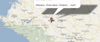
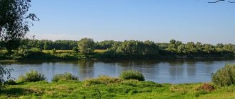
Kuzbass is located in the southeast of Western Siberia and is almost equidistant from the western and eastern borders of the Russian Federation. Geographically, the region occupies a middle position between Moscow and Vladivostok. It is part of the sixth time zone.
Kuzbass is located in temperate latitudes between 52°08′ and 56°54′ north latitude, and 84°33′ and 89°28′ east longitude. This corresponds in Russia to the latitudes of the Chelyabinsk, Moscow, Kaliningrad and Kamchatka regions, and in Western Europe to the cities of Warsaw and Berlin.
The region was formed within its modern borders on January 26, 1943.
The area of the region is 95.5 thousand square meters. km. This represents 4% of the territory of Western Siberia and 0.56% of the territory of Russia. The region's territory exceeds the territory of several Western European countries. Thus, the area of Hungary is 93 thousand square meters. km, the area of Portugal is 92 thousand square meters. km, Austria – 83.8 thousand sq. km, Ireland - 70 thousand sq. km, Norway - 62 thousand sq. km, Switzerland – 41 thousand sq. km, Belgium – 30.5 thousand sq. km. In the north, Kuzbass borders on the Tomsk region, in the east on the Krasnoyarsk Territory and the Republic of Khakassia. In the south, the border with the Republic of Gorny Altai and the Altai Territory passes along the ridges of Mountain Shoria and the Salair Ridge, in the west with the Novosibirsk region - along flat terrain.
The length of Kuzbass from north to south is almost 500 km, from west to east – 300 km. Kuzbass is located inland, near the center of the Eurasian continent, at the junction of the West Siberian Plain and the mountains of Southern Siberia, and is significantly removed from the seas and oceans. The distance to the nearest cold northern sea – the Kara Sea – is about 2 thousand km, to the nearest warm sea – the Black Sea – more than 4.5 thousand km.
The region includes 16 urban districts, 14 municipal districts, 4 municipal districts, 7 urban settlements and 30 rural settlements; includes 19 cities of regional subordination, 1 city of regional subordination, 1 urban-type settlement of regional subordination.
The region has the highest population density beyond the Urals. 85% of the population is concentrated in urban areas. In Kuzbass there are 4 urban districts with a population of over 100 thousand inhabitants (Kemerovo, Novokuznetsk, Prokopyevsk, Belovo). Municipal districts and districts have significant recreational potential and are notable for their unique natural landscapes.
Population and date of formation for municipalities of the Kemerovo region - Kuzbass as of 01/01/2021.
| Population, people | Date of formation | |
| Kemerovo region – Kuzbass | 2633446 | |
| Urban districts: | ||
| Anzhero-Sudzhensky | 72472 | 1931 |
| Belovsky | 125053 | 1938 |
| Berezovsky | 46929 | 1965 |
| Kaltansky | 29030 | 1959 |
| Kemerovo | 552546 | 1918 |
| Kiselevsky | 90539 | 1936 |
| Krasnobrodsky | 13698 | 2004 |
| Leninsk-Kuznetsky | 95391 | 1925 |
| Mezhdurechensky | 98028 | 1955 |
| Myskovsky | 42598 | 1956 |
| Novokuznetsk | 544583 | 1618 |
| Osinnikovsky | 45947 | 1938 |
| Polysaevsky | 28466 | 1989 |
| Prokopyevsky | 187877 | 1931 |
| Taiginsky | 24362 | 1896 |
| Yurginsky | 80367 | 1949 |
| Municipal districts: | ||
| Guryevsky | 38439 | 1935 |
| Izhmorsky | 10585 | 1924 |
| Kemerovo | 46776 | 1924 |
| Krapivinsky | 22392 | 1924 |
| Leninsk-Kuznetsky | 20575 | 1939 |
| Prokopyevsky | 30086 | 1924 |
| Promyshlennovsky | 46078 | 1935 |
| Tisulsky | 19768 | 1924 |
| Topkinsky | 42615 | 1924 |
| Tyazhinsky | 21112 | 1924 |
| Chebulinsky | 13996 | 1935 |
| Yurginsky | 20112 | 1935 |
| Yaisky | 16920 | 1963 |
| Yashkinsky | 26842 | 1930 |
| Municipal areas: | ||
| Belovsky | 25385 | 2004 |
| Mariinsky | 53032 | 2005 |
| Novokuznetsk | 50094 | 1925 |
| Tashtagolsky | 50753 | 1983 |
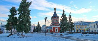
Winter Novokuznetsk - the southern capital of Kuzbass
© img.geliophoto.com
Novokuznetsk is a city with more than half a million people, located in the south of Western Siberia, in the Kemerovo region. Novokuznetsk is inextricably linked with Kuzbass, the mines and the metallurgical industry, but it differs from other cities in the region and Siberia. In the architecture of the city, entire streets are built in the Stalinist Empire style, some Stalin buildings are connected to Khrushchev buildings. There is a house-nut, a house-puck, houses-arcs and a house-stick, the first skyscraper in Siberia, a real fortress and streets that intersect themselves. And this city grew so quickly that its scale amazed contemporaries, and Vladimir Mayakovsky even wrote an ode poem about it.
1. Novokuznetsk was founded in 1618 as a fort - a fortified structure on the outskirts of the state. The fort housed troops that were supposed to protect against attacks by local nomadic tribes. The fort had a wooden palisade, fortifications, barracks, a church and residential buildings. By 1680, the settlement had grown and was given the status of a city. At the beginning of the 19th century, a fortress was built in the city to protect against Qing China. But only in Soviet times there was a rapid leap - and Novokuznetsk became the coal mining and metallurgical center of the entire region.
© img.geliophoto.com
2. Initially, the city was called Kuznetsk - the local population (Northern Shors) could already smelt iron from ore and were engaged in blacksmithing. In 1931, due to the construction of a large metallurgical plant, they decided to found another city nearby - this is how the village of Sad-Ogorod became Novokuznetsk. The new city grew very quickly, merged with the old one - and as a result, Kuznetsk became one of its districts. In 1932 the city was renamed Stalinsk, and in 1961 back to Novokuznetsk. Now more than 540 thousand people live here.
© img.geliophoto.com
3. Before the revolution, the city consisted almost entirely of wooden buildings - only a few houses and a fortress were built of stone. Mass development began in 1931, after the formation of Novokuznetsk. Nowadays in the city there are mainly houses with a height of 5 and 9 floors, although there are also taller buildings - 16, 18 floors. There are many Khrushchev buildings, but entire streets in the Stalinist Empire style have also been preserved.
© img.geliophoto.com
4. Theatre square. Located at the intersection of Kirova Street and Metallurgov Avenue. The development of the square began in the early 1930s, almost immediately after the formation of the new city. They planned to build the House of Soviets and the House of Government here, but the building of the House of Culture and Technology of Metallurgists was the first to appear.
© img.geliophoto.com
5. The first Siberian skyscraper. This building was built in 1960. Initially it was planned that it would have 14 floors, but the builders cut the budget - and only 11 were left. And the tower with a spire, which was supposed to decorate the building, was also removed from the project. But otherwise, the building fully corresponds to the parameters of that time - large windows, ceiling height - 3.6 meters.
© img.geliophoto.com
6. At that time, such large buildings were rare - the house on Kirova 22A immediately began to be called the first Siberian skyscraper. Although the construction technology differs from classic high-rise buildings, this building is entirely built of brick.
© img.geliophoto.com
7. At first they wanted to place a hotel in the building, but decided to use it as a hostel. Now the residents have bought most of the rooms.
© img.geliophoto.com
8. In 1963, the Drama Theater began operating - it was then that the square received the name Teatralnaya and it was decided to redevelop it. As a result, a fountain with a large bowl in the center appeared on the square. In the early 2000s, it was reconstructed, and a few years ago a winter version with multi-colored lighting appeared.
© img.geliophoto.com
9. Novokuznetsk Drama Theatre. In its place they planned to build the second stage of the Palace of Culture - at that time the troupe worked at the Metallurgists Theater. During the Great Patriotic War, the theater gave up its venue to actors from Moscow, the central cities of Russia and Ukraine, and the troupe moved performances to Leninsk-Kuznetsky, a small town between Novokuznetsk and Kemerovo. The team returned to Novokuznetsk only in 1963, when a new building was built. The building is designed in the style of Soviet classicism.
© img.geliophoto.com
10. Metallurgists' Garden.
© img.geliophoto.com
11. Metallurgov Avenue, 25. “The Noble Nest,” which was designed by the architect N. A. Brovkin, was intended for managers and engineers and advanced production workers of the metallurgical plant, so the building was originally called the “House of Shock Workers.” This is a square seven-story house with large apartments and unusual layout solutions: the entrance to the bathroom was from the bedroom, and the kitchen had its own garbage chute. It was here that the city's first elevator appeared.
© img.geliophoto.com
12. Graffiti portrait of Vladimir Vysotsky. Since 2015, graffiti portraits of celebrities related to Novokuznetsk began to be painted on houses. The first to appear was a ten-meter portrait of Mayakovsky on Entuziastov Street, the rest - on the houses of Kirov Street. There is also a portrait of Dostoevsky, not far from the house-museum.
© img.geliophoto.com
13. Graffiti portrait of Vladimir Mashkov. Even in Novokuznetsk you can find portraits of WWII heroes, academicians, and famous university rectors.
© img.geliophoto.com
14. Mayakovsky Square at the intersection of Metallurgov Avenue and Ordzhonikidze Street. There is a monument to the poet on the square. Although Mayakovsky had never been to Novokuznetsk, he dedicated a poem to this city, which began with prophetic words: “1,000,000 wagons of construction materials will be delivered to this place in the five-year period. There will be a metallurgy giant, a coal giant and a city of hundreds of thousands of people.”
© img.geliophoto.com
15. House on Mayakovsky Square. Metallurgov Avenue, 39. This house is considered one of the symbols of Novokuznetsk. Previously, the house was inhabited by theater figures, actors, doctors - the building was a classic example of housing for the Soviet elite. The townspeople at that time called it the “Theater House”.
© img.geliophoto.com
16. On the sixth floor of the house there is an open gallery with 32 columns. There are large arches in the center. Initially, tram tracks were located in this place and the architects had to provide passage - otherwise the house would not be allowed to be built here. But after construction was completed, the architects achieved the relocation of the tram tracks - so the city got a new bridge across the Aba, which runs along Metallurgov Avenue.
© img.geliophoto.com
17. During construction, this “Theater House” seemed so large that it was not placed on a par with other buildings on the avenue, but moved a little deeper. Along the edges of the building there are two towers, each with a spire with a star.
© img.geliophoto.com
18. Cinema "October".
© img.geliophoto.com
19. The intersection of Kirov Street and 25 Years of October.
© img.geliophoto.com
20. “House with a Turret” on Stroiteley Ave., 47/9. This is one of the last buildings built in Novokuznetsk in the Stalinist Empire style - it was during its construction that the requirements for architecture changed. As a result, instead of two neoclassical buildings that were conceived according to the project, Khrushchev buildings were added to the house with a turret.
© img.geliophoto.com
21. The project developer proposed building a tower on this house back in 1948. But during construction, the policy changed - requirements appeared to eliminate excesses in architecture. As a result, they did not build a turret. And only 55 years later, in 2003, the tower finally appeared on this house.
© img.geliophoto.com
22. The tower is visible from any point on Metallurgov Avenue. From a distance it resembles one of the towers of the Moscow Kremlin.
© img.geliophoto.com
23. Novokuznetsk railway station.
© img.geliophoto.com
24. Every day, 4-5 long-distance trains and 16-17 electric trains depart from the Novokuznetsk railway station.
© img.geliophoto.com
25. There is a large clock on the gables of the station. It is believed that this is the most accurate clock in Novokuznetsk. A few years ago, street ticket offices were demolished and another station was built - for suburban destinations.
© img.geliophoto.com
26. “Nut House” on Kurako Avenue, 16. This five-story pentahedron is one of the creations of the architect Loskutnikov. “Nut House” is a real elite housing of the Soviet era with two-level apartments and separate rooms for housekeepers. The rest of the buildings on Curaco Avenue are built in a similar style, but they do not have such luxurious apartments.
© img.geliophoto.com
27. The towers in this house are also residential - these rooms have windows on three sides. Before the appearance of the house on Mayakovsky Square, the “house-nut” was the largest residential building in Kuzbass.
© img.geliophoto.com
28. The ring at the intersection of Kirov and Bardina streets, Oktyabrsky and Kuznetskstroevsky avenues. Some streets in the city have peculiarities: for example, the numbering of houses on Razvedchikov Street on even and odd sides goes in different directions, and Guzhevaya Street in the Kuibyshevsky district is parallel to itself, perpendicular, and even crosses itself three times.
© img.geliophoto.com
29. Hotel "Novokuznetskaya".
© img.geliophoto.com
30. Monument “50 years of the formation of the USSR”. The monument was built in 1972 and was supposed to become a socialist symbol, but people simply call it “Chamomile”.
© img.geliophoto.com
31. Square named after Vypov, an outstanding architect of Novokuznetsk.
© img.geliophoto.com
32. Administration of Novokuznetsk. The building is made in the shape of a trefoil, elevators and stairs are located in the center. The main feature of the building is that it does not have a main facade, all sides are equal. The building stands on columns - you can walk freely under it. The city administration moved here in 1993.
© img.geliophoto.com
33. Tolyatti street. Named, like the city of the same name, in honor of the famous Italian politician.
© img.geliophoto.com
34. Kuznetskstroevsky prospect.
© img.geliophoto.com
35. Aba River. It runs through the entire city - the river is crossed by 9 bridges.
© img.geliophoto.com
36. Novokuznetsk Construction College.
© img.geliophoto.com
37. Kuznetsk fortress. The construction of the defensive structure lasted more than 20 years and was completed in 1820. The fortress was built as a replacement for a wooden fort - when the buildings fell into disrepair, it was decided to renovate the fortifications. It was a very large-scale and expensive structure for its time. The fortress itself was made in the form of an irregular polygon with high earthen fortifications and stone semi-bastions. With its cannons, the fortress covered Kuznetsk from the likely side of the enemy attack - the troops of Qing China. In 1870, the old barracks were rebuilt and a prison was organized in the fortress. After the revolution, the buildings were abandoned and only in 1950 it was decided to carry out restoration and preserve the fortress as a historical monument. In 1998, a new stage of restoration began - the historical buildings and interior were restored. Nowadays the historical and architectural museum “Kuznetsk Fortress” is located here.
© img.geliophoto.com
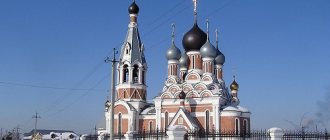
38. Spaso-Preobrazhensky Cathedral. It was built three times: the first - simultaneously with the Kuznetsk fortress. Soon after construction, the temple became the most significant for local residents and acquired the status of a cathedral. It stood for almost 100 years and burned down in the second decade of the 18th century. 70 years later, a second temple was built in the same place, which worked until the revolution, but in 1919, during anti-Kolchak protests, all the iconostases burned down and the bells collapsed to the ground. After 5 years, the first floor was restored and services began again, but already in 1929 the church was closed and an archaeological museum was located in the premises. Then for some time there was a school for combine operators, then a bakery. The building was finally abandoned in the 1950s. Parishioners repeatedly asked to hand over the temple to them, but each time they were refused. Only in 1989 the cathedral was given back to believers - and in 1992 large-scale restoration began. The cathedral celebrated its rebirth in 2004.
© img.geliophoto.com
39. Palace of Culture "Aluminshchik". This is the creation of Leonid Luzhbin, an architect from Leningrad. Luzhbin turned out to be very persistent and even at a time when everyone was refusing architectural excesses, he managed to build the building exactly as planned. The architect was constantly present at the construction site, ensured full compliance with the project, and forced the smallest details to be redone.
© img.geliophoto.com
40. According to the architect's plan, among the sculptures on the facade there was to be a rotating globe illuminated by spotlights - in honor of the World Festival of Youth and Students. But the building began to be erected when more than 10 years had passed since this event, so the idea was abandoned.
© img.geliophoto.com
41. The entrance arches to the park, the Aluminshchik cultural center and the house with a clock - Luzhbin developed all these projects as a single architectural composition that surrounds Lenin Square. The clock on the tower did not appear immediately - only 4 years after the end of construction, the project was completed. It is interesting that the clock mechanism was initially located not in the tower, but in the building of the Aluminumshchik Palace of Culture - for ease of maintenance. During its service, the watch broke down more than once until a more reliable device with GPS correction was installed.
© img.geliophoto.com
42. Arched houses on Torez Street. The big one in the city is called “Kursk Bulge”, the smaller one is called “Small Bulge”.
© img.geliophoto.com
43. Apart from their unusual shape, the semicircular houses are ordinary five-story Khrushchev buildings. After their construction, experiments with form were stopped and the following buildings in the city were erected as usual.
© img.geliophoto.com
44. House-ring in Novokuznetsk. The architects explained the choice of this form by the fight against excesses - it was impossible to build the planned square meters of housing on the allocated area. There were two options: build 9-story buildings with expensive elevators or change the shape of the house to a ring. We chose the second option. The edges of the ring are ordinary typical five-story buildings, which were connected by panels and used the space to obtain additional square meters.
© img.geliophoto.com
45. In the city this building is called the “puck house”, and next to it there is a curved five-story building - the “stick house”.
© img.geliophoto.com
46. Cathedral of the Nativity of Christ. Erected as a memorial to the miners who died in 1997 at the Zyryanovskaya mine. Construction of the cathedral began in 2001, but was stopped almost immediately - funding ran out. In 2008, construction resumed and in 2012 the cathedral was opened.
© img.geliophoto.com
47. In the process of work, it was decided to immortalize all the dead miners - the students collected 15,900 names since 1920.
© img.geliophoto.com
48. Temple of St. John the Warrior. On this site there was a wooden school, which was then converted into a sports school, and in 1994 a parish was opened in the building and in 1995 it was transferred to the church. Reconstruction began in 2000, and in 2008 the renovated temple opened.
© img.geliophoto.com
49. The wooden domes of the temple are covered with aspen figured planks, made by hand. Inside there are icons that were painted 100-200 years ago, and there are many stories online about miraculous healings that happened here.
© img.geliophoto.com
50. “I know that the city will be, I know that the garden will bloom when there are such people in the Soviet country,” Mayakovsky wrote in his poem about Novokuznetsk. Those who arrive are greeted by these very lines - huge luminous phrases on the five-story buildings of the station square.
© img.geliophoto.com
Map
| Kemerovo: maps |
Kemerovo: photo from space (Google Maps) Kemerovo: photo from space (Microsoft Virtual Earth)
| Kemerovo. Nearest cities. Distances in km. on the map (in brackets along roads) + direction. Using the hyperlink in the distance , you can get the route (information courtesy of the AutoTransInfo website) | |||
| 1 | Metal site | 8 () | SE |
| 2 | Fireboxes | 30 (32) | Z |
| 3 | Berezovsky | 36 () | WITH |
| 4 | Plotnikovo | 38 (35) | YU |
| 5 | Industrial | 56 (76) | SW |
| 6 | Krapivinsky | 59 (68) | SE |
| 7 | Yashkino | 70 (69) | NW |
| 8 | Leninsk-Kuznetsky | 78 (74) | YU |
| 9 | Anzhero-Sudzhensk | 81 (96) | WITH |
| 10 | Yurga | 82 (106) | NW |
| 11 | Polysayevo | 84 (84) | YU |
| 12 | Taiga | 84 (95) | WITH |
| 13 | Gramoteino | 92 (91) | YU |
| 14 | Yaya | 96 (124) | WITH |
| 15 | Izhmorsky | 99 (135) | WITH |
| 16 | Belovo | 105 (115) | YU |
| 17 | Inskaya | 105 (130) | YU |
| 18 | Toguchin | 108 (180) | Z |
| 19 | Bolotnoe | 111 (124) | Z |
| 20 | New Town | 117 () | YU |
| 21 | Bachatsky | 118 () | YU |
| 22 | Guryevsk | 119 (143) | YU |
a brief description of
The city is located in the foothills of the Kuznetsk Alatau, on the river. Tom, at the confluence of the river. Iskitim, 3482 km east of Moscow. Pier. Railway station. Road junction.
The climate is continental. The average temperature in January is -18, in July +20. Precipitation is 420 mm per year.
Territory (sq. km): 295
Information about the city of Kemerovo on the Russian Wikipedia website
Historical sketch
Kemerovo arose on the site of ancient Russian settlements, near the stronghold for the development of these lands - the Verkhnetomsk fort (founded in 1657, now the village of Verkhotomskoye), through which the road from Tomsk to the Kuznetsk fort passed.
In 1701, on the left bank of the Tom, near the mouth of Iskitim, Shcheglov’s settlement appeared, which later became a village.
In 1859, on the site of modern Kemerovo there were 7 settlements: the village of Shcheglovo (Ust-Iskitimskoye), the villages of Kemerovo (known since 1734), Evseevo, Krasny Yar, Kur-Iskitim (Pleshki), Davydovo (Ishanovo), Borovaya.
The village of Kemerovo was named after the first settlers of Kemerovo and gave the name to the Kemerovo mine that arose there.
In 1907, the first coal mines were built (coal was discovered here in 1721 for the first time in Kuzbass). The development of the village of Shcheglovo began in connection with the construction before 1917 of the Yurga - Kolchugino (modern Leninsk-Kuznetsky) railway with the Topki - Shcheglovo branch.
The year of foundation of the city is considered to be 1918, when the village of Shcheglovskoye was transformed into the city of Shcheglovsk. On November 12, 1928, the village of Kemerovo (since January 23, 1928 - a workers’ village) and a number of other settlements became part of the city of Shcheglovsk.
In 1932, Shcheglovsk was renamed Kemerovo. Since 1943 - the center of the Kemerovo region.
On January 27, 1941, the working village of Stroitel (PGT since 1935) and a number of other settlements entered the city boundaries.
On March 15, 1941, the city was divided into districts: Central, Zavodskoy, Kirovsky and Rudnichny.
In 1962, the village of Pioner (PGT since 1936, 4.5 thousand inhabitants, 1939; 11.7 thousand inhabitants, 1959) became part of the city; in 1982, the territory of the former village of Pioner was excluded from Kemerovo. In 2004, the working village of Pioneer was again within the city of Kemerovo.
On April 5, 1978, the Leninsky district of the city was formed at the expense of part of the territory of the Zavodsky and Central districts.
Municipal indicators
| Index | 1990 | 1999 | 2001 | 2003 | 2005 |
| Demography | |||||
| Number of births, per 1000 population | 12.4 | 8 | 9.3 | 10.4 | 10.5 |
| Number of deaths, per 1000 population | 10.1 | 13.8 | 14.3 | 15.6 | 15.4 |
| Natural increase (decrease), per 1000 population | 2.3 | -5.8 | -5 | -5.2 | -4.9 |
| Standard of living of the population and social sphere | |||||
| Average monthly nominal accrued wages, rub. | 0.348 | 1742 | 3314 | 5506 | 8839 |
| Average housing area per inhabitant (at the end of the year), sq.m. | 15.3 | 17.9 | 18.4 | 18.7 | 19.2 |
| Number of preschool institutions, pcs. | 244 | 160 | 153 | 149 | 150 |
| Number of children in preschool institutions, thousand people | 31.9 | 16.2 | 16.1 | 17.3 | 19.1 |
| Enrollment of children in preschool educational institutions (at the end of the year), as a percentage of the number of children of the corresponding age, % | 67.8 | 69.7 | |||
| Number of daytime educational institutions (at the beginning of the school year), pcs. | 83 | 98 | 100 | 98 | 100 |
| Number of students in daytime educational institutions, thousand people | 70.6 | 70.4 | 64.7 | 56.7 | 49.7 |
| Number of doctors, people. | 4636 | 4905 | 4996 | 5411 | 5480 |
| Number of nursing staff, people. | 8439 | 7024 | 6538 | 7318 | 6886 |
| Number of hospital institutions, pcs. | 23 | 29 | 27 | 27 | 28 |
| Number of hospital beds, thousand units | 9 | 8.3 | 7.7 | 7.6 | 7.9 |
| Number of medical outpatient clinics, pcs. | 49 | 85 | 70 | 68 | 90 |
| Capacity of medical outpatient clinics, visits per shift, thousand units. | 14.6 | 14 | 13.8 | 13.8 | 15.3 |
| Number of registered crimes, pcs. | 11542 | 12980 | 9843 | 12028 | |
| Persons who committed crimes were identified, persons. | 7073 | 7476 | 5443 | 5130 | |
| Economy, industry | |||||
| Number of enterprises and organizations (at the end of the year), pcs. | 13400 | 14444 | 16940 | 19325 | |
| Number of operating enterprises by type of activity: mining (at the end of the year), pcs. | 12 | ||||
| Number of operating enterprises by type of activity: manufacturing (at the end of the year), pcs. | 314 | ||||
| Number of operating enterprises by type of activity production and distribution of electricity, gas and water (at the end of the year), pcs. | 99 | ||||
| Volume of shipped goods of own production by type of mining (in actual prices), million rubles. | 4678.7 | ||||
| Volume of shipped goods of own production by type of manufacturing (in actual prices), million rubles. | 25041 | ||||
| Volume of shipped goods of own production by type of production and distribution of electricity, gas and water (in actual current prices), million rubles. | 11222.1 | ||||
| Construction | |||||
| Volume of work performed by type of activity “Construction” (until 2004 - volume of work performed under construction contracts), million rubles. | 0.312 | 1197 | 2139 | 2844 | 6051.1 |
| Commissioning of residential buildings, thousand sq.m. of total area | 158.8 | 96.9 | 71.9 | 126.4 | 142 |
| Commissioning of residential buildings, apartments | 1267 | 1021 | 1819 | 1951 | |
| Commissioning of preschool institutions, places | 730 | 0 | 0 | 0 | 35 |
| Commissioning of educational institutions, places | 3294 | 0 | 0 | 0 | 0 |
| Commissioning of hospital facilities, beds | 460 | 0 | 0 | 0 | 215 |
| Commissioning of outpatient clinics, visits per shift | 0 | 0 | 132 | 96 | 48 |
| Transport | |||||
| Number of bus routes (in intracity traffic), pcs. | 100 | 116 | 80 | 55 | |
| Number of tram routes, pcs. | 5 | 5 | 5 | 4 | |
| Length of operational tram tracks (at the end of the year), km | 40.3 | 41.6 | 41.6 | ||
| Number of trolleybus routes, pcs. | 6 | 7 | 9 | 11 | |
| Length of operational trolleybus lines (at the end of the year), km | 26.9 | 32.2 | 32.2 | ||
| Number of passengers transported by buses per year (in intracity traffic), million people. | 186.2 | 134.7 | 116.8 | 102.6 | 75 |
| Number of passengers transported by trams per year, million people. | 48.9 | 41 | 42.9 | 36.1 | 42.5 |
| Number of passengers transported by trolleybuses per year, million people. | 20.1 | 25.3 | 29 | 34.3 | 27.7 |
| Connection | |||||
| Number of telephone sets of the city public telephone network, thousand units. | 93.7 | 140.7 | 156.1 | 163.2 | 168.2 |
| Number of residential telephone sets of the city public telephone network, thousand units. | 62.5 | 110.4 | 124.3 | 131.5 | 136.7 |
| Number of payphones of the city telephone network (including universal ones), pcs. | 1590 | 1305 | |||
| Trade and services to the population | |||||
| Retail trade turnover (in actual prices), million rubles. | 1009 | 7771 | 15971 | 27289 | 44318.1 |
| Retail trade turnover (in actual prices), per capita, rub. | 1972 | 14534 | 30168 | 51751 | 84998.3 |
| Index of physical volume of retail trade turnover, % compared to the previous year | 108.6 | 118.7 | |||
| Index of physical volume of public catering turnover, % compared to the previous year | 115.3 | 140.8 | |||
| Number of stores, pavilions (at the end of the year), pcs. | 293 | 264 | |||
| Sales area of shops, pavilions (at the end of the year), sq.m. | 36881 | 85545 | |||
| Volume of paid services to the population (in actual prices), million rubles. | 0.153 | 1872 | 3600 | 5933 | 10152.2 |
| Volume of paid services to the population (in actual prices), per capita, rub. | 0.3 | 3502 | 6801 | 11252 | 19471.1 |
| Volume of household services to the population (in actual prices), million rubles. | 0.032 | 308.1 | 607.8 | 998.6 | 1357.9 |
| Volume of household services to the population (in actual prices), per capita, rub. | 0.056 | 576 | 1148 | 1894 | 2604.4 |
| Investments | |||||
| Investments in fixed assets (in actual prices), million rubles. | 0.436 | 2181 | 4002 | 6030 | 15917.6 |
| Share of investments in fixed assets financed from budgetary funds in the total volume of investments, % | 18.7 | 11.4 | 14.8 | 25.2 | |
Data sources:
- Regions of Russia. Main characteristics of the constituent entities of the Russian Federation: statistical collection. Goskomstat of Russia. - M:, 2003.
- Regions of Russia. Basic socio-economic indicators of cities. Statistical collection. Rosstat. - M:, 2005. p. 323
- Transport in Russia: Statistical collection. Goskomstat. - M:, 2003. pp. 110, 112, 120, 122
- Transport in Russia: Statistical collection. Rosstat. - M:, 2005. pp. 117, 119, 127, 129
- Regions of Russia. Basic socio-economic indicators of cities. 2006. Statistical collection. Rosstat. - M:, 2006. p. 319
Culture, science, education
Institute of Coal, Siberian Branch of the Russian Academy of Sciences.
University. Medical Academy.
Institutes: Kuzbass Polytechnic, technological, food industry, culture. Faculty of Moscow Commercial University, branch of Novosibirsk Agrarian University.
Theatres: drama, operetta, puppet theaters. Philharmonic. Circus.
Museums: local history, fine arts. Museum-reserve "Krasnaya Gorka".
Museums, galleries, exhibition halls
Kemerovo Regional Museum of Local Lore 650099, Kemerovo, Sovetsky Ave., 55 Phone(s) Website: https://www.kuzbasskray.ru/
Kemerovo Regional Museum of Fine Arts 650099, Kemerovo, Sovetsky Ave., 48 Phone(s) 36-5033 Website: https://www.kuzbassizo.ru/
Museum-Reserve "Krasnaya Gorka" 650044, Kemerovo, st. Krasnaya Gorka, 17 Telephone(s): inquire. ex.buro Website: https://www.redhill-kemerovo.ru/
Museum "Archaeology, Ethnography and Ecology of Siberia" Kemerovo State University 650043, Kemerovo, st. Krasnaya, 6 Phone(s) Website: https://museum.kemsu.ru/
Museum of Physical Culture and Sports of Kuzbass 65007, Kemerovo, st. Tukhachevsky, 19 Phone(s) Website: https://www.dmps.ru/sport/museum/
Ecomuseum-reserve "Tulber town" 650524, Kemerovo region, Kemerovo district, village. Starochervovo, per. Podgorny, 6 Phone(s) 89059608941 Website: https://tyulber.kemsu.ru/
Architecture, sights
The Tom River divides the city into two parts - the left bank, where the city center is located, and the right bank.
The city grew from separate mining villages, which later merged into a single community.
In the center of the city there is a wide Tom embankment overlooking the Krasnogorsk hills covered with pine forest.
| Population by year (thousands of inhabitants) | |||||||
| 1926 | 21.5 | 1976 | 446 | 2003 | 484.8 | 2015 | 549.2 |
| 1931 | 48.1 | 1979 | 470.6 | 2005 | 522.6 | 2016 | 553.1 |
| 1934 | 110.0 | 1982 | 495 | 2006 | 520.1 | 2017 | 556.9 |
| 1939 | 132.8 | 1986 | 514 | 2007 | 519.8 | 2018 | 559.0 |
| 1956 | 240 | 1989 | 520.3 | 2008 | 520.0 | 2019 | 558.7 |
| 1959 | 277.7 | 1992 | 520.6 | 2010 | 521.2 | 2020 | 556.4 |
| 1962 | 305 | 1996 | 540.8 | 2011 | 533.0 | 2021 | 552.5 |
| 1967 | 364 | 1998 | 497.8 | 2012 | 536.3 | ||
| 1970 | 385.0 | 2000 | 492.7 | 2013 | 540.1 | ||
| 1973 | 415 | 2001 | 489.5 | 2014 | 544.0 | ||
Large and small cities
The largest cities in the Kemerovo region from the list are the same ones that were listed above. However, there is an exception: the city of Ugra has a population of 81 thousand people, but in terms of area it is one of the smallest cities.
The smallest cities in terms of population are the cities of Guryevsk and Tashtagol, where 28 thousand people live, as well as the city of Kaltan with a population of 21 thousand, and the smallest is Salair, where only 7 thousand people live, despite the fact that the settlement was founded in 1626 .